Lamington, Queensland facts for kids
Quick facts for kids LamingtonQueensland |
|||||||||||||||
|---|---|---|---|---|---|---|---|---|---|---|---|---|---|---|---|

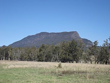
Mount Widgee, 2014
|
|||||||||||||||
| Population | 89 (2021 census) | ||||||||||||||
| • Density | 1.529/km2 (3.96/sq mi) | ||||||||||||||
| Established | 1997 | ||||||||||||||
| Postcode(s) | 4285 | ||||||||||||||
| Area | 58.2 km2 (22.5 sq mi) | ||||||||||||||
| Time zone | AEST (UTC+10:00) | ||||||||||||||
| Location |
|
||||||||||||||
| LGA(s) | Scenic Rim Region | ||||||||||||||
| State electorate(s) | Scenic Rim | ||||||||||||||
| Federal Division(s) | Wright | ||||||||||||||
|
|||||||||||||||
Lamington is a small rural area in Queensland, Australia. It is located in the beautiful Scenic Rim Region. In 2021, only 89 people lived there, making it a very quiet place.
Contents
Exploring Lamington's Landscape
Lamington is a very hilly area with many mountains. Christmas Creek, a stream that flows into the Logan River, starts here. The land around Christmas Creek is quite mountainous.
Some of the peaks and cliffs in Lamington include:
- Buchanans Fort: This mountain is 817 metres (about 2,680 feet) high.
- Little Widgee Mountain: This mountain is 759 metres (about 2,490 feet) high.
- Bujera: This is a cliff.
- Hillview Cliffs: These are also cliffs.
The southern part of Lamington is next to the western Lamington National Park. This park is famous for its rainforests and waterfalls.
Lamington's Past
The name Bujera comes from the Aboriginal language of the Mununjali people. It means "warm, love, adore, a good feeling." The Mununjali people are the traditional owners of this land.
The Old Schoolhouse
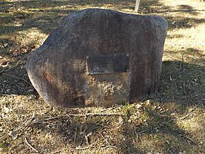
A school called Willowbank Provisional School first opened in Lamington on August 20, 1906. It later became Willowbank State School in 1909. In 1914, its name changed again to Lamington State School. The school closed its doors in April 1943. Today, you can find a monument with a plaque marking where the school used to be on Kerry Road.
The Beaudesert Tramway
From 1910 to 1944, Lamington was the end point for one part of the Beaudesert Shire Tramway. This tramway was a local railway system used to transport goods and people.
Surveying the Land
Between 1924 and 1930, a special measuring station was set up on the Hillview Cliffs. This station was used by Captain Vance of the Royal Australian Survey Corp to help map the area accurately.
Who Lives in Lamington?
In 2016, Lamington had 86 people living there. Most of the people were males (53.5%) and 46.5% were females. The average age was 48 years old, which was 10 years older than the national average in Australia. The average money earned by households each week was $1,374.
By 2021, the population of Lamington had grown slightly to 89 people.
Learning in Lamington
There are no schools directly in Lamington today. Children who live here usually go to Hillview State School in the nearby area of Hillview for primary school. For high school, students travel to Beaudesert State High School in Beaudesert.
 | Tommie Smith |
 | Simone Manuel |
 | Shani Davis |
 | Simone Biles |
 | Alice Coachman |


