Kanfen facts for kids
Quick facts for kids
Kanfen
|
||
|---|---|---|
|
||
| Country | France | |
| Region | Grand Est | |
| Department | Moselle | |
| Arrondissement | Thionville-Est | |
| Canton | Cattenom | |
| Area
1
|
8.5 km2 (3.3 sq mi) | |
| Population
(2007)
|
996 | |
| • Density | 117.2/km2 (303.5/sq mi) | |
| Time zone | UTC+01:00 (CET) | |
| • Summer (DST) | UTC+02:00 (CEST) | |
| INSEE/Postal code |
57356 /57330
|
|
| Elevation | 198–400 m (650–1,312 ft) | |
| 1 French Land Register data, which excludes lakes, ponds, glaciers > 1 km2 (0.386 sq mi or 247 acres) and river estuaries. | ||
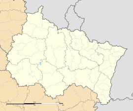
Kanfen is a small village in France. It is located in the Lorraine region, which is in the northeastern part of France. Kanfen is part of the Moselle department, close to the city of Thionville. In 2007, about 996 people lived there.
Contents
A Look at Kanfen's Past
How Kanfen Got Its Name
The first time we see the name of this village in writing was in 1239. Back then, it was called Cantevanne. Later, its name changed to Kaufen. In 1801, it became Kanfen, and it has been called that ever since. Even when the Alsace-Lorraine area became part of the German Empire in 1870, the name stayed the same.
The name Kanfen probably comes from two old words. One is a Gaulish word, canto, which means "mountain". The other is a Germanic word, Fenn, which means "marshland". So, it might mean something like "mountain marsh".
Kanfen's Journey Through History
For a long time, Kanfen and the whole Thionville area were part of the Duchy of Luxembourg. But in 1643, a famous French general named Le Grand Condé took control of Thionville. This meant Kanfen became part of the Kingdom of France. This change was officially confirmed by the Treaty of the Pyrenees in 1659.
Later, because it was in the Alsace-Lorraine region, Kanfen was part of the German Empire from 1871 to 1918. During World War II, it was also taken over by Nazi Germany between 1940 and 1944. After the war, it returned to France.
Where Kanfen Is Located
Kanfen is situated next to a hill called Kudertsberg, which is about 230 meters high. A small river called the Kiesel starts in the village and flows through it.
The village is about 12 kilometers north of Thionville. It's also about 20 kilometers south of Luxembourg City, the capital of Luxembourg. Kanfen is very close to the border with Luxembourg. The commune of Kanfen includes the main village and another area called Kanfen-sous-Bois.
Interesting Places to See
- Old Castle of the Lord of Kanfen: This old Castle was once called Keybourg. Today, a presbytery (a house for a priest) stands where the castle used to be.
- Saint-Maurice Church: This Church is located in an area called Keybourg. It was built in 1744 on the side of a hill.
- An Old Wayside Shrine: There is a special stone monument called a bildstock that dates back to 1634. You can find it where the Rue Volmerange and the Rue de Keybourg streets meet.
How Many People Live in Kanfen?
| 1901 | 1906 | 1911 | 1921 | 1926 | 1931 | 1936 | 1946 | 1954 | 1962 | 1968 | 1975 | 1982 | 1990 | 1999 | 2006 | 2007 | |||||||||||||||||||||||||||||||||||||||||||||||||||||||||||||||||||||||||||||||||||||||||||||||||||||||||||||||||||||||||||||||||||||||||||||||||||||||||||||||||||||||||||||||||||||||||||||||||||||||||||||||||||||||||||||||||||||||||||||||||||||||||||||||||||||||||||||||||||||||||||||||||||||||||||||||||||||||||||||||||||||||||||||||||||||||||||||||||||||||||||||||||||||||||||||||
|---|---|---|---|---|---|---|---|---|---|---|---|---|---|---|---|---|---|---|---|---|---|---|---|---|---|---|---|---|---|---|---|---|---|---|---|---|---|---|---|---|---|---|---|---|---|---|---|---|---|---|---|---|---|---|---|---|---|---|---|---|---|---|---|---|---|---|---|---|---|---|---|---|---|---|---|---|---|---|---|---|---|---|---|---|---|---|---|---|---|---|---|---|---|---|---|---|---|---|---|---|---|---|---|---|---|---|---|---|---|---|---|---|---|---|---|---|---|---|---|---|---|---|---|---|---|---|---|---|---|---|---|---|---|---|---|---|---|---|---|---|---|---|---|---|---|---|---|---|---|---|---|---|---|---|---|---|---|---|---|---|---|---|---|---|---|---|---|---|---|---|---|---|---|---|---|---|---|---|---|---|---|---|---|---|---|---|---|---|---|---|---|---|---|---|---|---|---|---|---|---|---|---|---|---|---|---|---|---|---|---|---|---|---|---|---|---|---|---|---|---|---|---|---|---|---|---|---|---|---|---|---|---|---|---|---|---|---|---|---|---|---|---|---|---|---|---|---|---|---|---|---|---|---|---|---|---|---|---|---|---|---|---|---|---|---|---|---|---|---|---|---|---|---|---|---|---|---|---|---|---|---|---|---|---|---|---|---|---|---|---|---|---|---|---|---|---|---|---|---|---|---|---|---|---|---|---|---|---|---|---|---|---|---|---|---|---|---|---|---|---|---|---|---|---|---|---|---|---|---|---|---|---|---|---|---|---|---|---|---|---|---|---|---|---|---|---|---|---|---|---|---|---|---|---|---|---|---|---|---|---|---|---|---|---|---|---|---|---|---|---|---|---|---|---|---|---|---|---|---|---|---|---|---|---|---|---|---|---|---|---|---|---|---|---|---|---|---|---|---|
| 512 | 493 | 586 | 511 | 543 | 522 | 518 | 444 | 440 | 503 | 483 | 469 | 615 | 722 | 776 | 970 | 996 | |||||||||||||||||||||||||||||||||||||||||||||||||||||||||||||||||||||||||||||||||||||||||||||||||||||||||||||||||||||||||||||||||||||||||||||||||||||||||||||||||||||||||||||||||||||||||||||||||||||||||||||||||||||||||||||||||||||||||||||||||||||||||||||||||||||||||||||||||||||||||||||||||||||||||||||||||||||||||||||||||||||||||||||||||||||||||||||||||||||||||||||||||||||||||||||||
| From the year 1968 on: population without double counting—residents of multiple communes (e.g. students and military personnel) only counted once. | |||||||||||||||||||||||||||||||||||||||||||||||||||||||||||||||||||||||||||||||||||||||||||||||||||||||||||||||||||||||||||||||||||||||||||||||||||||||||||||||||||||||||||||||||||||||||||||||||||||||||||||||||||||||||||||||||||||||||||||||||||||||||||||||||||||||||||||||||||||||||||||||||||||||||||||||||||||||||||||||||||||||||||||||||||||||||||||||||||||||||||||||||||||||||||||||||||||||||||||||
See also

- In Spanish: Kanfen para niños
 | Kyle Baker |
 | Joseph Yoakum |
 | Laura Wheeler Waring |
 | Henry Ossawa Tanner |


