Kathua District facts for kids
Kathua district is a special place in the Jammu and Kashmir region. It's one of 14 districts there. This area is known for its beautiful and varied landscapes. You can find rich farms, wide plains, and even tall mountains here.
Contents
Where is Kathua District?
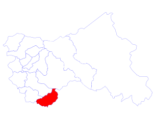
Kathua district is located in the southern part of Jammu and Kashmir. It shares its borders with many different places. To the northwest, it touches Jammu. To the north, you'll find the Doda District and Udhampur District. The state of Himachal Pradesh is to its east. To the south, it borders Punjab in India.
The land in Kathua is quite diverse. Near the border, there are fertile farming areas. As you go east, you'll see plains that lead up to the foothills of the Himalaya mountains. The eastern part of the district is mountainous.
How is Kathua District Organized?
Kathua district is divided into smaller parts called blocks. There are 8 blocks in total:
- Bani
- Barnoti
- Basholi
- Billawar
- Duggan
- Ghagwal
- Hiranagar
- Kathua
- Lohai Malhar
The district has about 587 villages.
Languages and Education
The main traditional language spoken in Kathua is Dogri. In the mountainous eastern areas, the Pahari language is more common.
For education, students learn in a few different languages. The main languages used in schools are English, Hindi, and Urdu.
People and Religions
Jammu and Kashmir is a state where most people are Muslim. However, Kathua district, like the rest of the Jammu region, is mostly Hindu. About 91% of the people in Kathua district practice Hinduism. Around 7% of the population is Muslim, and about 2% are Sikh.
Important Sub-Districts
Kathua district is also divided into smaller administrative areas called Tehsils. These include:
See also
 In Spanish: Distrito de Kathua para niños
 | Jewel Prestage |
 | Ella Baker |
 | Fannie Lou Hamer |


