Kejimkujik National Park facts for kids
Quick facts for kids Kejimkujik National Park |
|
|---|---|
|
IUCN Category II (National Park)
|
|
Little River
|
|
| Location | Nova Scotia, Canada |
| Nearest city | Halifax |
| Area | 404 km2 (156 sq mi) |
| Established | 1967 |
| Visitors | 60,649 (in 2015-16) |
| Governing body | Parks Canada |
| Official name: Kejimkujik National Historic Site of Canada | |
| Designated: | 1994 |
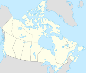
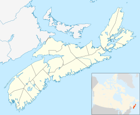
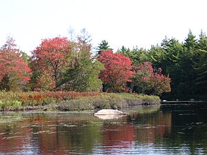
Kejimkujik National Park is a special place in Canada. It is a National Park that covers about 404 square kilometers (156 square miles). You can find it in the southwest part of Nova Scotia.
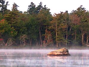
The park has two main parts. One part is inland, with forests and lakes. This area is also a National Historic Site. The other part is called Kejimkujik National Park Seaside. It is located right on the Atlantic coast.
The inland historic site is a beautiful forested area. For thousands of years, the Mi'kmaq people lived here. They left behind petroglyphs (rock carvings), old living sites, and travel routes. These show how important this land was to them.
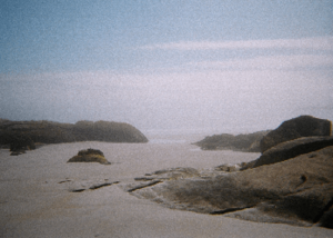
The seaside part is a wild area. It has bogs, sandy beaches, and tidal zones. Many different plants and animals live there.
The Royal Astronomical Society of Canada has named the park a dark-sky preserve. This means it's a great place to see stars because there isn't much light pollution.
The park gets its name from Kejimikujik Lake. This is the biggest lake inside the park.
Contents
History of Kejimkujik
For thousands of years, the Mi'kmaq people used the canoe routes in the park. They traveled from the Bay of Fundy all the way to the Atlantic coast.
There are four special Mi'kmaw petroglyph sites in the park. These are carvings made on slate rocks. You can find them on the eastern side of Kejimikujik Lake. These sites are very important and are carefully protected.
You can visit one of these sites on a guided tour in the summer. The petroglyphs show what Mi'kmaw life was like after Europeans arrived. They date back to the 1700s and 1800s.
Many carvings have special meanings. They show things like canoes, wigwams (traditional homes), and old clothing. There are also pictures of animals they hunted. Some carvings show European things like ships, horses, and Christian symbols.
A famous book called The Tent Dwellers was written by Albert Paine. It tells about his fishing trips in Nova Scotia. The story takes place in what is now Kejimkujik National Park. The book was published in 1908.
Fun Things to Do
Kejimkujik National Park offers many ways to enjoy nature.
The main campground, Jeremy's Bay, has 355 campsites. Many of these are good for large RVs. There is also a group campground at Jim Charles Point. It can hold up to 80 people. This spot is named after a local First Nations guide from the 1800s.
You can also find campsites deeper in the park. These are called backcountry sites. You can reach them by canoe, bicycle, or by hiking.
The park has 15 different trails. You can use them for hiking, skiing, or snowshoeing. You can even go winter camping here!
Animals and Plants
Most of the park's forest has grown back after being cut down. But there are still some areas with very old trees and plants. The park's shallow lakes, bogs, and marshes are home to many different amphibians and reptiles. More kinds live here than anywhere else in Atlantic Canada.
The park is part of the Southwest Nova Biosphere Reserve. This area is known for its Acadian forest.
Mammals
About 34 types of mammals live in the park. Some common ones include shrews, bats, and the Snowshoe Hare. You might also see squirrels, beavers, and porcupines. Red foxes and white-tailed deer are also found here.
Birds
Many birds call Kejimkujik home. You might spot a Hermit Thrush or a White-breasted Nuthatch. Other birds include the American Woodcock and the Northern Parula. At the seaside, you might see a Piping Plover. The Common Loon and Barred Owl are also common.
Water Life
At the Kejimkujik seaside, you can often see harbor seals. Scientists are studying European green crabs in the Little Port Joli Basin. Removing these crabs helps research on fish populations.
Some fish that are not native to the park have been introduced. These include the chain pickerel and the small-mouth bass.
Endangered Species
The park is a safe place for many animals that are at risk. These include the Blanding's turtle and the ribbon snake. Endangered birds like the piping plover and Canada Warbler also live here. The Monarch butterfly and Harlequin Duck are also protected.
Mercury in Loons
Scientists have found high levels of mercury in the blood of loons in the park. This is more than in loons from other parts of North America. This mercury can make it harder for them to have babies.
Loons mostly eat Yellow perch, which are small fish. These fish have more than twice the mercury of fish in nearby areas. Scientists are still trying to find out where all this mercury comes from. The Canadian government runs many research projects in the park to understand these issues.
Geography of the Park
Kejimkujik National Park is mostly a flat area. Its highest point is Mount Tom, which is about 180 meters (590 feet) tall. The ground is made of very old rocks like quartzite and slate. These rocks do not provide many nutrients to the soil.
About 15% of the park is covered by lakes. You can see signs of the last Ice Age here. There are hills called drumlins and large rocks called erratics. Long ridges of sand and gravel called eskers are also present.
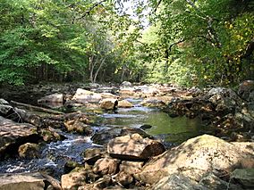
Important rivers in the park include the Mersey and the Shelburne. Major lakes are Kejimikujik and Luxton.
The Kejimkujik National Park Seaside has beautiful white sandy beaches. It also has coastal wetlands. You can see large fields of boulders and drumlins formed by glaciers.
Climate
Kejimkujik National Park has four clear seasons. It is located inland in western Nova Scotia. This means it usually has warmer temperatures and more rain than eastern Nova Scotia.
Winters are cold, with an average temperature of about -6.1°C (21°F) in January. Temperatures often stay below freezing. But warm spells can push temperatures above freezing. Sometimes it even gets above 10°C (50°F) in winter. The park gets a lot of snow, about 244 cm (96 inches) each year.
Summers are warm, with an average of 18.4°C (65°F) in July. It doesn't rain as much in summer as in winter. Temperatures rarely go above 30°C (86°F). This is because the ocean helps keep the air cooler.
Spring and fall are changing seasons. The weather can be mild but also a bit unpredictable. The park gets about 1399 mm (55 inches) of rain each year. This rain is spread out fairly evenly through all the seasons.
Trails
- Mersey Meadow: Easy, Linear, 70 metres one way
- Mill Falls: Easy, Linear, 2 kilometres return
- Beech Grove: Moderate, Loop, 2.2 kilometres
- Flowing Waters: Easy, Loop 1 kilometre
- Hemlocks and Hardwoods: Moderate, Loop, 5 kilometres
- Farmlands: Moderate, Loop, 1.1 kilometres
- Rogers Brook: Easy, Loop, 1 kilometres
- Grafton Woods: Easy, Loop, 1,6 kilometres
- Snake Lake: Moderate, Loop, 3 kilometres
- Gold Mines: Moderate, Linear, 1.5 kilometres one way
- Peter Point: Moderate, Linear, 1.9 kilometres one way
- Mersey River: Easy, Linear, 3.5 kilometres one way
- Slapfoot: Moderate, Linear, 3.2 kilometres one way
- Jake's Landing to Merrymakedge Beach: Moderate, Linear, 3 kilometres one way
- Ukem'k: Moderate, Linear, 6.3 kilometres one way
- Eel Weir to Fire Tower: Moderate, Linear, 19.5 kilometres return
- Channel Lake: Difficult, Loop, 24 kilometres
- Liberty Lake: Difficult, Linear, 60.5 kilometres
See also
 In Spanish: Parque nacional Kejimkujik para niños
 | Georgia Louise Harris Brown |
 | Julian Abele |
 | Norma Merrick Sklarek |
 | William Sidney Pittman |


