Kettleness facts for kids
Quick facts for kids Kettleness |
|
|---|---|
 Kettleness |
|
| OS grid reference | NZ831155 |
| Civil parish |
|
| Unitary authority |
|
| Ceremonial county | |
| Region | |
| Country | England |
| Sovereign state | United Kingdom |
| Post town | Whitby |
| Postcode district | YO21 |
| Police | North Yorkshire |
| Fire | North Yorkshire |
| Ambulance | Yorkshire |
| EU Parliament | Yorkshire and the Humber |
| UK Parliament |
|
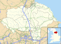
Kettleness is a small village, also called a hamlet, in North Yorkshire, England. It's part of the Scarborough District. Today, Kettleness has only a few houses. But a long time ago, in the early 1800s, it was a much bigger village.
Most of the old village was built on a piece of land that stuck out into the sea. This land became unstable because of mining for a material called alum. Sadly, the land slipped into the sea. After this, the houses were rebuilt a bit further inland, making Kettleness a smaller place.
Historically, Kettleness was busy with different industries. It had an alum works, where they processed a mineral. There was also a jet mining industry, and places where they dug for ironstone. Kettleness even had its own railway station from 1883 to 1958. For counting people, Kettleness is part of the parish of Lythe.
Contents
History of Kettleness
Kettleness isn't mentioned in the old book called the Domesday Book. But a nearby village, Goldsborough, is. Both were in an area known as a Wapentake called Langbaurgh. The name Kettleness comes from the nearby headland, Kettle Ness.
The name Kettle comes from an old Norse word, Kettil, which means a pot or cauldron. This probably describes the shape of the water around the headland. Ness is a Viking word for a headland, which is a piece of land that sticks out into the sea.
The Village Collapse
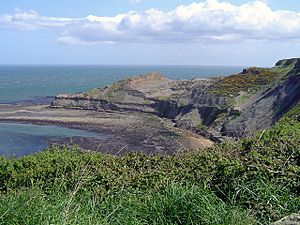
Kettle Ness is at the eastern end of Runswick Bay. The cliffs there are very tall, rising over 375 feet (114 meters) above the sea. The Kettleness you see today was built in the 1830s. This happened after the original village collapsed into the sea on December 17, 1829.
Luckily, the landslide was slow, so the villagers had time to escape. They found safety on a ship called The Henry that was in the bay. Kettleness is about 1.5 miles (2.4 km) north of the A174 road. It's also 7 miles (11 km) northeast of Whitby and 15 miles (24 km) southeast of Guisborough.
Local Buildings and Transport
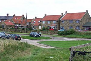
A small church, called a chapel-of-ease, was built in 1872. It cost £300, which was a lot of money back then! This building was made from local stone and had a Welsh slate roof. Many buildings in the area have distinctive red pantile roofs. Even though Kettleness is part of the Lythe church area, the chapel has since been turned into a recording studio.
Kettleness used to have a railway station that opened in 1883. It was on the railway line between Loftus and Whitby West Cliff railway station. This station also served the nearby village of Goldsborough. In 1911, about 54 people lived in the area. The station and the railway line closed in May 1958. This was because it cost too much to keep the tunnels and bridges safe. The old station building is now a place where scouting and outdoor groups can stay.
Kettleness During Wartime
During the First World War, a field near Kettleness was used by the Royal Naval Air Service. This was a place where aircraft could refuel as they flew along the east coast. Because Kettleness is right on the coast, it was also used as a base for small planes to patrol the nearby waters. After the war, the site became a coastguard station, helping to watch over the coast.
Geology and Industry
Like other places along the Cleveland coast, the ground under Kettleness has many valuable minerals. The rocks here contain alum shales, jet rock, and ironstone.
The Alum Industry
The headland was once home to the original village and the alum works. They started digging for alum around 1727. The area where the alum works and its buildings were is now a protected historical site. These works were among the last in the area to close, shutting down in 1861.
At its busiest, between 1805 and 1817, the works produced 900 tonnes of alum each year. It took 50 tonnes of shale rock to make just 1 tonne of alum. This meant they dug a lot of rock from the headland. This extensive digging made the ground unstable, causing the original village to collapse into the sea in 1829. However, the landslide uncovered new areas of shale. So, new alum works were built the next year, and workers' houses were built further inland.
Other Mining Activities
Besides alum and ironstone mining, the cliffs also supported a small jet industry. Jet is a black, shiny mineral used for jewelry. People still look for jet along the headland today. Ironstone was mined in two places at Kettleness. Between 1838 and 1857, stone was taken directly from the cliffs and beach. It was then loaded onto ships in the bay, which was a risky job. This ironstone was sent to furnaces in Wylam.
Another mine was located west of the village. It operated between 1910 and 1915. The ironstone from this mine was sent by train to the Skinningrove Ironworks. The unique geology and many fossils in this area have always attracted people. One famous discovery was the skeleton of a plesiosaur, a type of ancient marine reptile, found in 1883.
Legends and Culture
Kettleness is part of a special trail between Whitby and the village. This trail tells stories of strange and supernatural things. Some are just imagined, but others are claimed to be real. One such story is about a black dog, known as a barghest. It's said that this legend might have inspired Bram Stoker to include a black dog in his famous novel, Dracula.
In the book, one of the characters, Mina, watches the sunset over the Kettleness headland from the town of Whitby. In the 1950s, a vicar supposedly met the barghest that haunted the Kettleness area. He used holy water to make the spirit go away.
The trail was started in 2015. It follows parts of the Cleveland Way and includes several interesting stops on the way to Whitby.
 | Madam C. J. Walker |
 | Janet Emerson Bashen |
 | Annie Turnbo Malone |
 | Maggie L. Walker |


