
Knaptoft facts for kids
Quick facts for kids Knaptoft |
|
|---|---|
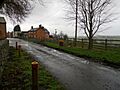
 Knaptoft (2012) |
|

Knaptoft
|
|
| Area | 2.227809 sq mi (5.77000 km2) |
| Population | 47 (2011) |
| • Density | 21/sq mi (8.1/km2) |
| OS grid reference | SP627896 |
| • London | 80.13 mi (128.96 km) |
| Civil parish |
|
| District |
|
| Shire county | |
| Region | |
| Country | England |
| Sovereign state | United Kingdom |
| Post town | LUTTERWORTH |
| Postcode district | LE17 |
| Dialling code | 0116 |
| Police | Leicestershire |
| Fire | Leicestershire |
| Ambulance | East Midlands |
| EU Parliament | East Midlands |
| UK Parliament |
|
| Website | Knaptoft Parish Council |
Knaptoft is a small place in Leicestershire, England. It's known as a deserted medieval village, which means it was once a busy village in the Middle Ages but was later abandoned. It's located about 9.7 km south of the city of Leicester.
The name Knaptoft might come from old English words. "Cnafa" could mean 'a boy', 'a young man', or 'a servant'. "Toft" means 'a plot of ground where a house stands'. So, it could mean "the plot of ground where a servant lives" or "the plot of ground of a young man". In 2011, only 47 people lived in the area around Knaptoft.
Contents
Where is Knaptoft Located?
Knaptoft sits on a small hill south of Shearsby, which is about 0.85 km away. To its west, about 1.51 km away, is Bruntingthorpe. To the east, about 1.31 km away, is Mowsley.
The ground in Knaptoft is mostly made of "Till." This is a type of soil and rock left behind by glaciers up to 2 million years ago. Some areas also have older rock layers from 105 to 191 million years ago.
Knaptoft's Past: A Look Back in Time

Knaptoft is mentioned in the Domesday Book of 1086. This was a big survey ordered by William the Conqueror to record everything in England. Back then, Knaptoft had about 22 households, including a priest. This means around 100-150 people lived there.
Archaeologists found a piece of Saxon pottery from the 8th or 9th century. This shows people lived here even before the Domesday Book was written. By 1279, the village had grown to 32 households.
In 1301, a survey showed that Knaptoft had a manor house, a windmill, and two fish ponds. It also had 20 tenants, who were people renting land. Today, you can still find what might be the old windmill mound.
Around 1507, the lord of the manor, William Turpin, made a big change. He decided to use the village's open fields for raising sheep instead of growing crops. This meant many villagers lost their farms. It's thought that many of them moved to the nearby village of Shearsby. By 1524, only five farm workers and the lord of the manor were left in Knaptoft.
A map from 1576 by Christopher Saxton shows Knaptoft, but doesn't say how big it was. In 1624, records still showed five farm workers, a church, and a manor. By 1775, there were no freeholders (people who owned their land) left in Knaptoft.
In 1778, most of the land in Knaptoft belonged to the Duke of Rutland. By 1790, the village had only 7 houses, and the manor house was falling apart. Over time, nearby areas like Shearsby and Mowsley became separate villages. By the 1870s, Knaptoft had 7 houses and 54 residents.
The Knaptoft Manor and Estate
Before 1066, an Anglo-Saxon lord named Harding owned Knaptoft. After the Norman Conquest, a Norman earl named Aubrey became the lord.
Later, the Gobion family took over the manor. In 1300, the Paynel family gained control through marriage. A survey from 1301 describes a manor house with a garden and two fish ponds. By 1417, the Turpin family became the lords, also through marriage.
It was the Turpin family who changed the farming. In 1507, William Turpin turned the fields into sheep pastures. This caused many villagers to move away. At the same time, orchards and gardens were added to the manor house grounds.
It's believed that the manor house was destroyed by fire between 1525 and 1530. The Turpin family then built a new Hall made of red brick and stone. This Hall stayed with the Turpin family until 1648. Local stories say that Oliver Cromwell's soldiers, called Roundheads, attacked the Hall and church in 1645. This happened after the Battle of Naseby, when they were chasing the defeated Royalist army. After the monarchy was restored in 1660, the Hall and land went to the Duke of Rutland.
In 1792, a writer named John Nichols visited Knaptoft. He wrote that the old Hall was abandoned and falling apart. He described it as having a round tower and being built in the 1500s. Fifteen years later, Nichols returned and said the Hall was a complete ruin.
The remains of the old Tudor Hall were used for farming until the 1800s. A new farmhouse was built in 1843. In 1869, the Duke of Rutland sold the estate. The Victorian farmhouse was replaced by a new one in 1931.
In 2014, the surviving parts of the Tudor Hall were listed as a Grade II listed building. This means they are important historical buildings. In 2019, the farmhouse was taken down to make way for new homes. However, the old Tudor Manor structures were saved and included in the new buildings. This keeps their history alive.
The Ruined Church of St. Nicholas

The village Church of St. Nicholas is now a ruin, but it is also a Grade II listed building. The church was first mentioned in 1143. It's believed the church was built in 1279, and the parts that are still standing look like they are from the 13th century.
In 1625, the village bought a bell for the church. In 1630, the church was still standing. Like the manor, it's thought that Oliver Cromwell's forces might have attacked and destroyed the church in 1645. However, some people think the church might have already been abandoned by then. By 1792, the church was recorded as a ruin. Much of its stone was even used to fix local roads.
Knaptoft in the 20th Century

In 1932, a wealthy person named Henry Truman Mills paid to fix the church walls. This helped to save what was left of the building.
A few years later, a historian named W. G. Hoskins studied many deserted medieval villages in Leicestershire, including Knaptoft. His work helped people learn more about these lost villages. In 1954, the site of the deserted medieval village was officially protected as a Scheduled Monument. This means it's an important historical site.
In 1964, two archaeologists, John G. Hurst and Maurice W. Beresford, visited Knaptoft. They then started the 'Deserted Medieval Village Research Group' to study more villages like it.
In 1977, to celebrate Queen Elizabeth II’s Silver Jubilee, the Harborough District Council put up a special plaque in the church ruins.
Knaptoft Today
Today, the Church of Saint Nicholas has no roof, but you can still see headstones and its stone font. Open-air church services are still held there on the third Sunday of June, July, August, and September at 3 PM. There's also a free car park next to the church for visitors.
The old Tudor Hall's Grade II listed remains are now part of the new houses built behind the church ruins. If you walk down the public footpath, you can find the two original fish ponds.
You can also go fishing at the Knaptoft medieval fishponds, which are now open to the public. These ponds were fixed up between 1976 and 1981. They were filled with fish like Roach, Rudd, and Tench from other old medieval fishponds nearby.
Famous People from Knaptoft
- Sir George Turpin (1529–1583) was a member of the English Parliament.
- John Moore (died 1619) was a writer and a church minister in Knaptoft.
Images for kids
-
Knaptoft (2012)
