Krell Hill facts for kids
Quick facts for kids Krell Hill |
|
|---|---|
| Tower Mountain | |
| Highest point | |
| Elevation | 3,658 ft (1,115 m) NAVD 88 |
| Prominence | 1,186 ft (361 m) |
| Geography | |
| Location | Spokane County, Washington, U.S. |
| Parent range | Selkirk |
| Topo map | USGS Spokane SE |
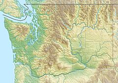
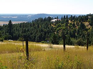
Krell Hill, also called Tower Mountain, is a peak located in Spokane County, Washington. It sits at the southern end of the Selkirk Mountains. This mountain is part of the Dishman Hills area.
Krell Hill rises sharply southeast of the flat Moran Prairie neighborhood. This neighborhood is part of Spokane's South Hill. The northwest side of the mountain is known as Browne's Mountain. This area is a neighborhood just outside Spokane city. South of the mountain, you can see the wide farmlands of the Palouse region. To the east, the land stays high towards Mica Peak. This area connects to the Coeur d'Alene Mountains, which are part of the Rocky Mountains. North of Krell Hill, the land slopes down into the Dishman Hills. It then goes further down into the Spokane River valley and the City of Spokane Valley. People often call it Tower Mountain because many tall TV and radio towers are built on its ridge.
Contents
Exploring Browne's Mountain
Browne's Mountain is a neighborhood located just outside the city of Spokane. It is named after a pioneer lawyer, J.J. Browne. This area is mostly homes. It is bordered by Glenrose Road to the west and north. 57th Avenue is its southern border and main road.
Views from the Mountain
Because Browne's Mountain is on a hillside, its houses have amazing views. You can see the South Hill and the Palouse farmlands. You can also spot the tower at Spokane International Airport. The Selkirk Mountains to the north and northwest of the city are also visible.
Iller Creek Conservation Area
The Iller Creek Conservation Area covers about 966 acres. It is on the eastern side of Krell Hill. This area is part of Spokane County's Conservation Futures program. Iller Creek flows down the eastern slopes of Krell Hill. It also drains a ridge located to the east. The creek starts on the northern side of a ridge. This ridge stretches eastward from the main mountain.
Discovering the Rocks of Sharon
Along the ridge that goes east from Krell Hill, you will find the Rocks of Sharon. On some maps, these rocks are simply called "Big Rock." This is because one of the rock formations is much larger and taller than the others. These huge granite rocks are a popular spot for rock climbers.
Accessing the Rocks
For many years, visitors had to hike over two miles to reach the Rocks of Sharon. They started from the north at Holman and Rockcrest. This route went up the Iller Creek valley. In August 2012, a new trailhead was opened. This was after several years of talks. The new access point is on Stevens Creek Road. It gives climbers and hikers a shorter way to reach the rocks from the south.
 | William Lucy |
 | Charles Hayes |
 | Cleveland Robinson |


