Labyrinth Mountain facts for kids
Quick facts for kids Labyrinth Mountain |
|
|---|---|

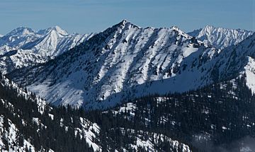
Southwest aspect from Jove Peak
|
|
| Highest point | |
| Elevation | 6,376 ft (1,943 m) |
| Prominence | 1,736 ft (529 m) |
| Isolation | 4.87 mi (7.84 km) |
| Parent peak | Rock Mountain (6,840 ft) |
| Geography | |
| Location | Chelan County, Washington, U.S. |
| Parent range | North Cascades Cascade Range |
| Topo map | USGS Labyrinth Mountain |
| Climbing | |
| Easiest route | trail + class 2 scrambling |
Labyrinth Mountain is a tall mountain in Washington state. It stands about 6,376 feet (1,943 meters) high. You can find it in Chelan County, near Stevens Pass.
This mountain is part of the Henry M. Jackson Wilderness. It is managed by the Okanogan-Wenatchee National Forest. The closest taller mountain is Rock Mountain, which is about 4.87 miles (7.84 km) away.
A man named Albert Hale Sylvester gave Labyrinth Mountain its name. He thought the lines on its topographic map looked like a Labyrinth, which is a maze. Because of this, he also named nearby Minotaur and Theseus Lakes after characters from Greek mythology. Water from the mountain flows into streams that feed the Little Wenatchee River.
Mountain Weather
Labyrinth Mountain is on the east side of the Cascade Range. This means it gets a little less rain than areas to the west. Summers here can be warm, and sometimes there are thunderstorms.
Most weather systems come from the Pacific Ocean. They move east towards the Cascade Mountains. When these systems hit the tall mountains, the air is forced to rise. As the air goes up, it cools and drops its moisture. This causes a lot of rain or snow to fall on the western side of the Cascades. This process is called Orographic lift.
During winter, the weather is often cloudy. But in summer, high pressure systems over the Pacific Ocean bring clear skies. The best time to visit or climb Labyrinth Mountain is from July to September. This is when the weather is usually the nicest.
How the Mountain Formed
The North Cascades area has very rugged land. You can see sharp peaks, long ridges, and deep valleys carved by glaciers. These amazing shapes were created by geological events that happened millions of years ago.
The Cascade Range began forming a very long time ago. The North American Plate slowly moved over the Pacific Plate. This movement caused many volcanic eruptions. For example, Glacier Peak, a large volcano, started forming about 18.2 miles (29.3 km) north of Labyrinth Mountain.
Also, small pieces of the Earth's crust, called terranes, came together to form the North Cascades. This happened about 50 million years ago.
During the Pleistocene period, which was over two million years ago, huge sheets of ice called glaciers moved across the land. They carved and shaped the mountains and valleys. Most of the valleys were free of ice about 12,000 years ago. The combination of land being pushed up (orogeny) and fault lines, along with the glaciers, created the tall peaks and deep valleys we see today in the North Cascades.
 | Tommie Smith |
 | Simone Manuel |
 | Shani Davis |
 | Simone Biles |
 | Alice Coachman |


