
Laganbank (District Electoral Area) facts for kids
Quick facts for kids LaganbankDistrict Electoral Area |
|
|---|---|
 Map showing Laganbank wards within Belfast |
|
| Area | 8.37 km2 (3.23 sq mi) |
| Population | 32,316 (2008 Estimate) |
| • Density | 3,861/km2 (10,000/sq mi) |
| District | |
| County | |
| Country | Northern Ireland |
| Sovereign state | United Kingdom |
| EU Parliament | Northern Ireland |
| UK Parliament |
|
| NI Assembly |
|
Laganbank was a special area in Belfast, Northern Ireland. From 1985 to 2014, it was one of nine "district electoral areas." This means it was a specific part of the city that elected people to the Belfast City Council. Laganbank was located in the south of Belfast and had five smaller areas called "wards": Ballynafeigh, Botanic, Shaftesbury, Stranmillis, and Rosetta.
Laganbank, along with a nearby area called Balmoral, made up most of the Belfast South areas for the Northern Ireland Assembly and the UK Parliament.
The area was bordered by the Malone Road and the M1 Motorway to the west. To the south, it had the River Lagan. The Ormeau Park and Ormeau Road were to the east. To the north, it reached College Square North and the Cathedral Quarter. The River Lagan flowed right through the middle of Laganbank, splitting it into two parts. Botanic, Shaftesbury, and Stranmillis were on the west side of the river. Ballynafeigh and Rosetta were on the east side. Laganbank also included most of the city centre, like Donegall Square.
While some parts of Laganbank, especially near the Malone Road, had very fancy homes, other areas in the north, like Donegall Road, Sandy Row, and 'the Markets', faced economic challenges.
Contents
History of Laganbank
Laganbank was first created for local elections in 1985. Before that, its different wards were part of other areas in Belfast. For example, Shaftesbury was in Area F, and Stranmillis and Botanic were in Area C. Rosetta and Ballynafeigh were in Area A.
In 2014, the Laganbank district was changed. Most of its wards became part of a new area called Botanic District Electoral Area. The Rosetta ward joined a different new area called Lisnasharragh District Electoral Area.
Culture and Attractions

The part of Laganbank west of the River Lagan is known as the Queen's Quarter. This area is centered around Queen's University Belfast. It has many important cultural places in the city.
The Queen's Quarter hosts the Belfast Festival at Queen's. This is the biggest yearly arts festival in Ireland. You can also find places like the Botanic Gardens, the Brian Friel Theatre, and the Crescent Arts Centre here. Other attractions include the Elmwood Hall, the Lyric Theatre, the Naughton Gallery at Queen's, the Queen's Film Theatre, and the Ulster Museum.
Inside the city centre part of Laganbank, there are more cultural spots. These include the Grand Opera House, the Linen Hall Library, and the Ormeau Baths Gallery. You can also visit the Ulster Hall, enjoy the Ulster Orchestra, or attend events at the Waterfront Hall. This area is sometimes called the Golden Mile. This is because it has many bars, clubs, and restaurants.
Laganbank is known for being one of the most ethnically diverse areas in Northern Ireland. It has a lower percentage of White residents compared to Belfast as a whole.
Other Important Places

Here are some other important places you could find in the Laganbank district:
- Belfast City Hall
- Belfast City Hospital
- Railway stations: Belfast Central, Botanic, Great Victoria Street, and City Hospital
- Broadcasting House (home of BBC Northern Ireland)
- Crown Liquor Saloon
- Europa Hotel
- Havelock House (home of UTV)
- Queen's University Belfast Students' Union
- Royal Courts of Justice
- St George's Market
- St Malachy's Church
- Victoria Square Shopping Centre
- Windsor House
Wards of Laganbank
Laganbank was made up of five wards. A ward is a smaller area within a district. Each ward had its own population.
| Map | Ward | Population (2011 Census) |
Area | Density | NI Assembly | UK Parliament | Ref |
|---|---|---|---|---|---|---|---|
| 1 | Ballynafeigh | 5,928 | 0.67 km2 | 8,848/km2 | Belfast South | Belfast South | |
| 2 | Botanic | 8,945 | 1.3 km2 | 6,881/km2 | Belfast South | Belfast South | |
| 3 | Rosetta | 6,564 | 1.6 km2 | 4,103/km2 | Belfast South | Belfast South | |
| 4 | Shaftesbury | 7,214 | 2.23 km2 | 3,235/km2 | Belfast South | Belfast South | |
| 5 | Stranmillis | 8,139 | 2.47 km2 | 3,295/km2 | Belfast South | Belfast South | |
| Laganbank | 36,790 | 8.27 km2 | 4,449/km2 | ||||
Education in Laganbank
Laganbank was home to several important schools and colleges. These included Queen's University Belfast, which is a major university. Also located here were Stranmillis University College and Union Theological College. The College Square campus of Belfast Metropolitan College was also in this area. Because of these schools, many students chose to live nearby, especially in the Holyland area.
The district also had some well-known schools for younger students. These included Aquinas Diocesan Grammar School, Methodist College Belfast (often called 'Methody'), and the Royal Belfast Academical Institution.
Images for kids
-
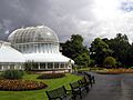
The Palm House, Belfast Botanic Gardens


