
Lake Atitlán facts for kids
Quick facts for kids Lake Atitlán |
|
|---|---|

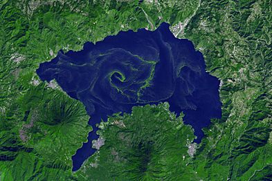
Seen from the Space Shuttle. Volcán San Pedro is at the left of the image; Panajachel is the largest white patch along the upper right shore. North is to the top of the image.
|
|

Lake Atitlán
Location in Guatemala
|
|
| Location | Sololá Department |
| Coordinates | 14°42′N 91°12′W / 14.700°N 91.200°W |
| Type | Crater lake, endorheic |
| Basin countries | Guatemala |
| Surface area | 130.1 km2 (50.2 sq mi) |
| Average depth | 154 m (505 ft) |
| Max. depth | 340 m (1,120 ft) (est.) |
| Water volume | 20 km3 (16,000,000 acre⋅ft) |
| Surface elevation | 1,562 m (5,125 ft) |
Lake Atitlán (Spanish: Lago de Atitlán) is a beautiful lake found in the Guatemalan Highlands. It's part of the Sierra Madre mountain range. This lake is located in the Sololá Department of southwestern Guatemala. It is known as the deepest lake in Central America.
Contents
What's in a Name?
The name "Atitlán" means "between the waters." It comes from the Nahuatl language. In Nahuatl, "atl" means water, and "titlan" means between. When combined, they form "Atitlán."
Geography and Beauty
Lake Atitlán is very deep, reaching about 340 metres (1,120 ft) at its deepest point. Its average depth is 154 metres (505 ft). The lake covers an area of about 130.1 km2 (50.2 sq mi). It's roughly 18 km × 8 km (11.2 mi × 5.0 mi) in size and holds about 20 km3 (4.8 cu mi) of water.
Atitlán is a special type of lake called an endorheic lake. This means it gets water from two nearby rivers but doesn't drain into the ocean. The lake is surrounded by tall cliffs and three volcanoes on its southern side. The lake basin was formed by a huge volcanic eruption about 84,000 years ago. The towns and villages around Lake Atitlán are strongly influenced by the Maya people.
Many people consider Lake Atitlán one of the most beautiful lakes in the world. It's a very important place for tourists in Guatemala. A famous German explorer, Alexander von Humboldt, called it "the most beautiful lake in the world." Even the writer Aldous Huxley said it was "too much of a good thing" because of its amazing beauty and volcanoes.
The area around San Marcos has very tall cliffs next to the lake. This spot has become famous for cliff diving in recent years.
Farming Around the Lake
The land around Lake Atitlán is great for farming. People grow a lot of coffee and avocados here. They also grow many other crops like corn, onions, beans, squash, tomatoes, cucumbers, garlic, and strawberries. The lake itself is a key source of food for the local people, many of whom are indigenous.
How the Lake Was Formed
The first volcanic activity in this area happened about 11 million years ago. Since then, there have been four big volcanic events that created and then collapsed huge craters. The most recent one started about 1.8 million years ago. This led to the formation of the lake's current basin, which is a large caldera. The lake now fills a big part of this caldera.
The huge eruption that formed the caldera is known as the Los Chocoyos eruption. It blasted out a massive amount of volcanic ash and rock, about 300 km3 (72 cu mi)! This ash spread over a huge area, about 6,000,000 square kilometres (2,300,000 sq mi). It has been found as far away as Florida and Ecuador.
After the Los Chocoyos eruption, three volcanoes grew inside the caldera. Volcán Atitlán is on the southern edge of the caldera. Volcán San Pedro and Volcán Tolimán are inside the caldera. San Pedro is the oldest and stopped erupting around 40,000 years ago. Tolimán started growing after San Pedro and might still be active, but it hasn't erupted in recorded history. Atitlán has mostly formed in the last 10,000 years and is still active. Its last eruption was in 1853.
On February 4, 1976, a very strong earthquake (magnitude 7.5) hit Guatemala. It caused the lake bed to crack, and water started draining from the lake. This made the water level drop by two metres (6 ft 7 in) in just one month.
Changes in Nature
In 1955, the area around Lake Atitlán became a national park. To attract more tourists, a type of fish called the black bass was brought into the lake in 1958. This fish was popular with people who liked to fish.
However, the black bass quickly took over. It ate many of the native fish species, causing more than two-thirds of them to disappear. It also played a part in the extinction of the Atitlan grebe. This was a rare bird that lived only near Lake Atitlán.
A special weather event in the area is called Xocomil. This word from the Kaqchickel language means "the wind that carried away sin." This strong wind often blows across the lake in the late morning and afternoon. It happens when warm winds from the Pacific Ocean meet colder winds from the North.
In August 2015, a thick bloom of algae, called Microcystis cyanobacteria, appeared in Lake Atitlán again. The first big bloom happened in 2009. There are concerns that if pollution continues, the lake could become unsafe for people to use.
Local Culture
The lake is surrounded by many villages where the Maya culture is still very strong. People often wear traditional clothing. The Maya people of Atitlán mainly speak Tz'utujil and Kaqchikel.
During the Spanish conquest of the Americas, the Kaqchikel first joined the Spanish. They helped defeat their old enemies, the Tz'utujil and K'iche' Maya. But later, the Spanish conquered the Kaqchikel too when they refused to pay tribute.
Santiago Atitlán is the largest community by the lake. It is known for its worship of Maximón. Maximón is an idol that combines beliefs from traditional Mayan gods, Catholic saints, and old legends. The statue of Maximón is cared for by a local religious group. It moves to different houses throughout the year and is part of a big parade during Semana Santa.
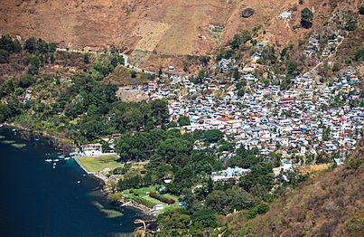
While Maya culture is strong in most lakeside towns, Panajachel has become very popular with tourists. Many hippies visited in the 1960s. Even though a civil war caused many foreigners to leave, tourism boomed again after 1996. Today, Panajachel's economy relies almost entirely on tourism.
Several ancient Mayan sites have been found in the lake. Sambaj is about 55 feet below the current lake level. It seems to be from a very old time, before 300 B.C. It has remains of many buildings, including a large group believed to be the city center.
Another site, Chiutinamit, was found by local fishermen. They noticed what looked like a city underwater. Divers found pottery pieces there, which helped date the site to around 250 A.D.
There is a project called "Underwater archeology in the Lake Atitlán. Sambaj 2003 Guatemala." It aims to explore these underwater sites.
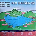
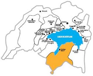
There is no road that goes all the way around the lake. You can reach communities by boat or by roads that come from the mountains. Some towns, like Jaibalito, can only be reached by boat. Santa Catarina Palopó and San Antonio Palopó are connected by road to Panajachel. Other main towns include Santa Clara La Laguna, San Juan La Laguna, and San Pedro La Laguna in the west; Santiago Atitlán in the south; and San Lucas Tolimán in the east.
Recent studies suggest that a special ceremonial site called Samabaj was on an island in Lake Atitlán. This site was important because of its connection to the Popol Wuj, a sacred book of the K'iche' Mayan people.
Impact of the Civil War
During the Guatemalan Civil War (1960 - 1996), the lake area experienced many difficult times. The government fought against guerrillas. Indigenous people were sometimes thought to support the guerrillas, and they faced harsh treatment. It is believed that at least 300 Maya people from Santiago Atitlán disappeared during this conflict.
Two events from this time gained international attention. One was the killing of Stanley Rother, a missionary from Oklahoma, in a church in Santiago Atitlán in 1981. In 1990, a peaceful protest march to an army base was met with gunfire. This resulted in the deaths of 11 unarmed civilians. Because of international pressure, the Guatemalan government closed the army base. Santiago Atitlán was then declared a "military-free zone." A memorial for the massacre was damaged in a mudslide in 2005.
Natural Disasters
In October 2005, heavy rains from Hurricane Stan caused a lot of damage in Guatemala, especially around Lake Atitlán. A huge landslide buried the lakeside village of Panabaj. This caused the deaths of as many as 1,400 people and left 5,000 homeless. Many bodies were buried under tons of earth. After this, the mayor of Santiago Atitlán, Diego Esquina Mendoza, said that Panabaj was now a mass gravesite. He said, "Those buried by the mudslide may never be rescued. Here they will stay buried, under five meters of mud. Panabáj is now a cemetery."
Four and a half years later, Tropical Storm Agatha brought even more rain. This caused more damage and dozens of deaths between San Lucas Tolimán and San Antonio Palopó. Since then, roads have been repaired, and travel to the region is back to normal.
Images for kids
-
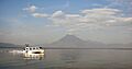
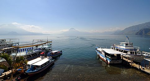
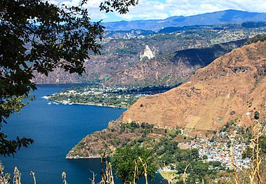
A view across Lake Atitlán from Panajachel to Volcán San Pedro
-
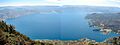
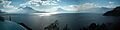
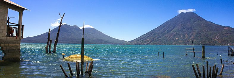
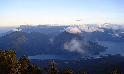
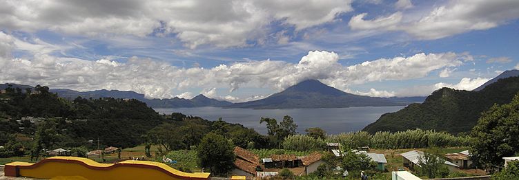
Panorama view of the lake as seen from the top of Volcán San Pedro
-
San Pedro la Laguna and Volcán San Pedro
-
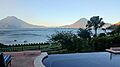
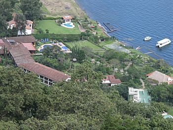
View from Hotel Atitlán near Panajachel
-
Map of Lake Atitlán
-
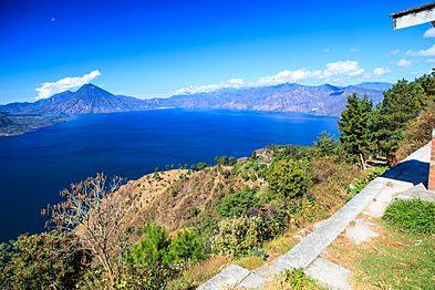
Lake Atitlán, from Tzam Poc Hotel near Santa Catarina Palopó
-
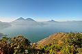
Aerial panoramic view of Lake Atitlán


Gallery
-
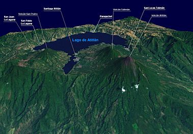
Volcano Atitlan, San Pedro, Toliman & Lago Atitlan isometric view
-
Another view from the Lake
-
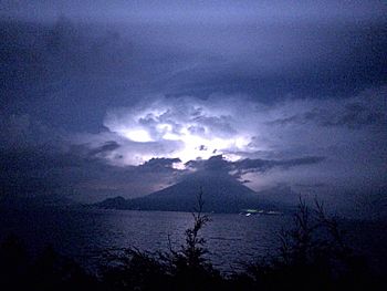
Storm over San Pedro volcano, 2015
-
Sunrise at lake atitlán Guatemala
-
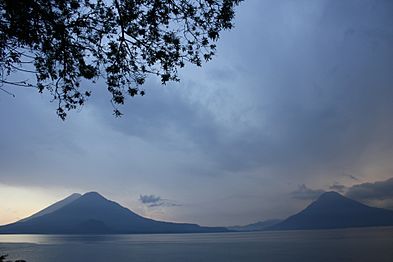
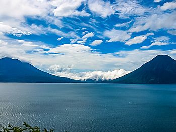
Volcanoes of Lake Atitlan
-
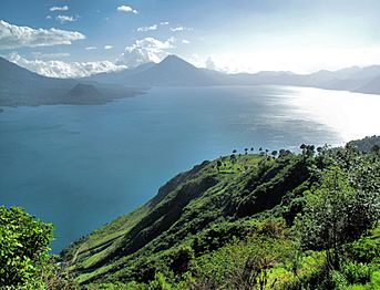
Lake Atitlán, seen from San Marcos Guatemala
-
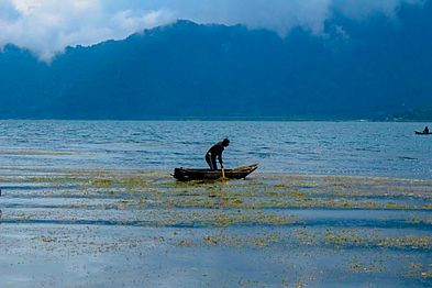
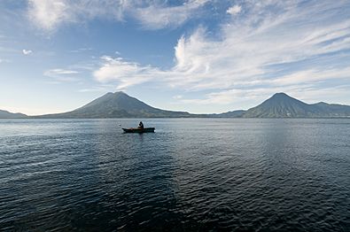
Fisherman in Lake Atitlán
-
Lake Atitlán and volcanoes
-
Hotel on the shores of Lake Atitlán Guatemala
-
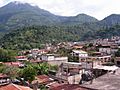
Panajachel
-
Lake Atitlan & volcanoes from the East
-
Clouds, mountains, lakes
-
A harmful bloom of cyanobacteria (blue-green algae) spread across the lake (false colour image)
-
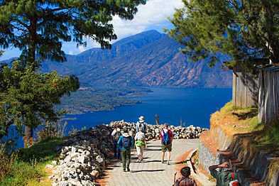
Hike down from the east rim to Lake Atitlán
-
Hike down from the east rim to Lake Atitlán-Panajachel
-
Hike down from the east rim to Lake Atitlán-Panajachel
-
Santiago Atitlán map
-
Lake Atitlán Guatemala
-
Panorama of Lake Atitlán, Guatemala
-
Volcanoes near Lake Atitlán Guatemala
-
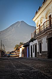
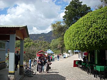
Town Street, Lake Atitlán, Guatemala with Volcano
-
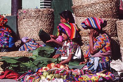
Indigenous people near Lake Atitlán Guatemala
-
Solalá
-
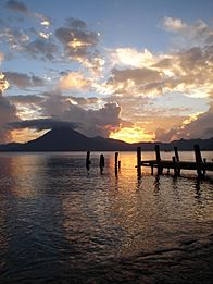
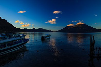
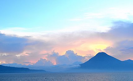
Guatemala Panjachel sunset
-
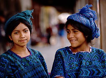
Indigenous girls
-
Panajachel shore
-
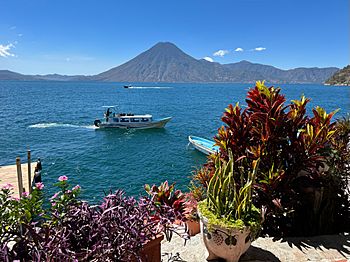
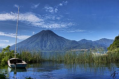
View of a lancha and Volcán Atitlán from Hotel La Casa del Mundo


.jpg)


.jpg)


.jpg)


.jpg)
.jpg)
.jpg)


See also
 In Spanish: Lago de Atitlán para niños
