Lakeland, Queensland facts for kids
Quick facts for kids LakelandQueensland |
|||||||||||||||
|---|---|---|---|---|---|---|---|---|---|---|---|---|---|---|---|
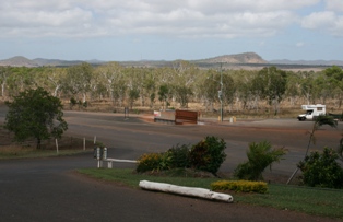
Lakeland Downs
|
|||||||||||||||
| Population | 333 (2021 census) | ||||||||||||||
| • Density | 0.07028/km2 (0.1820/sq mi) | ||||||||||||||
| Postcode(s) | 4871 | ||||||||||||||
| Area | 4,738.0 km2 (1,829.4 sq mi) | ||||||||||||||
| Time zone | AEST (UTC+10:00) | ||||||||||||||
| Location | |||||||||||||||
| LGA(s) | Shire of Cook | ||||||||||||||
| State electorate(s) | Cook | ||||||||||||||
| Federal Division(s) | Leichhardt | ||||||||||||||
|
|||||||||||||||
Lakeland is a small country town in Queensland, Australia. It's located in the Shire of Cook. In 2021, about 333 people lived in Lakeland.
Contents
Where is Lakeland?
Lakeland is a small farming town. It's found on the Cape York Peninsula in northern Queensland. Two important roads meet here: the Peninsula Developmental Road and the Mulligan Highway. The road from Cairns to Lakeland is fully paved, making travel easier.
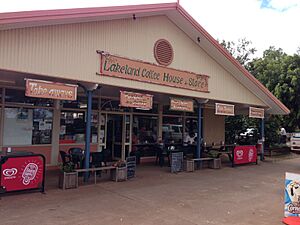
You'll find a hotel, a cafe, a roadhouse, and a small store in Lakeland. Farmers in the area grow crops like peanuts, maize, and sorghum. They also raise cattle and produce coffee, tea, and tropical fruits.
A Glimpse into Lakeland's Past
The town of Lakeland is named after William Lakeland. He was one of the first people to explore and search for valuable minerals on the Cape York Peninsula.
Who Lives in Lakeland?
The number of people living in Lakeland has slowly grown over the years.
- In 2011, there were 227 people.
- By 2016, the population grew to 299 people.
- In 2021, the latest count showed 333 people living in Lakeland.
Important Historical Sites
Lakeland has a special place listed for its history. These are called heritage-listed sites.
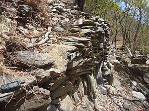
- Nuggety Gully Water Race and Chinese Camp: This site is part of the Mareeba Mining District. It shows old stone structures used for mining and a camp where Chinese miners lived.
Lakeland's Economy
Farming is a big part of Lakeland's economy. Most farms get water for their crops from special dams. These dams collect water during the wet season. The main products from Lakeland are cattle and various crops, including bananas.
Learning in Lakeland
Lakeland State School is a primary school for children from early childhood up to Year 6. It's a government school for both boys and girls. In 2018, the school had 17 students.
There isn't a high school in Lakeland. Older students usually go to Cooktown State School in Cooktown. Because Cooktown is quite far, some students learn through distance education (studying from home) or go to boarding schools.
Protecting the Environment
There's a project in Lakeland called the "Lakeland Agricultural Area Water Quality Monitoring Program." This program works with local landowners to check the quality of the water.
In 2016, the Queensland Government bought a large property called Springvale Station. This land was bought to help protect the environment. It helps reduce dirt and mud from washing into the Normanby River. This river flows into Princess Charlotte Bay and the amazing Great Barrier Reef.
Scientists and traditional owners are working together to manage Springvale Station. Their goal is to stop soil erosion and protect the water quality.
Amazing Animals and Plants
Springvale Station Nature Refuge is a very important place for wildlife. It's home to many endangered or vulnerable plants and animals. These include:
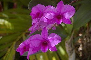
- The Cooktown orchid, which is Queensland's state flower.
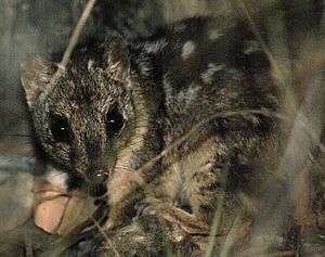
- Animals like the ghost bat, northern quoll, red goshawk, spectacled flying-fox, spotted-tailed quoll, Semon's leaf nosed bat, and large eared-horseshoe bat.
This special area is not open to the public to ensure the animals and plants are not disturbed.
Local Services and Shops
Lakeland has a few places where you can get what you need. There's a hotel, a cafe, a roadhouse, and a hardware store.
Places to See
If you're visiting Lakeland, you might want to check out James Earl Lookout. It's about 14.7 kilometers south-southeast of the town, off the Mulligan Highway. The lookout is named after James Earl, a grazier (someone who raises livestock) from the past.
Getting Around
Lakeland has its own airport, Lakeland Airport (YLND). It's located north of the town, right next to the Mulligan Highway.
 | DeHart Hubbard |
 | Wilma Rudolph |
 | Jesse Owens |
 | Jackie Joyner-Kersee |
 | Major Taylor |


