Normanby River facts for kids
Quick facts for kids Normanby |
|
|---|---|
 |
|
|
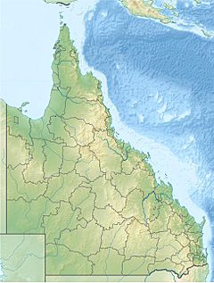
Location of Normanby River river mouth in Queensland
|
|
| Other name(s) | East Normanby, West Normanby, East Normanby North Branch, East Normanby South Branch, Granite Normanby |
| Country | Australia |
| State | Queensland |
| Region | Far North Queensland, Cape York Peninsula, Wet Tropics of Queensland |
| Physical characteristics | |
| Main source | Great Dividing Range west of Wujal Wujal 15°55′S 145°12′E / 15.917°S 145.200°E |
| River mouth | Princess Charlotte Bay Rinyirru National Park 0 m (0 ft) 14°23′47″S 144°08′37″E / 14.39639°S 144.14361°E |
| Length | 350 km (220 mi) |
| Basin features | |
| Basin size | 24,408 km2 (9,424 sq mi) |
| Tributaries |
|
| National park | Rinyirru National Park |
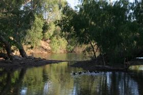
The Normanby River is a big river system in Far North Queensland, Australia. It's actually made up of several smaller rivers. These include the East Normanby River and the West Normanby River. People sometimes call this whole area the Norman-Laura Catchment.
Contents
Where is the Normanby River?
The Normanby River starts in the Great Dividing Range. This is a mountain range west of a town called Wujal Wujal. The river forms when its East and West Branches join together.
The river then flows mostly north-northwest. It passes through savanna grasslands that get flooded during certain times of the year. Finally, it reaches its mouth at Princess Charlotte Bay. This bay is about 150 kilometres (93 mi) northwest of Cooktown.
River's Journey and Tributaries
The Normanby River is joined by 18 smaller rivers and creeks. One of the most important ones is the Laura River.
The river flows through the Rinyirru National Park. This park covers a large part of the river's area. During the wet season, from November to May, the park becomes completely impassable. This means you cannot travel through it.
The Rinyirru National Park has many large wetlands. These wetlands are home to a wide variety of fish species. Near where the river meets the sea, it flows very slowly. It forms a large delta, which is hard to reach even in the dry season.
The entire Normanby River system starts high up, at 622 metres (2,041 ft) above sea level. It then flows all the way down to the ocean. The total length of its journey from start to finish is over 490 kilometres (300 mi).
How Big is the Normanby River?
Some people think the Normanby River system is the third largest river in Australia. However, the Australian Government's official agency, Geoscience Australia, doesn't list it among the ten longest rivers. It's also not among the three longest continuous river systems in the country.
The Normanby River might be the largest river that flows into the Coral Sea. It has less than half the water flow of the Murray and Mitchell Rivers.
Protecting the Environment
The Normanby River system, along with the Laura River, is very important. It's the fourth largest river system that flows into the Great Barrier Reef. It sends a lot of water into the Reef every year. Because of this, most scientific studies of the Normanby River focus on how it affects the health of the Reef.
The Normanby River is special because it has no dams. This means it flows naturally. Australian Government studies use it as an example to understand how other rivers used to behave before dams were built.
In 2016, the Queensland Government bought a large property called Springvale Station. This property is 56,295-hectare (139,110-acre) big. It was bought to help protect the area and reduce dirt and mud flowing into the Normanby River. This dirt can harm the Great Barrier Reef.
A plan called the Erosion Management Plan will help manage Springvale Station. It will also look for ways to control erosion on the property.
Animals and Plants of Springvale Station
Springvale Station Nature Refuge is a very important home for many animals and plants. Some of these species are endangered or vulnerable. This means they are at risk of disappearing forever.
Animals found here include the ghost bat, northern quoll, and red goshawk. You might also find the spectacled flying-fox and the spotted-tailed quoll. Two types of bats, the Semon's leaf nosed bat and the large eared-horseshoe bat, also live here.
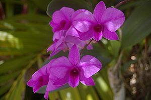
A special flower, the Cooktown orchid, also grows on Springvale Station. This orchid is the state flower of Queensland. The Nature Refuge is not open to the public.
Local Life and Economy
The Normanby River area includes small towns like Lakeland, Laura, and Lakefield. There are also several farms and remote communities.
Most of the land around the Normanby River is used for raising beef cattle. These cattle farms are often very large. Many of them are worked by Aboriginal people. The soil in this area is not good for growing crops like sugar cane. Sugar cane is a main crop in other parts of tropical Australia.
Tourism is important in the area. Keeping roads and other transport routes open after regular floods is also a big job. The areas where the river meets the sea, called estuaries, are used for both commercial and recreational fishing.
River's Name
The Normanby River was named in September 1872 by a man named William Hann. He named it after George Phipps, 2nd Marquess of Normanby. George Phipps was the third Governor of Queensland from 1871 to 1874.
Indigenous Language
The Guugu Yimithirr language is an Australian Aboriginal language. It is spoken in areas like Hope Vale and Cooktown. The language region includes parts of the Normanby River and Annan River areas.
See also
 | Bayard Rustin |
 | Jeannette Carter |
 | Jeremiah A. Brown |


