Langdon, New Hampshire facts for kids
Quick facts for kids
Langdon, New Hampshire
|
|
|---|---|

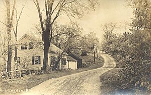
Street scene, c. 1909
|
|

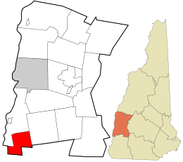
Location in Sullivan County and the state of New Hampshire.
|
|
| Country | United States |
| State | New Hampshire |
| County | Sullivan |
| Incorporated | 1787 |
| Area | |
| • Total | 16.3 sq mi (42.3 km2) |
| • Land | 16.3 sq mi (42.1 km2) |
| • Water | 0.08 sq mi (0.2 km2) 0.45% |
| Elevation | 676 ft (206 m) |
| Population
(2020)
|
|
| • Total | 651 |
| • Density | 40/sq mi (15.5/km2) |
| Time zone | UTC-5 (Eastern) |
| • Summer (DST) | UTC-4 (Eastern) |
| ZIP code |
03602
|
| Area code(s) | 603 |
| FIPS code | 33-40900 |
| GNIS feature ID | 0873642 |
Langdon is a small town in Sullivan County, New Hampshire, United States. It's a quiet place with a population of 651 people, according to the 2020 census.
Contents
History of Langdon
Langdon was first settled in 1773 by a person named Seth Walker. The town officially became a town on January 11, 1787. This process is called incorporation. It was named after Governor John Langdon, who was an important political leader.
One cool thing about Langdon is the Prentiss Bridge. It's the shortest covered bridge in all of New Hampshire! This special bridge was built in 1874. It crosses over a stream called Great Brook. The bridge is a lattice truss type, which means it has a crisscross pattern of wood. It is about 34 feet (10.5 meters) long.
Langdon's Geography
Langdon covers a total area of about 16.3 square miles (42.3 square kilometers). Most of this area is land. Only a tiny part, about 0.08 square miles (0.2 square kilometers), is water. This water makes up less than half a percent of the town's total area.
The town has two main waterways: the Cold River and its smaller branch, Great Brook. All the water in Langdon eventually flows into the Connecticut River. This means Langdon is part of the Connecticut River's watershed, which is an area of land where all the water drains into one main river.
The highest point in Langdon is the top of Holden Hill. It stands about 1,348 feet (411 meters) above sea level.
Nearby Towns
Langdon is surrounded by several other towns:
- Charlestown is to the north.
- Acworth is to the east.
- Alstead is to the southeast.
- Walpole is to the southwest.
Langdon's Population
The population of Langdon has changed over many years. Here's how the number of people living in Langdon has grown and shrunk since 1790:
| Historical population | |||
|---|---|---|---|
| Census | Pop. | %± | |
| 1790 | 244 | — | |
| 1800 | 484 | 98.4% | |
| 1810 | 632 | 30.6% | |
| 1820 | 654 | 3.5% | |
| 1830 | 667 | 2.0% | |
| 1840 | 615 | −7.8% | |
| 1850 | 575 | −6.5% | |
| 1860 | 478 | −16.9% | |
| 1870 | 411 | −14.0% | |
| 1880 | 364 | −11.4% | |
| 1890 | 305 | −16.2% | |
| 1900 | 339 | 11.1% | |
| 1910 | 340 | 0.3% | |
| 1920 | 279 | −17.9% | |
| 1930 | 267 | −4.3% | |
| 1940 | 276 | 3.4% | |
| 1950 | 378 | 37.0% | |
| 1960 | 338 | −10.6% | |
| 1970 | 337 | −0.3% | |
| 1980 | 437 | 29.7% | |
| 1990 | 580 | 32.7% | |
| 2000 | 586 | 1.0% | |
| 2010 | 688 | 17.4% | |
| 2020 | 651 | −5.4% | |
| U.S. Decennial Census | |||
In the year 2000, there were 586 people living in Langdon. These people lived in 237 different homes. About 29.5% of these homes had children under 18 years old living there. The average age of people in Langdon in 2000 was 41 years old.
Things to See in Langdon
- Prentiss Bridge – This is New Hampshire's smallest covered bridge, a cool historical site to visit!
See also
 In Spanish: Langdon (Nuevo Hampshire) para niños
 | Aaron Henry |
 | T. R. M. Howard |
 | Jesse Jackson |

