Le Grand Champ Bottom facts for kids
Quick facts for kids Le Grand Champ Bottom |
|
|---|---|

Le Grand Champ Bottoms
|
|
| Location | Ste. Genevieve County, Missouri, United States |
| Coordinates | 37°56′53″N 89°59′49″W / 37.948°N 89.997°W |
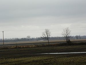
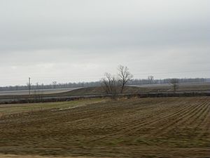
Le Grand Champ (which means "the big field" in French) is a wide, flat area of land next to the Mississippi River in Ste. Genevieve County, Missouri. These flat areas are often called "bottoms" or "floodplains" because they are formed by rivers depositing soil over time.
This area is a continuation of the American Bottom, which stretches south from St. Louis along the east side of the Mississippi River. When the river breaks around Morrow Island, Le Grand Champ continues on the west side. It even includes Kaskaskia Island.
Contents
What's in a Name?
Le Grand Champ got its name because it was the main farming area for the original French settlement of Ste. Genevieve, known as "Le Vieux Village de Ste. Genevieve." It was common for French villages to call their shared farming land "the big field." Sometimes, it was also called "grand carre" or "quarre." Later, when Americans arrived, they simply called it "The Big Field."
A Look Back in Time
Early Native American Life
The very first people known to live in this area were the Mound Builders. These ancient Native American groups were skilled farmers, especially with corn. They built large earthen mounds, especially in the flat river areas like Le Grand Champ.
The Mississippian culture, a major group of Mound Builders, started to decline around the 12th and 13th centuries. By the time Europeans arrived, they had mostly disappeared. When Europeans first came to the area, the main Native American group was the Illiniwek. They lived across much of what is now Illinois and eastern Missouri.
One Illiniwek tribe, the Kaskaskia, moved south from the area of present-day Peoria, Illinois, to the region around Kaskaskia, Illinois. Later, in the late 1770s and 1780s, parts of another Illiniwek tribe, the Peoria, moved to New Ste. Genevieve and around Le Grand Champ. They were trying to escape problems with the British and Americans. Another tribe, the Kickapoos, who spoke an Algonquian language, followed them.
French Settlers Arrive
Le Grand Champ was the shared farming land for the French settlers of Ste. Genevieve. It's located south of the town and stretches down to the River aux Vases along the Mississippi River.
When the French settled Ste. Genevieve, each family received a house lot and one or more farming plots in the common fields. These plots were long and narrow, usually about 192 feet wide and a mile long. They stretched from the river back to the bluffs. This way of dividing land was common in Europe long ago.
A fence separated the common fields from the "commons." The commons was a shared area where villagers could gather firewood and let their livestock graze. Each person who owned a strip of land in the common field had to help maintain the fence that crossed their property. Even as late as 1907, people were still farming Le Grand Champ in this traditional way.
Le Grand Champ was very important for feeding Ste. Genevieve. It also supplied a lot of food to New Orleans, making it a key "breadbasket" for the Louisiana territory. Farmers grew many crops here, including corn, pumpkins, wheat, oats, barley, flax, cotton, and tobacco.
A village of Peoria and Kickapoo people was located on Le Grand Champ, close to old Ste. Genevieve. Children from these tribes and French children often played together.
However, relations with the Osage Indians to the southwest were not always peaceful. The Osage did not live near Ste. Genevieve, but they often hunted in the area. They were also known to take livestock from the French settlers. The Peoria and Kickapoo tribes would go on hunts for food, but they sometimes had to stop because they feared the Osage.
To help protect the settlement, the French welcomed Shawnee and Delaware tribes from Ohio and Indiana. These tribes settled south of Le Grand Champ in what is now Perry County. They established six settlements there, acting as a buffer against the Osage. However, even with their help, the Osage raids continued.
Facing the Floods
Flooding has always been a big concern for the people living in Le Grand Champ Bottom. In the early days, under French and Spanish rule, every settler had to build and maintain protective walls (levees) on their land.
In 1785, a massive flood covered the entire floodplain. This event caused the residents to move the town of Ste. Genevieve to a new, higher location that was safer from floods. In more recent times, major floods have hit the area in 1943, 1973, 1993, and during the winter of 2015–16.
Where is Le Grand Champ?
Le Grand Champ is located about three miles south of the current town of Ste. Genevieve. This specific area of the floodplain was historically known as "Pointe Basse."
In 1811, it was estimated that the entire bottomland around Le Grand Champ was about 10,000 acres. However, the part that was actually farmed was roughly 3,000 acres. To the northeast of Le Grand Champ is the American Bottom, and to the south are Kaskaskia Island and Bois Brule Bottom.
Towns in Le Grand Champ Bottoms
 | Frances Mary Albrier |
 | Whitney Young |
 | Muhammad Ali |


