Leal, North Dakota facts for kids
Quick facts for kids
Leal
|
|
|---|---|

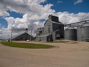
Grain elevators in Leal
|
|

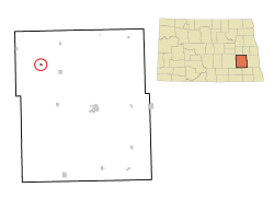
Location of Leal, North Dakota
|
|
| Country | United States |
| State | North Dakota |
| County | Barnes |
| Founded | 1892 |
| Incorporated (village) | 1917 |
| Incorporated (city) | 1967 |
| Named for | Scottish for "faithful" |
| Government | |
| • Type | Mayor-Council |
| Area | |
| • Total | 0.13 sq mi (0.33 km2) |
| • Land | 0.13 sq mi (0.33 km2) |
| • Water | 0.00 sq mi (0.00 km2) |
| Elevation | 1,467 ft (447 m) |
| Population
(2020)
|
|
| • Total | 27 |
| • Estimate
(2022)
|
24 |
| • Density | 209.30/sq mi (80.87/km2) |
| Time zone | UTC-6 (Central (CST)) |
| • Summer (DST) | UTC-5 (CDT) |
| ZIP code |
58479
|
| Area code(s) | 701 |
| FIPS code | 38-45460 |
| GNIS feature ID | 1029852 |
Leal is a small city located in Barnes County, in the state of North Dakota, United States. In 2020, only 27 people lived there. The city was started in 1892. Its name comes from a Scots word that means "faithful." In an old phrase, laund o the leal means Heaven.
Contents
History of Leal, North Dakota
The first people to settle in this area were Scottish-English families. They came from Ontario, Canada, in 1883. The town area of Leal was officially planned out in 1892. A post office opened there on December 28, 1892. Later, in 1902, the Soo Line Railroad built a train stop in Leal.
Leal officially became a village in 1917. It was part of Edna Township before that. Then, in 1967, Leal changed from a village to a city. This happened because the North Dakota Legislature (the state's law-making group) changed how towns were officially named. After this change, all villages and towns in North Dakota automatically became cities.
Geography of Leal
Leal is found in Edna Township, which is in the northeast part of Barnes County. It is about 73 miles (117 km) west of Fargo. The closest city to Leal is Rogers.
The United States Census Bureau says that Leal covers a total area of 0.14 square miles (0.36 square kilometers). All of this area is land, with no water.
What is Leal's Climate Like?
Leal has an extreme continental climate. This means it has very hot summers and very cold winters. This is because it is in the Great Plains, far from mountains and oceans. The lowest temperature ever recorded in Leal was -37°F (-38°C) on December 23, 1983. The highest temperature ever recorded was 106°F (41°C) on July 30, 2006.
Population and People in Leal
| Historical population | |||
|---|---|---|---|
| Census | Pop. | %± | |
| 1920 | 88 | — | |
| 1930 | 105 | 19.3% | |
| 1940 | 102 | −2.9% | |
| 1950 | 72 | −29.4% | |
| 1960 | 70 | −2.8% | |
| 1970 | 41 | −41.4% | |
| 1980 | 45 | 9.8% | |
| 1990 | 35 | −22.2% | |
| 2000 | 36 | 2.9% | |
| 2010 | 20 | −44.4% | |
| 2020 | 27 | 35.0% | |
| 2022 (est.) | 24 | 20.0% | |
| U.S. Decennial Census 2020 Census |
|||
The number of people living in Leal has changed over the years. In 1920, there were 88 people. The population grew to 105 in 1930. Since then, it has generally decreased. In 2010, only 20 people lived in Leal. By 2020, the population had slightly increased to 27 people.
How Many People Live Here?
The census from 2010 showed that 20 people lived in Leal. These people lived in 10 different homes, and 6 of these were families. The city had about 143 people per square mile (55 people per square kilometer).
Most of the people living in Leal in 2010 were White (95%). A small number (5%) were from two or more racial backgrounds.
In the 10 homes, 10% had children under 18 living there. 40% were married couples. 20% were homes where a woman was the head of the house without a husband present. 40% of the homes were not families. About 10% of all homes had someone living alone who was 65 years old or older.
The average age of people in Leal in 2010 was 53 years old. 15% of residents were under 18. 10% were between 18 and 24. 15% were between 25 and 44. 45% were between 45 and 64. And 15% were 65 years old or older. More women lived in Leal than men, with 65% being female and 35% male.
See also
 In Spanish: Leal (Dakota del Norte) para niños
 | Selma Burke |
 | Pauline Powell Burns |
 | Frederick J. Brown |
 | Robert Blackburn |


