Linthorpe, Queensland facts for kids
Quick facts for kids LinthorpeQueensland |
|||||||||||||||
|---|---|---|---|---|---|---|---|---|---|---|---|---|---|---|---|

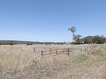
Fields and windmill along Biddeston Linthorpe Road, 2014
|
|||||||||||||||
| Population | 416 (2021 census) | ||||||||||||||
| • Density | 3.838/km2 (9.94/sq mi) | ||||||||||||||
| Postcode(s) | 4356 | ||||||||||||||
| Area | 108.4 km2 (41.9 sq mi) | ||||||||||||||
| Time zone | AEST (UTC+10:00) | ||||||||||||||
| Location |
|
||||||||||||||
| LGA(s) | Toowoomba Region | ||||||||||||||
| State electorate(s) | Condamine | ||||||||||||||
| Federal Division(s) | Groom | ||||||||||||||
|
|||||||||||||||
Linthorpe is a small countryside area in the Toowoomba Region of Queensland, Australia. It's known as a "locality," which is like a small district or neighborhood. In 2021, about 416 people lived in Linthorpe.
Contents
Linthorpe's Location and Landscape
Linthorpe is located in a famous farming area called the Darling Downs. This region is known for its rich soil and flat lands, perfect for growing crops.
Major roads help mark the edges of Linthorpe:
- The Gore Highway is along its southern side.
- The Toowoomba–Cecil Plains Road runs along the northern edge.
- The Oakey-Pittsworth Road is on the north-western side.
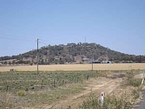
Linthorpe also has a few hills and mountains:
- Dummies Mountain is about 610 meters (2,001 feet) high.
- Majuba Hill is about 599 meters (1,965 feet) high.
- Mount Haystack is about 528 meters (1,732 feet) high.
A Look Back at Linthorpe's History
Linthorpe has a simple but interesting history, especially when it comes to its school.
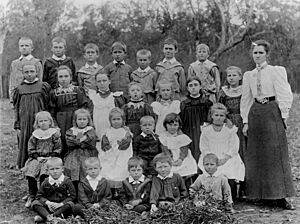
- A school first opened here on 12 March 1900. It was called Motley Provisional School. A "provisional school" was a type of small school set up in new areas.
- In January 1901, its name changed to Linthorpe Provisional School.
- On 1 January 1909, it became Linthorpe State School, meaning it was a full public school.
- The school taught students until it closed in 1960. It was located at 1190 Stoneleigh Road.
Who Lives in Linthorpe?
The number of people living in Linthorpe has changed a little over the years.
- In 2016, there were 440 people living in Linthorpe.
- By 2021, the population was 416 people.
Learning and Schools Near Linthorpe
Linthorpe itself does not have any schools. Students living here travel to nearby towns for their education.
For primary school, children can go to:
- Mount Tyson State School, to the west in Mount Tyson.
- Biddeston State School, to the north-east in Biddeston.
- Southbrook State School, to the east in Southbrook.
- Pittsworth State School, to the south in Pittsworth.
For high school, students usually attend:
- Oakey State High School, located north in Oakey.
- Pittsworth State High School, located south in Pittsworth.
 | James B. Knighten |
 | Azellia White |
 | Willa Brown |


