List of places of worship in Eastbourne facts for kids
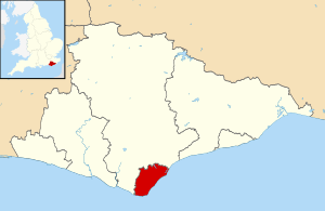
Eastbourne is a town on the coast of East Sussex, England. It has over 50 churches and other places where people worship. Some old churches are still standing but are used for other things now. For a long time, Eastbourne was mostly farms with a few small villages. But around 1780, it started to become a popular seaside town. This happened because important people visited, the weather was good, and trains made it easy to get there.
As the town grew, many churches were built. Eastbourne has many different types of churches and religious groups. Today, 46 places of worship are still in use. Nine old churches are also still standing, but they are used for other purposes. Most people in Eastbourne are Christian. The oldest church in town belongs to the Church of England. Many other Christian churches, like Nonconformist and Roman Catholic ones, were built in the 1800s. As Eastbourne got bigger, new churches were built in areas like The Hydneye and Langney. There are also places of worship for Jewish and Muslim people.
Some church buildings in Eastbourne are "listed." This means they are special because of their history or design. Historic England decides which buildings get this status. There are three levels of listing:
- Grade I: For buildings that are extremely important.
- Grade II*: For very important buildings that are more than just special.
- Grade II: For buildings that are special.
Contents
Eastbourne's Religious History
Eastbourne is on the coast in southeast England. About 100,000 people live there. The area has been lived in since the Stone Age. A large Roman house once stood near where Eastbourne Pier is today. Four small villages grew up on the farmland behind the cliffs. These were Meads, Seahouses, South Bourne, and Bourne (also called Old Town). People mostly farmed, fished, or sometimes smuggled goods. The main church was St Mary the Virgin Church in Old Town, built in the 1100s.
In the late 1700s, people started coming to Bourne's beach for sea-bathing, believing it was good for their health. A visit from Prince Edward in 1780 made tourism popular. Two rich families, the Davies-Gilberts and the Dukes of Devonshire, owned all the land. They helped the town grow in a planned way. They made sure buildings looked good together and encouraged building things like theatres, schools, and churches.
In 1828, Canon Thomas Pitman became the Vicar of Eastbourne. He saw that the town needed a new Anglican church closer to the seafront. He convinced the Duke of Devonshire to give land for it. He also raised £2,500 himself. This church, designed by Decimus Burton, opened in 1838 and became Holy Trinity Church. It was Eastbourne's first Anglican church in the modern town.
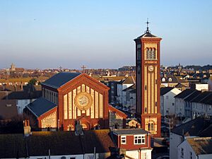
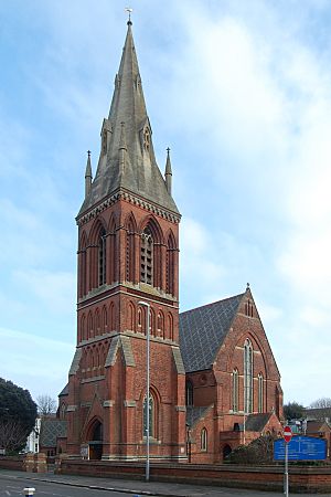
More churches were built during the Victorian era (1837-1901). Christ Church opened in 1859. St Saviour's Church was built in 1867 on land given by the Duke of Devonshire. All Souls Church, with its bright colours, opened in 1882. St Peter's Church was built in 1894 but was later taken down in 1971. Churches were also built in the Meads and Upperton areas. St Saviour's Church is often called the best Victorian church in Eastbourne. All Souls Church is also very striking with its large bell tower and colourful bricks.
Eastbourne was heavily bombed during World War II. Many churches were damaged or destroyed. St Anne's Church was ruined and taken down. Only the tower of St John the Evangelist's Church survived. St Mary's Church at Hampden Park was also mostly destroyed in 1940, except for its bell tower. St Elisabeth's Church was damaged. After the war, new Anglican churches were built in new housing areas. St Peter's at Hydneye opened in 1953, and St Richard's in Langney was finished in 1956. Some older Anglican churches have been demolished, but one, St Philip's, was replaced by a new building that still has space for worship.
After the English Reformation, the Roman Catholic faith almost disappeared in Eastbourne. Laws in the late 1700s removed many rules against their worship. In 1830, a Catholic mission started in St Leonards. This mission looked after Catholics in a large part of East Sussex, including Eastbourne. By 1862, it was clear Eastbourne needed its own mission.
In 1867, Father Charles King started holding Mass in his house in Ceylon Place. Only about five or six people usually came. However, many coastguards and soldiers also attended. Stella Maris Church, built in 1868–69, became the first permanent Catholic church. It was a brick building that could hold 100 people. It closed in 1890 and was taken down. In 1890, a former market building became the new Catholic church temporarily. It took over ten years to find land and money for a permanent church. The first stone of Our Lady of Ransom Church was laid in 1900. This church served a huge area. By the 1950s, new churches were built in Eastbourne (St Agnes and St Gregory) and nearby towns. Another church was later built in Hampden Park.
Formal Methodist worship in Eastbourne began in 1810. A Wesleyan chapel was built on Grove Road. A new one was built nearby in 1863–64, which was rebuilt in 1907–08 as the Central Methodist Church. Other Wesleyan chapels opened in Old Town (1898) and the east end of town (1904). Primitive Methodists also had chapels. In 1932, the Wesleyan and Primitive Methodists joined to form the Methodist Church we know today. A new Methodist church, St Stephen, opened in Hampden Park in 1960. St Aidan's Church closed and was taken down in the early 2000s.
The Congregational church started services in Eastbourne in 1862. Churches were built in 1864 and 1885. The Presbyterian Church of England opened chapels in the town centre (St Andrew's; 1878) and Hampden Park (St Luke's; 1913). In 1972, these two groups joined to form the United Reformed Church. Some of their churches were sold or closed. A new church, St Barnabas', was built in Langney in 1975–76. It is shared by Baptist, Methodist, and United Reformed congregations. St Luke's closed in 2005. Its members moved to Hampden Park's Methodist church, which is now called Broadway United Church.
In 2015, the Methodist and United Reformed Churches planned to combine four of their churches into one new building called Emmanuel Church. This new church would be on Upperton Road. The other three churches would then close. Planning permission was given to take down St Andrew's Church and build flats. Greenfield Methodist Church changed its name to Emmanuel and now holds services for both groups. Upperton church closed in 2019. Central Methodist Church is now used by the Church of God Worldwide Mission, a Pentecostal group.
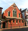
Baptist worship in Eastbourne started in 1871. A temporary iron chapel was built in the town centre. This was replaced by Ceylon Place Baptist Church in 1885. It was used for 120 years before closing. The church was renamed New Hope Church in 2010. In 2015, they bought a former social club and turned it into their church. Victoria Baptist Church opened in 1973. Strict Baptists have been in Eastbourne for even longer. Their current church, Grove Road Strict Baptist Church, was built in 1881.
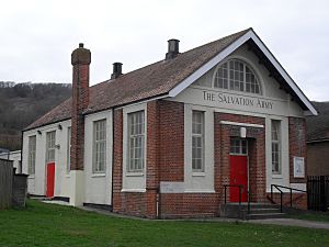
The Salvation Army has two places of worship: a citadel built in 1890 and a hall built in 1927. Jehovah's Witnesses used different buildings until their new Kingdom Hall opened in Hampden Park in 1985. Christian Scientists worshipped in the town centre from the early 1900s until their church closed in 2018. Informal services are now held at a hotel.
Religious Groups in Eastbourne
In 2011, a census showed that 99,412 people lived in Eastbourne.
- About 59.58% said they were Christian.
- 1.47% were Muslim.
- 0.48% were Buddhist.
- 0.43% were Hindu.
- 0.21% were Jewish.
- 0.05% were Sikh.
- 0.59% followed another religion.
- 29.17% said they had no religion.
- 8% did not say their religion.
The number of Christians in Eastbourne was similar to the rest of England. More people in Eastbourne identified as Buddhist or "any other religion" compared to the national average. More people in Eastbourne also said they had no religion. Other religions had fewer followers in Eastbourne compared to the rest of England.
How Churches are Organized
All Anglican churches in Eastbourne are part of the Diocese of Chichester. This diocese has its main church, or cathedral, in Chichester.
The five Roman Catholic churches in Eastbourne are managed by the Roman Catholic Diocese of Arundel and Brighton. Their cathedral is in Arundel.
The Central Sussex United Area helps manage Methodist and United Reformed churches. This group was formed in 2007. Broadway United Church, Emmanuel Church, and St Barnabas' United Church are part of this area. The Haven Church, which is a partnership between Methodist and Anglican churches, is also managed by this group.
New Hope and Victoria Baptist Churches are part of the South Eastern Baptist Association. Grove Road Strict Baptist Chapel is linked to the Gospel Standard movement.
The Church of Jesus Christ of Latter-day Saints in Eastbourne is part of the Crawley Stake. Their group started in the 1960s. When their church building opened in 2001, it became a larger group called a Ward.
Current Places of Worship
| Name | Image | Location | Religion | Grade | Notes |
|---|---|---|---|---|---|
| St Mary the Virgin Church (More images) |
 |
Old Town 50°46′22″N 0°15′57″E / 50.7727°N 0.2657°E |
Anglican | I | This is Eastbourne's oldest church. It was built around 1200. It has old stone carvings and many memorials to important people. |
| All Souls Church (More images) |
 |
Eastbourne 50°46′13″N 0°17′17″E / 50.7703°N 0.2881°E |
Anglican | II* | Built in 1882, this church has a mix of Italian, Byzantine, and Roman styles. It has a tall bell tower and colourful brickwork. |
| Holy Trinity Church (More images) |
 |
Eastbourne 50°46′01″N 0°17′17″E / 50.7669°N 0.2881°E |
Anglican | II* | This church was built between 1837 and 1839. It is made of flint and has an Early English style. |
| St Saviour's Church (More images) |
 |
Eastbourne 50°45′57″N 0°16′58″E / 50.7659°N 0.2829°E |
Anglican | II* | Built in 1865–1868, this church has a very tall spire, the highest in Eastbourne. It has colourful mosaics and a tiled floor inside. |
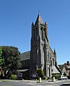
| All Saints Church (More images) |
 |
Eastbourne 50°45′43″N 0°16′47″E / 50.7619°N 0.2796°E |
Anglican | II | This Gothic Revival church was built from 1878 to 1880. The main part of the church was destroyed by fire in 1927 and had to be rebuilt. |
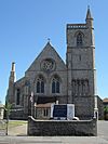
| Christ Church (More images) |
 |
Roselands 50°46′27″N 0°17′49″E / 50.7743°N 0.2969°E |
Anglican | II | Designed in 1859, this church was known as Eastbourne's "fishermen's church." Famous visitors included Princess Alice and Lewis Carroll. |
| St Elisabeth's Church (More images) |
 |
Downside 50°47′00″N 0°15′17″E / 50.7834°N 0.2547°E |
Anglican | II | The original church was unsafe, so the congregation moved to the church hall next door. It opened as a church and community centre in 2004. |
| St Mary the Virgin Church (More images) |
 |
Hampden Park 50°47′49″N 0°16′18″E / 50.7969°N 0.2717°E |
Anglican | II | The first church here was built in 1908. It was bombed in World War II. The current church was built in 1952–54 and was one of the first listed buildings after the war. |
| St Michael and All Angels Church (More images) |
 |
Ocklynge 50°46′42″N 0°15′52″E / 50.7784°N 0.2644°E |
Anglican | II | This large church was built in the early 1900s. The main part of the church was finished in 1911. |
| St Andrew's Church (More images) |
 |
Norway 50°47′00″N 0°18′16″E / 50.7834°N 0.3045°E |
Anglican | – | A temporary iron church was used here from 1885. The permanent church was built in 1911–12. |
| St John the Evangelist's Church (More images) |
 |
Meads 50°45′29″N 0°16′20″E / 50.7580°N 0.2723°E |
Anglican | – | Most of this church was destroyed by bombing in 1942. It was rebuilt from 1955–57, and its tower became a separate bell tower. |
| St Peter's Church (More images) |
 |
Hydneye 50°48′01″N 0°17′00″E / 50.8002°N 0.2834°E |
Anglican | – | This church and hall was built in the 1970s. It replaced an older St Peter's Church that was taken down in 1971. |
| St Philip's Church (More images) |
 |
Roselands 50°46′38″N 0°17′27″E / 50.7772°N 0.2907°E |
Anglican | – | The original church was taken down in 2004 due to problems. The church hall was rebuilt for worship in 2006. |
| St Richard's Church (More images) |
 |
Langney 50°47′45″N 0°18′52″E / 50.7957°N 0.3144°E |
Anglican | – | This church was built in 1956 to serve the Langney area. Its foundation stone was made from rubble from a demolished church. |
| Eastbourne Evangelical Free Church (More images) |
 |
Old Town 50°46′21″N 0°15′34″E / 50.7724°N 0.2595°E |
Evangelical | – | This red-brick building started as the Victoria Gospel Hall in the 1920s. It was later extended and became an Evangelical church. |
| Gateway Christian Church (More images) |
 |
Hydneye 50°48′00″N 0°16′47″E / 50.8001°N 0.2797°E |
Evangelical | – | This church was rebuilt and extended in 2015–16. The group started as Frenchgate Chapel in 1938. |
| Kings Church (More images) |
 |
Hampden Park 50°47′45″N 0°17′12″E / 50.7958°N 0.2866°E |
Evangelical | – | This large Evangelical church is part of a conference centre. It was registered for worship in 1998. |
| Living Stones Community Church (More images) |
 |
Old Town 50°46′29″N 0°16′00″E / 50.7746°N 0.2667°E |
Evangelical | – | This church meets at Community Wise, a youth and community centre built in 1964. |
| Old Town Community Church |  |
Old Town 50°46′48″N 0°15′15″E / 50.7801°N 0.2543°E |
Evangelical | – | This church started in 1994 from the Living Stones Community Church. It meets in the Old Town Community Centre. |
| St Anthony's Centre (More images) |
 |
St Anthony's Hill 50°47′20″N 0°18′36″E / 50.7890°N 0.3101°E |
Evangelical | – | This building opened in 2006. It is used for worship and as a community centre. |
| Our Lady of Ransom Church (More images) |
 |
Eastbourne 50°45′58″N 0°16′40″E / 50.7661°N 0.2778°E |
Roman Catholic | II | This Roman Catholic church was designed in 1900–01. It has a beautiful interior and a tower added in 1912. |
| Christ the King Church (More images) |
 |
Langney 50°47′33″N 0°18′53″E / 50.7924°N 0.3148°E |
Roman Catholic | – | This modern church was built in 1967. It is made of dark brick and concrete. |
| St Agnes' Church (More images) |
 |
Roselands 50°46′39″N 0°17′48″E / 50.7774°N 0.2968°E |
Roman Catholic | – | This red-brick church opened in 1907. It was once a separate parish but is now part of Our Lady of Ransom. |
| St Gregory's Church (More images) |
 |
Downside 50°46′57″N 0°15′15″E / 50.7825°N 0.2541°E |
Roman Catholic | – | This modern church was built in 1965. It has a striking circular baptistery made of glass and flint. |
| St Joachim's Church (More images) |
 |
Hampden Park 50°48′03″N 0°16′38″E / 50.8008°N 0.2773°E |
Roman Catholic | – | This church was built between 1959 and 1960 for Catholics in Hampden Park. |
| New Hope Baptist Church (More images) |
 |
Roselands 50°46′41″N 0°18′01″E / 50.7780°N 0.3003°E |
Baptist | – | This church bought a new building in 2015. It was originally a club for former Royal Navy members. |
| Victoria Baptist Church (More images) |
 |
Downside 50°46′47″N 0°15′37″E / 50.7798°N 0.2604°E |
Baptist | – | This church opened in 1973. It replaced an older chapel in Old Town. |
| Emmanuel Church (Greenfield Methodist Church) (More images) |
 |
Old Town 50°46′22″N 0°15′43″E / 50.7728°N 0.2620°E |
Methodist/United Reformed Church | – | This church was built in 1898 for Wesleyan Methodists. It is now called Emmanuel Church and hosts services for both Methodists and United Reformed Church members. |
| Broadway United Church (More images) |
 |
Hampden Park 50°47′57″N 0°15′57″E / 50.7993°N 0.2658°E |
Methodist/United Reformed Church | – | This church was originally St Stephen's Methodist Church, built in 1960. It united with the United Reformed Church in 2005 and changed its name. |
| Salvation Army Hall, Eastbourne Citadel Corp (More images) |
 |
Eastbourne 50°46′17″N 0°17′33″E / 50.7714°N 0.2926°E |
Salvation Army | – | This Salvation Army building was designed in 1890. It has distinctive painted battlements. |
| Salvation Army Hall, Eastbourne Old Town Corp (More images) |
 |
Downside 50°46′47″N 0°15′00″E / 50.7797°N 0.2501°E |
Salvation Army | – | This hall opened in 1927 and serves the west side of Eastbourne. It has always been used for Salvation Army worship. |
| St Barnabas United Church (More images) |
 |
Langney 50°48′10″N 0°18′07″E / 50.8028°N 0.3019°E |
Baptist/Methodist/United Reformed Church | – | This church was built in 1975–76 for the growing population of Langney. It is a shared church for three different Christian groups. |
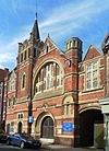
| South Street Free Church (More images) |
 |
Eastbourne 50°46′00″N 0°16′46″E / 50.7666°N 0.2795°E |
Countess of Huntingdon's Connexion | II | This church was built in 1903. It is made of red brick with stone details. |
| Elim Family Church (More images) |
 |
Upperton 50°46′17″N 0°16′37″E / 50.7714°N 0.2770°E |
Elim Foursquare Gospel Alliance | – | The original church was taken down in 2006–2007. A new building with flats and a nursery school was built above a worship space. |
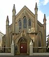
| St Panteleimon and St Theodore Church (More images) |
 |
Eastbourne 50°46′08″N 0°17′28″E / 50.7689°N 0.2912°E |
Greek Orthodox | – | This building was originally a Calvinist chapel built in 1857. It was sold to the Greek Orthodox Church in 1990. |
| Suncoast Church (More images) |
 |
Eastbourne 50°46′42″N 0°17′18″E / 50.7782°N 0.2884°E |
International Network of Churches | – | This church is part of an evangelical movement. It is located in an industrial area. |
| Kingdom Hall (More images) |
 |
Hampden Park 50°48′06″N 0°16′37″E / 50.8016°N 0.2770°E |
Jehovah's Witnesses | – | This building opened in 1985. It is used by three different Jehovah's Witnesses groups from Eastbourne. |
| Eastbourne Hebrew Congregation Synagogue (More images) |
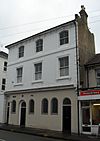 |
Eastbourne 50°46′10″N 0°17′18″E / 50.7694°N 0.2883°E |
Jewish (Orthodox) | – | This synagogue is in the town centre. It was made larger in 2001. |
| Church of Jesus Christ of Latter-day Saints, Eastbourne Ward Meetinghouse (More images) |
 |
Eastbourne 50°45′57″N 0°16′47″E / 50.7658°N 0.2798°E |
Latter-day Saint | – | This building was once a theological college built in 1874. It became a meetinghouse for Latter-day Saints in 2001. |
| Eastbourne Islamic Cultural Centre and Mosque (More images) |
 |
Eastbourne 50°46′22″N 0°17′13″E / 50.7727°N 0.2869°E |
Muslim | – | The original mosque was an old office building. A new, larger mosque was finished in 2018. |
| Speak Life Centre (Eastbourne Christian Prayer Centre) (More images) |
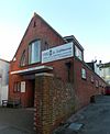 |
Eastbourne 50°46′04″N 0°17′16″E / 50.7677°N 0.2877°E |
Non-denominational | – | This small building is used for worship, prayer, and as a community centre. It is also a broadcasting and recording studio. |
| Marine Hall (More images) |
 |
Eastbourne 50°46′20″N 0°17′43″E / 50.7722°N 0.2954°E |
Open Brethren | – | This hall was built in 1893 for the Open Brethren group. It has been in use ever since. |
| Deliverance Centre Eastbourne at Central Methodist Church (More images) |
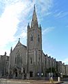 |
Eastbourne 50°46′08″N 0°17′20″E / 50.7689°N 0.2888°E |
Pentecostal | II | This church was built in 1907–08. It was the main meeting place for Wesleyan Methodists. It is now used by a Pentecostal group. |
| Friends Meeting House (More images) |
 |
Eastbourne 50°45′55″N 0°17′04″E / 50.7654°N 0.2844°E |
Quaker | – | Eastbourne's Quaker community has worshipped here since 1939. The building had to be rebuilt after being damaged by bombs in the war. |
| Eastbourne Christian Spiritualist Church (More images) |
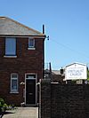 |
Eastbourne 50°46′22″N 0°17′21″E / 50.7727°N 0.2892°E |
Spiritualist | – | This building has been used for Spiritualist services since 1957. |
| Grove Road Strict Baptist Church (More images) |
 |
Eastbourne 50°46′05″N 0°16′47″E / 50.7680°N 0.2796°E |
Strict Baptist | – | This chapel was built in 1881. It was damaged by bombs in the war and took until 1950 to repair. |
Former Places of Worship
| Name | Image | Location | Religion | Grade | Notes |
|---|---|---|---|---|---|
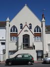
| Beamsley Methodist Church (More images) |
 |
Eastbourne 50°46′36″N 0°17′55″E / 50.7767°N 0.2987°E |
Methodist | – | This building was a Methodist church and school from 1886 to 1904. It is no longer used for religious purposes. |
| Wish Hill Methodist Church (More images) |
 |
Lower Willingdon 50°47′47″N 0°15′10″E / 50.7965°N 0.2527°E |
Methodist | – | This building was a Wesleyan chapel. It is now used as the headquarters for the Beachy Head Chaplaincy. |
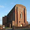
| St Elisabeth's Church (original building) (More images) |
 |
Downside 50°46′59″N 0°15′18″E / 50.7831°N 0.2549°E |
Anglican | II | This large church was built in 1935. It had problems with its walls and roof, so it is no longer used as a church. The hall next door is now used for worship. |
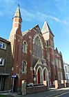
| Ceylon Place Baptist Church (More images) |
 |
Eastbourne 50°46′11″N 0°17′31″E / 50.7696°N 0.2919°E |
Baptist | – | This church was built in 1885. It was damaged in World War II. It closed in 2005 and was turned into flats. |
| First Church of Christ, Scientist, Eastbourne (More images) |
 |
Eastbourne 50°45′57″N 0°16′55″E / 50.7657°N 0.2820°E |
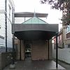
Christian Scientist | – | This church was built in 1922. It was renovated in the 1970s. It was put up for sale in 2018. |
| Edgmond Evangelical Church (More images) |
 |
Old Town 50°46′20″N 0°15′51″E / 50.7722°N 0.2641°E |
Evangelical | – | This building was an excise office around 1840. It became a church in 1872. It was sold in 2011 and is now used for a project helping people with learning disabilities. |
| Bourne Hall (More images) |
 |
Eastbourne 50°46′12″N 0°17′33″E / 50.7701°N 0.2926°E |
Plymouth Brethren | – | This small building was used by the Plymouth Brethren in the 1930s. It is now used for private lessons and textiles. |
| St Gregory's Church (original building) |  |
Downside 50°46′58″N 0°15′15″E / 50.7827°N 0.2541°E |
Roman Catholic | – | This small wooden chapel was built in 1934. The new St Gregory's Church was built next to it in 1965. This old building became a hall and then a nursery school. |
| St Andrew's Church (More images) |
 |
Eastbourne 50°45′54″N 0°17′05″E / 50.7649°N 0.2846°E |
United Reformed Church | – | This church was built in 1878. It closed as part of a project to combine churches. There are plans to take it down and build housing. |
See also
 | Percy Lavon Julian |
 | Katherine Johnson |
 | George Washington Carver |
 | Annie Easley |


