List of places of worship in Lewes District facts for kids
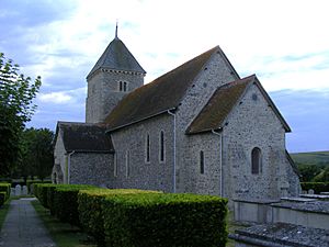
The Lewes area in East Sussex has many churches and other places of worship. There are 70 buildings still used for religious services today. Another 21 buildings used to be places of worship but are now used for other things.
Most of the Lewes district is countryside with small villages. These villages often have very old churches. The main towns are Lewes, Newhaven, Seaford, Peacehaven, and Telscombe Cliffs. These towns have more religious buildings.
Most people in the district are Christian. Until 2017, there were no places of worship for other religions. Then, a mosque and Islamic community centre opened in Seaford. Many types of Christian churches are found here. The town of Lewes has a long history of Protestant churches that are not part of the main Church of England. However, most churches in the area belong to the Church of England.
Many of these religious buildings are "listed." This means they are special because of their history or architecture. Historic England decides which buildings get listed status. There are three levels:
- Grade I: These buildings are super important and have "exceptional interest."
- Grade II*: These are "particularly important" buildings.
- Grade II: These buildings have "special interest."
Contents
Exploring Lewes's Places of Worship
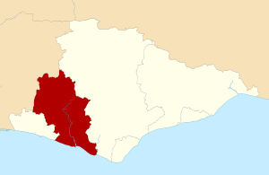
The Lewes district covers about 113 square miles (293 square kilometers) in western East Sussex. The English Channel forms its southern edge. Four of the five biggest towns—Peacehaven, Telscombe Cliffs, Newhaven, and Seaford—are on the coast. Lewes, the main town, is inland. The rest of the area is mostly rural.
Lewes town is in a key spot by the River Ouse and surrounded by hills. People have lived here since Anglo-Saxon times. By the 10th century, it was the most important town in Sussex. Many old Church of England churches still stand in Lewes. Some older churches, like St Andrew's, are no longer used.
Other Christian groups, called Nonconformists, have been in Lewes for over 300 years. Groups like Unitarians, Methodists, Quakers, and Baptists built chapels in the 1700s and 1800s. Many are still active today. Ditchling and Wivelsfield also have strong Nonconformist roots. Most villages in the district had developed by the 1100s, and many of their churches date from that time.
Ancient Churches and Their Styles
St Andrew's Church in Bishopstone was built around 975 AD. It still has parts from Anglo-Saxon and Norman times. Southease church's main part is from the 11th century. St John the Baptist's Church in Southover was also built in the 11th century.
Many Church of England churches in the district were built in the 12th century. This was when Norman style changed to Early English Gothic. Churches in Iford, Piddinghoe, Rodmell, and Telscombe are mostly from this period. Other churches, like those in Barcombe and Newhaven, have some 12th-century parts.
Churches in Chailey, East Blatchington, and St Michael's in Lewes started in the 13th century. St Pancras Church in Kingston-near-Lewes was built in the 14th century. Glynde's church was rebuilt in the fancy Palladian style in the 1760s. The old church in Falmer was rebuilt in the early 1800s.
New churches were built in the 1800s, like St John sub Castro in Lewes (1839). More churches were built in the 1900s as towns grew. These include churches in Peacehaven (1955) and Seaford (1959).
Catholic Churches in the Area
Before 1865, Roman Catholics in Lewes had to go to Brighton to worship. The first Catholic church in Lewes, dedicated to The Sacred Heart and St Pancras, opened in 1870. It was replaced by the current St Pancras Church in 1939.
Newhaven got its first permanent Catholic church in 1898, called The Sacred Heart. Seaford's St Thomas More Church opened in 1935. Peacehaven's Church of the Immaculate Conception opened in 1963.
Methodist and United Reformed Churches
In 1947, there were Methodist churches in Lewes, Newhaven, and Seaford. The Lewes building closed in 1973, and the congregation moved to Christ Church. Newhaven's chapel closed around 1947, and Methodists now share St Michael and All Angels Church. Seaford's Methodist chapel closed in 2016, and its members joined the United Reformed chapel.
The United Reformed Church was formed in 1972. It combined the Congregational Church and the Presbyterian Church of England. Seaford Congregational Chapel is now the Cross Way Clinton Centre, shared by Methodists and United Reformed members. Christ Church in Lewes also combines these groups.
Baptists and Other Protestant Groups
Baptists and Unitarians have a long history in the district. A Baptist group in Ditchling built a chapel around 1730. Some members later left to form a Strict Baptist chapel in Wivelsfield, called Bethel Chapel, which opened in 1763 and is still used.
Westgate Chapel in Lewes, built around 1700, became Unitarian in the 1700s. Eastgate Baptist Church in Lewes opened in 1843. Jireh Chapel, for Independent Calvinistic Baptists, opened in 1805. The Free Presbyterian Church of Ulster has used it since 1998.
The Countess of Huntingdon's Connexion, another Calvinist group, has a chapel in Wivelsfield called Ote Hall Chapel. It opened in 1778 and is the oldest surviving chapel of its kind.
Evangelical and Other Faiths
King's Church, an Evangelical group, has congregations in Lewes and Seaford. Former mission halls in Ditchling, Newick, and South Chailey are now used by Evangelical groups.
Quakers have met in Lewes since 1675. Their current meeting house dates from 1784. Ditchling also has a Quaker meeting house. Jehovah's Witnesses have three Kingdom Halls in the district: Lewes, Peacehaven, and Seaford. Elim Pentecostal Church opened a chapel in Newhaven in 1964. The Church of Jesus Christ of Latter-day Saints opened a chapel in Wivelsfield in 1999.
Religious Groups in Lewes District
In 2011, a census showed that 97,502 people lived in Lewes District.
- 57% said they were Christian.
- 0.57% were Muslim.
- 0.5% were Buddhist.
- 0.33% were Jewish.
- 0.26% were Hindu.
- 0.04% were Sikh.
- 0.62% followed another religion.
- 32.45% said they had no religion.
- 8.23% did not state their religion.
Compared to England as a whole, Lewes District had fewer Christians but more Buddhists and people with no religion.
How Churches are Organized
All Church of England churches in Lewes district are part of the Diocese of Chichester. This is a large area managed by the Bishop of Chichester. The diocese is divided into smaller areas called archdeaconries and then deaneries. Most churches in the district are in the Rural Deanery of Lewes and Seaford.
The four Roman Catholic churches in Lewes district are part of the Roman Catholic Diocese of Arundel and Brighton. They are all in the Lewes Deanery.
Baptist churches in Lewes, Newhaven, and Seaford are part of the East Sussex Network. Some Baptist groups, like Coastlands Church in Peacehaven, meet in community buildings instead of their own church buildings.
The Methodist Church and the United Reformed Church work together in the Central Sussex United Area. This partnership helps manage their churches in the region.
Current Places of Worship
| Name | Image | Location | Religion | Grade | Notes | Refs |
|---|---|---|---|---|---|---|
| St Mary the Virgin Church (More images) |
 |
Barcombe 50°54′39″N 0°00′59″E / 50.9108°N 0.0165°E |
Anglican | II* | This church serves a large countryside area. Part of the main hall (nave) is from the 12th century. The tower and wider altar area (chancel) were built a century later. It was repaired in 1879–1880. | |
| Jubilee Christian Centre (More images) |
 |
Barcombe 50°54′58″N 0°00′51″E / 50.9162°N 0.0141°E |
Baptist | – | Barcombe's first Baptist chapel opened in 1810. A new brick building, registered in 1980, now stands there. The church changed its name from Barcombe Baptist Church in 2006. | |
| St Andrew's Church (More images) |
 |
Beddingham 50°51′09″N 0°03′05″E / 50.8526°N 0.0515°E |
Anglican | I | This church is in an isolated spot by the river. It has Norman origins and was added to over many years. Most of the building is from the 14th and 16th centuries. | |
| St Andrew's Church (More images) |
 |
Bishopstone 50°47′23″N 0°05′16″E / 50.7897°N 0.0877°E |
Anglican | I | Norman settlers rebuilt this village's early 8th-century Anglo-Saxon church. Parts of the nave, porch, and tower are still original. The 12th-century rebuilding created an Early English-style church. | |
| St Peter's Church (More images) |
 |
Chailey 50°57′24″N 0°01′09″W / 50.9567°N 0.0192°W |
Anglican | II* | This church has its 13th-century chancel (altar area) and tower. The tower has a shingled spire. The nave (main hall) was made bigger in 1878–1879. | |
| St Thomas à Becket Church (More images) |
 |
Cliffe, Lewes 50°52′28″N 0°01′08″E / 50.8745°N 0.0188°E |
Anglican | II* | This strong flint church has parts from the 12th century to the late 19th century. A square tower stands at the west end. | |
| Lewes Free Presbyterian Church (More images) |
 |
Cliffe, Lewes 50°52′32″N 0°01′07″E / 50.8755°N 0.0187°E |
Free Presbyterian Church of Ulster | I | This large chapel was built for a Strict Baptist group in 1805 and made bigger in 1826. It is one of only seven churches in England used by this Protestant group. | |
| St Leonard's Church (More images) |
 |
Denton 50°48′16″N 0°03′46″E / 50.8045°N 0.0628°E |
Anglican | II* | The church has some parts from the Norman era, and the baptism font is also very old. Its outside look was changed in the 19th century. | |
| St Margaret's Church (More images) |
 |
Ditchling 50°55′17″N 0°06′57″W / 50.9213°N 0.1157°W |
Anglican | I | This church looks like it's from the 13th century, and most of the work was done then. However, the nave (main hall) is two centuries older. It has a central tower with a small spire. | |
| Emmanuel Chapel (More images) |
 |
Ditchling 50°55′12″N 0°06′54″W / 50.9199°N 0.1149°W |
Evangelical | – | Ditchling still has Nonconformist churches today. A former mission hall here was replaced by this building, which opened in 1972. | |
| Friends Meeting House |  |
Ditchling 50°55′21″N 0°06′51″W / 50.9225°N 0.1142°W |
Quaker | – | This small meeting house serves Quakers in Ditchling and nearby areas. It was registered for worship in 1967. It used to be an agricultural building and even an abattoir! | |
| Ditchling Unitarian Chapel (The Old Meeting House) (More images) |
 |
Ditchling 50°55′18″N 0°06′47″W / 50.9216°N 0.1131°W |
Unitarian | II | Built in 1740 for General Baptists, this chapel is connected to a house from 1672. The red-brick chapel was renovated between 1877 and 1887. | |
| St Peter's Church (More images) |
 |
East Blatchington 50°46′44″N 0°06′13″E / 50.7790°N 0.1036°E |
Anglican | II* | Parts of this church are from the 13th century, especially the tower. Some people think it might have Norman origins too. | |
| Seaford Baptist Church (More images) |
 |
East Blatchington 50°46′37″N 0°05′44″E / 50.7769°N 0.0955°E |
Baptist | – | This current building, a round structure, was built in the 1970s. It replaced an older brick church in Seaford town centre that was there from 1901 to 1973. | |
| East Chiltington Church (More images) |
 |
East Chiltington 50°55′10″N 0°03′09″W / 50.9194°N 0.0525°W |
Anglican | II* | The nave (main hall) is the oldest part, built in the early 12th century. The tower is a bit newer, and the chancel (altar area) is from the 14th century. | |
| St Laurence's Church (More images) |
 |
Falmer 50°51′45″N 0°04′34″W / 50.8624°N 0.0760°W |
Anglican | II* | This church was rebuilt between 1815 and 1817 from old ruins. Its unusual Neo-Norman look comes from a restoration in 1840. | |
| St Mary the Virgin Church (More images) |
 |
Glynde 50°51′53″N 0°04′06″E / 50.8646°N 0.0683°E |
Anglican | II* | Sir Thomas Robinson rebuilt this church in the Palladian style between 1763 and 1765. It's a box-like building with a large dome holding a bell. | |
| St Peter's Church (More images) |
 |
Hamsey 50°53′28″N 0°00′34″E / 50.8912°N 0.0095°E |
Anglican | I | This 12th-century church is in a very remote spot by the River Ouse. The east part of the nave and west end of the chancel are original. | |
| St Nicholas' Church (More images) |
 |
Iford 50°50′54″N 0°00′03″W / 50.8484°N 0.0007°W |
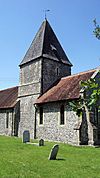
Anglican | I | Even with Victorian repairs, this church shows its 12th-century origins. The oldest part is the nave, separated from the chancel by a tower. | |
| St Pancras' Church (More images) |
 |
Kingston near Lewes 50°51′23″N 0°01′28″W / 50.8563°N 0.0245°W |
Anglican | II* | This church was built in the early 14th century in the Decorated Gothic style. Much of the original stone was repaired in 1874. | |
| St Anne's Church (More images) |
 |
Lewes 50°52′21″N 0°00′06″E / 50.8724°N 0.0016°E |
Anglican | I | This church's outside looks Early English-style due to 1889 repairs. But inside, Norman details are strong. It is the main church for Lewes. | |
| St Michael's Church (More images) |
 |
Lewes 50°52′20″N 0°00′26″E / 50.8723°N 0.0071°E |
Anglican | I | This town-centre church has a round west tower, which is unusual. It has an octagonal spire and is covered in pebbles. | |
| St John sub Castro Church (More images) |
 |
Lewes 50°52′34″N 0°00′34″E / 50.8760°N 0.0094°E |
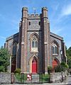
Anglican | II | Its name means St John under the Castle. Parts of an older Anglo-Saxon church were used in this new building from 1839. | |
| Eastgate Baptist Church (More images) |
 |
Lewes 50°52′30″N 0°00′48″E / 50.8751°N 0.0134°E |
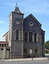
Baptist | – | This Romanesque Revival style chapel opened in 1843. It replaced an earlier building on the same site. It has a tower and spire. | |
| Kingdom Hall (More images) |
 |
Lewes 50°52′19″N 0°00′40″E / 50.8720°N 0.0111°E |
Jehovah's Witnesses | – | This building is used by Jehovah's Witnesses and was registered in 1987. Services are also held in Sign language. Part of the building was a school from 1840. | |
| Christ Church (More images) |
 |
Lewes 50°52′34″N 0°00′09″W / 50.8760°N 0.0025°W |
Methodist/United Reformed Church | – | This modern building houses both United Reformed and Methodist groups. It opened in 1954 as Lewes Congregational Church. It became a joint church in 1999. | |
| Friends Meeting House (More images) |
 |
Lewes 50°52′21″N 0°00′50″E / 50.8726°N 0.0139°E |
Quaker | II | The first meeting house was built in 1675. The current brick building replaced it in 1784. It has been extended many times. | |
| St Pancras' Church (More images) |
 |
Lewes 50°52′21″N 0°00′09″E / 50.8724°N 0.0025°E |
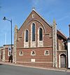
Roman Catholic | – | An older stone church from 1870 was replaced in 1938–39 by this larger brick and flint building. It is a simple Gothic-style church. | |
| Westgate Chapel (More images) |
 |
Lewes 50°52′18″N 0°00′24″E / 50.8718°N 0.0067°E |
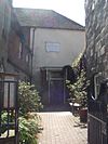
Unitarian | II* | Parts of a 16th-century inn were used to build this chapel around 1700. It has a plain outside with some flintwork. It started as Presbyterian but became Unitarian. | |
| St Mary's Church (More images) |
 |
Nevill Estate, Lewes 50°52′49″N 0°00′30″W / 50.8802°N 0.0082°W |
Anglican | – | This church on the edge of Lewes opened in 1938. It is used as a church hall and for community events, with occasional services. | |
| St Michael and All Angels Church (More images) |
 |
Newhaven 50°47′30″N 0°02′43″E / 50.7918°N 0.0454°E |
Anglican/ Methodist |
II* | Newhaven's main church stands on high ground. Its east tower and apse are Norman. Methodists joined the church in the 1970s. | |
| Newhaven Baptist Church (More images) |
 |
Newhaven 50°47′37″N 0°02′47″E / 50.7935°N 0.0463°E |
Baptist | – | The first chapel was built in 1901. It became the church hall when the current church was built in 1938. The simple brick building has an Art Deco feel. | |
| Elim Church Newhaven (More images) |
 |
Newhaven 50°47′34″N 0°02′51″E / 50.7929°N 0.0476°E |
Pentecostal | – | A Pentecostal group worships at this red-brick building. It was registered for worship in 1964. It is now called the "Newhaven Hub." | |
| St Mary's Church (More images) |
 |
Newick 50°58′09″N 0°01′24″E / 50.9693°N 0.0232°E |
Anglican | II* | Parts of the original nave from about 1100 still remain. The church was extended in the 14th century. The tower is from the 15th century. | |
| Newick Evangelical Free Church (More images) |
 |
Newick 50°58′20″N 0°00′26″E / 50.9723°N 0.0071°E |
Evangelical | – | This small building from 1892 was originally a mission hall. It is now used by an Evangelical community for worship. | |
| St Peter's Church (More images) |
 |
Offham 50°53′31″N 0°00′36″W / 50.8920°N 0.0099°W |
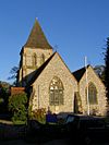
Anglican | II | Ewan Christian designed this church in the Decorated Gothic style in 1859. It has an altar area with a tower and spire. | |
| Church of the Ascension (More images) |
 |
Peacehaven 50°47′35″N 0°00′12″E / 50.7931°N 0.0032°E |
Anglican | – | This red-brick church, with a squat tower, replaced the community's first church from 1922. | |
| Peacehaven Evangelical Free Church (More images) |
 |
Peacehaven 50°47′25″N 0°00′29″E / 50.7902°N 0.0081°E |
Evangelical | – | This modern brick building serves an Evangelical group. It is on the main South Coast Road and was registered in 1966. | |
| Kingdom Hall (More images) |
 |
Peacehaven 50°47′20″N 0°00′39″E / 50.7889°N 0.0108°E |
Jehovah's Witnesses | – | This modern Kingdom Hall is used by Jehovah's Witnesses. It was registered for worship in 1964. | |
| Church of the Immaculate Conception (More images) |
 |
Peacehaven 50°47′34″N 0°00′02″W / 50.7929°N 0.0006°W |
Roman Catholic | – | The town's first Roman Catholic church was built in 1925 as a temporary building. It is now a church hall, replaced by this permanent brick church in 1963. | |
| St John's Church (More images) |
 |
Piddinghoe 50°48′34″N 0°02′08″E / 50.8095°N 0.0355°E |
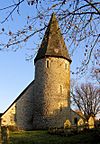
Anglican | I | The round tower and the nave of this riverside church are from the early 12th century. A north aisle was added later. | |
| St Michael and All Angels Church (More images) |
 |
Plumpton 50°54′18″N 0°04′18″W / 50.9051°N 0.0717°W |
Anglican | I | This church is surrounded by Plumpton Agricultural College buildings. The nave is mostly 12th-century. The tower and chancel are a century newer. | |
| All Saints Church (More images) |
 |
Plumpton Green 50°56′06″N 0°03′37″W / 50.9350°N 0.0602°W |
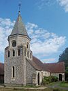
Anglican | – | This church from 1893 was originally a smaller church for St Michael and All Angels. The old baptism font is believed to be from an old church in Lewes. | |
| St Mary the Virgin Church (More images) |
 |
Ringmer 50°53′38″N 0°03′16″E / 50.8940°N 0.0544°E |
Anglican | I | Fragments from the Norman era remain in this large church. It was rebuilt in the 15th century and changed again in 1884. | |
| St Peter's Church (More images) |
 |
Rodmell 50°50′19″N 0°01′04″E / 50.8385°N 0.0177°E |
Anglican | I | Some windows have been replaced, but the church has changed little since the late 12th century. The tower and an adjacent room were added then. | |
| St Leonard's Church (More images) |
 |
Seaford 50°46′19″N 0°06′05″E / 50.7719°N 0.1013°E |
Anglican | I | This church's size shows how important Seaford was as a port long ago. The nave and some windows are from the Norman era. The tower is from the 15th century. | |
| King's Church Seaford (More images) |
 |
Seaford 50°46′13″N 0°06′06″E / 50.7702°N 0.1017°E |
Evangelical | – | King's Church started a group in Seaford in 2010. They bought the former Cross Way Church Centre in 2019. This building was an Early English-style Methodist chapel from 1894. | |
| Kingdom Hall (More images) |
 |
Seaford 50°46′17″N 0°06′01″E / 50.7713°N 0.1003°E |
Jehovah's Witnesses | – | This Kingdom Hall serves Jehovah's Witnesses in Seaford. It was registered for worship in 1983. | |
| Seahaven Islamic Community Centre and Mosque (More images) |
 |
Seaford 50°46′21″N 0°06′05″E / 50.7725°N 0.1015°E |
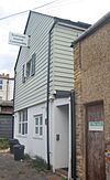
Muslim | – | This mosque and community centre opened in October 2017. The Muslim community had been worshipping in rented places since 2003. | |
| St Thomas More Church (More images) |
 |
Seaford 50°46′26″N 0°06′26″E / 50.7739°N 0.1073°E |
Roman Catholic | – | This simple church was built in 1935. It has a smooth outside with some flintwork. An extension was added in 1969. | |
| Seaford Independent Spiritualist Church |  |
Seaford 50°46′25″N 0°06′12″E / 50.7735°N 0.1032°E |
Spiritualist | – | This church was started in 1991. The group first met in a hall, then got their own building. | |
| Cross Way Church (More images) |
 |
Seaford 50°46′24″N 0°06′07″E / 50.7732°N 0.1019°E |
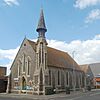
Methodist/United Reformed Church | – | The name "Cross Way" has been used since the Methodist and United Reformed groups joined. This building was designed in 1877. It was changed in 2016–17 to be a church and community centre. | |
| Chailey Free Church (More images) |
 |
South Chailey 50°56′14″N 0°01′09″W / 50.9372°N 0.0192°W |
Evangelical | – | This independent Evangelical group worships in a modern building. It is on the site of an old mission hall. | |
| St Michael and All Angels Church (More images) |
 |
South Malling, Lewes 50°52′52″N 0°00′24″E / 50.8812°N 0.0068°E |
Anglican | II* | The foundation stone of this rebuilt church was laid in 1626. But the building has origins from the 13th century. It was repaired in 1874. | |
| King's Church (More images) |
 |
South Malling, Lewes 50°52′40″N 0°00′56″E / 50.8778°N 0.0156°E |
Evangelical | – | This Evangelical group, started in 1985, worships in an industrial building. They moved to a new converted building in 2010. | |
| St Peter's Church (More images) |
 |
Southease 50°49′46″N 0°01′09″E / 50.8295°N 0.0192°E |
Anglican | I | This ancient building has a round tower, like two other churches nearby. The nave and chancel are from the 11th century. Old wall paintings have been found inside. | |
| St John the Baptist's Church (More images) |
 |
Southover, Lewes 50°52′09″N 0°00′22″E / 50.8691°N 0.0062°E |
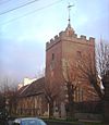
Anglican | I | This building was originally a guesthouse for the nearby Lewes Priory in the late 11th century. It became a church in the 13th century. | |
| Streat Church (More images) |
 |
Streat 50°55′13″N 0°04′46″W / 50.9202°N 0.0795°W |
Anglican | II* | This church, with a nave from about 1200, was heavily repaired in 1854. A small bell tower with a spire is also present. | |
| St Luke's Church (More images) |
 |
Sutton, Seaford 50°46′36″N 0°07′40″E / 50.7766°N 0.1278°E |
Anglican | – | This modern brick and flint building serves the Chyngton and Sutton areas of Seaford. It has a round tower at one corner and opened in 1959. | |
| Seaford Community Church |  |
Sutton, Seaford 50°46′49″N 0°06′53″E / 50.7802°N 0.1147°E |
Evangelical | – | This independent Evangelical group worships in a modern building. It was registered for worship in 1969. | |
| Chyngton Methodist Church (More images) |
Sutton, Seaford 50°46′48″N 0°07′38″E / 50.7799°N 0.1273°E |
Methodist | – | This church is in a multi-purpose building used by many local groups. It serves Methodists in the Chyngton and Sutton areas of Seaford. | ||
| St Mary's Church (More images) |
 |
Tarring Neville 50°48′57″N 0°02′55″E / 50.8157°N 0.0487°E |
Anglican | I | This 13th-century church has a nave and south aisle under one roof. It has a west tower with a tiled pyramid roof. | |
| St Lawrence's Church (More images) |
 |
Telscombe 50°48′46″N 0°00′23″W / 50.8128°N 0.0064°W |
Anglican | I | This 12th-century church is one of the only buildings in the small village. The chancel arch looks Norman but is from the 19th century. | |
| Telscombe Cliffs Community Church(More images) |  |
Telscombe Cliffs 50°47′46″N 0°01′05″W / 50.7961°N 0.0181°W |
United Reformed Church | – | This United Reformed church serves the coastal towns of Peacehaven and Telscombe Cliffs. It was registered for marriages in 1932. | |
| St Peter's Church (More images) |
 |
West Firle 50°50′42″N 0°05′18″E / 50.8450°N 0.0884°E |
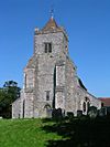
Anglican | I | One doorway from about 1200 is the oldest part of this church. The rest was built in the late 13th and 14th centuries. It has a private chapel for the Gage family. | |
| St Martin's Church (More images) |
 |
Westmeston 50°54′24″N 0°05′50″W / 50.9067°N 0.0972°W |
Anglican | II* | This small church serves a long, narrow area. It managed East Chiltington's church until 1934. The nave is mostly 12th-century. | |
| St Peter and St John the Baptist's Church (More images) |
 |
Wivelsfield 50°58′15″N 0°05′43″W / 50.9709°N 0.0952°W |
Anglican | II* | Some 11th-century stone and a doorway remain from the original building. The church has parts from many different time periods. | |
| Bethel Strict Baptist Chapel (More images) |
 |
Wivelsfield 50°57′46″N 0°05′43″W / 50.9627°N 0.0952°W |
Baptist | II | This Strict Baptist chapel was founded in 1780. It is mostly made of brick and has been made bigger several times. | |
| Ote Hall Chapel (More images) |
 |
Wivelsfield 50°58′04″N 0°05′27″W / 50.9678°N 0.0907°W |
Countess of Huntingdon's Connexion | II | Selina Hastings, Countess of Huntingdon, founded this chapel in 1778. It was completed in 1780. | |
| Church of Jesus Christ of Latter-day Saints (More images) |
 |
Wivelsfield Green 50°57′49″N 0°04′24″W / 50.9635°N 0.0733°W |
Latter-day Saint | – | This church was built on an empty site in Wivelsfield Green. It was registered for marriages in 2005. |
Former Places of Worship
| Name | Image | Location | Religion | Grade | Notes | Refs |
|---|---|---|---|---|---|---|
| St Francis of Assisi Church (More images) |
 |
Barcombe Cross 50°55′29″N 0°01′11″E / 50.9248°N 0.0196°E |
Anglican | – | This timber and brick church was built in the late 1890s. It stopped being used for religion around 2003 and is now a community hall. | |
| Protestant Dissenters Mission House (More images) |
 |
Barcombe Cross 50°55′24″N 0°00′40″E / 50.9234°N 0.0110°E |
Non-denominational | – | This mission chapel was built in the first half of the 19th century. It is no longer used for religious services. | |
| Beulah Strict Baptist Chapel |  |
Ditchling 50°55′20″N 0°06′51″W / 50.9222°N 0.1142°W |
Baptist | – | This chapel was built for the Strict Baptist community in 1867. After it closed in the late 1930s, it became a private house. | |
| St John the Evangelist's Church (More images) |
 |
East Blatchington 50°46′36″N 0°05′51″E / 50.7767°N 0.0975°E |
Anglican | – | This church was built in the mid-1920s but closed in 1980. It is now used as a nursery school. | |
| All Saints Church (More images) |
 |
Lewes 50°52′21″N 0°00′48″E / 50.8724°N 0.0134°E |
Anglican | II* | This building has parts from many different times. It has been used as an arts and community centre since 1975. | |
| Providence Baptist Chapel | 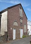 |
Lewes 50°52′34″N 0°00′40″E / 50.8760°N 0.0112°E |
Baptist | – | This chapel is now a theatre. It closed in 1932 after about 70 years of religious use. | |
| Providence Strict Baptist Chapel | 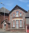 |
Lewes 50°52′31″N 0°00′44″E / 50.8752°N 0.0121°E |
Baptist | – | This building opened in 1906 as a mission hall. It was a Baptist chapel from 1924 until about 1980, then became a house. | |
| Wesleyan Methodist Chapel (More images) |
 |
Lewes 50°52′22″N 0°00′40″E / 50.8727°N 0.0110°E |
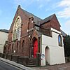
Methodist | – | An older chapel stood here. This building was built in 1867, closed in 1973, and became an antiques centre, then flats. | |
| Hamilton Memorial Presbyterian Church (More images) |
 |
Lewes 50°52′27″N 0°00′42″E / 50.8741°N 0.0117°E |
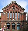
Presbyterian Church of England | – | This large chapel closed in the 1940s. It is now an antiques showroom and market. | |
| Calvinistic Baptist Chapel |  |
Newhaven 50°47′30″N 0°02′57″E / 50.7918°N 0.0493°E |
Baptist | – | This red-brick building was built in 1904. It closed in 1976 and later became a house. | |
| Congregational Chapel |  |
Newhaven 50°47′35″N 0°02′56″E / 50.7930°N 0.0488°E |
Congregational | – | After closing in 1938, this building was restored and became a market, which is now closed. | |
| Newhaven Methodist Church (More images) |
 |
Newhaven 50°47′35″N 0°03′05″E / 50.7930°N 0.0513°E |
Methodist | – | This church from 1893 is now a Sea Cadets headquarters. It closed in 1940. | |
| Primitive Methodist Chapel | 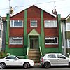 |
Newhaven 50°47′34″N 0°03′02″E / 50.7928°N 0.0506°E |
Methodist | – | Newhaven's first Methodist chapel dates from 1885. It is no longer used for religion and has been changed a lot. | |
| Church of the Sacred Heart (More images) |
 |
Newhaven 50°47′24″N 0°03′05″E / 50.7900°N 0.0514°E |
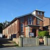
Roman Catholic | – | Newhaven's Roman Catholic church was built in 1898. It closed in 2019. | |
| Convent Chapel of the Sacred Heart |  |
Newhaven 50°47′34″N 0°02′47″E / 50.7927°N 0.0463°E |
Roman Catholic | – | Newhaven's first Roman Catholic place of worship was designed around 1878. It stopped being used around 1943 and was later a library and arts centre. | |
| Zion Chapel (More images) |
 |
Newick 50°58′29″N 0°00′33″E / 50.9746°N 0.0091°E |
Baptist | II | This brick chapel dates from 1834. It has a large front and a cemetery. In 2001, it was approved to be turned into flats. | |
| St Mary the Virgin Church (Church of Our Lady Queen of Heaven) (More images) |
 |
North Chailey 50°58′20″N 0°01′18″W / 50.9721°N 0.0218°W |
Anglican and Roman Catholic | II | Built in 1876, this church was used by Anglicans until 1976. Then it was used by the Catholic Church until 1990 and later sold. | |
| Rehoboth Independent Congregational Chapel (More images) |
 |
Ringmer 50°53′38″N 0°03′35″E / 50.8940°N 0.0597°E |
Congregational | – | This red-brick building was turned into a house in 1995. It dates from 1914 and is on the site of an older chapel. | |
| Congregational Chapel (More images) |
 |
South Heighton 50°48′27″N 0°03′28″E / 50.8074°N 0.0577°E |
Congregational | – | This small brick chapel was built in 1891. It stopped being used in the mid-20th century and is now a home. | |
| Southover General Baptist Chapel (More images) |
 |
Southover, Lewes 50°52′12″N 0°00′30″E / 50.8700°N 0.0082°E |
Baptist | II | This chapel was turned into a house in 1972 after over 200 years as a place of worship. It was the first Baptist chapel in the Lewes area. | |
| St Bartholomew's Church (More images) |
 |
Spithurst 50°56′21″N 0°01′42″E / 50.9391°N 0.0284°E |
Anglican | – | This church was designed in 1880. It was declared no longer needed in 1994 but is still used as a retreat and youth centre. |
See also


