List of places of worship in Woking (borough) facts for kids
Woking is a busy town in Surrey, England. It has more than 50 places where people can worship, like churches, mosques, and temples. This shows how diverse and welcoming Woking is. Some of these buildings are very old, like the Anglican churches in nearby villages. Woking is also home to Britain's oldest mosque built specifically for worship, a Buddhist temple, and an Eastern Orthodox church.
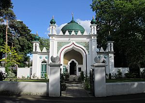
Many of these places are "listed buildings." This means they are special because of their history or design. The government protects these buildings. There are three levels of protection: Grade I (most important), Grade II* (very important), and Grade II (special interest). The Shah Jahan Mosque is a Grade I listed building, which is the highest level.
Contents
Woking's Worship Places: A Quick Look
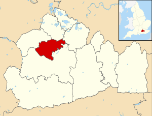
Woking is one of 11 local areas in Surrey. It covers about 6,357 hectares (15,710 acres). In 2011, nearly 100,000 people lived here. The town of Woking is the main centre, but there are also smaller towns like Knaphill and Byfleet, and villages like Brookwood.
Woking used to be a small market town. Its original centre was what we now call Old Woking. The area was mostly heathland with poor soil. Old roads connected villages like Horsell and Byfleet. These villages had ancient churches that are still standing today.
The Basingstoke Canal was built in 1794, and the railway arrived in 1838. These transport links helped Woking grow into the modern town it is today. As more people moved in, new churches were needed. St John the Baptist's Church was built in 1842. It was the first of many Anglican churches in modern Woking. Other Anglican churches were built as the population spread, like those in Knaphill and Woodham.
Catholic Churches in Woking
Roman Catholic worship takes place at the large St Dunstan's Church, which opened in 2008. There are also smaller Catholic churches in Knaphill and West Byfleet. The current St Dunstan's is the third church with that name. The older ones were replaced to create a single, modern building.
Protestant Nonconformist Groups
In the past, many people in Woking belonged to Nonconformist groups. These were Protestant churches that were not part of the Church of England. The first Baptist chapel in Old Woking was built in 1782. Other Baptist chapels were built in places like Horsell and Knaphill.
Methodist churches also played a big role. The first Methodist chapel in "new" Woking was built in 1863. Over the years, many Methodist churches were built and sometimes replaced as the town grew. Today, Trinity Methodist Church is the main one in Woking town centre.
The United Reformed Church was formed in 1972 when two other church groups joined together. Woking has one United Reformed Church today.
Some other groups, like the Plymouth Brethren, also had meeting places in Woking for a long time. Many of these older buildings are now used for other purposes or have been replaced.
Other Faiths in Woking
Woking is home to places of worship for Muslims, Buddhists, and Eastern Orthodox Christians. The Shah Jahan Mosque opened in 1889. It was the first mosque built for this purpose in Britain and a very important centre for Islam in the country.
Thai Buddhists have a temple in a former hospital chapel. Eastern Orthodox Christians worship in one of the old cemetery chapels in Brookwood Cemetery.
Who Belongs to What Religion?
The 2011 census showed that Woking is a diverse place.
- 58.8% of people identified as Christian.
- 7.4% were Muslim. This is much higher than the national average for England.
- 2% were Hindu.
- 0.7% were Buddhist.
- 0.2% were Jewish.
- 0.2% were Sikh.
- 23.1% said they had no religion.
- 7.3% did not state their religion.
This shows that Woking has a mix of different faiths and beliefs.
How Places of Worship are Managed
Anglican Churches
The 18 Anglican churches in Woking are part of the Deanery of Woking. This is a local area within the Diocese of Guildford, which is led by Guildford Cathedral.
Roman Catholic Churches
Woking has four Roman Catholic churches. Three of them are part of the Woking Deanery, and one is part of the Guildford Deanery. These deaneries are part of the larger Roman Catholic Diocese of Arundel and Brighton.
Other Denominations
Many other churches in Woking are part of larger networks or groups. For example, Baptist churches are linked to the South Eastern Baptist Association. Methodist churches are part of the Woking and Walton-on-Thames Methodist Circuit. Evangelical churches often belong to groups like the Fellowship of Independent Evangelical Churches.
Special Listed Buildings
These are the rules for how buildings get their special "listed" status:
| Grade | Criteria |
|---|---|
| Grade I | Buildings that are super special and important, sometimes even worldwide. |
| Grade II* | Buildings that are very important and have more than just special interest. |
| Grade II | Buildings that are important for the country and have special interest. |
Current Places of Worship in Woking
| Name | Image | Location | Religion | Grade | Notes | Refs |
|---|---|---|---|---|---|---|
| St Mary the Virgin's Church (More images) |
 |
Byfleet 51°19′58″N 0°28′33″W / 51.3329°N 0.4758°W |
Anglican | I | This church was rebuilt around 1290. It has walls made of flint and puddingstone. A bell-cot holds three bells from 1853. | |
| St Nicholas' Church (More images) |
 |
Pyrford 51°18′49″N 0°30′33″W / 51.3137°N 0.5093°W |
Anglican | I | This church dates back to the mid-1100s. It was carefully restored in 1869. You can see different building materials, including rare Caen stone. Old wall paintings were found here. | |
| St Peter's Church (More images) |
 |
Old Woking 51°18′06″N 0°32′13″W / 51.3016°N 0.5369°W |
Anglican | I | Only the nave walls remain from the original Norman building. The tower and a south aisle were added later. The porch has a unique stepped roof. | |
| St Mary the Virgin's Church (More images) |
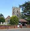 |
Horsell 51°19′22″N 0°34′13″W / 51.3228°N 0.5704°W |
Anglican | II* | This village church was restored in 1890. Parts of it date back to the 14th century. The tower looks similar to a nearby church in Worplesdon. | |
| All Saints Church (More images) |
 |
Woodham 51°20′05″N 0°32′36″W / 51.3346°N 0.5433°W |
Anglican | II | Built in 1893, this church was designed to look like an old Surrey chapel. It has many features that look like Norman architecture. A large extension was added in 1906. | |
| Christ Church (More images) |
 |
Woking 51°19′12″N 0°33′29″W / 51.3199°N 0.5581°W |
Anglican | II | This church in the town centre was built in 1889. It is made of bright red brick and has two copper spires. The inside is very spacious. | |
| St John the Baptist's Church (More images) |
 |
West Byfleet 51°20′18″N 0°30′09″W / 51.3383°N 0.5026°W |
Anglican | II | Construction of this church started in 1910 and finished two years later. It was designed in the Gothic Revival style, using flint and stone walls. | |
| St Mary of Bethany Church (More images) |
 |
Mount Hermon 51°18′40″N 0°34′05″W / 51.3111°N 0.568°W |
Anglican | II | This church from 1907 has detailed brickwork and tiling. It has a wide front facing the street with a large window. There is no tall tower, just a small bell-turret. | |
| All Souls Church (More images) |
 |
Sutton Green 51°17′04″N 0°33′37″W / 51.2845°N 0.5603°W |
Anglican | – | This church was built in 1921 to remember the 28 local people who died in World War I. It replaced an older "tin tabernacle" (a church made of corrugated iron). | |
| Church of the Good Shepherd (More images) |
 |
Pyrford 51°19′31″N 0°30′34″W / 51.3254°N 0.5094°W |
Anglican | – | Designed in 1964, this church serves the main part of Pyrford village. It has modern stained glass windows, including one by Margaret Traherne. | |
| Emmanuel Church (More images) |
 |
Mayford 51°17′52″N 0°35′18″W / 51.2977°N 0.5882°W |
Anglican | – | This church started as a mission hall in 1905, with services first held in a barn. The current church building opened in 1992 on the same spot. | |
| Holy Trinity Church (More images) |
 |
Knaphill 51°18′59″N 0°37′29″W / 51.3163°N 0.6247°W |
Anglican | – | Built in 1907, this red-brick church replaced an earlier tin tabernacle. Its design has a Romanesque Revival feel. A princess even laid its foundation stone! | |
| St Andrew's Church (More images) |
 |
Goldsworth Park 51°19′08″N 0°35′27″W / 51.3188°N 0.5907°W |
Anglican | – | This church was built in 1988 to serve the Goldsworth Park housing area. It is one of five churches started by St John the Baptist's Church. | |
| St John the Baptist's Church (More images) |
 |
St John's 51°18′59″N 0°37′29″W / 51.3163°N 0.6247°W |
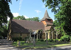
Anglican | – | This was the first Anglican church built in Woking since the ancient St Peter's. It was designed in 1842 and served the new residential area near the Basingstoke Canal. | |
| St Mark's Church (More images) |
 |
Westfield 51°18′01″N 0°33′40″W / 51.3004°N 0.5611°W |
Anglican | – | This building started as a church school in 1849. It became a place of worship in 1924 and was named St Mark's in 1970. | |
| St Paul's Church (More images) |
 |
Maybury 51°19′20″N 0°32′34″W / 51.3222°N 0.5427°W |
Anglican | – | Built in 1895, this church was originally a smaller chapel connected to Christ Church in the town centre. It is mainly made of red brick. | |
| St Saviour's Church (More images) |
 |
Brookwood 51°18′17″N 0°38′15″W / 51.3046°N 0.6374°W |
Anglican | – | This church was built in 1909. An earlier wooden "tin tabernacle" church from 1897 was moved to make way for it and became the church hall. | |
| St Michael's Church (More images) |
 |
Sheerwater 51°20′02″N 0°31′39″W / 51.3339°N 0.5275°W |
Anglican/Methodist | – | This church is shared by Anglicans and Methodists. It was built in the 1970s for the Sheerwater housing estate. | |
| St Edward the Confessor's Church (More images) |
 |
Sutton Place 51°16′28″N 0°33′37″W / 51.2745°N 0.5604°W |
Roman Catholic | II | This church was built in 1876 on the grounds of Sutton Place mansion. It was an important meeting place for Catholics in Surrey for many years. | |
| Church of Our Lady Help of Christians (More images) |
 |
West Byfleet 51°20′18″N 0°30′24″W / 51.3384°N 0.5067°W |
Roman Catholic | – | A temporary wooden chapel opened here in 1917. The current church was built later, starting in 1955, as the number of worshippers grew. | |
| St Dunstan's Church (More images) |
 |
Maybury 51°19′09″N 0°32′43″W / 51.3192°N 0.5452°W |
Roman Catholic | – | This is the third St Dunstan's Church in Woking. The current building opened in 2008, replacing an older church from 1927 and a very first "tin tabernacle" from 1899. | |
| St Hugh of Lincoln's Church (More images) |
 |
Knaphill 51°19′05″N 0°36′49″W / 51.318°N 0.6137°W |
Roman Catholic | – | The first church here was built in 1908. As the population grew, a new, permanent church was built in 1971 to serve the community. | |
| Courtenay Free Church |  |
Maybury 51°19′31″N 0°32′37″W / 51.3254°N 0.5435°W |
Evangelical | – | The original Courtenay Free Church was a mission hall built in 1906. The current building replaced it in 1969. | |
| Father's House Woking (More images) |
 |
Woking 51°19′17″N 0°33′07″W / 51.3215°N 0.5519°W |
Evangelical | – | This building was originally a "Brethren Gospel Hall" in the late 1800s. It was replaced by the current building, which is now used by a Charismatic Evangelical group. | |
| Horsell Evangelical Church |  |
Horsell 51°19′24″N 0°34′31″W / 51.3234°N 0.5752°W |
Evangelical | – | This church started as a mission chapel in the late 1890s. A "tin tabernacle" was used until the current building was completed in 1984. | |
| Welcome Church (More images) |
 |
Woking 51°19′03″N 0°33′51″W / 51.3176°N 0.5641°W |
Evangelical | – | This church, formerly known as The Coign Church, started as a house church in 1884. It has grown a lot and now has a new building that opened in 2020. | |
| Byfleet Methodist Church (More images) |
 |
Byfleet 51°20′17″N 0°28′41″W / 51.3381°N 0.478°W |
Methodist | – | The original Methodist chapel in Byfleet was used until the 1920s. The current church building on Rectory Lane opened in 1933. | |
| Knaphill Methodist Church (More images) |
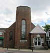 |
Knaphill 51°19′04″N 0°37′03″W / 51.3177°N 0.6176°W |
Methodist | – | The first chapel here opened in 1867. Because it became unsafe, a new, large Art Deco-style building was completed in 1935. | |
| Trinity Methodist Church (More images) |
 |
Woking 51°19′20″N 0°33′35″W / 51.3223°N 0.5598°W |
Methodist | – | This octagonal church, praised for its design, replaced an older chapel in the town centre. It opened in 1965 and has large windows. | |
| Knaphill Baptist Church (More images) |
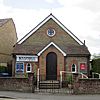 |
Knaphill 51°19′03″N 0°37′14″W / 51.3174°N 0.6206°W |
Baptist | – | This brick chapel, originally called 'Hope Chapel', was built in 1882. It was founded by a horticulturist named Robert Lloyd. | |
| New Life Church (More images) |
 |
Old Woking 51°18′10″N 0°33′05″W / 51.3028°N 0.5513°W |
Baptist | – | This church started as 'Kingfield Baptist Church' in 1929. It was a "church plant" from Woking Baptist Church. It now has a new building. | |
| Kingdom Hall (More images) |
 |
Brookwood 51°18′17″N 0°38′28″W / 51.3048°N 0.6412°W |
Jehovah's Witnesses | – | This building was once a Primitive Methodist chapel. It was later taken over by Jehovah's Witnesses and rebuilt as a purpose-built Kingdom Hall. | |
| Kingdom Hall (More images) |
 |
Byfleet 51°20′18″N 0°28′16″W / 51.3384°N 0.4712°W |
Jehovah's Witnesses | – | This Kingdom Hall serves the Jehovah's Witnesses community in Byfleet. It was registered for worship in 1971. | |
| Calvary Church |  |
Woking 51°18′50″N 0°34′27″W / 51.314°N 0.5742°W |
Assemblies of God | – | This church, known as 'Woking Assembly of God', was registered for worship in 1969. It is still linked to the Assemblies of God denomination. | |
| Wat Phra Dhammakaya London (More images) |
 |
Knaphill 51°18′50″N 0°37′02″W / 51.3139°N 0.6171°W |
Buddhist | – | Also called 'Woking Buddhist Temple', this is a Thai Buddhist temple. It is located in the former chapel of a large hospital that closed in 1994. | |
| First Church of Christ, Scientist, Woking (More images) |
 |
Woking 51°18′55″N 0°33′14″W / 51.3154°N 0.554°W |
Christian Scientist | – | This church is a branch of the main Christian Science church in Boston, USA. It has services and a Sunday school. | |
| St Edward the Martyr's Orthodox Church (More images) |
 |
Brookwood 51°17′58″N 0°37′27″W / 51.2995°N 0.6241°W |
Eastern Orthodox | – | The remains of Edward the Martyr (a king from the 900s) are kept in this former cemetery chapel. It became an Eastern Orthodox church in 1990. | |
| Shah Jahan Mosque (More images) |
 |
Maybury 51°19′21″N 0°32′41″W / 51.3226°N 0.5446°W |
Muslim | I | This was Britain's first purpose-built mosque, opened in 1889. It has a beautiful onion dome and a special courtyard for washing. | |
| Word of Life Church |  |
Woking 51°19′21″N 0°33′03″W / 51.3224°N 0.5508°W |
Pentecostal | – | This church replaced an older meeting room in 1986. It started in the 1970s and also holds services in another part of Woking. | |
| Friends Meeting House |  |
Woking 51°19′03″N 0°32′40″W / 51.3174°N 0.5444°W |
Quaker | – | The Quaker community in Woking started in 1947. They bought a house in 1965 and turned it into a meeting room and flat. | |
| Salvation Army Hall (More images) |
 |
Horsell 51°19′25″N 0°34′55″W / 51.3235°N 0.5819°W |
Salvation Army | – | This is the third Salvation Army building in Woking. The first one was built in 1910, but it was replaced due to town redevelopment. | |
| Church of the Holy Cross (More images) |
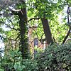 |
Maybury 51°19′13″N 0°32′16″W / 51.3202°N 0.5377°W |
Society of St. Pius X | II* | This beautiful chapel was added to a convent in 1897-1901. The convent is now housing, but the chapel is still used for worship by the Society of St. Pius X. | |
| Woking and District Spiritualist Church (More images) |
 |
Woking 51°19′17″N 0°33′08″W / 51.3214°N 0.5521°W |
Spiritualist | – | This church was registered for worship in 1970. It replaced an older Spiritualist church that dated back to 1938. | |
| Providence Baptist Church (More images) |
 |
Knaphill 51°19′11″N 0°36′27″W / 51.3197°N 0.6075°W |
Strict Baptist | – | Worship has happened on this site for over 140 years. The current church and hall were built in 1998. | |
| Woking United Reformed Church (More images) |
 |
Woking 51°18′57″N 0°33′20″W / 51.3159°N 0.5555°W |
United Reformed Church | – | This church was built in 1952 and was originally called St Andrew's Presbyterian Church. It was renamed in 2005 when another church joined it. | |
| Woking Vineyard Church |  |
Woking 51°19′07″N 0°33′29″W / 51.3186°N 0.5581°W |
Vineyard Movement | – | This church used to meet at the Old Woking Community Centre. It now meets at 'The Lighthouse', which also helps the community with things like food banks. |
Former Places of Worship
| Name | Image | Location | Religion | Grade | Notes | Refs |
|---|---|---|---|---|---|---|
| St Thomas's Mission Church |  |
Littlewick, Knaphill 51°19′37″N 0°36′08″W / 51.327°N 0.6023°W |
Anglican | – | This wooden church from 1901 was in the middle of a wood. It became a nursery school in 1968. | |
| Anthonys Baptist Chapel | 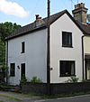 |
Anthonys, Horsell Common 51°20′21″N 0°32′35″W / 51.3391°N 0.5431°W |
Baptist | – | This chapel started with house meetings in the isolated area of Anthonys. Chapel Cottage, where it was, is now a house. | |
| Anthonys Baptist Church | 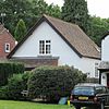 |
Anthonys, Horsell Common 51°20′24″N 0°32′37″W / 51.3401°N 0.5436°W |
Baptist | – | This brick church was built in 1900–01. It was used until the 1980s, when it was sold and turned into a home. | |
| Goldsworth Road Meeting Room |  |
Woking 51°19′02″N 0°34′09″W / 51.3171°N 0.5692°W |
Plymouth Brethren | – | This meeting room was built in 1986 for the Brethren. It has since closed and is now a Muslim community centre. | |
| Mayford Baptist Chapel |  |
Mayford 51°17′40″N 0°34′09″W / 51.2945°N 0.5692°W |
Baptist | – | This small chapel has a history as a Baptist place of worship going back to 1824. It is now a house. | |
| West Byfleet United Reformed Church | 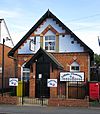 |
West Byfleet 51°20′29″N 0°30′10″W / 51.3415°N 0.5029°W |
United Reformed Church | – | This church started as a Congregational meeting room in 1858. It later became a United Reformed Church but is no longer in use. |
 | Audre Lorde |
 | John Berry Meachum |
 | Ferdinand Lee Barnett |


