List of tallest buildings in Rhode Island facts for kids
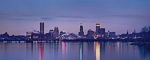
The state of Rhode Island has 27 buildings that are taller than 175 feet (53 meters). Five of these buildings are over 300 feet (91 meters) tall. All of these super-tall buildings are in Providence, the state's capital and largest city.
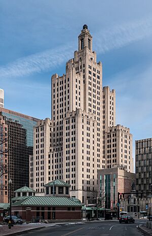
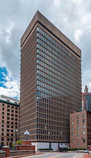
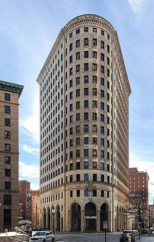
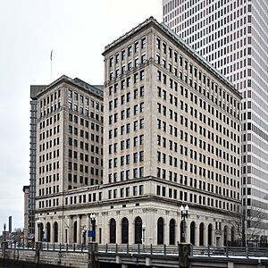
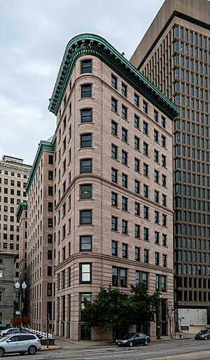
The tallest skyscraper in Providence and Rhode Island is the Industrial National Bank Building. It stands at 111 Westminster Street in Downtown Providence. This building has 26 floors and is 428 feet (130 meters) tall. People often call it the "Superman Building." This is because it looks like the Daily Planet building from the 1950s TV show, Adventures of Superman. It is also the sixth-tallest building in New England, not counting those in Boston.
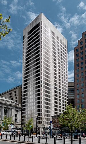
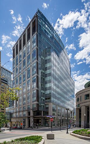
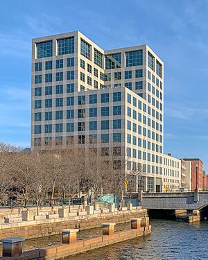
The second-tallest building in Providence is One Financial Plaza. It has 30 floors and is 410 feet (125 meters) tall. It was finished in 1973.
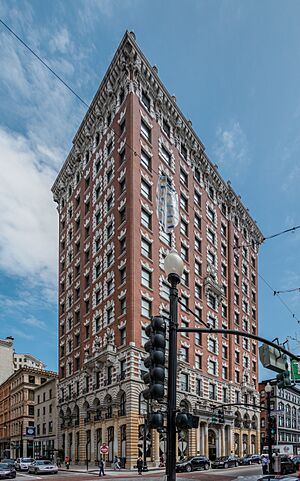
Providence was one of the first places in the United States to have many factories. Because of this, many of its tallest buildings were built before 1930. Examples include the Industrial National Bank Building, Turk's Head Building, and Bannigan Building. The city had another big building boom in the 1970s. During this time, One Financial Plaza and Textron Tower were built. These are the city's second and fifth-tallest buildings.
In the 1990s and 2000s, Providence saw another period of new construction. This time was called the Providence "Renaissance." During this period, four of the city's ten tallest buildings were constructed.
Contents
Tallest Buildings in Rhode Island
This list shows the tallest buildings in Rhode Island. We measure their height by including spires and fancy architectural parts. However, we do not count antenna masts. If you see an equal sign (=) next to a rank, it means two or more buildings are the same height. The "Year" column tells you when the building was finished.
| Rank | Name | Image | Height ft (m) |
Floors | Year | Location | Use | Notes |
|---|---|---|---|---|---|---|---|---|
| 1 | Industrial National Bank Building | 428 (130) | 26 | 1928 | Providence
41°49′28.27″N 71°24′39.89″W / 41.8245194°N 71.4110806°W |
Vacant |
|
|
| 2 | One Financial Plaza | 410 (125) | 30 | 1973 | Providence
41°49′31.11″N 71°24′36.14″W / 41.8253083°N 71.4100389°W |
Office |
|
|
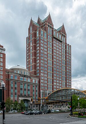
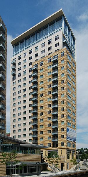
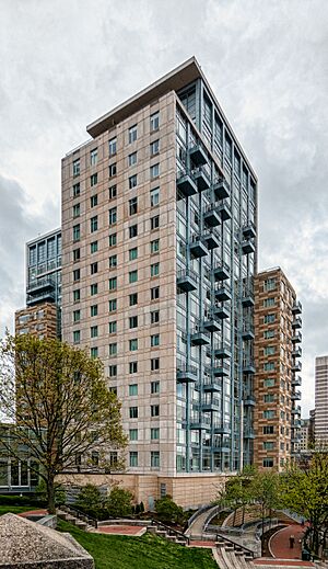
| 3 | The Residences Providence | 380 (116) | 31 | 2007 | Providence
41°49′30.32″N 71°24′54.77″W / 41.8250889°N 71.4152139°W |
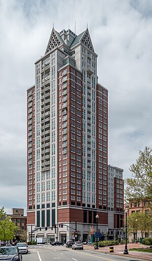
Residential | This is the tallest building in Rhode Island built in the 2000s. | |
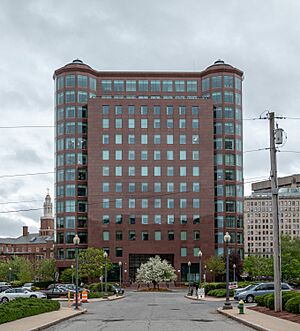
| 4 | Omni Providence Hotel | 329 (100) | 25 | 1993 | Providence
41°49′31.15″N 71°24′58.5″W / 41.8253194°N 71.416250°W |
Hotel |
|
|
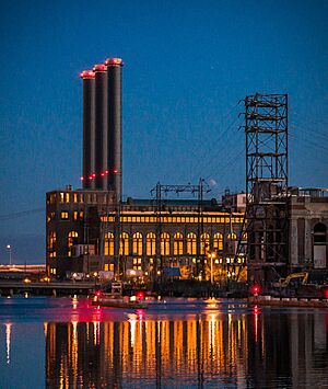
| N/A | Manchester Street Generating Station | 321 (98) | 1996 | Providence
41°48′57″N 71°24′16″W / 41.815829°N 71.404329°W |
Power station |
|
||
| 5 | Textron Tower | 311 (95) | 23 | 1971-72 | Providence
41°49′29.63″N 71°24′33.05″W / 41.8248972°N 71.4091806°W |
Office |
|
|
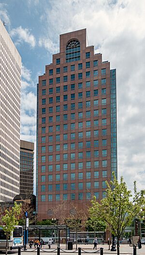
| 6 | 50 Kennedy Plaza | 285 (87) | 20 | 1985 | Providence
41°49′29.8″N 71°24′38.09″W / 41.824944°N 71.4105806°W |
Office | This is the tallest building in Rhode Island built in the 1980s. | |
| 7 | Blue Cross & Blue Shield of Rhode Island Headquarters | 236 (72) | 14 | 2009 | Providence
41°49′40.2672″N 71°24′48.261″W / 41.827852000°N 71.41340583°W |
Office | ||
| 8 | Waterplace 1 | 236 (72) | 19 | 2008 | Providence
41°49′38.44″N 71°24′45.098″W / 41.8273444°N 71.41252722°W |
Residential |
|
|
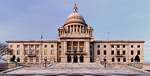
| 9 | Rhode Island State House | 223 (68) | 4 | 1904 | Providence
41°49′51.1032″N 71°24′54.053″W / 41.830862000°N 71.41501472°W |
Governmental |
|
|
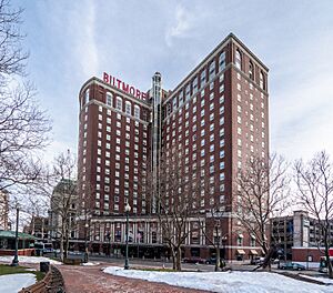
| 10= | Biltmore Hotel | 220 (67) | 18 | 1922 | Providence
41°49′27.73″N 71°24′48.4″W / 41.8243694°N 71.413444°W |
Hotel |
|
|
| 10= | The Tower at Carnegie Abbey | 220 (67) | 17 | 2009 | Portsmouth
41°36′58.3″N 71°16′10.8″W / 41.616194°N 71.269667°W |
Residential |
|
|
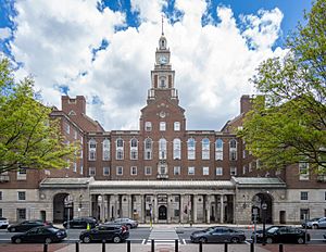
| 12 | Providence County Courthouse | 217 (66) | 7 | 1930 | Providence
41°49′31.76″N 71°24′24.84″W / 41.8254889°N 71.4069000°W |
Governmental | This is the tallest building in Rhode Island built in the 1930s. | |
| 13 | Turk's Head Building | 217 (66) | 16 | 1913 | Providence
41°49′28.42″N 71°24′35.5″W / 41.8245611°N 71.409861°W |
Office | This is the tallest building in Rhode Island built in the 1910s. | |
| 14 | Waterplace 2 | 210 (64) | 17 | 2008 | Providence
41°49′38.22″N 71°24′48.05″W / 41.8272833°N 71.4133472°W |
Residential | ||
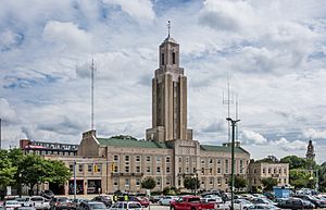
| 15 | Pawtucket City Hall | 209 (64) | 3 | 1933 | Pawtucket
41°52′44.2″N 71°22′55.8″W / 41.878944°N 71.382167°W |
Governmental |
|
|
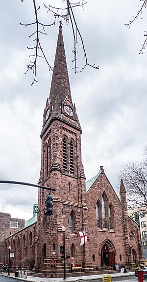
| 16 | Grace Church | ~206 (63) | 1 | 1860 | Providence
41°49′19″N 71°24′49″W / 41.82183°N 71.413507°W |
Church | This is the tallest building in Rhode Island built in the 19th century. | |
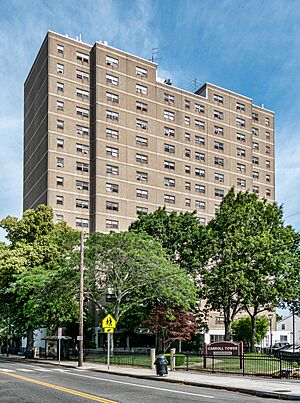
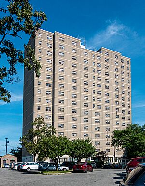
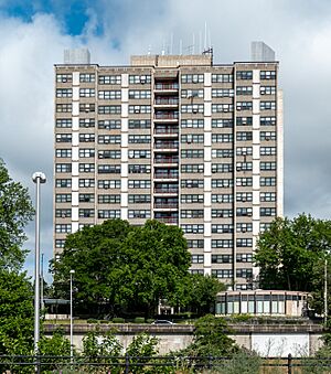
| 17= | Carrol Tower | 199 (61) | 16 | 1973 | Providence
41°49′38.22″N 71°24′48.05″W / 41.8272833°N 71.4133472°W |
Residential |
|
|
| 17= | Parenti Villa | 199 (61) | 16 | 1973 | Providence
41°49′11.6″N 71°26′10.0″W / 41.819889°N 71.436111°W |
Residential |
|
|
| 19 | Towers East | 194 (59) | 16 | 1976 | Pawtucket
41°52′33″N 71°23′09″W / 41.875806°N 71.385755°W |
Residential | ||
| 20 | First Unitarian Church of Providence | 189 (58) | 1816 | Providence
41°49′28″N 71°24′18″W / 41.824381°N 71.404901°W |
Church |
|
||
| 21 | Charlesgate North | 187 (57) | 15 | 1970 | Providence
41°50′19.6902″N 71°24′35.2368″W / 41.838802833°N 71.409788000°W |
Residential | ||
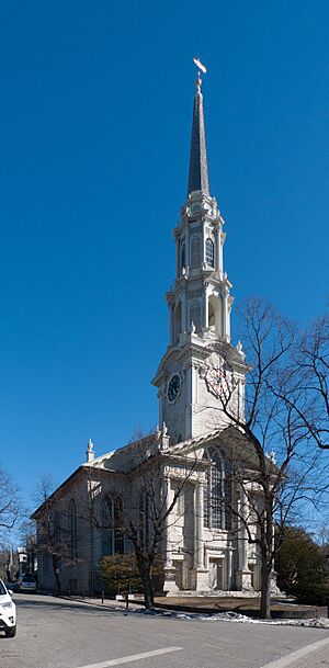
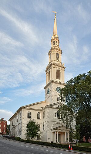
| 22 | First Baptist Church | 185 (56) | 1775 | Providence
41°49′39″N 71°24′30″W / 41.827476°N 71.408292°W |
Church | This is the tallest building in Rhode Island built in the 18th century. | ||
| 23 | Fogarty Manor | 182 (55) | 1969 | Pawtucket
41°52′50″N 71°22′59″W / 41.880481°N 71.38316°W |
Residential | This is the tallest building in Rhode Island built in the 1960s. | ||
| 24= | One Citizens Plaza | 180 (55) | 13 | 1990 | Providence
41°49′38.4558″N 71°24′38.2926″W / 41.827348833°N 71.410636833°W |
Office | ||
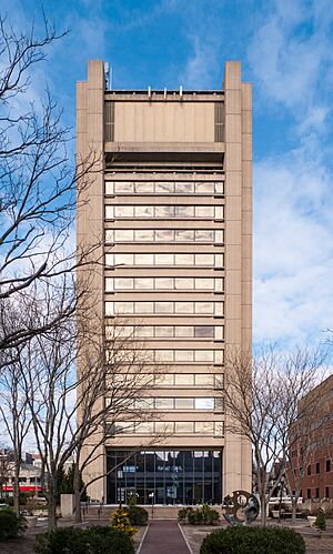
| 24= | Brown University Sciences Library | 180 (55) | 15 | 1971 | Providence
41°49′36.85″N 71°24′0.49″W / 41.8269028°N 71.4001361°W |
University |
|
|
| 26 | 121 South Main Street | 178 (54) | 11 | 1984 | Providence
41°49′27″N 71°24′25″W / 41.824074°N 71.407019°W |
University |
|
|
| 27 | Hospital Trust Building | 177 (54) | 13 | 1920 | Providence
41°49′32.38″N 71°24′34.83″W / 41.8256611°N 71.4096750°W |
University |
|
|
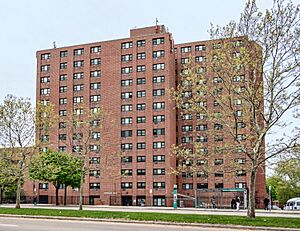
| 28 | Sister Dominica Manor | 175 (53) | 16 | 1966 | Providence
41°49′21.84″N 71°25′16.69″W / 41.8227333°N 71.4213028°W |
Residential |
|
|
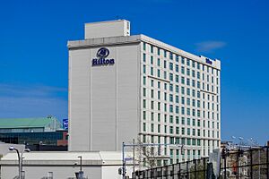
| 29 | Hilton Providence Hotel | ~173 (53) | 14 | 1969 | Providence
41°49′23″N 71°25′07″W / 41.822989°N 71.418550°W |
Hotel |
|
|
| 30 | Edge College Hill | 172 (52) | 15 | 2018 | Providence
41°49′40″N 71°24′36″W / 41.827908°N 71.410074°W |
Residential |
|
|
| 31 | Slater Hill Apartments | 170 (52) | 14 | Pawtucket
41°52′29″N 71°23′10″W / 41.874726°N 71.386038°W |
Residential | |||
| 32 | One Regency Plaza | ~161 | 13 | 1973 | Residential | |||
| 33 | Bannigan Building | ~160 (49) | 11 | 1896 | Providence
41°49′29″N 71°24′33″W / 41.824679°N 71.409209°W |
Office |
|
|
| 34 | Union Trust Company Building | ~157 (48) | 12 | 1902 | Providence
41°49′25″N 71°24′41″W / 41.823685°N 71.411350°W |
Office | ||
| 35 | Cathedral of Saints Peter and Paul | 156 (48) | 1889 | Providence
41°49′09″N 71°24′59″W / 41.819282°N 71.416506°W |
Church |
|
Tallest Buildings Planned for the Future
This table lists buildings that are currently being planned or discussed.
| Name | Height ft (m) |
Floors | Status | Location | Notes |
|---|---|---|---|---|---|
| Hope Point Tower | 550 (168) | 46 | Never built | Jewelry District, Providence |
|
| Edge College Hill II | 187 (57) | 15 | Proposed | College Hill, Providence |
|
| 137-151 Friendship St. | 120 (37) | 12 | Proposed | Jewelry District, Providence |
|
| 151 Chestnut St. | 112 (34) | 9 | In approval | Jewelry District, Providence |
|
Tallest Buildings That Were Torn Down
| Name | Height ft (m) |
Floors | Built | Destroyed | Location | Use | Notes |
|---|---|---|---|---|---|---|---|
| Hartford Park | 10 | 1951 | 1989 | Providence | Residential |
|
History of Rhode Island's Tallest Buildings
This table shows buildings that were once the tallest in Rhode Island. Since the First Baptist Church in America was built, all buildings that have held the "tallest" title have been in Providence.
| Name | Image | Location | Years as tallest | Height ft (m) |
Floors | Coordinates | Reference |
|---|---|---|---|---|---|---|---|
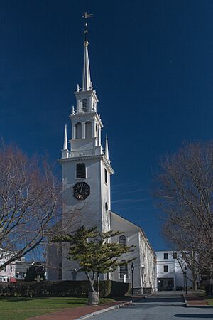
| Trinity Church | Newport | c. 1750–1775 | ~150 (46) | 41°29′14″N 71°18′48″W / 41.48732°N 71.31328°W | |||
| First Baptist Church | Providence | 1775–1816 | 185 (56) | 41°49′39″N 71°24′30″W / 41.827476°N 71.408292°W | |||
| First Unitarian Church of Providence | Providence | 1816–1816 | 189 (58) | ||||
| Grace Church | Providence | 1860–1904 | ~206 (63) | 41°49′19″N 71°24′49″W / 41.82208°N 71.41365°W | |||
| Rhode Island State House | Providence | 1904–1927 | 223 (68) | 4 | 41°49′51.08″N 71°24′53.87″W / 41.8308556°N 71.4149639°W | ||
| Industrial National Bank Building | Providence | 1927–present | 428 (130) | 26 | 41°49′28.27″N 71°24′39.89″W / 41.8245194°N 71.4110806°W |
See also
 In Spanish: Anexo:Edificios más altos de Rhode Island para niños
 | Kyle Baker |
 | Joseph Yoakum |
 | Laura Wheeler Waring |
 | Henry Ossawa Tanner |


