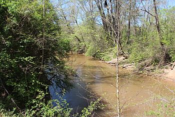
Little River (Etowah River tributary) facts for kids
Quick facts for kids Little River (Etowah River) |
|
|---|---|

Little River in Cherokee County
|
|
| Country | United States |
| Physical characteristics | |
| Main source | Georgia |
The Little River is a river in Georgia, United States. It is about 29.3 miles (47.2 kilometers) long. This river flows into the Etowah River. A tributary is a smaller stream or river that flows into a larger one.
Contents
About the Little River
The Little River is mostly in Cherokee County. It also forms part of the border between Cherokee County and Fulton County. This border used to be with Milton County. The river also touches the city limits of Milton.
Where Does the River Flow?
The Little River generally flows from east to west. It helps divide the Woodstock area to the south from the Holly Springs area to the north. Its biggest stream that flows into it is Noonday Creek. Noonday Creek starts in Cobb County and flows north through Cherokee County. It now empties directly into Lake Allatoona. The place where the Little River used to meet the Etowah River is now underwater, beneath Lake Allatoona.
The River's Journey
The Little River starts as a small stream. It begins between Free Home and Holbrook. This is just west of the Cherokee and Forsyth county line. It's also south of Georgia State Route 20 (SR 20).
The river flows south-southwest. It crosses Free Home Highway (SR 372). Then, it flows next to Birmingham Road (also SR 372). After flowing through Almond Lake, it gets water from another stream. It then becomes part of the county line for a while.
Meeting Other Streams
After passing Trickum Road, the river winds generally northwest. It meets Rubes Creek and Mill Creek at the same spot. This is just before Canton Highway in Woodstock.
Continuing northwest, the river passes Rope Mill Park. It then crosses Interstate 575. The river starts to get wider as it nears Lake Allatoona. It meets Toonigh Creek and then the Noonday Creek arm of the lake. The river widens and narrows again before meeting the Blankets Creek arm. It then turns southwest and north again to meet Rose Creek. It widens and narrows once more at Little River Landing. Soon after this, it flows into the Etowah River, which is the largest part of Lake Allatoona.
Bell's Ferry and the Lake
Bell's Ferry was a place on Bells Ferry Road. It was used to cross the river between Marietta and Canton. These are the county seats for Cobb and Cherokee counties. Today, this spot informally separates the river from the main part of Lake Allatoona. There is a small marina here called Little River Landing. The United States Army Corps of Engineers also maintains a boat ramp and parking lot here.
 | William L. Dawson |
 | W. E. B. Du Bois |
 | Harry Belafonte |

