Cherokee County, Georgia facts for kids
Quick facts for kids
Cherokee County
|
|||||
|---|---|---|---|---|---|
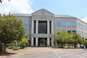
Cherokee County Justice Center
|
|||||
|
|||||
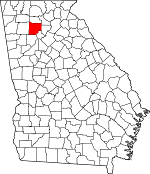
Location within the U.S. state of Georgia
|
|||||
 Georgia's location within the U.S. |
|||||
| Country | |||||
| State | |||||
| Founded | 1831 | ||||
| Named for | Cherokee people | ||||
| Seat | Canton | ||||
| Largest city | Woodstock | ||||
| Area | |||||
| • Total | 434 sq mi (1,120 km2) | ||||
| • Land | 421 sq mi (1,090 km2) | ||||
| • Water | 13 sq mi (30 km2) 2.9%% | ||||
| Population
(2020)
|
|||||
| • Total | 266,620 | ||||
| • Estimate
(2023)
|
286,602 |
||||
| • Density | 614.3/sq mi (237.19/km2) | ||||
| Time zone | UTC−5 (Eastern) | ||||
| • Summer (DST) | UTC−4 (EDT) | ||||
| Congressional districts | 6th, 11th | ||||
Cherokee County is a county located in the US state of Georgia. In 2020, about 266,620 people lived here. The main city, or county seat, is Canton. The county is run by a group called the Board of Commissioners. They are elected by the people. Cherokee County is also part of the larger Atlanta Metropolitan Area.
Contents
A Look Back at Cherokee County's History
How Cherokee County Began
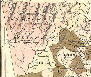
Cherokee County was created on December 26, 1831. This happened because of a law passed by the Georgia General Assembly, which is Georgia's law-making group. The county covered a very large area. It was named after the Cherokee people who lived there.
Gold was found in the local streams. This made many European Americans want to move onto the Cherokee people's land.
In 1832, Georgia started the Cherokee Land Lottery. This lottery gave land deeds to white male citizens. This land had belonged to the Cherokee people. Around this time, the Cherokee people were forced to move. They were sent to a place called Indian Territory west of the Mississippi River.
How the County Was Divided
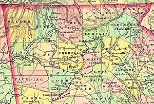
On December 3, 1832, the General Assembly passed another law. This law created several new counties. These counties were Forsyth, Lumpkin, Union, Cobb, Gilmer, Murray, Cass (now Bartow), Floyd, and Paulding. All these new counties were formed from what was once Cherokee County.
The town of Etowah was named the county seat in 1833. Its name was later changed to Canton. Canton is still the county seat today.
In 1857, a small part of the county was given away. It became part of Milton County. Today, this area includes cities like Milton and Alpharetta.
Growing and Developing Over Time
In the 1890s, a railroad line was built through the county. This line was first called The Atlanta & Knoxville Railroad. Later, it was bought by the Louisville & Nashville Railroad. This company built train stations in Woodstock and Holly Springs.
Cherokee County started to grow very quickly after Interstate 575 was built. The first part of this highway opened in 1979. The freeway cuts through the middle of the county. It is the main road, connecting towns like Woodstock and Canton. Today, the southern parts of the county have the most people. These areas are closest to the big city of Atlanta.
Exploring Cherokee County's Geography
Cherokee County covers about 434 square miles. Most of this area, about 422 square miles, is land. The rest, about 13 square miles, is water. A lot of this water is in Lake Allatoona in the southwest. The lake gets its water from the Etowah and Little Rivers. These are the county's main waterways.
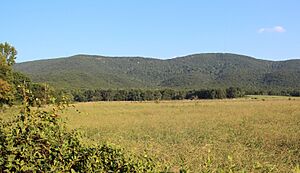
The northern part of the county starts to rise up. It leads towards the foothills of the north Georgia mountains.
What Mountains Are in Cherokee County?
There are nine main mountain peaks in Cherokee County. Here they are, from tallest to shortest:
- Bear Mountain – 2,297 feet (700 meters)
- Pine Log Mountain – 2,260 feet (689 meters)
- Oakey Mountain – 1,686 feet (514 meters)
- Dry Pond Mountain – 1,644 feet (501 meters)
- Hickory Log Mountain – 1,545 feet (471 meters)
- Polecat Mountain – 1,503 feet (458 meters)
- Byrd Mountain – 1,358 feet (414 meters)
- Garland Mountain – 1,348 feet (411 meters)
- Posey Mountain – 1,306 feet (398 meters)
Which Counties Are Next to Cherokee County?
Cherokee County shares borders with these other counties:
- Pickens – to the north
- Dawson – to the northeast
- Forsyth – to the east
- Fulton – to the southeast
- Cobb – to the south
- Bartow – to the west
- Gordon – to the northwest
Who Lives in Cherokee County?
The population of Cherokee County has grown a lot over the years. In 1840, there were about 5,895 people. By 2020, the population had grown to 266,620 people. This shows how much the county has developed.
In 2020, there were 266,620 people living in the county. There were 93,441 households, which are groups of people living together. About 69,257 of these were families.
In 2010, the average household had 2.80 people. The average family had 3.20 people. The median age of people in the county was 36.3 years old. The median income for a household was $66,320. For a family, it was $77,190.
Learning and Schools in Cherokee County
Public Schools
- Cherokee County School District
- Cherokee Charter Academy
Private Schools
Some private schools in Cherokee County include:
- Lyndon Academy (Holly Springs)
- Cherokee Christian Schools (Woodstock)
- Cherokee Christian Academy (Woodstock)
- Community Christian School (Canton)
- Crossroads Christian School (Canton)
- Omega Learning Academy (Woodstock)
- The King's Academy (Woodstock)
Colleges and Universities
- Reinhardt University is a private college located in Waleska, Georgia.
- Chattahoochee Technical College has campuses in Woodstock and Canton.
Getting Around Cherokee County
Main Roads and Highways
 Interstate 75
 Interstate 575
 State Route 5
 State Route 5 Business (Canton)
 State Route 5 Business (Ball Ground)
 State Route 20
 State Route 92
 State Route 108
 State Route 140
 State Route 369
 State Route 372
 State Route 401 (this is another name for I-75)
 State Route 417 (this is another name for I-575)
Airport Information
The Cherokee County Airport is located near I-575. It is about 6 miles northeast of downtown Canton.
The airport recently finished a big project. They built a new terminal building. They also made the runway longer, from 3,414 feet to 5,000 feet. These changes help the airport handle more planes.
Public Transportation Services
The Cherokee Area Transit Service helps people get around the county. It serves both rural and suburban areas.
Cities and Towns in Cherokee County
Cities
- Ball Ground
- Canton (this is the county seat)
- Holly Springs
- Mountain Park (partly in Fulton County)
- Nelson (partly in Pickens County)
- Waleska
- Woodstock
Unincorporated Communities
These are smaller communities that are not officially cities or towns:
- Batesville
- Buffington
- Free Home
- Gold Ridge
- Hickory Flat
- Keithsburg
- Lake Arrowhead
- Lebanon
- Toonigh (a neighborhood in Holly Springs)
- Macedonia
- Mica
- Oak Grove
- Orange
- Salacoa
- Sixes
- Sutallee
- Towne Lake
- Univeter
- Victoria
Famous People from Cherokee County
Many interesting people have lived in or come from Cherokee County:
- Joseph E. Brown was elected governor of Georgia in 1857. He later became a U.S. Senator.
- Ira Roe Foster was a general in the Georgia Militia. He was also a lawyer, doctor, and served in the state government.
- Josh Holloway is an actor and model. He is famous for his role as Sawyer on the TV show Lost. He went to school in Free Home and Canton.
- Johnny Hunt was the president of the Southern Baptist Convention from 2008 to 2010.
- Chris Kirk is a professional golfer on the PGA Tour. He went to Etowah High School.
- Nick Markakis played professional baseball for the Atlanta Braves. He went to Woodstock High School.
- Bruce Miller played professional football in the NFL for the San Francisco 49ers. He went to Woodstock High School.
- Robert Rechsteiner, also known as Rick Steiner, was a professional wrestler. He is now part of the school board for the county.
- Blair Redford is an actor. He grew up in Canton. He is known for his roles on The Young and the Restless and Passions.
- Dean Rusk was the U.S. Secretary of State. He was born in Cherokee County. A school, Dean Rusk Middle School, is named after him.
- Buster Skrine played professional football in the NFL for the New York Jets. He went to Etowah High School.
- Drew Waters is a professional baseball player for the Atlanta Braves. He went to Etowah High School.
See also
 In Spanish: Condado de Cherokee (Georgia) para niños
 | Bessie Coleman |
 | Spann Watson |
 | Jill E. Brown |
 | Sherman W. White |


