Lord Howe Island Marine Park facts for kids
Quick facts for kids Lord Howe Island Marine ParkAustralia |
|
|---|---|
|
IUCN Category II (National Park)
|
|
 |
|
| Established | 1999 |
| Area | 465.45 km2 (179.7 sq mi) |
| Managing authorities | Marine Parks Authority New South Wales |
| Website | Lord Howe Island Marine Park |
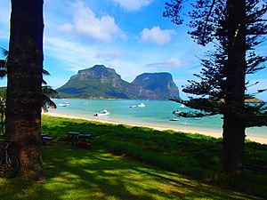
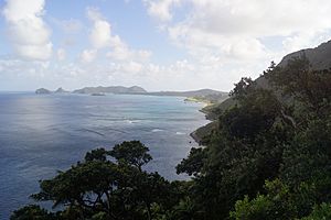
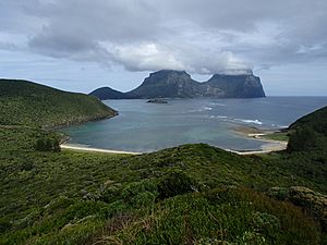
The Lord Howe Island Marine Park is a special ocean area around Lord Howe Island in Australia. It's famous for having the world's most southern coral reef ecosystem. Lord Howe Island is about 10 kilometers long and 2 kilometers wide. It has a big lagoon with a reef system on one side and 28 small islands along its coast.
In 1999, the waters up to three nautical miles (about 5.5 kilometers) from Lord Howe Island were made a marine park. This was done to protect its amazing ocean biodiversity (all the different kinds of life). The park is managed by the New South Wales Marine Parks Authority. Both Lord Howe Island and Ball's Pyramid are part of this protected area. The marine park helps protect the island, which is also a World Heritage Site.
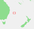
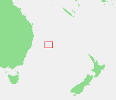
Lord Howe Island is far away, about 643 kilometers northeast of Sydney, New South Wales, Australia. Because it's so remote, it has a very unique marine system with many species found nowhere else. The marine park was created because the area has incredible natural beauty, many different ocean habitats, and is important to the island community.
Contents
Protecting the Ocean: How the Park is Managed
Setting Up the Marine Park
The Lord Howe Island Marine Park was officially started on February 26, 1999. A special plan, called a zoning plan, began on December 1, 2004. This plan helps protect the park's important natural and cultural features while still allowing people to use the area in ways that don't harm it. Because the island is small and isolated, there are some threats to its biodiversity. The marine park helps protect ocean life from too much fishing and from the pressure of more people visiting.
To create the zoning plan, scientists and experts gathered lots of information about the environment, people, and economy. In 2001, they asked the public for their ideas. Then, in 2002, a draft plan was made, including suggestions from the public and advice from a special committee. This plan was shared in 2003, and the final zoning plan started on December 1, 2004. The waters further out, from 3 to 12 nautical miles, became a federal marine park in 2000.
How the Park is Managed Day-to-Day
In 1999, Australia introduced the Environment Protection and Biodiversity Conservation Act (EPBC Act). This law helps guide how to protect biodiversity in different ocean regions. It looks at the whole ecosystem, including how different species interact. This process helped identify areas like Lord Howe Island Marine Park that needed protection.
The New South Wales government created the Lord Howe Island Marine Park to protect the waters around the island. It took a few years of talks with different groups before the zoning plan started in 2004. This plan divides the coastal waters into different zones. Each zone allows certain human activities to help protect the ocean's valuable features.
The main goals of the zoning plan are:
- To protect the many different kinds of ocean life and their homes.
- To keep natural processes in the ocean working well.
- To allow sustainable fishing and use of ocean plants, as long as it doesn't harm the first two goals.
- To give people chances to enjoy, understand, and appreciate the marine park.
The zoning plan has different levels of protection. About 73% of the park is called "Habitat Protection Zones." Here, most types of fishing are allowed, like charter boat and recreational fishing, but spearfishing is not. The other 27% of the park is made up of seven "Sanctuary Zones." In these zones, fishing, anchoring boats, and other harmful activities are not allowed at all. A tiny part (0.004%) is a "Special Purpose Zone" for specific management needs, like allowing limited fish feeding. Unlike other marine parks, Lord Howe Island Marine Park does not have "General Use zones." The plan also has rules for specific activities and protects important species.
The zoning plan protects the park's natural and cultural values while allowing people to enjoy activities like swimming, surfing, fishing, scuba diving, sailing, boating, and research. The number of visitors to the island is limited to help control how much impact people have on the marine park.
Ocean Climate Around Lord Howe Island
Lord Howe Island has a mild climate. The average water temperature is about 25°C in summer and 18°C in winter. The island gets about 1650mm of rain each year in its lower areas.
The ocean currents and mild sea temperatures keep the island's climate from getting too hot or too cold. It can be windy, especially in late winter and spring, with winds mostly coming from the southeast and northeast.
Amazing Ocean Life: Biodiversity
How the Island Was Formed
Lord Howe Island has very special geology and landforms, which also affect the habitats in the marine park. It's located at the very edge of where coral reefs can grow, so it has both tropical and temperate ocean environments. Over a very long time, Lord Howe Island is slowly moving north (about 5-6 cm per year) because Australia's tectonic plate is moving. This means it's moving into warmer, reef-forming waters.
A white rock called calcarenite is important in the marine park. It forms the central and northern parts of the island, even below sea level in some places. Calcarenite is made from cemented bits of algae, coral, and sand. Scientists believe it formed about 350,000 years ago.
The presence of calcarenite on beaches and in shallow water shows that the sea level was higher (about 2-3 meters above today's level) during a warm period long ago. Not many reefs from that time are visible now, as they might have been destroyed when the sea level dropped.
The fringing reef on the western side of Lord Howe Island acts like a natural wall, absorbing wave energy and protecting the low-lying central part of the island from storms. The calm lagoon behind the reef has many different habitats, including sandy areas, lagoon corals, gravel, and patches of reef.
Ocean Life and Ecosystems
Lord Howe Island and its waters are so important that they were added to the UNESCO World Heritage List in 1982. The marine park is special because it has a unique mix of tropical and temperate reef species, both plants and animals. Many of these species are found at the very edge of their normal range, showing how unique this coral reef ecosystem is. It truly is the southernmost coral reef in the world.
The Lord Howe Island Marine Park also has a huge variety of marine algae, fish, and ocean invertebrates (animals without backbones). Many of these species are endemic, meaning they are only found here. Humans only discovered Lord Howe Island in 1778, so its original plants and animals have remained mostly untouched.
Ocean Plants (Flora)
Scientists have found three main types of marine plant communities in the park: coral reefs, large seaweed beds, and open ocean communities. Where these grow depends on how much wave exposure they get. The Lord Howe Island Group has more than 305 types of bottom-dwelling algae, and 47 of these are endemic. This means about 15% of the algae species are found only in this marine park. Two types of non-endemic seagrasses are also found here: Eelgrass (Zostera muelleri subsp capricorni) and Paddleweed (Halophila ovalis).
Ocean Animals (Fauna)
The ocean life around Lord Howe Island includes both subtropical and temperate species. This is because of its location and the influence of the southerly flowing East Australian Current. As a result, the waters here have a rich and unique variety of life. A large barrier coral reef protects a calm lagoon and sandy beach on the western side of the island. On the eastern side, fringing reefs are found just offshore.
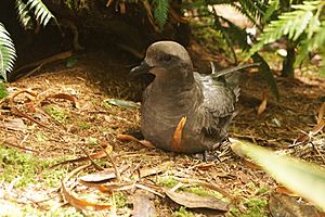
The Lord Howe Island Group has a diverse fish population with over 400 species recorded. About 10% of the inshore fish species are endemic, meaning they live only around Lord Howe Island. Also, 8% of the 110 species of echinoderms (like starfish and sea urchins) are endemic. Many seabirds live and nest on the island, but they fly out to sea to feed on schools of fish and squid. This wide variety of life shows how tropical and temperate species mix here, and how many different ocean environments are present.
Challenges and Threats to the Marine Park
It's widely known that ocean life around the world is threatened by too much fishing and harmful human activities like pollution. These actions can quickly change animal homes and lead to species loss. On Lord Howe Island, two plant species, nine land birds, one bat, and four invertebrate species have already become extinct locally.
Isolated islands are especially at risk because they are small and have many unique species. Even small disturbances caused by humans can lead to species extinction. Key threats to the Lord Howe Island Marine Park include human-caused climate change and animals getting tangled in or eating human-made trash in the ocean.
Human-caused climate change is listed as a major threat under New South Wales law. The loss of natural habitats due to greenhouse gas emissions is also listed under Australian federal law. Climate change is likely to change sea surface temperatures, which can have serious effects on seabird breeding.
Over time, more and more people have visited Lord Howe Island. The number of visitors has almost doubled between 1988 and 2000. The number of homes on the island also increased by 55% in that time.
The Shoreline (Littoral Zone)
Lord Howe Island has about 37 kilometers of shoreline, or littoral zone, but only eight kilometers are easy to reach. This accessible part has been most affected because much of the forest near the beach has been cut down. This removes the natural protection from strong winds, which then impacts the forest further inland.
The Lagoon's Health
The lagoon is six kilometers long and 1.5 kilometers wide. It contains the largest coral reef system on Lord Howe Island, which is recognized for its World Heritage value. The main threats to the lagoon's environment are:
- The impact of water quality from groundwater flowing into the lagoon.
- Possible changes in water clarity (turbidity).
- Damage from boat anchors (both inside and outside the lagoon).
- Overfishing, especially of slow-growing fish species.
- Big changes in water temperature, which can cause coral bleaching and kill other marine species.
How the Marine Park Helps
Marine parks are becoming widely used to protect ocean biodiversity and manage overfishing. In other places, protected areas like marine reserves have led to more species, higher numbers of animals, better growth, more total weight of living things (biomass), and more successful reproduction. The Lord Howe Island Marine Park is seeing similar positive results.
Marine parks are often designed by protecting different types of habitats. The idea is that if many habitats are protected, the species living in them will also be protected, which helps increase ocean biodiversity. This is the main goal of the marine park at Lord Howe Island.
A study in 2010, six years after the zoning plan started, showed good results. The average number of fish species, the density (how many fish in an area), and the total weight of fish were usually higher in the sanctuary zones (where fishing is not allowed) compared to the habitat protection zones (where fishing is allowed). The amount of hard corals was also higher in sanctuary zones.
Sanctuary zones have been successful in protecting key species and biomass. However, scientists need more long-term data and research to understand how large algae communities are growing in these zones.
Other research after the park was created has shown both successes and some negative outcomes. For example, the Galapagos shark (Carcharhinus galapagensis) increased in number in sanctuary zones. There was also an increase in the number of the endemic double header wrasse (Coris bulbifrons), bluefish (Girella cyanea), and the spotted sawtail (Prionurus maculates) in sanctuary zones.
However, there have been some negative outcomes too. The population of a habitat-changing sea urchin (Centrostaphanus rodgersii) grew three times larger between 2006 and 2010. The numbers of another common sea urchin (Heliocidaris tuberculata) doubled. If sea urchins become too numerous, they can seriously harm reef systems by eating too much important algae. Another negative was a big drop in the bluefish population in the habitat protection zones.
While there will always be both successes and challenges after a marine park is put in place, the successes are expected to continue to outweigh the failures. It can take up to 20 years for the ocean ecosystem to reach a new balance after such changes.
Images for kids
See also
 In Spanish: Parque marino Lord Howe para niños
 | Emma Amos |
 | Edward Mitchell Bannister |
 | Larry D. Alexander |
 | Ernie Barnes |


