
Lysander, New York facts for kids
Quick facts for kids
Lysander, New York
|
|
|---|---|

Location in Onondaga County and the state of New York.
|
|
| Country | United States |
| State | New York |
| County | Onondaga |
| Government | |
| • Type | Town Council |
| Area | |
| • Total | 64.61 sq mi (167.34 km2) |
| • Land | 61.71 sq mi (159.84 km2) |
| • Water | 2.89 sq mi (7.50 km2) |
| Elevation | 436 ft (133 m) |
| Population
(2020)
|
|
| • Total | 23,074 |
| • Density | 357.13/sq mi (137.887/km2) |
| Time zone | UTC-5 (Eastern (EST)) |
| • Summer (DST) | UTC-4 (EDT) |
| ZIP code |
13027
|
| Area code(s) | 315 |
| FIPS code | 36-44039 |
| GNIS feature ID | 0979177 |
Lysander is a town in Onondaga County, New York, United States. It's located northwest of the city of Syracuse. Many parts of Lysander have a suburban feel, meaning they are residential areas near a larger city.
In 2020, about 23,074 people lived in Lysander. The town was named after Lysander, a famous military leader from ancient Sparta. A clerk who liked classic history chose the name.
Contents
History of Lysander


The area that is now Lysander was once part of a large land area called the Central New York Military Tract. This land was set aside for soldiers after the American Revolutionary War.
People from outside the area first started settling here around 1797. The Town of Lysander was officially formed in 1794. It was created from the northern parts of the Military Tract.
Over time, Lysander's size changed. Some of its land was used to create new towns. For example, parts of Lysander became the towns of Hannibal in 1806 and Cicero in 1807. Lysander also became smaller when Oswego County was formed in 1816.
Exploring Lysander's Geography
Lysander covers a total area of about 64.6 square miles (167.3 square kilometers). Most of this area is land, about 61.9 square miles (159.8 square kilometers). The rest is water, which is about 2.7 square miles (7.5 square kilometers).
The northern edge of Lysander borders Oswego County. The western edge borders Cayuga County. The southern border of the town is defined by the Erie Canal and the Seneca River.
Cross Lake is found on Lysander's western border. The Oswego River forms part of the town's eastern border. The Oswego, Seneca, and Oneida Rivers all meet at the eastern edge of Lysander.
Major Roads in Lysander
Several important roads run through Lysander.
- New York State Route 370, also known as West Genesee Road, goes from east to west in the southern part of town.
- New York State Route 48 runs through the middle of Lysander.
- New York State Route 31 crosses NY-370 in the southeastern area.
- New York State Route 690 is a big highway that starts in the southern part of Lysander.
Understanding Lysander's Population
| Historical population | |||
|---|---|---|---|
| Census | Pop. | %± | |
| 1820 | 1,723 | — | |
| 1830 | 3,228 | 87.3% | |
| 1840 | 4,306 | 33.4% | |
| 1850 | 5,833 | 35.5% | |
| 1860 | 4,741 | −18.7% | |
| 1870 | 4,944 | 4.3% | |
| 1880 | 4,903 | −0.8% | |
| 1890 | 5,163 | 5.3% | |
| 1900 | 4,838 | −6.3% | |
| 1910 | 4,509 | −6.8% | |
| 1920 | 4,725 | 4.8% | |
| 1930 | 4,849 | 2.6% | |
| 1940 | 5,207 | 7.4% | |
| 1950 | 6,798 | 30.6% | |
| 1960 | 10,225 | 50.4% | |
| 1970 | 11,968 | 17.0% | |
| 1980 | 13,897 | 16.1% | |
| 1990 | 16,346 | 17.6% | |
| 2000 | 19,285 | 18.0% | |
| 2010 | 21,759 | 12.8% | |
| 2020 | 23,074 | 6.0% | |
| U.S. Decennial Census | |||
The population of Lysander has grown a lot over the years. In 1820, there were only 1,723 people. By 2020, the population had reached 23,074. This shows that more and more people have chosen to live in Lysander.
According to the 2000 census, there were 19,285 people living in Lysander. Most residents were White. A small percentage of the population identified as African American, Native American, or Asian.
Many households in Lysander had children under 18 living with them. The average household had about 2.7 people. The average family size was about 3.1 people.
The median income for a household in Lysander in 2000 was $59,128. This means that half of the households earned more than this amount, and half earned less. The median income for families was a bit higher, at $67,539. A small percentage of the population, about 3.8%, lived below the poverty line.
Communities and Locations in Lysander

Lysander is home to several smaller communities and interesting spots.
- Baird Corners – A small community in the northwestern part of the town.
- Baldwinsville – Part of this village is in southern Lysander. The Seneca River and Erie Canal divide it.
- Belgium – A community located near the eastern border of the town.
- Cold Springs – You can find this community in the southeastern part of Lysander.
- Jacksonville – A community in the northern part of the town.
- Jack's Reef – This community is in the southwestern part of town, along the Seneca River. It's split between Lysander and two other towns.
- Hortontown – A farm located in the central part of Lysander.
- Lamson – A community in the northern part of the town.
- Little Utica – Another community found in the northern section of Lysander.
- Lysander – This is the main community, also called Lysander, near the western town line.
- Beaver Lake – A lake located west of Hortontown.
- Plainville – A community in the southwestern part of the town.
- Radisson – A special planned community in the eastern part of Lysander.
- Red Rock – A community in the southeastern part of town, along the Seneca River and Erie Canal.
- Seneca Estates – A fancy neighborhood with about 120 homes. It's close to the Seneca River and has its own private marina for boats.
- West Phoenix – A community in the northeastern corner of Lysander.
- Wrights Corners – A location east of Lamson.
Notable People from Lysander
- Esther Baker Steele (1835–1911) – She was an educator, author, traveler, and someone who helped others.
Images for kids
-
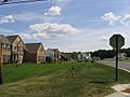
Apartments in Lysander just outside Baldwinsville
-
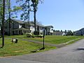
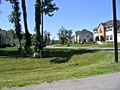
Neighborhood in eastern Lysander
-
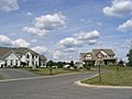
Single family homes in Lysander
-
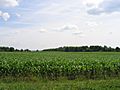
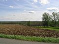
Farmland in Lysander
-
Lysander countryside in the spring
-
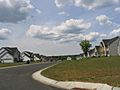
Neighborhood in Radisson planned community
-
New homes just outside Baldwinsville
-
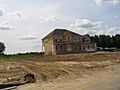
New home under construction in Lysander


See also
 In Spanish: Lysander para niños
