Cicero, New York facts for kids
Quick facts for kids
Cicero, New York
|
|
|---|---|
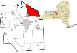
Location in Onondaga County and the state of New York.
|
|
| Country | United States |
| State | New York |
| County | Onondaga |
| Government | |
| • Type | Town Council |
| Area | |
| • Total | 48.47 sq mi (125.52 km2) |
| • Land | 48.28 sq mi (125.04 km2) |
| • Water | 0.19 sq mi (0.48 km2) |
| Elevation | 413 ft (126 m) |
| Population
(2020)
|
|
| • Total | 31,435 |
| • Density | 648.55/sq mi (250.438/km2) |
| Time zone | UTC-5 (Eastern (EST)) |
| • Summer (DST) | UTC-4 (EDT) |
| ZIP code |
13039
|
| Area code(s) | 315|680 |
| FIPS code | 36-15704 |
| GNIS feature ID | 0978826 |
| Website | Town of Cicero |
Cicero is a town located in northern Onondaga County, New York, in the United States. In 2020, about 31,435 people lived there. The town was named by a clerk who liked classics, honoring a famous Roman statesman named Cicero.
The Town of Cicero is in the central part of New York. It is a suburb of Syracuse and sits in the northeastern section of Onondaga County.
Contents
History of Cicero
Cicero was once part of the Central New York Military Tract. This was land set aside for soldiers who fought in the American Revolution.
The Town of Cicero was first formed in 1790. It was part of the Town of Lysander when Onondaga County started in 1794. Later, in 1807, Cicero became its own separate town. The first person to settle there was John Leach, who opened a tavern at a place called Cody's Corners.
In 1827, the town was split almost in half. The western part of Cicero then became the Town of Clay.
The Stone Arabia School is an important historical building in Cicero. It was added to the National Register of Historic Places in 2007.
Geography of Cicero
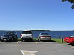
Cicero covers about 48.5 square miles (125.5 square kilometers). Most of this area is land, with a very small amount of water.
The northern border of Cicero is the Oneida River. This river also marks the edge of Oswego County. To the east, Cicero shares a border with Madison County. This boundary is marked by the Chittenango Creek.
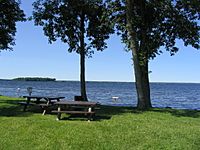
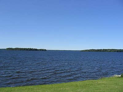
Oneida Lake is located at Cicero's northern border. It is one of the largest lakes in New York State. Cicero also has a large wet area called Cicero Swamp. The town has many wetlands, forests, and farms. However, more and more housing developments are being built on former farmland. The soil in Cicero is mostly brown and can be slightly or moderately acidic.
Several important roads pass through Cicero. These include U.S. Route 11, Interstate 81, Interstate 481, and New York State Route 31. New York State Route 298 also meets NY-31 near the eastern side of town. There is a small airport in Cicero called Michael Airfield, which is used for general aviation.
The Erie Canal was rebuilt and now follows the Oneida River. This river runs along the northern border of Cicero.
Population in Cicero
| Historical population | |||
|---|---|---|---|
| Census | Pop. | %± | |
| 1820 | 1,303 | — | |
| 1830 | 1,808 | 38.8% | |
| 1840 | 2,464 | 36.3% | |
| 1850 | 2,980 | 20.9% | |
| 1860 | 3,277 | 10.0% | |
| 1870 | 2,902 | −11.4% | |
| 1880 | 2,934 | 1.1% | |
| 1890 | 2,636 | −10.2% | |
| 1900 | 2,611 | −0.9% | |
| 1910 | 2,475 | −5.2% | |
| 1920 | 2,536 | 2.5% | |
| 1930 | 3,684 | 45.3% | |
| 1940 | 4,346 | 18.0% | |
| 1950 | 5,956 | 37.0% | |
| 1960 | 14,725 | 147.2% | |
| 1970 | 22,539 | 53.1% | |
| 1980 | 23,648 | 4.9% | |
| 1990 | 25,560 | 8.1% | |
| 2000 | 27,982 | 9.5% | |
| 2010 | 31,682 | 13.2% | |
| 2020 | 31,435 | −0.8% | |
| U.S. Decennial Census | |||
In 2000, there were about 27,982 people living in Cicero. These people lived in 10,538 households, and 7,692 of these were families. The population density was about 577 people per square mile.
Many households in Cicero had children under 18 living with them. Most households were made up of married couples. About 21% of all households were individuals living alone.
The population in Cicero is spread out across different age groups. About 28% of the people were under 18 years old. The median age was 36 years. This means half the people were younger than 36, and half were older.
The average income for a household in Cicero was about $50,055 in 2000. For families, the average income was around $57,531. A small number of families and people lived below the poverty line.
Neighborhoods and Places in Cicero
Cicero has many different communities and locations within its borders:
- Bay Colony – This neighborhood has a mix of older and newer homes.
- Boyson Bay – A bay on Oneida Lake, located west of Kraus Landing.
- Brewerton – A small community near the northern town line. It is on US Route 11, close to Interstate 81.
- Bridgeport – Another small community that is also partly in Madison County.
- Brown Center – A community located south of Cicero Center.
- Cedar Point – A large neighborhood found north of Lakeshore Road.
- Cicero – The main community of Cicero is in the southwestern part of the town, on US Route 11 near Interstate 81.
- Cicero Center – A community on NY-31 in the eastern part of the town.
- Cicero Swamp Wildlife Management Area – A protected area for nature in the southeastern part of Cicero.
- Ciceroville – This was once a small community and is now a historical spot.
- Darby Farms – One of the oldest neighborhoods in Cicero, located in the southwestern part of town near Interstate 81.
- Eldan Meadows - A neighborhood located between South Bay Rd, Button Rd, and Lakeshore Rd.
- Forest Beach – A community on the shore of Oneida Lake, east of Brewerton.
- Gulfstream - A neighborhood between Weaver Rd, Mud Mill Rd, and Lakeshore Rd.
- Harbour Village – A place near the eastern town line on NY-31.
- Henryk Woods – A small neighborhood on the east side of Thompson Road.
- Hiller Heights – A housing development in the southwestern part of the town, near Interstate 81.
- John's Landing – A small neighborhood on the northern side of town.
- Kraus Landing – A community on the shore of Oneida Lake, north of Cicero Center.
- Laurelwood – A nice neighborhood off South Bay, across from Gillette Road Middle School.
- Long Point – A short piece of land sticking out into Oneida Lake, south of Forest Beach.
- Lower South Bay – A community on the shore of Oneida Lake.
- Maple Bay – A bay on Oneida Lake, east of Kraus Landing.
- Muskrat Bay – A small bay north of Sandy Bay village.
- Mystic Woods – A neighborhood on the western side of Thompson Road with a mix of new and older homes.
- North Syracuse – Part of the Village of North Syracuse is in Cicero, at the western town line.
- Oneida Park – A location near the eastern town line on NY-298.
- Renee Gardens – A small neighborhood on the northern side of town.
- Syracuse Hancock International Airport – A small part of this airport is at the southern border of Cicero.
- The Crossings – A nice neighborhood that hosted the "Parade of Homes" in 2006.
- The Pastures – Another nice neighborhood that hosted the "Parade of Homes" in 2002.
- Valentine's Beach – A community on the shore of Oneida Lake, north of Cicero Center.
- Lyon’s Runne- An upscale neighborhood near Oneida Lake, with new homes still being built.
- Wallington Meadows – A small neighborhood close to Lakeshore Road and Oneida Lake. It is currently growing with new homes.
See also
 In Spanish: Cicero (Nueva York) para niños
 | Tommie Smith |
 | Simone Manuel |
 | Shani Davis |
 | Simone Biles |
 | Alice Coachman |


