Manitook Mountain facts for kids
Quick facts for kids Manitook Mountain |
|
|---|---|
| Highest point | |
| Elevation | 638 ft (194 m) ridge high point |
| Geography | |
| Location | Granby, Connecticut |
| Parent range | Metacomet Ridge |
| Geology | |
| Age of rock | 200 Ma |
| Mountain type | Fault-block; igneous |
| Climbing | |
| Easiest route | trailless |
Manitook Mountain, also known as Manituck Mountain, is a mountain ridge in north-central Connecticut. It stands about 638 feet (194 m) (194 meters) tall and stretches for about 1.6 miles (2.6 km) (2.6 km). This mountain is part of the Metacomet Ridge, a long, narrow chain of mountains that runs from Long Island Sound all the way to the Vermont border.
Manitook Mountain is special because of its rocky ledges and unique microclimates. A microclimate is like a tiny weather zone where the temperature and moisture are different from the surrounding area. These special conditions help unusual plants and animals live there. There are no official hiking trails on Manitook Mountain.
Contents
Where is Manitook Mountain?
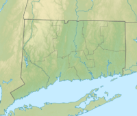
Manitook Mountain is located entirely within the town of Granby, Connecticut. It rises sharply, about 400 feet (120 m) (122 meters) above the land around it. The highest point of the mountain is 638 feet (194 m) (194 meters) above sea level.
The northern part of the mountain is very close to the border between Connecticut and Massachusetts. From the Congamond Lakes to the north, Manitook Mountain looks very impressive.
Water Flow from the Mountain
The northern side of Manitook Mountain drains into the Congamond Lakes. From there, the water flows into Great Brook, then into the Westfield River, and finally into the Connecticut River. The Connecticut River eventually empties into Long Island Sound.
The rest of the mountain's water flows into the Salmon Brook. This brook then joins the Farmington River, which also flows into the Connecticut River.
How Manitook Mountain Formed
Manitook Mountain is made of a type of rock called basalt, also known as traprock. This rock formed from lava that came out of the ground a very long time ago.
A Look at the Mountain's Age
The mountain formed about 200 million years ago, near the end of the Triassic Period. At that time, the huge continent of Pangaea was breaking apart. The North American continent was separating from Africa and Eurasia.
As the land pulled apart, hot lava flowed up from deep inside the Earth. This lava spread out in thick layers and then cooled down, turning into solid rock.
Earthquakes and Cliffs
Later, earthquakes and movements in the Earth's crust caused these rock layers to tilt. This tilting created the steep cliffs and the ridgeline that we see on Manitook Mountain today.
Plants and Animals
Manitook Mountain has a mix of different environments. The upper slopes are often hot and dry, while the ravines (small valleys) are cool and moist. The rocky ledges, made of basalt, are rich in minerals.
This combination of conditions creates those special microclimates. These microclimates support plants and animals that are not commonly found in other parts of Connecticut.
Birds of Prey
Manitook Mountain is also an important pathway for raptors (like hawks and eagles) during their yearly migration. They use the air currents around the ridge to help them fly south for the winter or north for the summer.
Protecting the Mountain
One of the biggest challenges for Manitook Mountain is the growth of towns and cities nearby, known as suburban sprawl. This growth can threaten the mountain's unique ecosystem and natural beauty.
As of 2007, much of the mountain was still covered in trees and undeveloped. The Granby Land Trust is an organization that helps manage and protect several areas on and near Manitook Mountain.
- Farnsworth, Elizabeth J. "Metacomet-Mattabesett Trail Natural Resource Assessment." 2004.
- Raymo, Chet and Maureen E. Written in Stone: A Geologic History of the Northeastern United States. Globe Pequot, Chester, Connecticut, 1989.
- DeLorme Topo 6.0 (2006). Mapping software. DeLorme: Yarmouth, Maine
 | Delilah Pierce |
 | Gordon Parks |
 | Augusta Savage |
 | Charles Ethan Porter |


