
Marion, Indiana facts for kids
Quick facts for kids
Marion
|
||
|---|---|---|

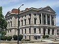
Grant County Courthouse
|
||
|
||
| Nickname(s):
City of Champions
|
||

Location of Marion in Grant County
|
||
| Country | ||
| State | ||
| County | Grant | |
| Government | ||
| • Type | Mayor-Council | |
| Area | ||
| • Total | 15.76 sq mi (40.82 km2) | |
| • Land | 15.68 sq mi (40.61 km2) | |
| • Water | 0.08 sq mi (0.21 km2) 0.51% | |
| Elevation | 814 ft (248 m) | |
| Population
(2020)
|
||
| • Total | 28,310 | |
| • Density | 1,805.48/sq mi (697.11/km2) | |
| Time zone | UTC-5 (EST) | |
| • Summer (DST) | UTC-4 (EDT) | |
| ZIP codes |
46952-46953
|
|
| Area code(s) | 765 | |
| FIPS code | 18-46908 | |
| GNIS feature ID | 2395009 | |
| Website | City of Marion website | |

Marion is a city in Grant County, Indiana, USA. It's the main city of the county, located by the Mississinewa River. In 2020, about 28,310 people lived there. The city is named after Francis Marion, a brave general from the American Revolutionary War.
Marion is home to Indiana Wesleyan University. This is a large Christian university in the Midwest. It's also Indiana's biggest private university, counting its online and regional campuses. About 2,800 students attend the main campus. Famous people born in Marion include actor James Dean and cartoonist Jim Davis, who created Garfield. Actress Julia Roberts and singer Lyle Lovett got married here in 1993. Ronald Douglas Morrell Jr. became Marion's first African American mayor in 2024.
Contents
History of Marion
How Marion Started
A battle called the Battle of the Mississinewa happened near Marion in December 1812. It was fought between American soldiers and Miami villages. Today, people reenact this battle every fall. It's part of the "Mississinewa 1812" festival, the biggest War of 1812 reenactment in the USA.
In 1831, Martin Boots and David Branson gave 30 acres of land to start the city of Marion. They chose a spot by the fast-flowing Mississinewa River. The Miami Indians named the river, meaning "Falling water." Just 19 years before, a bloody battle had taken place 7 miles downstream.
When Grant County was formed in 1831, Marion became its main city. The river helped the city by providing water and power. Like many other towns, Marion was named after General Francis Marion. He was a hero from the American Revolutionary War, known as the "Swamp Fox."
Growing with Industry
_(14756991591).jpg)
For over 50 years, Marion grew slowly. It was a farming town with small businesses. Native Americans often visited from their nearby reservation. In the 1880s, natural gas was found in central Indiana. This caused Grant County to grow very quickly. Towns like Gas City and Matthews popped up, attracting thousands of people.
However, the gas supply eventually ran out, and many businesses left. But some industries, especially glass factories, stayed.

In 1888, the US Congress opened a new home for disabled soldiers in Grant County. It was called the Marion Branch. Congress gave $200,000 for building, and local residents provided natural gas for heating. Marion was chosen because of the gas and support from Congressman George Washington Steele. This facility is now part of the Veterans Administration (VA) health system.
Modern Times
Marion's growth slowed down after the gas boom, before World War I. But in 1955, a new General Motors plant opened, creating many jobs. The city grew very fast again.
Today, Marion has important buildings and places. The Marion Branch Historic District is one of them. It covers 212 acres and includes the old hospital grounds.
Marion High School has a large campus. It includes a 1,468-seat auditorium. This is home to the Marion Philharmonic Orchestra and other groups. The city also has the Marion Public Library.

The Marion Giants, the local high school basketball team, have won eight state championships. They play in the 7,500-seat Bill Green Athletic Arena. The city also has a 2.75-mile Riverwalk. This path goes from downtown to Matter Park. There's also a newly renovated YMCA Memorial Coliseum. It honors war veterans and was once the Giants' home court.
The Hostess House is a public mansion used for events. Marion General Hospital is a well-known hospital that has been nationally recognized for many years.
Geography and Climate
Where is Marion Located?
Marion is located along the Mississinewa River.
In 2010, the city covered about 15.79 square miles. Most of this area, about 15.71 square miles, is land. The rest, about 0.08 square miles, is water.
What's the Weather Like?
| Climate data for Marion, Indiana (1991–2020 normals, extremes 1893–present) | |||||||||||||
|---|---|---|---|---|---|---|---|---|---|---|---|---|---|
| Month | Jan | Feb | Mar | Apr | May | Jun | Jul | Aug | Sep | Oct | Nov | Dec | Year |
| Record high °F (°C) | 71 (22) |
76 (24) |
86 (30) |
95 (35) |
100 (38) |
103 (39) |
108 (42) |
103 (39) |
102 (39) |
92 (33) |
84 (29) |
71 (22) |
108 (42) |
| Mean maximum °F (°C) | 56.4 (13.6) |
60.0 (15.6) |
71.2 (21.8) |
80.2 (26.8) |
87.8 (31.0) |
92.1 (33.4) |
92.8 (33.8) |
91.0 (32.8) |
89.6 (32.0) |
82.5 (28.1) |
69.2 (20.7) |
58.4 (14.7) |
94.3 (34.6) |
| Mean daily maximum °F (°C) | 33.0 (0.6) |
37.0 (2.8) |
48.1 (8.9) |
61.2 (16.2) |
72.0 (22.2) |
80.8 (27.1) |
83.8 (28.8) |
82.0 (27.8) |
76.6 (24.8) |
64.2 (17.9) |
49.7 (9.8) |
38.0 (3.3) |
60.5 (15.8) |
| Daily mean °F (°C) | 25.4 (−3.7) |
28.2 (−2.1) |
38.0 (3.3) |
49.6 (9.8) |
60.6 (15.9) |
70.0 (21.1) |
73.2 (22.9) |
71.3 (21.8) |
64.9 (18.3) |
53.0 (11.7) |
40.7 (4.8) |
30.5 (−0.8) |
50.4 (10.2) |
| Mean daily minimum °F (°C) | 17.7 (−7.9) |
19.5 (−6.9) |
28.0 (−2.2) |
38.0 (3.3) |
49.2 (9.6) |
59.2 (15.1) |
62.5 (16.9) |
60.5 (15.8) |
53.3 (11.8) |
41.9 (5.5) |
31.7 (−0.2) |
23.0 (−5.0) |
40.4 (4.7) |
| Mean minimum °F (°C) | −3.0 (−19.4) |
3.0 (−16.1) |
12.4 (−10.9) |
25.0 (−3.9) |
34.5 (1.4) |
46.1 (7.8) |
52.0 (11.1) |
51.1 (10.6) |
40.9 (4.9) |
29.2 (−1.6) |
18.4 (−7.6) |
5.6 (−14.7) |
−6.7 (−21.5) |
| Record low °F (°C) | −23 (−31) |
−20 (−29) |
−11 (−24) |
5 (−15) |
26 (−3) |
34 (1) |
43 (6) |
38 (3) |
28 (−2) |
15 (−9) |
−5 (−21) |
−22 (−30) |
−23 (−31) |
| Average precipitation inches (mm) | 2.85 (72) |
2.15 (55) |
2.87 (73) |
4.10 (104) |
4.76 (121) |
4.42 (112) |
4.33 (110) |
3.93 (100) |
3.39 (86) |
3.12 (79) |
3.26 (83) |
2.58 (66) |
41.76 (1,061) |
| Average snowfall inches (cm) | 8.1 (21) |
6.3 (16) |
3.7 (9.4) |
0.3 (0.76) |
0.0 (0.0) |
0.0 (0.0) |
0.0 (0.0) |
0.0 (0.0) |
0.0 (0.0) |
0.1 (0.25) |
1.0 (2.5) |
5.0 (13) |
24.5 (62) |
| Average precipitation days (≥ 0.01 in) | 11.5 | 9.2 | 10.2 | 12.0 | 12.7 | 11.0 | 9.6 | 8.8 | 8.2 | 9.7 | 9.6 | 10.2 | 122.7 |
| Average snowy days (≥ 0.1 in) | 5.4 | 4.4 | 1.5 | 0.2 | 0.0 | 0.0 | 0.0 | 0.0 | 0.0 | 0.0 | 0.8 | 3.3 | 15.6 |
| Source: NOAA | |||||||||||||
People of Marion
| Historical population | |||
|---|---|---|---|
| Census | Pop. | %± | |
| 1850 | 703 | — | |
| 1870 | 1,658 | — | |
| 1880 | 3,182 | 91.9% | |
| 1890 | 8,759 | 175.3% | |
| 1900 | 17,337 | 97.9% | |
| 1910 | 19,359 | 11.7% | |
| 1920 | 23,747 | 22.7% | |
| 1930 | 24,496 | 3.2% | |
| 1940 | 26,767 | 9.3% | |
| 1950 | 30,081 | 12.4% | |
| 1960 | 37,854 | 25.8% | |
| 1970 | 39,607 | 4.6% | |
| 1980 | 35,874 | −9.4% | |
| 1990 | 32,618 | −9.1% | |
| 2000 | 31,320 | −4.0% | |
| 2010 | 29,948 | −4.4% | |
| 2020 | 28,310 | −5.5% | |
| Source: US Census Bureau | |||
Population in 2020
In 2020, Marion had 28,310 people. The city's population is made up of different groups.
| Race / Ethnicity (NH = Non-Hispanic) | Pop 2000 | Pop 2010 | Pop 2020 | % 2000 | % 2010 | % 2020 |
|---|---|---|---|---|---|---|
| White alone (NH) | 24,381 | 22,704 | 19,740 | 77.84% | 75.81% | 69.73% |
| Black or African American alone (NH) | 4,830 | 4,337 | 4,058 | 15.42% | 14.48% | 14.33% |
| Native American or Alaska Native alone (NH) | 134 | 105 | 74 | 0.43% | 0.35% | 0.26% |
| Asian alone (NH) | 212 | 221 | 286 | 0.68% | 0.74% | 1.01% |
| Pacific Islander alone (NH) | 6 | 4 | 15 | 0.02% | 0.01% | 0.05% |
| Some Other Race alone (NH) | 60 | 54 | 145 | 0.19% | 0.18% | 0.51% |
| Mixed race or Multiracial (NH) | 569 | 867 | 1,730 | 1.82% | 2.90% | 6.11% |
| Hispanic or Latino (any race) | 1,128 | 1,656 | 2,262 | 3.60% | 5.53% | 7.99% |
| Total | 31,320 | 29,948 | 28,310 | 100.00% | 100.00% | 100.00% |
Population in 2010
In 2010, there were 29,948 people living in Marion. There were 11,828 households, and 6,739 families. About 78.1% of the people were White, 14.7% were African American, and 5.5% were Hispanic or Latino.
The average age in Marion was 36.2 years. About 21.1% of residents were under 18. Also, 16% were 65 years or older.
Economy of Marion

Marion's factories make car parts, paper products, and machinery. The paper plate industry actually started in Marion. At one time, five of the nine paper plate factories in the country were here.
The land around Marion is part of the Corn Belt. This means farming is still a big part of the local economy. Farmers grow corn, soybeans, and raise hogs. They also grow special crops like tomatoes.
Some factories have closed in Marion over the years. This caused a tough time for the city's economy. However, Marion has worked hard to attract new businesses. It was even named one of the "Top 100 Micro-Enterprises for Economic Development" in the Midwest. In the last ten years, private businesses have invested over $1,113,000 in Marion.
Arts and Culture

Several important buildings in Marion are listed on the National Register of Historic Places. These include the Grant County Jail and Sheriff's Residence and the Marion Branch, National Home for Disabled Volunteer Soldiers Historic District.
From 1900 to 1901, Marion had its own baseball team called the Glass Blowers.
Christmas City U.S.A.
Christmas City U.S.A. is a local group that celebrates Christmas in Marion. They organize the Annual Christmas Parade. This parade happens the Saturday before Thanksgiving and starts the holiday season.
The idea began in 1965 to make the holiday season bigger. In 1970, the group worked with the Chamber of Commerce to promote Marion as "Christmas City U.S.A." They even trademarked the name. In 1991, local leaders decided to make the city truly live up to its name. They combined the Mississinewa Riverwalk with holiday lights.
The Christmas City Walkway of Lights started in 1992. The first year, it had about 56,000 lights. Now, it has over 2,000,000 lights and is almost 4 miles long!
Transportation
The Marion Municipal Airport is about 4 miles southwest of downtown Marion.
The Marion Transit System provides bus services in the city. They have regular bus routes and on-demand services.
Famous People from Marion
- Jolly Blackburn, a cartoonist and writer.
- Chad Curtis, a professional baseball player.
- Jim Davis, creator of the Garfield comic strip.
- James Dean, a famous actor.
- Willis Van Devanter, a Supreme Court Justice.
- Mildred Dilling, a harpist.
- Jim Gallagher, Jr., a professional golfer.
- Samuel Levi Jones, a painter and artist.
- Jeff King, a professional baseball player.
- Kenesaw Mountain Landis, the first Commissioner of Baseball.
- Mike Melvill, the first commercial astronaut.
- Keith O'Conner Murphy, a singer-songwriter.
- Stretch Murphy, a Hall of Fame basketball player.
- William N. Oatis, an Associated Press reporter.
- Joseph Price, a professional basketball player and coach.
- Zach Randolph, a professional basketball player.
- Amber Richards, a transgender female impersonator and TV personality.
- Wayne Seybold, a former Marion mayor and Olympic skater.
- Caleb Blood Smith, a US Secretary of the Interior under President Abraham Lincoln.
- George Washington Steele, an Indiana Congressman and first governor of the Oklahoma Territory.
- Monte Towe, a professional basketball player and coach.
- Bertha L. Turner, a caterer and cookbook author.
- Jan Wiley, an actress.
Images for kids
-
Grant County Courthouse
-

Flag of Marion, Indiana
-

Location of Marion in Grant County
See also
 In Spanish: Marion (Indiana) para niños
