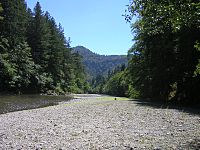
Mattole River facts for kids
Quick facts for kids Mattole River |
|
|---|---|
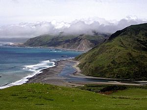
Mattole River Estuary
|
|
|
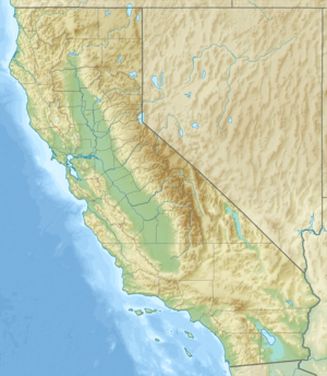
Location of the mouth of Mattole River in California
|
|
| Native name | Mattóal |
| Country | United States |
| State | California |
| Region | Mendocino County, Humboldt County |
| Cities | Petrolia, Whitethorn, Honeydew |
| Physical characteristics | |
| Main source | King Range 11 mi (18 km) southwest of Redway, California 1,780 ft (540 m) 39°59′7″N 123°58′19″W / 39.98528°N 123.97194°W |
| River mouth | Pacific Ocean 4 mi (6 km) west of Petrolia, California 0 ft (0 m) 40°18′8″N 124°21′14″W / 40.30222°N 124.35389°W |
| Length | 62 mi (100 km) |
| Basin features | |
| Basin size | 304 sq mi (790 km2) |
The Mattole River is a river on the north coast of California. It flows north, then west, and finally empties into the Pacific Ocean. Most of its 62 miles (100 km) journey is through southern Humboldt County. A small part of the river also flows through northern Mendocino County.
Towns near the Mattole River include Petrolia, Honeydew, and Whitethorn. The river meets the ocean at the Mattole Estuary. This is about 4 miles (6.4 km) west of Petrolia.
Contents
History of the Mattole River
The name "Mattole" comes from an Athabaskan Indian group called the Mattole people. They called themselves Mattóal or bedool. Neighboring tribes called them Medol or me'tuul. Local stories say that "Mattole" means "clear water."
The Mattole people mainly lived along the Mattole and Bear rivers. They faced many challenges during the Bald Hills War. They were greatly impacted due to their resistance to new settlers.
Mattole River Watershed
The Mattole River and its 74 smaller streams drain an area of about 304 square miles (790 km2). This area includes the eastern side of the King Range. The river flows through the Mattole Valley before reaching the Pacific Ocean.
The Mattole River starts at about 1,780 feet (540 m) high. However, some of its smaller streams begin even higher, around 4,000 feet (1,200 m) above sea level. The North Fork of the Mattole River joins the main river west of Petrolia. For most of its path, the river is only about 4.2 miles (6.8 km) east of the King Range National Conservation Area.
Near Honeydew, California, the river flows past Humboldt Redwoods State Park. Many creeks feed into the river's drainage area. Some of the largest are the Upper North Fork, Honeydew Creek, Bear Creek, Rattlesnake Creek, and Oil Creek.
Ecology and Conservation Efforts
The California Coastal Commission has listed the Mattole River as an "impaired waterbody." This means its water quality is not as good as it should be. The river flows into the Punta Gorda State Marine Reserve, which is a protected ocean area.
People are working to restore the Mattole River watershed. This area was damaged by old logging methods and road building. Natural erosion and two big floods in 1955 and 1964 also caused harm.
The Mattole River and Range Partnership helps with this restoration. This group includes the Mattole Restoration Council, Mattole Salmon Group, and Sanctuary Forest. They work with landowners and get money from different sources.
River Uses and Wildlife Habitat
The Mattole River is used for fun activities like fishing. It also provides water for farms, towns, and industries. The river is a home for wildlife, especially fish. It has cold, fresh water that fish need to migrate and lay their eggs.
The Mattole River is home to three types of salmonid fish that are listed as threatened. These are Chinook salmon, coho salmon, and steelhead. Coho salmon are also threatened under California state law.
Salmon Population Decline
In 2009-2010, the Mattole Salmon Group counted only three adult Coho salmon in the river. This was the lowest number since they started counting in 2004. This is much lower than historical numbers. In the 1800s, estimates were 17,000 to 20,000 adult Coho salmon each year. In the 1950s and 1960s, it was around 5,000 to 8,000 annually.
In 2010–2011, ten Coho salmon were counted. These numbers are 95% lower than in 2006–2007. Each salmon run happens on a three-year cycle.
Restoration Efforts and Beaver Dams
Groups like the Mattole Restoration Council and the Mattole Salmon Group work to restore the river's habitat. They are a good example for other communities. They recently planned a project to reduce winter runoff and increase summer water flow. They are using a model based on beaver dams and pools.
Research shows that beaver dams can greatly help salmon. One study found that beaver dams help produce 527 to 1,174 young salmon. In comparison, a pool formed by large wood only produces 6 to 15 young salmon. This suggests that bringing beavers back could be much more effective for salmon recovery.
In the early 1990s, local residents formed the Mattole Watershed Alliance. They wanted to improve the river's conditions. Their goal was to protect the wild salmon populations.
Plants of the Mattole River
The Mattole River area has several types of plant communities:
- Coast redwood forests in the southern headwaters.
- Mixed coast Douglas-fir and hardwood trees. These include tanoak and Pacific madrone.
- Mixed chaparral, with plants like manzanita, mountain whitethorn, California scrub oak, and coyote brush.
- Grasslands.
Along the riverbanks, you can find bigleaf maple, red alder, Fremont cottonwood, Oregon ash, and willow trees.
Parks and Recreation
Arthur W. Way County Memorial Park is located on the north bank of the Mattole River. It's a great place for people to enjoy the river and its surroundings.
Changes to the Mattole River's Environment
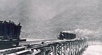
In the 1850s, European-American settlers started farming and ranching in the area. This changed how the native Mattole people used the river's resources. After World War II, logging of Douglas fir trees increased a lot. This was due to more building construction.
As logging grew, more wood and debris ended up in the Mattole River. This caused more damage to the river's health. From 1947 to 1988, the old-growth forests in the watershed decreased by 90 percent.
The increase in industrial activity led to many new roads being built. These roads made the river's smaller streams unstable. Logging practices, like dragging logs down stream channels, became common. This harmed both the streams and the surrounding forests.
Logging was very active from 1955 to 1964. During this time, two very large floods also hit the area. These floods greatly changed the structure of the Mattole streams. The floods caused a lot of dirt and debris to enter the river. This made it harder for water to flow and harmed the animals living in the river.
In 1970, the best areas for salmon to lay their eggs were damaged. This happened when land was divided for new housing developments. These developments caused sediment to build up in the streams. This filled in important salmon spawning habitats.
Mattole River Restoration Efforts
Surveys in 1959 and 1964 reported many salmon in the Mattole River. There were about 10,000 Chinook salmon and 4,000 coho salmon. However, by the 1980s, the Chinook salmon numbers dropped to 3,000. In 1990 and 1991, Chinook salmon fell to 100, and coho salmon also dropped to about 100. The American Fisheries Society called these species "high risk for extinction."
Mattole Salmon Group
In 1980, local residents formed the Mattole Salmon Group (MSG). Their goal was to bring back the native salmon populations. The MSG created special "hatchboxes" lined with gravel. These boxes helped replace the lost spawning areas. Adult salmon were kept until they laid their eggs. The eggs were then incubated in the hatchboxes. This process greatly increased the survival rate of eggs to young fish, from 15 percent to 80 percent.
In 1981, local residents and activists started the Mattole salmon project. They began incubating salmon eggs and clearing logjams. They also removed other obstacles that blocked fish migration. They planted trees along the riverbanks to help keep them strong.
Mattole Restoration Council
Freeman House released the first Mattole Restoration Newsletter in 1983. It encouraged residents to work for healthy forests, many fish, good grasslands, and diverse plant and animal life.
In 1983, the Mattole Restoration Council (MRC) was formed. Their aim was to bring together landowners and residents for restoration work. In 1987, they published "Elements of Recovery." This guide mapped and listed areas of erosion in the watershed. It also showed how many roads, both active and abandoned, were in the Mattole basin.
In 1991, the MRC's Douglas fir reforestation project was very successful. About 70 to 80 percent of the planted trees survived. These new trees provided more shade, which helps salmon eggs hatch. Salmon eggs need cool water to develop properly.
From 1977 to 1984, special rock structures were built to protect about 400 yards of the riverbank. Six of these structures created deep pools, 3 to 6 feet deep. These pools were shaded by trees along the river.
Headwater Channel Species
Southern Torrent Salamander
From the early 1960s to 1999, the Southern torrent salamander was found in calm, undisturbed water.
Pacific Tailed Frogs and Reproduction
In 1997, logging limited the ancient pacific tailed frogs in the headwater channels. This caused the species to become endangered.
By 2005, pacific tailed frogs were found in small numbers in old-growth forests. Their small groups are spread out along the river. This is because the water temperatures are too high. These high temperatures are above what their eggs need to develop during the summer. Pacific tailed frogs are also endangered because they need specific temperatures to survive.
Reptiles of the Mattole River
Foothill Yellow-Legged Frog
In 2005, Foothill yellow-legged frogs were commonly found in all parts of the river. Their tadpoles are found more often when temperatures are above 13 degrees Celsius. Adult frogs often sit in the sun on gravel bars, boulders, and rocks. They do this to warm their bodies using the sun's rays. Their eggs are laid in shallow, sunny water near rocks.
Rough-Skinned Newts
Rough-skinned newts can be found in the smaller headwater channels or on land.
Western Fence Lizards
In 2010, Western fence lizards were found along the river's channels. Their numbers increase as the water temperature and sediment levels rise. They stay in warmer areas because their insect prey is easier to find there.
 | James B. Knighten |
 | Azellia White |
 | Willa Brown |


