Mazama, Washington facts for kids
Quick facts for kids
Mazama, Washington
|
|
|---|---|

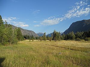
A small meadow in Mazama
|
|
| Country | United States |
| State | Washington |
| County | Okanogan |
| Elevation | 2,106 ft (642 m) |
| Time zone | UTC-8 (Pacific (PST)) |
| • Summer (DST) | UTC-7 (PDT) |
| ZIP code |
98833
|
| Area code(s) | 509 |
| GNIS feature ID | 1522828 |
Mazama is a small community in Okanogan County, Washington. It has about 158 people. It is found in the Methow Valley, on the east side of the North Cascades mountains. This area is also near the North Cascades National Park.
Mazama is located along the North Cascades Highway (Highway 20). It is about 14 miles (23 km) northwest of Winthrop. The community is also about 28 miles (45 km) south of the border with Canada. The center of Mazama is 2,106 feet (642 m) high. It sits below Goat Peak, which is 4,895 feet (1,492 m) higher.
Mazama was started around the early 1900s. It grew quickly because it was a starting point for people going to mining towns. These towns, like Barron and Robinson, were in the tough Harts Pass area. Today, Mazama is a small but active place. It has a general store, an adventure shop, a gas station, a café, and two restaurants. It is a popular spot for summer weddings, rock climbing, and winter sports. You can enjoy heli-skiing, back-country skiing, and cross-country skiing here. Mazama is home to one of the world’s longest cross-country skiing trails. This trail is 120 miles (190 km) long and goes right through the community.
Contents
What Does the Name "Mazama" Mean?
In the 1800s, this town was called "Goat Creek." This name came from a creek at the base of Goat Peak, which was then called Goat Mountain. When the town got its post office in 1899, settlers wanted a new name. They chose "Mazama," thinking it meant "mountain goat" in Greek.
Later, they found out they had made a mistake. The word "Mazama" does not mean "mountain goat" in Greek. According to a language expert named William O. Bright, the name "Mazama" actually comes from a Nahuatl word. This word, mazame, means "deer" (plural). In the past, people in the area used this word to talk about mountain goats or bighorn mountain sheep. In 1896, the word was used to name a mountaineering club in Portland, called The Mazamas.
Nature and Animals in Mazama
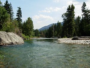
The Methow River flows just south of Mazama. This river is very important for Chinook salmon. It provides a place for them to lay their eggs.
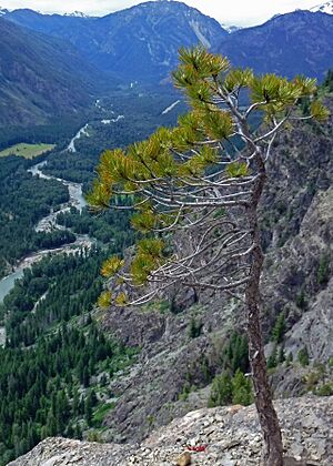
The forests around Mazama have many native trees. You can find Douglas-fir and Ponderosa pine trees. Along the creeks and rivers, there are many Cottonwood trees.
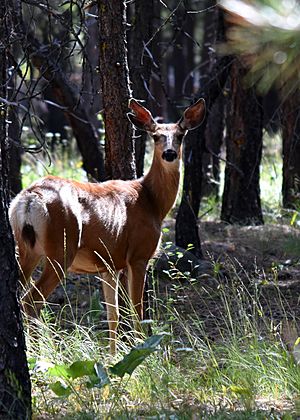
More than seventy different kinds of mammals live in this area. This includes the Northern pocket gopher. Interestingly, the Mazama pocket gopher does not live here.
Mazama's Weather and Climate
Mazama has a type of weather called a humid continental climate. This means it has warm, dry summers and cold, snowy winters. The town is located on the side of the North Cascades mountains. These mountains block much of the rain and snow that comes from the Pacific Ocean. This creates a "rain shadow" effect.
The rain shadow gets stronger the further you go from the mountains. For example, Winthrop, which is about 14 miles further down the valley, gets only about half as much rain as Mazama. Mazama gets a lot of snow. Also, the winter days are short in this deep mountain valley. Because of this, the first settlers called the area "Early Winters."
The coldest temperature ever recorded in Washington state was in Mazama. It was −48 °F (−44 °C) on December 30, 1968.
| Climate data for Mazama, Washington | |||||||||||||
|---|---|---|---|---|---|---|---|---|---|---|---|---|---|
| Month | Jan | Feb | Mar | Apr | May | Jun | Jul | Aug | Sep | Oct | Nov | Dec | Year |
| Record high °F (°C) | 58 (14) |
55 (13) |
74 (23) |
90 (32) |
97 (36) |
112 (44) |
109 (43) |
103 (39) |
101 (38) |
84 (29) |
65 (18) |
51 (11) |
112 (44) |
| Mean daily maximum °F (°C) | 28.7 (−1.8) |
36.4 (2.4) |
46.1 (7.8) |
57.3 (14.1) |
66.8 (19.3) |
74.2 (23.4) |
82.5 (28.1) |
82.5 (28.1) |
73.2 (22.9) |
56.8 (13.8) |
37.7 (3.2) |
27.7 (−2.4) |
55.9 (13.3) |
| Daily mean °F (°C) | 21.1 (−6.1) |
27.2 (−2.7) |
35.5 (1.9) |
44.5 (6.9) |
53.2 (11.8) |
60.5 (15.8) |
67.1 (19.5) |
66.8 (19.3) |
57.6 (14.2) |
44.4 (6.9) |
30.7 (−0.7) |
21.0 (−6.1) |
44.1 (6.7) |
| Mean daily minimum °F (°C) | 13.5 (−10.3) |
17.9 (−7.8) |
24.8 (−4.0) |
31.4 (−0.3) |
39.5 (4.2) |
46.7 (8.2) |
51.8 (11.0) |
51.0 (10.6) |
42.1 (5.6) |
31.9 (−0.1) |
23.7 (−4.6) |
14.3 (−9.8) |
32.4 (0.2) |
| Record low °F (°C) | −32 (−36) |
−21 (−29) |
−8 (−22) |
10 (−12) |
20 (−7) |
26 (−3) |
27 (−3) |
32 (0) |
19 (−7) |
8 (−13) |
−14 (−26) |
−48 (−44) |
−48 (−44) |
| Average precipitation inches (mm) | 3.90 (99) |
2.32 (59) |
1.78 (45) |
1.02 (26) |
1.01 (26) |
1.03 (26) |
0.67 (17) |
0.68 (17) |
0.80 (20) |
1.64 (42) |
3.32 (84) |
4.05 (103) |
22.22 (564) |
| Average snowfall inches (cm) | 35.6 (90) |
19.0 (48) |
8.1 (21) |
0.3 (0.76) |
0 (0) |
0 (0) |
0 (0) |
0 (0) |
0 (0) |
1.8 (4.6) |
16.7 (42) |
39.4 (100) |
120.8 (307) |
| Average precipitation days (≥ 0.01 in) | 14 | 11 | 9 | 7 | 7 | 6 | 5 | 5 | 5 | 9 | 13 | 15 | 106 |
| Source: WRCC (normals 1950-2012) | |||||||||||||
The Mazama area gets about 119.7 inches of snow each year. On average, there are 136 days per year with at least 1 inch of snow on the ground. The most snow ever recorded at one time was 62 inches. This happened on January 1, 1997.
| Climate data for Mazama, Washington, 1991–2020 normals, 1965–2020 extremes: 2141ft (653m) | |||||||||||||
|---|---|---|---|---|---|---|---|---|---|---|---|---|---|
| Month | Jan | Feb | Mar | Apr | May | Jun | Jul | Aug | Sep | Oct | Nov | Dec | Year |
| Record high °F (°C) | 58 (14) |
55 (13) |
74 (23) |
90 (32) |
97 (36) |
103 (39) |
103 (39) |
103 (39) |
101 (38) |
84 (29) |
65 (18) |
51 (11) |
103 (39) |
| Mean maximum °F (°C) | 41.4 (5.2) |
47.1 (8.4) |
59.4 (15.2) |
73.1 (22.8) |
84.9 (29.4) |
89.7 (32.1) |
96.8 (36.0) |
97.0 (36.1) |
89.2 (31.8) |
73.3 (22.9) |
50.6 (10.3) |
39.4 (4.1) |
96.5 (35.8) |
| Mean daily maximum °F (°C) | 29.2 (−1.6) |
36.6 (2.6) |
46.0 (7.8) |
57.5 (14.2) |
68.2 (20.1) |
74.6 (23.7) |
84.5 (29.2) |
84.1 (28.9) |
74.4 (23.6) |
56.5 (13.6) |
38.5 (3.6) |
28.2 (−2.1) |
56.5 (13.6) |
| Daily mean °F (°C) | 22.5 (−5.3) |
28.0 (−2.2) |
35.9 (2.2) |
45.0 (7.2) |
54.8 (12.7) |
61.5 (16.4) |
69.6 (20.9) |
68.7 (20.4) |
59.4 (15.2) |
45.0 (7.2) |
31.7 (−0.2) |
22.3 (−5.4) |
45.4 (7.4) |
| Mean daily minimum °F (°C) | 15.8 (−9.0) |
19.3 (−7.1) |
25.8 (−3.4) |
32.6 (0.3) |
41.4 (5.2) |
48.4 (9.1) |
54.7 (12.6) |
53.3 (11.8) |
44.5 (6.9) |
33.6 (0.9) |
24.9 (−3.9) |
16.4 (−8.7) |
34.2 (1.2) |
| Mean minimum °F (°C) | −5.9 (−21.1) |
1.4 (−17.0) |
12.7 (−10.7) |
23.9 (−4.5) |
29.1 (−1.6) |
37.8 (3.2) |
43.9 (6.6) |
41.8 (5.4) |
31.5 (−0.3) |
20.6 (−6.3) |
8.8 (−12.9) |
−3.1 (−19.5) |
−10.2 (−23.4) |
| Record low °F (°C) | −32 (−36) |
−21 (−29) |
−8 (−22) |
10 (−12) |
20 (−7) |
26 (−3) |
27 (−3) |
32 (0) |
19 (−7) |
8 (−13) |
−14 (−26) |
−48 (−44) |
−48 (−44) |
| Average precipitation inches (mm) | 3.61 (92) |
2.35 (60) |
1.99 (51) |
1.05 (27) |
1.13 (29) |
1.04 (26) |
0.61 (15) |
0.54 (14) |
0.76 (19) |
2.09 (53) |
3.84 (98) |
4.05 (103) |
23.06 (587) |
| Average snowfall inches (cm) | 34.30 (87.1) |
19.60 (49.8) |
11.20 (28.4) |
0.20 (0.51) |
0.00 (0.00) |
0.00 (0.00) |
0.00 (0.00) |
0.00 (0.00) |
0.00 (0.00) |
2.30 (5.8) |
17.60 (44.7) |
37.90 (96.3) |
123.1 (312.61) |
| Average extreme snow depth inches (cm) | 35 (89) |
35 (89) |
30 (76) |
8 (20) |
0 (0) |
0 (0) |
0 (0) |
0 (0) |
0 (0) |
2 (5.1) |
9 (23) |
25 (64) |
41 (100) |
| Average precipitation days (≥ 0.01 in) | 15.3 | 11.2 | 10.7 | 7.4 | 7.5 | 6.8 | 4.5 | 4.3 | 5.6 | 10.0 | 14.1 | 15.2 | 112.6 |
| Average snowy days (≥ 0.1 in) | 13.4 | 8.3 | 5.2 | 0.3 | 0.0 | 0.0 | 0.0 | 0.0 | 0.0 | 0.8 | 8.0 | 13.9 | 49.9 |
| Source 1: NOAA | |||||||||||||
| Source 2: XMACIS2 (records, monthly max/mins & 1991-2020 snow depth) | |||||||||||||
Mazama's Rocks and Soil
The rocks in and around Mazama are mostly from the Cretaceous period. These include types of volcanic rock called andesite and diorite. There are also plutonic rocks, which form deep underground. Some younger rocks, called dikes, cut through the older volcanic rocks north of town.
The mountains around Mazama have large cracks called faults. These faults show how the Earth's crust has moved over time. The valley floor where the Methow River flows is covered with recent river deposits. The soil in Mazama is often stony and sandy, with ash from past volcanic activity.
Fun Things to Do in Mazama
The Mazama area is a great place for outdoor activities. You can enjoy cross-country skiing and snowshoeing in the winter. In warmer months, popular activities include hiking, rock climbing, and mountaineering.
In the 1970s and 1980s, there were plans to build a large ski resort near Mazama. It was going to be on Sandy Butte. This resort would have been very big, designed for up to 8,200 skiers. However, many local people did not want the resort built. The final plan for the resort was stopped in 1999. This happened because the state government said the project could not get enough water.
Mazama is also home to one of the Outward Bound School locations in the Northwest. Outward Bound is a program that teaches outdoor skills and teamwork. This school started in 1965.
See also
 In Spanish: Mazama (Washington) para niños


