
Meienried facts for kids
Quick facts for kids
Meienried
|
||
|---|---|---|

Group of houses in Underfar (Meienried), view from the old course of the Zihl river
|
||
|
||

Meienried
Location in Switzerland

Meienried
Location in Canton of Bern
|
||
| Country | Switzerland | |
| Canton | Bern | |
| District | Seeland | |
| Area | ||
| • Total | 0.65 km2 (0.25 sq mi) | |
| Elevation | 430 m (1,410 ft) | |
| Population
(Dec 2020 )
|
||
| • Total | 53 | |
| • Density | 81.5/km2 (211/sq mi) | |
| Postal code |
3294
|
|
| Surrounded by | Büren an der Aare, Dotzigen, Safnern, Scheuren | |

Meienried is a small town in the Seeland area of Switzerland. It is located in the canton of Bern.
Contents
History of Meienried
Meienried was first mentioned in old records in the year 1255. Its name was written as Meinrieth back then.
The village grew around a place where people could cross the river by ferry. There was also a customs station here, first mentioned in 1268. This means people had to pay a fee to bring goods across. The village was built on a small hill between the Zihl and Aare rivers.
On the Zihl river side was a village called Underfar. It had a boat landing and a ferry that went to Safnern. On the Aare river side was Oberfar, with ferries to Dotzigen and Büren an der Aare.
Meienried was part of the Büren region. This region belonged to the Counts of Neuchâtel-Nidau. In 1255, these Counts gave Meienried to the Gottstatt Monastery. They had just started this monastery. Later, between 1388 and 1393, the entire Büren region, including Meienried, became part of Bern.
From 1868 to 1875, a big project called the Jura water correction took place. This project helped protect the village from floods from the nearby rivers. In 1970, the wet marshy areas around the village were drained. This created more land for farming.
In 1934, the Meienried Nature Preserve was created. This preserve helps protect the old path of the Zihl river and a special spot called Meienriedloch. In 2003, another area, the Tümpel bei Alter Aare, was named an important place for amphibian animals to lay their eggs.
Even though it's a small village, Meienried has its own town hall and school system. Most people who live here travel to work in bigger towns like Büren or even Bern.
Geography of Meienried
Meienried covers an area of about 0.70 square kilometers (0.27 square miles). A large part of this land, about 71.2%, is used for farming. Forests cover about 16.7% of the area.
About 3.0% of the land has buildings or roads. Rivers and lakes make up about 6.1% of the area. A small part, 4.5%, is unproductive land, meaning it cannot be used for farming or building.
The village is located where the Zihl and Aare rivers meet. This is called a confluence.
On January 1, 2010, Meienried became part of a new administrative area. This new area is called Verwaltungskreis Seeland.
Meienried's Coat of Arms
The coat of arms for Meienried has a special design. It shows a red rose with green leaves and a gold center. This rose is placed on a silver (white) band at the top of a green shield.
People of Meienried (Demographics)
Meienried has a small population. As of 2010, about 1.9% of the people living there were not Swiss citizens. Over the past ten years (2000-2010), the number of people in Meienried has gone down by about 14.3%.
Most people in Meienried speak German. About 93.2% of the population speaks German as their main language. A smaller number speak French (5.1%) or Czech (1.7%).
In 2008, about 52.8% of the people were male, and 47.2% were female. Most of the people living in Meienried were born in Switzerland. About 35.6% were born right in Meienried.
As of 2010, children and teenagers (ages 0-19) make up about 5.7% of the population. Adults (ages 20-64) make up the largest group at 81.1%. Seniors (over 64 years old) are about 13.2% of the population.
In 2000, there were 29 people who had never been married. There were 24 married people, 3 widows or widowers, and 3 divorced people. Most homes in Meienried are permanently lived in.
The population of Meienried has changed over time. For example, in 1850, there were 107 people. By 2000, the population was 59.
Sights in Meienried
The entire area of Meienried is recognized as an important Swiss heritage site. This means it has special cultural or natural value.
Economy of Meienried
In 2011, the unemployment rate in Meienried was about 2.93%. This means a small number of people who wanted jobs could not find them.
In 2008, there were 22 people working in Meienried. Most of these jobs were in the primary economic sector. This sector includes jobs like farming. There were 13 people working in agriculture, and 5 businesses were involved in this area.
No one was employed in the secondary sector, which includes manufacturing or building. There were 9 people working in the tertiary sector. This sector includes jobs like services, such as hotels or restaurants. There was one business in this sector.
In 2000, 25 workers traveled outside of Meienried for their jobs. About 13.9% of working people used public transportation to get to work. Most people, about 63.9%, used a private car.
Religion in Meienried
Based on information from 2000, most people in Meienried belong to the Swiss Reformed Church. About 79.7% of the population were part of this church. A smaller number, about 5.1%, were Roman Catholic.
About 10.17% of the people said they did not belong to any church. This includes people who are agnostic (not sure if God exists) or atheist (do not believe in God).
Education in Meienried
In Meienried, about 35.6% of the people have finished upper secondary education. This is education after middle school that is not always required. About 11.9% of people have gone on to higher education. This means they attended a university or a Fachhochschule (a type of professional college).
During the 2010-2011 school year, no students were attending school right in Meienried. However, in 2000, 12 students from Meienried went to schools outside the village.
See also
 In Spanish: Meienried para niños
Images for kids
-
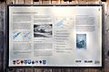
Information board about the Jura water corrections in Underfar (Meienried)

