Mojave, California facts for kids
Quick facts for kids
Mojave, California
|
|
|---|---|
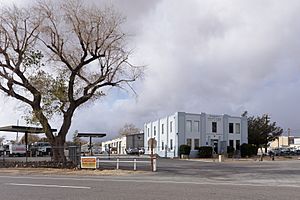
LADWP Mojave District Headquarters
|
|
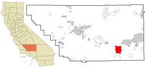
Location in Kern County and the state of California
|
|
| Country | United States |
| State | California |
| County | Kern |
| Area | |
| • Total | 58.375 sq mi (151.191 km2) |
| • Land | 58.29 sq mi (150.970 km2) |
| • Water | 0.085 sq mi (0.220 km2) 0.146% |
| Elevation | 2,762 ft (842 m) |
| Population
(2020)
|
|
| • Total | 4,699 |
| • Density | 80.497/sq mi (31.080/km2) |
| Time zone | UTC-8 (PST) |
| • Summer (DST) | UTC-7 (PDT) |
| ZIP codes |
93501, 93502, 93519
|
| Area code(s) | 661 |
| FIPS code | 06-48452 |
| GNIS feature ID | 1652752 |
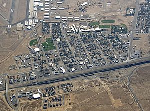
Mojave (formerly Mohave) is a small town in Kern County, California, United States. It's about 50 miles (80 km) east of Bakersfield and 100 miles (160 km) north of Los Angeles. The town sits high up, at about 2,762 feet (842 meters) above sea level.
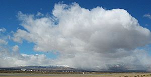
Mojave is found in the western part of the Mojave Desert, near the Tehachapi Mountains. It's even a stop along the famous Pacific Crest Trail! In 2010, about 4,238 people lived here.
Contents
Discovering Mojave: A Look at Its History
The town of Mojave started in 1876. It was first a camp for workers building the Southern Pacific Railroad.
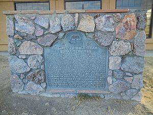
From 1884 to 1889, Mojave was a very important place. It was the western end of a 165-mile (266 km) route. Here, a famous twenty-mule team would bring borax from the Harmony Borax Works in Death Valley. Later, Mojave became the main office for building the Los Angeles Aqueduct. This aqueduct brings water to Los Angeles.
Mojave Airport: A Hub for Aviation and Space
Mojave has a long and exciting history with planes and space travel. It's close to big air bases like Edwards Air Force Base and Naval Air Weapons Station China Lake. The airport here, now called the Mojave Air and Space Port, is very active. It's used for flight testing, developing space technology, and storing large aircraft.
Early Days of Mojave Airport
In 1935, Kern County opened the Mojave Airport. It was built to help the gold and silver mining industry nearby. At first, it had two dirt runways. There were no places to refuel or service planes.
In 1941, the government started making improvements for national defense. They added two asphalt runways, each 4,500 feet (1,372 meters) long. Kern County agreed that the military could take over the airport if there was a war.
Mojave's Role in World War II
After the attack on Pearl Harbor in 1941, the U.S. Marine Corps took over the airport. They made it much bigger, calling it Marine Corps Auxiliary Air Station (MCAAS) Mojave. They extended the runways and added a third one. Barracks were built for over 3,000 military members.
Many of the Marine Corps' best pilots from World War II trained here. During the war, Mojave hosted many aircraft squadrons. At its busiest, the air station had 145 training planes. It even had a large swimming pool for aviators to practice emergency water escapes. Famous entertainers like Bob Hope visited to perform for the troops.
After the War: Changes and Reopening
MCAAS Mojave closed on February 7, 1946. The U.S. Navy used it for drone operations for less than a year. The base then stayed closed for four years.
When the Korean War started, Mojave was reopened. It became an auxiliary landing field for MCAS El Toro. Marine Corps squadrons used Mojave for training when the weather was bad at El Toro. The base was recommissioned as a MCAAS on December 31, 1953.
From Military Base to Civilian Airport
In 1961, the Marines moved their operations. Kern County then took over the airport. In 1972, the East Kern Airport District (EKAD) was created to manage the airport. This district still runs the airport today.
During the 1970s, a small airline called Golden West Airlines offered flights from Mojave. You could fly directly to Los Angeles (LAX) using their turboprop planes.
Mojave Air and Space Port: A Look to the Stars
On November 20, 2012, the airport's name was changed to the Mojave Air and Space Port. Officials felt this new name was better known around the world. The change officially happened on January 1, 2013.
Today, the airport is home to many aerospace companies. These include Scaled Composites and the civilian National Test Pilot School. Mojave was where the Rutan Voyager was built. This plane was the first to fly around the world without stopping or refueling.
The Mojave Air and Space Port is also the first inland spaceport in the United States. It was the launch site for the first private spaceflight. This happened on June 21, 2004, when SpaceShipOne took off from here.
Mojave also has a Mojave Transportation Museum.
Mojave's Geography and Climate
Mojave is located at 35°03′09″N 118°10′26″W / 35.05250°N 118.17389°W. The town covers an area of about 58.4 square miles (151.3 km2). Almost all of this area is land.
Mojave's Desert Climate
Mojave has a desert climate. This means it has very hot summers and cool winters. In January, the average high temperature is about 57.8°F (14.3°C). The average low is about 34.3°F (1.3°C). In July, the average high is around 97.7°F (36.5°C). The average low is about 69.8°F (21.0°C).
Mojave usually has about 98 days a year where the temperature reaches 90°F (32°C) or higher. It also has about 45.7 days where the temperature drops to 32°F (0°C) or lower. The hottest temperature ever recorded was 118°F (48°C) on August 5, 1914. The coldest was 8°F (-13°C) on December 23, 1990.
Rainfall and Snow in Mojave
Mojave gets about 5.96 inches (15.1 cm) of rain each year. There are usually about 22 days with some rain. The wettest year was 1983, with 15.51 inches (39.4 cm) of rain. The driest year was 1942, with only 0.85 inches (2.2 cm).
The most rain in one month was 6.85 inches (17.4 cm) in February 1998. The most rain in 24 hours was 3 inches (7.6 cm) on January 30, 1915. Snow is not very common in Mojave. On average, it gets about 1.7 inches (4.3 cm) of snow each year. The most snow in one month was 11 inches (28 cm) in February 1911.
| Climate data for Mojave, California, 1991–2020 normals, extremes 1904–2021 | |||||||||||||
|---|---|---|---|---|---|---|---|---|---|---|---|---|---|
| Month | Jan | Feb | Mar | Apr | May | Jun | Jul | Aug | Sep | Oct | Nov | Dec | Year |
| Record high °F (°C) | 82 (28) |
90 (32) |
89 (32) |
99 (37) |
104 (40) |
112 (44) |
117 (47) |
118 (48) |
110 (43) |
100 (38) |
96 (36) |
79 (26) |
118 (48) |
| Mean maximum °F (°C) | 68.5 (20.3) |
73.0 (22.8) |
79.6 (26.4) |
87.0 (30.6) |
95.1 (35.1) |
102.1 (38.9) |
106.8 (41.6) |
105.0 (40.6) |
99.9 (37.7) |
92.0 (33.3) |
79.4 (26.3) |
69.3 (20.7) |
107.9 (42.2) |
| Mean daily maximum °F (°C) | 57.9 (14.4) |
60.4 (15.8) |
66.5 (19.2) |
71.6 (22.0) |
80.8 (27.1) |
90.8 (32.7) |
97.2 (36.2) |
97.2 (36.2) |
89.5 (31.9) |
78.4 (25.8) |
66.2 (19.0) |
56.5 (13.6) |
76.1 (24.5) |
| Daily mean °F (°C) | 45.3 (7.4) |
47.6 (8.7) |
53.4 (11.9) |
58.4 (14.7) |
67.0 (19.4) |
77.2 (25.1) |
83.1 (28.4) |
82.2 (27.9) |
75.0 (23.9) |
63.9 (17.7) |
52.4 (11.3) |
44.2 (6.8) |
62.5 (16.9) |
| Mean daily minimum °F (°C) | 32.8 (0.4) |
34.9 (1.6) |
40.3 (4.6) |
45.3 (7.4) |
53.2 (11.8) |
63.6 (17.6) |
69.1 (20.6) |
67.2 (19.6) |
60.6 (15.9) |
49.4 (9.7) |
38.6 (3.7) |
31.8 (−0.1) |
48.9 (9.4) |
| Mean minimum °F (°C) | 23.4 (−4.8) |
27.6 (−2.4) |
31.9 (−0.1) |
36.1 (2.3) |
42.6 (5.9) |
50.5 (10.3) |
60.6 (15.9) |
58.2 (14.6) |
50.3 (10.2) |
39.6 (4.2) |
30.1 (−1.1) |
22.9 (−5.1) |
21.0 (−6.1) |
| Record low °F (°C) | 10 (−12) |
16 (−9) |
17 (−8) |
27 (−3) |
32 (0) |
38 (3) |
43 (6) |
47 (8) |
31 (−1) |
22 (−6) |
13 (−11) |
8 (−13) |
8 (−13) |
| Average precipitation inches (mm) | 1.08 (27) |
1.49 (38) |
0.80 (20) |
0.21 (5.3) |
0.13 (3.3) |
0.03 (0.76) |
0.18 (4.6) |
0.17 (4.3) |
0.10 (2.5) |
0.42 (11) |
0.34 (8.6) |
0.81 (21) |
5.76 (146.36) |
| Average snowfall inches (cm) | 0.5 (1.3) |
0.1 (0.25) |
0.2 (0.51) |
0.0 (0.0) |
0.0 (0.0) |
0.0 (0.0) |
0.0 (0.0) |
0.0 (0.0) |
0.0 (0.0) |
0.0 (0.0) |
0.0 (0.0) |
0.4 (1.0) |
1.2 (3.06) |
| Average precipitation days (≥ 0.01 in) | 3.9 | 4.2 | 2.8 | 1.5 | 0.7 | 0.2 | 0.3 | 0.4 | 0.4 | 1.4 | 1.6 | 2.8 | 20.2 |
| Average snowy days (≥ 0.1 in) | 0.2 | 0.1 | 0.0 | 0.0 | 0.0 | 0.0 | 0.0 | 0.0 | 0.0 | 0.0 | 0.0 | 0.1 | 0.4 |
| Source 1: NOAA | |||||||||||||
| Source 2: XMACIS2 | |||||||||||||
Who Lives in Mojave? A Look at the Population
The United States Census Bureau defines Mojave as a census-designated place (CDP). This means it's a specific area used for collecting statistics.
Mojave's Population in 2010
The 2010 United States Census counted 4,238 people living in Mojave. This means there were about 72.6 people per square mile (28.0 per km2).
Here's a look at the different groups of people:
- 2,381 (56.2%) were White.
- 638 (15.1%) were African American.
- 54 (1.3%) were Native American.
- 53 (1.3%) were Asian.
- 19 (0.4%) were Pacific Islander.
- 867 (20.5%) were from other races.
- 226 (5.3%) were from two or more races.
- 1,592 people (37.6%) were Hispanic or Latino of any race.
All 4,238 people lived in homes. No one lived in group homes or institutions.
There were 1,525 households in Mojave.
- 614 (40.3%) had children under 18 living there.
- 597 (39.1%) were married couples.
- 305 (20.0%) had a female head of household with no husband.
- 111 (7.3%) had a male head of household with no wife.
- 417 households (27.3%) had only one person living there.
- 128 (8.4%) had someone living alone who was 65 or older.
The average household had 2.78 people. The average family had 3.37 people.
The population was spread out by age:
- 1,298 people (30.6%) were under 18.
- 509 people (12.0%) were aged 18 to 24.
- 938 people (22.1%) were aged 25 to 44.
- 1,052 people (24.8%) were aged 45 to 64.
- 441 people (10.4%) were 65 or older.
The average age was 31.0 years. For every 100 females, there were 102.3 males.
There were 1,817 housing units in Mojave. About 719 (47.1%) were owned by the people living in them. About 806 (52.9%) were rented.
Mojave's Population in 2000
In the census of 2000, there were 3,836 people living in Mojave. There were 1,408 households and 940 families. The population density was about 65.6 people per square mile (25.3 per km2).
The racial makeup of the town was:
- 67.54% White
- 5.58% Black or African American
- 1.33% Native American
- 2.01% Asian
- 0.13% Pacific Islander
- 18.12% from other races
- 5.29% from two or more races
- 28.31% of the population was Hispanic or Latino of any race.
There were 1,408 households. About 37.5% had children under 18. About 43.7% were married couples. The average household size was 2.71 people. The average family size was 3.31 people.
The median income for a household in Mojave was $24,761. The median income for a family was $28,496. About 31.7% of families and 36.2% of the population lived below the poverty line.
See also
 In Spanish: Mojave (California) para niños


