Montville, Connecticut facts for kids
Quick facts for kids
Montville, Connecticut
|
||
|---|---|---|
| Town of Montville | ||
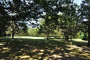
Fort Shantok, on the Mohegan reservation
|
||
|
||
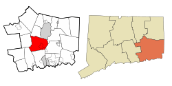 New London County and Connecticut New London County and Connecticut |
||
| Country | ||
| U.S. state | ||
| County | New London | |
| Region | Southeastern CT | |
| Incorporated | 1786 | |
| Government | ||
| • Type | Mayor-council | |
| Area | ||
| • Total | 44.2 sq mi (114.4 km2) | |
| • Land | 42.0 sq mi (108.7 km2) | |
| • Water | 2.2 sq mi (5.8 km2) | |
| Elevation | 259 ft (335 m) | |
| Population
(2020)
|
||
| • Total | 18,387 | |
| • Density | 416.28/sq mi (160.73/km2) | |
| Time zone | UTC−5 (EST) | |
| • Summer (DST) | UTC−4 (EDT) | |
| ZIP Codes |
06353, 06370, 06382
|
|
| Area code(s) | 860/959 | |
| FIPS code | 09-48900 | |
| GNIS feature ID | 0213464 | |
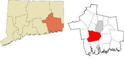
Montville is a town located in New London County, Connecticut, in the United States. It is part of the Southeastern Connecticut Planning Region. In 2020, about 18,387 people lived there.
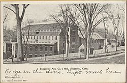
Montville includes several smaller communities or villages. These are Chesterfield, Mohegan, Oakdale, and Uncasville. Many people who live in Montville feel more connected to their specific village than to the town as a whole. The famous Mohegan Sun casino resort is found in the village of Uncasville.
Contents
History of Montville
In the 1600s, when English settlers first arrived, southeastern Connecticut was a place of competition. Two main Native American groups, the Pequot people and the Mohegan, were rivals. The Mohegan people became friends with the English settlers.
Early Mohegan Settlement
To protect his people from the Pequot, the Mohegan leader, called a sachem, Uncas, built a strong village. This village was on a high point above the Thames River. Today, this area is known as Fort Shantok within Montville. The Mohegan village had tall fences, called palisades, for protection. These fences were first built around 1636 during the Pequot War. They were rebuilt during later wars with the Narragansett people from about 1653 to 1657, and again during King Philip's War (1675–1676).
How Montville Became a Town
When the boundaries of New London were first set in 1646, the Oxoboxo River marked its northern edge. Areas of what is now Montville, south of this river, were part of New London. The land north of the river was considered Mohegan territory.
Over time, English settlers gained control of more Mohegan lands. The first land grants were made by Uncas in 1658. By 1703, the area between the Oxoboxo River and Norwich was added to New London.
In 1786, Montville officially separated from New London and became its own town. Before this, it was known as the North Parish of New London. In 1819, the nearby town of Salem was formed using parts of Montville, Lyme, and Colchester. The name "Montville" means "mountain village."
Historic Places in Montville
Four important places in Montville are listed on the National Register of Historic Places. This means they are recognized for their historical value:
- Bridge No. 1860: A bridge on Massapeag Side Road over Shantok Brook.
- Fort Shantok Archeological District: The area where the Mohegan village once stood.
- Raymond-Bradford Homestead: An old home on Raymond Hill Road.
- Uncasville School: This building now serves as the Montville Town Hall.
Geography and Communities
Montville covers a total area of 44.2 square miles (114.4 km2). Most of this, 42.0 square miles (108.7 km2), is land, and 2.2 square miles (5.8 km2) is water.
Main Communities in Montville
Montville is made up of several smaller communities. These include:
- Chesterfield
- Kitemaug
- Massapeag
- Mohegan
- Oakdale
- Palmertown
- Uncasville
People living in Montville often feel more connected to their specific village than to the entire town. For example, the center of Oakdale is quite small. The Mohegan Sun casino resort is often said to be in Uncasville, even though it's about three miles south of the village center. The Mohegan people call the area Uncasville because it is named after a very important sachem (leader) from the 1600s.
Population Information
| Historical population | |||
|---|---|---|---|
| Census | Pop. | %± | |
| 1820 | 1,951 | — | |
| 1850 | 1,848 | — | |
| 1860 | 2,141 | 15.9% | |
| 1870 | 2,495 | 16.5% | |
| 1880 | 2,664 | 6.8% | |
| 1890 | 2,344 | −12.0% | |
| 1900 | 2,395 | 2.2% | |
| 1910 | 2,894 | 20.8% | |
| 1920 | 3,411 | 17.9% | |
| 1930 | 3,970 | 16.4% | |
| 1940 | 4,135 | 4.2% | |
| 1950 | 4,766 | 15.3% | |
| 1960 | 7,759 | 62.8% | |
| 1970 | 15,662 | 101.9% | |
| 1980 | 16,455 | 5.1% | |
| 1990 | 16,673 | 1.3% | |
| 2000 | 18,546 | 11.2% | |
| 2010 | 19,571 | 5.5% | |
| 2020 | 18,387 | −6.0% | |
| U.S. Decennial Census | |||
In 2000, Montville had 18,546 people living in 6,426 households. About 4,678 of these were families. The population density was about 441.4 inhabitants per square mile (170.4/km2).
About 34.7% of households had children under 18. Most households (58.6%) were married couples. The average household had 2.63 people, and the average family had 3.05 people.
The population was spread out by age:
- 23.6% were under 18 years old.
- 8.5% were between 18 and 24.
- 34.2% were between 25 and 44.
- 22.8% were between 45 and 64.
- 10.8% were 65 years or older.
The average age in Montville was 36 years.
The median income for a household was $55,086. For families, it was $61,643. The average income per person in the town was $22,357. About 4.1% of the population lived below the poverty line.
Mohegan Native American Nation
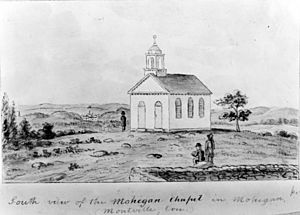
The Mohegan Native American Tribal Nation has lived in this part of Connecticut for thousands of years. In the 1600s, the Connecticut colony gave them a reservation of about 700-acre (2.8 km2). This land is north of the Uncasville village.
Even though the reservation is inside Montville's borders, the Mohegan Tribe is recognized by the U.S. government as a sovereign nation. This means they are not subject to local or state laws. The tribe runs the Mohegan Sun casino resort, which opened in 1996. They also offer educational programs about their history and culture.
Education in Montville
Public schools in Montville are managed by Montville Public Schools. A board of nine elected members and two high school students oversees the school system.
The school system includes:
- One regular high school
- One alternative high school
- One middle school
- Three elementary schools
Montville High School serves students from 9th to 12th grade. It has about 800 students.
Montville is also home to St. Thomas More School. This is a private boarding school well-known for its basketball program.
Economy and Power Plant
Power Generation in Montville
NRG Energy Inc., a company based in California, runs an electricity plant in Montville. This plant uses oil and natural gas to make power. Environmental groups once called it one of the "Sooty Six" because it was among the dirtiest power plants in the state.
The plant had to add special equipment to control pollution to follow a state law from 2002. In 2006, the company suggested building a new type of coal-powered plant there. This new plant would cost $1.6 billion.
The company wanted the state to promise long-term contracts to buy the electricity it would make. They also wanted their plan to be chosen over other new power plant ideas in the state. At that time, only 18 plants in the world used the special technology NRG suggested. In 2013, NRG Energy announced plans to add fuel cells, solar power, and biomass conversion to the plant.
Notable People from Montville
Many interesting people have connections to Montville:
- George Miller Beard (1839–1883): A doctor who studied nerves and coined the term "neurasthenia" in 1869.
- Charles W. Comstock (1857–1917): A lawyer who served as a United States Attorney and a Connecticut Judge.
- Sidney E. Frank (1919–2006): A very successful businessman who helped make Grey Goose vodka and Jägermeister popular.
- Ned Hanlon (1857–1937): A famous baseball player who is in the Baseball Hall of Fame.
- James Hillhouse (1754–1832): A real estate developer who built many parts of New Haven. He was also a congressman, a U.S. senator, and the treasurer of Yale University for many years.
- David Jewett (1772–1842): A naval commander from the 19th century.
- Samson Occom (1723–1792): A Mohegan minister and preacher.
- Oliver Hillhouse Prince (1787–1837): Represented Georgia in the U.S. Senate for a short time.
See also
 In Spanish: Montville (Connecticut) para niños
 | Roy Wilkins |
 | John Lewis |
 | Linda Carol Brown |


