Salem, Connecticut facts for kids
Quick facts for kids
Salem, Connecticut
|
|||
|---|---|---|---|
| Town of Salem | |||

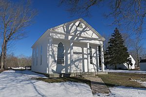
Salem Town House
|
|||
|
|||
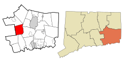
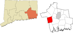
 New London County and Connecticut New London County and Connecticut |
|||
| Country | |||
| U.S. state | |||
| County | New London | ||
| Region | Southeastern CT | ||
| Incorporated | 1819 | ||
| Government | |||
| • Type | Selectman-town meeting | ||
| Area | |||
| • Total | 29.8 sq mi (77.2 km2) | ||
| • Land | 29.0 sq mi (75.0 km2) | ||
| • Water | 0.8 sq mi (2.2 km2) | ||
| Elevation | 315 ft (96 m) | ||
| Population
(2020)
|
|||
| • Total | 4,213 | ||
| • Density | 141.38/sq mi (54.57/km2) | ||
| Time zone | UTC-5 (Eastern) | ||
| • Summer (DST) | UTC-4 (Eastern) | ||
| ZIP Code |
06420
|
||
| Area code(s) | 860/959 | ||
| FIPS code | 09-66210 | ||
| GNIS feature ID | 0213499 | ||
Salem is a small town located in New London County, Connecticut. It's part of the Southeastern Connecticut Planning Region. In 2020, about 4,213 people lived here.
Contents
Discovering Salem's Past
Early Days and First Settlers
The land where Salem is now was first home to the Mohegan people. The first European settlers arrived in 1664. They were from England and settled in what was then part of Montville. In the early 1700s, more settlements grew in an area that was part of Colchester. This area was known as "Paugwonk." Even today, a small part of town near the Gardner Lake Firehouse is sometimes called Paugwonk.
Because these early settlements were far from churches, the people asked for a new church area in 1725. They named it New Salem Parish. This name honored Colonel Samuel Browne, who owned a lot of land there. He was from Salem, Massachusetts. It's believed that Colonel Browne had enslaved people and ran one of the biggest farms using enslaved labor in New England. The people of New Salem strongly supported the American Revolution.
Becoming a Town: 1819 to Today
Salem officially became a town in 1819. Its land came from parts of Colchester, Lyme, and Montville. The land was very rocky, which meant not many people settled there. Salem was always a busy crossroads. The old Hartford and New London Turnpike (now Route 85) was a toll road. Lawmakers often traveled on it in the winter when the Connecticut River was frozen. This road also offered stagecoach service until the 1890s.
Music Vale Seminary: A School for Music
Salem became famous when Oramel Whittlesey started the Music Vale Seminary in 1835. Students at this school learned music. They also helped with farming, just like most families in Salem at that time. Pianos were even made nearby. The seminary burned down once and was rebuilt. But after Whittlesey died in 1867, the school began to decline. When it burned down again, it was never rebuilt. Today, only a barn and a historical marker show where the seminary once stood.
Early Electricity in Rural Areas
Salem was one of the first places in the country to get rural electrification. This happened at Frederick C. Rawolle Jr.'s farm. Rawolle was an engineer from New York. He retired young after selling his invention for breaking up oil wells. He bought a huge amount of land, about 2,800 acres (11 km2), between 1917 and 1924. This land surrounded Mountain Lake and Fairy Lake. It was once owned by Native American leaders from the Niantic and Mohegan tribes. This area became known as Fairy Lake Farm.
Rawolle decided to make his own electricity. It was too hard to bring power lines from New London, which was about 12 miles (19 km) away. In 1922, he finished building a hydroelectric system. It cost about one million dollars, which was a huge amount of money back then. Airplanes flying from New York to Boston even used the bright lights of Fairy Lake Farm to guide them. Rawolle also opened a store in New London to sell farm produce. However, he lost all his money during the stock market crash in 1929. He died in 1954. His large stone house at the farm is still there, but it is empty.
The Bingham Family: Explorers and Heroes
Hiram Bingham III was from Salem. He was an adventurer, a U.S. senator, and an explorer. He famously rediscovered Machu Picchu in Peru in 1911. He brought many ancient items to Yale University. In 2011, many of these items were returned to Cusco, Peru.
His son, Hiram Bingham IV, was a diplomat in Marseilles, France, during World War II. He bravely helped thousands of Jews escape danger from the Nazi concentration camps. Much of the Bingham family still lives in Salem today. Hiram IV passed away in 1988. A U.S. Postal Stamp was made in his honor in 2006. In 2011, a film was made about his life-saving actions during the war.
Salem Today: A Growing Community
Over the years, Salem has changed from a small farming town to a bedroom community. This means many people who live here travel to other towns for work. In the 1990s, it was one of the fastest-growing towns in Connecticut. However, it is still a small town compared to others in the state. Salem didn't even have its own ZIP code until the mid-1990s. Before that, it shared one with Colchester.
In its early years, Salem had several small schoolhouses. One is still visible on White Birch Road. Salem School was built in 1940. It has had many additions since then, with the newest one opening in 1994. Today, Salem School is one of the largest schools for grades K-8 in Connecticut, with about 600 students. Students in grades 9-12 go to high school in East Lyme. This arrangement will continue until at least 2039.
Connecticut Route 85 became a state road in 1932. Traffic grew a lot over the years. A new highway, Route 11, was planned to help. But construction stopped in 1972 due to lack of money. The project was restarted in the 1990s. In 2004, it was announced as a high-priority project. The new highway was also supposed to include a "greenway" of protected land. However, Connecticut stopped work on the project in 2009 due to funding issues. Most Salem residents want the highway finished to reduce traffic on local roads.
Salem has very few businesses or industries. This means that property taxes in the town are generally high. The last dairy farm in Salem closed in 2004. However, there is a small farm called Syman Says Farms that raises dairy goats and makes goat milk products.
In 2006, Salem Boy Scout Troop 123 was one of the largest in Connecticut. That year, they sent more scouts to summer camp than any other troop in the state. Many second-grade boys in Salem join the Cub Scouts.
Fun Salem Traditions
Salem has several long-standing traditions that happen every year:
- Memorial Day Parade
- Salem 5K Road Race
- Salem Apple Festival: This festival is held at the end of October on the town green. You can find all sorts of apple treats, from pies to fritters. They also sell pies and apple-themed items across from the town green. The Salem Public Library holds its yearly book sale at Salem School during the festival.
Historic Places in Salem
Several places in Salem are listed on the National Register of Historic Places:
- Abel H. Fish House – on Buckley Hill and Rathbun Hill Roads (added 1982)
- Salem Historic District – along state Route 85 (added 1980)
- Ebenezer Tiffany House – at 460 Darling Road (added 1983)
- Woodbridge Farm – at 29, 30, and 90 Woodbridge Road (added 1997)
Salem Town Green
Like many New England towns, Salem's town green was first built around a church. The current church, Salem Congregational Church, was built in 1840. The Music Vale Seminary was about half a mile south of the green. The town hall, library, sports fields, and Salem School are all located nearby. A grange hall and a historical society building are also around the green.
The green has not changed much over the last two hundred years. The biggest changes have happened in the last two decades. Salem School has had many additions since it was first built in 1940. In 2003, the town voted to build a new library, which opened in 2004. This new building replaced the old, tiny library that the Bingham family donated in 1928. Also in 2004, work began to expand the sports fields.
Salem's Geography
Salem covers about 29.8 square miles (77.2 km2). Most of this, about 29.0 square miles (75.0 km2), is land. The rest, about 0.8 square miles (2.1 km2), is water.
Population Changes Over Time
| Historical population | |||
|---|---|---|---|
| Census | Pop. | %± | |
| 1820 | 1,053 | — | |
| 1850 | 764 | — | |
| 1860 | 830 | 8.6% | |
| 1870 | 717 | −13.6% | |
| 1880 | 574 | −19.9% | |
| 1890 | 481 | −16.2% | |
| 1900 | 468 | −2.7% | |
| 1910 | 443 | −5.3% | |
| 1920 | 424 | −4.3% | |
| 1930 | 403 | −5.0% | |
| 1940 | 504 | 25.1% | |
| 1950 | 618 | 22.6% | |
| 1960 | 925 | 49.7% | |
| 1970 | 1,453 | 57.1% | |
| 1980 | 2,335 | 60.7% | |
| 1990 | 3,310 | 41.8% | |
| 2000 | 3,858 | 16.6% | |
| 2010 | 4,151 | 7.6% | |
| 2020 | 4,213 | 1.5% | |
| U.S. Decennial Census | |||
In 2000, there were 3,858 people living in Salem. The town had 1,358 households, with 1,075 of them being families. About 43.5% of households had children under 18. Most households (68.9%) were married couples. The average household had 2.84 people.
The median age in Salem was 37 years old. About 29.4% of the population was under 18. The median income for a household was $68,750.
Education in Salem
The Salem School District runs a school for students from Pre-Kindergarten to 8th grade.
For high school, students in grades 9 through 12 attend East Lyme High School in East Lyme. This school is part of the East Lyme Public Schools.
Interesting Facts
Salem has a Witch Meadow Lake and Witch Meadow Campground. These names might be a playful nod to the famous witch trials that happened in Salem, Massachusetts.
Famous People from Salem
- Hiram Bingham III (1875–1956): He was a Connecticut governor, a U.S. Senator, and an adventurer who discovered Machu Picchu. He lived in Salem for a long time.
- Hiram Bingham IV (1903–1988): He was an American diplomat during World War II. He helped thousands of Jewish people escape the Nazis during the Holocaust. He was from Salem and lived there for many years.
- Rachel Robinson (born 1922): She is the wife of famous baseball player Jackie Robinson and a civil rights activist. She has lived in Salem for a long time.
See also
 In Spanish: Salem (Connecticut) para niños
 | Delilah Pierce |
 | Gordon Parks |
 | Augusta Savage |
 | Charles Ethan Porter |


