
Moston Brook facts for kids
Quick facts for kids Moston Brook |
|
|---|---|

Moston Brook near Williams Road, Manchester
|
|

Location of the mouth within Greater Manchester
|
|
| Physical characteristics | |
| Main source | Failsworth, Oldham, Greater Manchester, United Kingdom |
| River mouth | River Irk 53°29′47″N 2°13′39″W / 53.49639°N 2.22750°W |
Moston Brook is a small river, also called a stream. It's in Greater Manchester, in the north-west of England. This stream flows into the River Irk. Moston Brook starts where two smaller streams, Bower Brook and Hole Bottom Brook, join together. This meeting point is near the Rochdale Canal in Failsworth, which is part of Oldham.
The brook then flows southwest. It forms the boundary between Moston, Manchester and Failsworth. Most of its journey is hidden underground in pipes called culverts. The brook is about 3.7 miles (6 kilometres) long.
Long ago, the brook was used by factories during Manchester's "Cottonopolis" time. People used its water for washing, bleaching, and dyeing yarns. Moston was especially known for silk weaving. Later, old clay and sand pits near the brook, which were used for brickworks, became landfill sites.
More parts of the brook were put into culverts to make space for these landfills. The last landfill closed in the 1990s. Because of all the factories and waste, the brook became very polluted. In the early 2000s, it was one of the dirtiest rivers in Greater Manchester.
But things have changed! People started working hard to clean up the brook. They fixed pipes that were leaking sewage and built drains to stop dirty water from factories and old landfills from getting in. Work is still happening to make the area even better.
Thanks to these efforts, Moston Brook is now seen as a great place for the community. It's also home to many different plants and animals. The parts of the brook that are still above ground are used by local people for fun activities.
Contents
Where Does Moston Brook Flow?

Moston Brook flows for about 3.7 miles (6.0 km). It starts where Bower Brook and Hole Bottom Brook meet. It then flows into the River Irk. The brook is part of the larger River Irwell drainage basin, which collects water from a wide area.
The very beginning of Moston Brook is now hidden. Its first parts are completely covered by two large pipes, called the South Culvert and the North Culvert. The South Culvert is what's left of Bower Brook, which flows from the Werneth area.
Hole Bottom Brook starts in north Hollinwood. It runs to the Failsworth border near the Rochdale Canal. A small part of this brook can still be seen in daylight. The North Culvert was added in the 1990s to carry water from a new part of the M60 motorway.
The spot where Bower Brook and Hole Bottom Brook join is considered the true start of Moston Brook. From there, the brook flows southwest. It creates the boundary between the City of Manchester and the Metropolitan Borough of Oldham.
Some parts of the brook are hidden under Broadway Common. This was done because of landfill activities. The brook then flows into Manchester, between Moston and Newton Heath. Here, it goes into another culvert under Moston Vale.
Another stream, Dean Brook, joins it here. Dean Brook flows past Moston Hall in Broadhurst Park. It also goes into a culvert south of Joyce Street. A long time ago, the section between Failsworth and Dean Brook was called Morris Brook.
You can briefly see the brook again in Collyhurst, near Manchester Communication Academy. After that, it goes back into culverts. These pipes carry it almost all the way to where it meets the River Irk.
The main parts of Moston Brook that are still above ground include:
- Wrigley Head – This part of the brook is close to the Rochdale Canal.
- Hardman Fold – This area used to be a farm, a brickworks, and a clay-pit. Later, it became a landfill. Now, it's a beautiful area with meadows, woodlands, and a path along the water. A public footpath also runs on the Manchester side.
- Broadway – This area includes Lower Failsworth Memorial Land. After World War I, people bought this land together for everyone in Failsworth to enjoy.
- Moston Fairway – This is a special urban nature reserve. It's managed by the Lancashire Wildlife Trust. Part of it used to be a railway yard until 1981. Even though it's not directly connected to the brook valley, it's very close and is considered part of the same green space.
Moston Brook's Past

The area around Moston Brook was mostly countryside. But since the 1500s, people used the brook for washing, bleaching, and dyeing yarns. Moston was especially known for silk weaving. By 1848, Moston Mill Print Works was built next to the brook to use its water. Later, Spring Valley Dye Works opened in Failsworth.
A mill pond, a mill race, and a weir were built for the mill. Only the weir is still there today. Monsall Hospital was built on the brook's banks in 1871. In 1878, North Road football stadium and cricket ground were built nearby. This was for the Newton Heath LYR works team, which later became Manchester United F.C..
There used to be "white hills" along the brook's banks. These hills were made from industrial waste. Photos from 1913 show these hills. Clay and sand pits next to the brook provided materials for brickworks on Hale Lane, Failsworth.
Around 1949, these pits started being used as landfills. The last one, Hardman Fold, closed in the 1990s. The brook was slowly put into culverts along much of its path. Sometimes, this was to make more room for landfills. For example, the part of the brook near Monsall Hospital was put into a culvert in the mid-1970s for a landfill.
Monsall Hospital closed in 1993 and was torn down. Moston Brook High School, built where the North Road sports pitches used to be, closed in August 2000.
In the 1980s, the remaining visible part of the brook between Failsworth and Moston was reshaped and improved. The valley slopes were made smoother. Paths and steps were added, and drainage channels were installed. Work was also done to make the ground more stable.
Cleaning Up the Environment
Pollution Problems
During and after the Industrial Revolution, many factories and workshops appeared in north Manchester, Failsworth, and Oldham. This caused Moston Brook to become very polluted. Local children even called it the "Black Brook." The brook's color would change depending on the dyes or paints being dumped into it.
Sadly, children were known to have drowned in the brook while playing there. Other pollutants over the years included oil gas tar from Hollinwood Gas Works and waste from Failsworth tannery. Both the Rochdale and Hollinwood Canals also overflowed into the streams, bringing more pollution.
From 1990 to 2007, the brook always got the lowest possible grade from the Environment Agency. This meant it was very polluted and had very few living things in it. It was considered one of the hardest bodies of water to improve in the North West of England.
The brook was failing tests for levels of ammonia, phosphate, and dissolved oxygen. These are important for healthy water.
Making Improvements
Because of these bad results, the Environment Agency and United Utilities decided to work together. They wanted to make the brook's water cleaner. This included checking and fixing combined sewer overflows (CSOs). These are pipes that sometimes release sewage during heavy storms.
A study in 2013 found that pollution came from several sources. These included sewage from storm overflows, dirty water from old landfill sites, and sewage from homes with wrong pipe connections. They also looked at leaks from St Josephs's Cemetery and runoff from the M60 motorway. The study found that there were no fish living in the brook.
United Utilities has spent £2 million to improve the sewerage system near the brook. The Greater Manchester Waste Disposal Authority (GMWDA) spent £400,000 on a special plant for one of its old landfills. The Environment Agency has paid for sustainable drainage systems. These stop surface water from nearby industrial sites and old landfills from entering the brook.
Both Oldham and Manchester Councils see that the brook has the potential to be a great place for biodiversity. In 2010, Oldham Council hired a project officer. This person is in charge of making the Moston Brook area better. Manchester Council has also looked into cases of fly tipping (illegal dumping).

There is a local group called the Moston Brook Friends Group. This group meets to plan ways to improve access to the brook. They also organize events, volunteering sessions, guided walks, and nature activities.
Wildlife Around the Brook
In 2007, a survey looked at the habitats around Moston Brook. Important habitats found include lowland broad-leaved woodland, marshy grassland, reed beds, and lowland heath/acid grassland. These are all important habitats listed in plans to protect nature.
Important animals found include song thrushes, house sparrows, starlings, snipe, and kestrels.
The Moston Brook area is located between two important nature sites. One is the Rochdale Canal Special Area of Conservation (SAC) and Site of Special Scientific Interest (SSSI). This is a very important site for nature conservation in Europe. The other is the Moston Fairway Nature Reserve. This used to be railway yards. It is a Site of Biological Importance (SBI), which is an important site for nature conservation in the region.
Fun and Recreation
Moston Brook is a great place for people living in Moston and Failsworth to enjoy. The project officer for the site helps organize activities. They also encourage local communities to use the area.
For example, an annual Fun Day is held on Lower Failsworth Memorial Land. Activities include falconry displays, bouncy castles, arts and crafts, and model train rides. The Lancashire Wildlife Trust has organized volunteering sessions around Moston Brook. The project officer has also led bat spotting tours with the local community.
Oldham and Manchester Councils have built entrances to the brook along its route. These allow people to access paths and cycleways. These can be used for walks, bike rides, and educational activities.
-
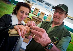
Creating an insect house – Moston Brook Fun Day 2013
-
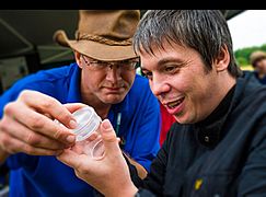
Moston Brook Fun Day 2013


