Mount Abraham (Maine) facts for kids
Quick facts for kids Mount Abraham |
|
|---|---|

Mount Abraham viewed from the north, from atop nearby Sugarloaf Mountain
|
|
| Highest point | |
| Elevation | 4,050 ft (1,230 m) |
| Prominence | 900 ft (270 m) |
| Listing | New England 4000 footers |
| Geography | |
| Topo map | USGS Mount Abraham |
Mount Abraham is a beautiful mountain located in Franklin County, Maine. It stands tall at 4,050 feet (about 1,234 meters) above sea level. This makes it one of Maine's highest peaks. To the north, you'll find Spaulding Mountain, another nearby peak.
Where the Water Flows

Water from Mount Abraham eventually reaches the ocean! Rain and melting snow from the northeast side of the mountain flow into Rapid Stream. This stream then joins the West Branch of the Carrabassett River. From there, the water flows into the Kennebec River, and finally into the Gulf of Maine.
On the southern part of the mountain's southwest side, water drains into Quick Stream. This also leads to the West Branch of the Carrabassett River. Water from the northern part of the southwest side goes into Perham Stream. This stream connects to Orbeton Stream and then the Sandy River. The Sandy River is another tributary that flows into the Kennebec River.
Mountain History
Mount Abraham has an interesting past. In the late 1800s, people used to cut down trees on the mountain. This process is called logging. They would move the cut logs down the mountain using special wooden slides covered in ice!
After the logs were moved, they were shipped by train. A special narrow-gauge railroad called the Sandy River and Rangeley Lakes Railroad helped transport the logs, lumber, and pulpwood (wood used to make paper).
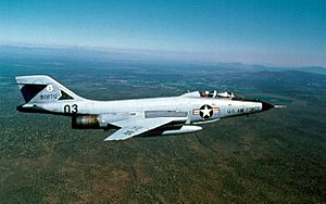
On November 14, 1967, something unusual happened. A McDonnell F-101B Voodoo fighter jet crashed on the mountain. This jet belonged to the 60th Fighter-Interceptor Squadron. It was flying with another jet when they accidentally collided. The two pilots in the crashed jet were able to safely eject. The second aircraft made an emergency landing at Dow AFB.
Hiking and Trails
Mount Abraham is a great place for hiking. The famous Appalachian Trail (AT) passes near the mountain. The AT is a very long trail, about 2,170 miles (3,490 km) long. It stretches all the way from Georgia to Maine.
The Appalachian Trail runs between Saddleback Junior and Spaulding Mountain. It passes about 2 miles (3 km) northwest of Mount Abraham's summit. You can reach the top of Mount Abraham from the AT by taking a special path called the Mount Abraham Side Trail. This side trail is marked with blue blazes, which are painted marks on trees that guide hikers.
 | DeHart Hubbard |
 | Wilma Rudolph |
 | Jesse Owens |
 | Jackie Joyner-Kersee |
 | Major Taylor |


