Mount Airy, Maryland facts for kids
Quick facts for kids
Mount Airy, Maryland
|
|||||
|---|---|---|---|---|---|
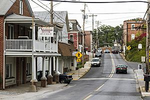
Main Street in Mt. Airy
|
|||||
|
|||||
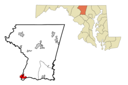
Location in Carroll County
|
|||||
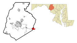
Location in Frederick County
|
|||||
| Country | |||||
| State | |||||
| Counties | Frederick, Carroll | ||||
| Settled | 1830 | ||||
| Incorporation | 1894 | ||||
| Government | |||||
| • Type | Mayor-Council | ||||
| Area | |||||
| • Total | 4.13 sq mi (10.71 km2) | ||||
| • Land | 4.12 sq mi (10.68 km2) | ||||
| • Water | 0.01 sq mi (0.03 km2) | ||||
| Elevation | 764 ft (233 m) | ||||
| Population
(2020)
|
|||||
| • Total | 9,654 | ||||
| • Density | 2,343.20/sq mi (904.71/km2) | ||||
| Time zone | UTC-5 (Eastern (EST)) | ||||
| • Summer (DST) | UTC-4 (EDT) | ||||
| ZIP code |
21771
|
||||
| Area code(s) | 301, 240 | ||||
| FIPS code | 24-53875 | ||||
| GNIS feature ID | 2391316 | ||||
Mount Airy is a town in Maryland, a state in the United States. It is located in both Carroll and Frederick counties. Mount Airy is close to both the Washington Metropolitan Area and Baltimore Metropolitan Area. In 2020, about 9,654 people lived there.
People often call the area around the town "Mount Airy" or the "Four-County Area." This is because the mailing area for Mount Airy includes parts of Frederick, Carroll, Montgomery, and Howard counties.
Contents
History of Mount Airy
Early Settlement and the Railroad
Mount Airy was first settled in 1830. People started building houses along a place called Parr's Ridge. Henry Bussard built the very first house. The town became well-known because of its train station on the Baltimore and Ohio Railroad (B&O). This railroad connected Baltimore to Frederick.
The town got its name from an Irish B&O worker. He complained about his ears freezing on a windy day, saying it was "mount airy." In its early days, Mount Airy's economy was supported by milling, canning, and sewing businesses.
Growth and Challenges
The town grew because it was close to the National Road. This important road went west from Baltimore all the way to Illinois. By the 1890s, Mount Airy was growing fast. Three new churches were built during this time.
In 1901, a very important bridge called the Twin Arch was built. It helped with railroad transportation. However, the town faced challenges. Three big fires in 1903, 1914, and 1925 caused a lot of damage. But each time, the people of Mount Airy rebuilt their town.
County Divisions and Railroad Changes
When Carroll County set its borders in 1837, Mount Airy ended up being split between Carroll and Frederick counties. It has stayed that way ever since. About a mile south of town, four counties meet: Carroll, Frederick, Howard, and Montgomery.
Mount Airy is quite high up, at about 830 feet (253 meters). Because of this, the B&O railroad built four "inclined planes" in 1831. These were like ramps that helped trains climb the steep hills. Horses and steam engines pulled the trains up. Passengers even had to get off during this process! One of these old sites, Plane #4, is still known today.
By 1839, stronger trains were built. The inclined planes were no longer needed, and a new railroad line was built north of the town. In 1901, a new railroad tunnel was built south of town. The old line became a smaller track that went right into the center of Mount Airy. Henry Bussard, the first major landowner, became the station agent for the new train station.
Community Life and Education
By 1846, Mount Airy had a few houses, a store, a barber shop, and a shoemaker. Pine Grove Chapel was built around 1846 to serve as a community church. The chapel's basement was also used as a private school. The school and church had to close for a while during the American Civil War due to soldiers nearby. They reopened in 1867 after the war.
In 1893, the Carroll County Board of Education built a new three-room schoolhouse. It opened in September 1894. This building is now part of the Calvary United Methodist Church property.
Town Government and Modern Times
Mount Airy officially became a town in 1894. This meant it got its own government with a mayor and a council. Byron S. Dorsey was the first mayor, serving for ten years. By 1900, the town had 332 residents. By 1910, the population grew to 428. The town then decided it had enough students for a state-approved high school.
After the big fires in the early 1900s, the Mount Airy Volunteer Fire Company was started in 1926. This helped the town protect itself from future fires.
Even during the Great Depression in the 1930s, Mount Airy continued to grow. The railroad helped the town's economy. New services like electricity became available. Several large businesses started, including a poultry farm, car repair shops, an ice factory, and the Mount Airy Canning Company, which created about 250 jobs. The first movie theater opened in 1932. The town also got a park, a grocery store, and a lumberyard.
The Mount Airy Historic District, which includes the old railroad station, was added to the National Register of Historic Places in 1984.
Today, Mount Airy's economy is no longer just about the railroad. Many people who live there work in Washington, DC or Baltimore. The town is a popular place to live for those who work in these bigger cities. Interstate 70 now borders the southern part of the town, making travel easy. Mount Airy has grown a lot in recent decades. In 2007, President George W. Bush even gave a speech in Mount Airy.
The town hosts fun events every year. These include the Main Street Chili Cookoff, Celebrate Mount Airy in August, Mount Airy Oktoberfest in September, and A Main Street Christmas in December.
Geography and Environment
Location and Landscape
Mount Airy is located right on the border between Frederick and Carroll counties. Its main street, now Maryland Route 808, sits on top of Parrs Ridge. This ridge is high up, between 800 and 850 feet (244 to 259 meters) above sea level. The town has many hills because of the valleys that stretch out from this ridge.
Mount Airy is also unique because it sits on a "water divide." This means that water on one side of the ridge flows in one direction, and water on the other side flows in a different direction. Water on the west side of Mount Airy flows into the Potomac River. Water on the east side flows into the Patapsco River and then to Baltimore Harbor. Both of these rivers eventually lead to the Chesapeake Bay.
The town of Mount Airy covers about 4.13 square miles (10.70 square kilometers). Most of this area is land, with a very small amount of water.
Transportation Routes
Most people travel to and from Mount Airy by road. The main highway is Interstate 70 and U.S. Route 40. This highway forms the southern edge of Mount Airy. It goes east to Baltimore (about 32 miles) and west to Frederick (about 14 miles).
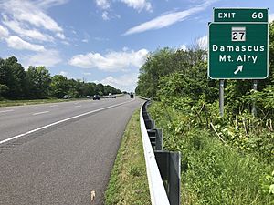
Maryland Route 27 (Ridge Road) also runs through the eastern part of town. It goes northeast to Westminster (about 16 miles) and southwest to Interstate 270 in Germantown (about 14 miles). Maryland Route 808 follows the older path of Maryland Route 27 through downtown Mount Airy.
Climate and Weather
Mount Airy has a mild, temperate climate with four clear seasons. The weather can change a lot because of cold air from the north and warm, humid air from the south. Being close to the Atlantic Coast also means the area gets enough rain from coastal storms.
The average yearly temperature is about 54 degrees Fahrenheit (12 degrees Celsius). January is usually the coldest month, and July is the warmest. Temperatures go above 90 degrees Fahrenheit (32 degrees Celsius) about 27 days a year.
Mount Airy gets about 45 inches (114 cm) of rain each year. February is usually the driest month, and August is the wettest. The growing season for plants lasts about 177 days, from April to September. The average snowfall in Mount Airy is about 28 inches (71 cm) per year.
Population and People
| Historical population | |||
|---|---|---|---|
| Census | Pop. | %± | |
| 1880 | 91 | — | |
| 1900 | 332 | — | |
| 1910 | 428 | 28.9% | |
| 1920 | 754 | 76.2% | |
| 1930 | 860 | 14.1% | |
| 1940 | 791 | −8.0% | |
| 1950 | 1,061 | 34.1% | |
| 1960 | 1,352 | 27.4% | |
| 1970 | 1,825 | 35.0% | |
| 1980 | 2,450 | 34.2% | |
| 1990 | 3,730 | 52.2% | |
| 2000 | 6,425 | 72.3% | |
| 2010 | 9,288 | 44.6% | |
| 2020 | 9,654 | 3.9% | |
| U.S. Decennial Census | |||
How Many People Live Here?
In 2010, there were 9,288 people living in Mount Airy. There were 3,107 households, which are groups of people living together in one home. About 2,453 of these were families. The town had about 2,254 people per square mile (870 people per square kilometer).
Most people in Mount Airy are White (92.1%). There are also African American (2.4%), Asian (2.2%), and Native American (0.2%) residents. About 4.7% of the population is Hispanic or Latino.
Families and Age Groups
In 2010, about half of the households (50.1%) had children under 18 living with them. Most households (65.2%) were married couples living together.
The average age of people in Mount Airy was 36.1 years old.
- 32% of residents were under 18.
- 6.1% were between 18 and 24.
- 28.2% were between 25 and 44.
- 25.4% were between 45 and 64.
- 8.3% were 65 years or older.
The town had slightly more females (51.5%) than males (48.5%).
Education in Mount Airy
Mount Airy has three elementary schools and one middle school.
Elementary Schools
- Mount Airy Elementary School: This school was built in 1935. It was updated in the mid-1980s with air conditioning and Internet access. It teaches students in grades 3–5.
- Parr's Ridge Elementary School: This school was built in 2005 because Mount Airy Elementary was getting too crowded. It teaches students from kindergarten to Grade 2.
- Twin Ridge Elementary School: This school is on the western side of Mount Airy. It is managed by Frederick County Public Schools, unlike the other two.
Middle and High Schools
- Mount Airy Middle School: The original middle school was built in 1958. It was a high school until 1965. A brand new middle school building was built and opened in 2013. The old building was taken down that same year.
For high school, students from the Carroll County part of Mount Airy go to South Carroll High School. It is about 10 miles (16 km) northeast of town. Students from the Frederick County part go to Linganore High School. It is about 7 miles (11 km) west of town.
Mount Airy also has a private school called Mount Airy Christian Academy. It offers education from pre-school all the way to 12th grade.
Notable People
- Joe Alexander (born 1986), a professional basketball player.
- Josh Boone (born 1984), an NBA player.
- John M. Gaver Sr. (1900–1982), a famous horse trainer in the Racing Hall of Fame.
- Rob Havenstein (born 1992), an NFL player.
See also
 In Spanish: Mount Airy (Maryland) para niños
 | Stephanie Wilson |
 | Charles Bolden |
 | Ronald McNair |
 | Frederick D. Gregory |


