Mount Molloy, Queensland facts for kids
Quick facts for kids Mount MolloyQueensland |
|||||||||||||||
|---|---|---|---|---|---|---|---|---|---|---|---|---|---|---|---|

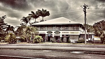
National Hotel, Mount Molloy, 2017
|
|||||||||||||||
| Population | 266 (2021 census) | ||||||||||||||
| • Density | 1.0518/km2 (2.724/sq mi) | ||||||||||||||
| Established | 1906 | ||||||||||||||
| Postcode(s) | 4871 | ||||||||||||||
| Area | 252.9 km2 (97.6 sq mi) | ||||||||||||||
| Time zone | AEST (UTC+10:00) | ||||||||||||||
| Location | |||||||||||||||
| LGA(s) | Shire of Mareeba | ||||||||||||||
| State electorate(s) | Cook | ||||||||||||||
| Federal Division(s) | Leichhardt | ||||||||||||||
|
|||||||||||||||
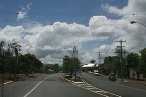
Mount Molloy is a small town and area in Queensland, Australia. It's known for its history in mining and timber. The town is about 55 kilometres (34 mi) north of Cairns. Today, the main activity in the area is raising cattle. In 2021, about 266 people lived in Mount Molloy.
Contents
Exploring Mount Molloy's Location
Mount Molloy is located where the waters of the Mitchell River and Barron River flow. You can find it near towns like Julatten, Mount Carbine, and Mount Mulligan. A road called Quaid Road ends just south of the town. The western part of Mount Molloy is where the town itself is. The central and eastern parts are protected areas, including Kuranda National Park.
A Look Back at Mount Molloy's Past
The land around Mount Molloy was originally home to the Djabugay people. Their language, also called Djabuganjdji or Tjupakai, was spoken in this part of Far North Queensland.
The town got its name from Patrick Molloy. He was an early traveler who discovered copper here in 1885. This discovery led to the start of Mount Molloy as a mining town.
Mining and Early Life
In the 1890s, Mount Molloy was a busy copper mining town. It was a common place for people to set up camp. Many Chinese market gardeners grew food like grain for the miners nearby.
The Molloy Post Office opened in 1905. It was later renamed Mount Molloy Post Office in 1982.
Schools and Railways
The Mount Molloy School of Arts, a community hall, opened in November 1905. It was quite large, measuring 60 by 50 feet (18 by 15 m).
Mount Molloy Provisional School started teaching students on July 23, 1906. By 1907, it had 75 students. It became Mount Molloy State School in 1909. The school had to move twice because of floods. It officially opened at its current spot in 1976.
A private railway line was built to Mount Molloy. It connected to the main line from Cairns to Mareeba at Biboohra. This railway opened in August 1908. It was built by a company called Mount Molloy Ltd to help with their copper smelting. The railway was later taken over by Queensland Railways in 1917. The branch line eventually closed in May 1964.
Between 2008 and 2013, Mount Molloy was part of the Tablelands Region.
Mount Molloy's Population
The number of people living in Mount Molloy has changed a bit over the years:
- In 2011, there were 273 people.
- In 2016, the population was 254 people.
- In 2021, the population was 266 people.
Places of Historical Importance
Mount Molloy has a few sites that are listed as important heritage places:
- James Venture Mulligan's Grave on Bakers Road.
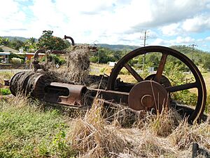
- Johnston's Sawmill Steam Plant at the corner of Santowski Crescent and Peninsular Development Road.
Learning in Mount Molloy
Mount Molloy State School is a government primary school. It teaches students from Prep to Year 6. The school is located at 30-40 Fraser Road. In 2018, it had 44 students.
There isn't a high school in Mount Molloy. Older students usually go to Mossman State High School in Mossman or Mareeba State High School in Mareeba.
Community Connections
The Mount Molloy branch of the Queensland Country Women's Association (CWA) is a local group. They meet at the CWA Hall on 31 Main Street.
 | Isaac Myers |
 | D. Hamilton Jackson |
 | A. Philip Randolph |


