Mount Wilkinson facts for kids
Quick facts for kids Mount Wilkinson |
|
|---|---|

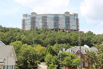
Mount Wilkinson in 2015
|
|
| Highest point | |
| Elevation | 981 ft (299 m) |
| Geography | |
| Parent range | Appalachian Mountains |
| Topo map | USGS Northwest Atlanta |
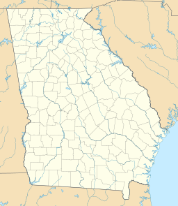
Mount Wilkinson is a small mountain in Cobb County, Georgia, USA. It is located just north of Vinings. Even though it looks tall from the ground, it's actually about the same height as the land around it. This is because it sits in the Chattahoochee River valley.
This mountain used to be called Signal Mountain. Today, many people know it as Vinings Mountain.
A famous story says that in 1864, during the American Civil War, U.S. Army General William Tecumseh Sherman stood on top of Vinings Mountain. From there, he supposedly saw the church spires of Atlanta for the very first time.
Today, Mount Wilkinson looks quite different. It has many tall office buildings on its top. These buildings are part of the Cumberland/Galleria area, which is a busy business center near Atlanta. There is also a small, private cemetery on the mountain. Hardy Pace, who helped start Vinings, is buried there. He also ran Pace's Ferry.
Why is it Called Mount Wilkinson?
Mount Wilkinson got its name from Mell B. Wilkinson. He was a co-founder and the first president of the Atlanta Scout Council. This mountain was once the home of the Bert Adams Scout Camp. This camp is now located near Covington, Georgia.
The Atlanta Rotary Club helped buy the mountain for the camp. They gave half of the money needed. Other smaller gifts quickly made up the rest.
From Scout Camp to Shopping Center
The Scout camp also owned land that was later sold. This land was used to build the Cumberland Mall and many other office buildings and apartments. Even today, you can find streets in the area named after the camp and the mountain. For example, there's Bert Adams Road and Mt. Wilkinson Parkway.
 | Janet Taylor Pickett |
 | Synthia Saint James |
 | Howardena Pindell |
 | Faith Ringgold |


