
Mureș County facts for kids
Quick facts for kids
Mureș County
Județul Mures
Maros megye
|
||
|---|---|---|

The Saschiz fortified church
|
||
|
||
 |
||
| Country | ||
| Development region1 | Centru | |
| Historic region | Transylvania | |
| County seat | Târgu Mureș | |
| Government | ||
| • Type | County Board | |
| Area | ||
| • Total | 6,714 km2 (2,592 sq mi) | |
| Area rank | 11th in Romania | |
| Population
(2021-12-01)
|
||
| • Total | 518,193 | |
| • Rank | 12th in Romania | |
| • Density | 82/km2 (210/sq mi) | |
| Time zone | UTC+2 (EET) | |
| • Summer (DST) | UTC+3 (EEST) | |
| Postal Code |
54wxyz3
|
|
| Area code(s) | +40 x654 | |
| Car plates | MS5 | |
| GDP (nominal) | US$ 8.120 billion (204) | |
| GDP per capita | US$ 7,068 (2015) | |
| Website | County Board County Prefecture |
|
| 1The developing regions of Romania have no administrative role. 2 as of 2007, the Prefect is not a politician, but a public functionary. He (or she) is not allowed to be a member of a political party, and is banned to have any political activity in the first six months after the resignation (or exclusion) from the public functionary corps 3w, x, y, and z are digits that indicate the city, the street, part of the street, or even the building of the address 4x is a digit indicating the operator: 2 for the former national operator, Romtelecom, and 3 for the other ground telephone networks 5used on both the plates of the vehicles that operate only in the county limits (like utility vehicles, ATVs, etc.), and the ones used outside the county |
||

Mureș County is a county in Romania, located in the historical region of Transylvania. Its main city and administrative center is Târgu Mureș. The county was created in 1968. This was part of a big change that brought back the old county system, which is still used today. Mureș County is known for its diverse cultures, including Hungarian-speaking Székelys and Transylvanian Saxons. It has a rich history with many fortified churches and towns.
Contents
What's in a Name?
In Hungarian, Mureș County is called Maros megye. In German, it's known as Kreis Mieresch. Before 1920, a similar area was called Maros-Torda County under the Kingdom of Hungary. Later, there was also a Mureș-Magyar Autonomous Region from 1960 to 1968.
Exploring Mureș Geography
Mureș County covers a total area of about 6,714 square kilometers.
The northeastern part of the county has mountains like the Călimani and Gurghiu. These are part of the Inner Eastern Carpathians. The rest of the county is part of the Transylvanian Plateau, which has wide valleys.
The most important river flowing through the county is the Mureș River. The Târnava Mare River and the Târnava Mică River also flow through this area.
Neighboring Counties
Mureș County shares borders with seven other counties:
- Harghita County to the East.
- Alba County and Cluj County to the West.
- Bistrița-Năsăud County and Suceava County to the North.
- Sibiu County and Brașov County to the South.
People of Mureș County
_county_ethnic.PNG)

In 2011, Mureș County had a population of 550,846 people. The population density was about 82 people per square kilometer.
Here's a look at the different groups of people living in Mureș County over the years:
| Ethnic structure (2002) | |||||||||||||
|---|---|---|---|---|---|---|---|---|---|---|---|---|---|
| Total | Romanians | Hungarians | Roma | Germans | Other | ||||||||
| 580,851 | 309,375 | 228,275 | 40,425 | 2,045 | 731 | ||||||||
| 100% | 53.26% | 39.30% | 6.96% | 0.35% | 0.12% | ||||||||
| Ethnic structure (2011) | |||||||||||||
|---|---|---|---|---|---|---|---|---|---|---|---|---|---|
| Total | Romanians | Hungarians | Roma | Germans | Other | ||||||||
| 550,846 | 277,372 | 200,858 | 46,947 | 1,478 | 792 | ||||||||
| 100% | 52.60% | 38.09% | 8.90% | 0.28% | 0.13% | ||||||||
| Ethnic structure (2021) | |||||||||||||
|---|---|---|---|---|---|---|---|---|---|---|---|---|---|
| Total | Romanians | Hungarians | Roma | Germans | Other | ||||||||
| 518,193 | 252,400 | 165,014 | 44,880 | 904 | 617 | ||||||||
| 100% | 54.42% | 35.58% | 9.68% | 0.19% | 0.13% | ||||||||
Most people in Mureș County are Romanian Orthodox (53.3%). Other religions include Reformed Church (27%) and Roman Catholic Church (9.5%).
| Historical population | ||
|---|---|---|
| Year | Pop. | ±% p.a. |
| 1930 | 425,721 | — |
| 1948 | 461,403 | +0.45% |
| 1956 | 513,261 | +1.34% |
| 1966 | 561,598 | +0.90% |
| 1977 | 605,345 | +0.68% |
| 1992 | 607,298 | +0.02% |
| 2002 | 580,851 | −0.44% |
| 2011 | 550,846 | −0.59% |
| 2021 | 518,193 | −0.61% |
Fun Places to Visit
Mureș County has many interesting places for tourists. Here are some of the main attractions:
- The old city of Târgu Mureș
- The medieval city of Sighișoara
- Sovata resort, known for its salty lakes
- The city of Reghin
- The medieval fortified church of Saschiz
- The beautiful Călimani Mountains and Gurghiu Mountains
- The Via Transilvanica trail, great for hiking and biking
Media and Communication
Mureș County has various ways for people to get news and entertainment. There are several TV and radio stations, both national and local. For example, you can find channels like TVR 1 and Pro TV, as well as local news channels like TTM. Radio stations include Radio România Târgu-Mureș and popular commercial stations like PRO FM and Kiss FM.
The county also has local newspapers and magazines such as Cuvântul Liber, Zi de Zi, and Népújság.
Economy and Industries
The main industries in Mureș County are:
- Wood industry: This involves processing wood from the forests.
- Food industry: Producing and preparing food products.
- Textiles: Making clothes and fabrics.
- Glass and ceramics: Creating glass and pottery items.
- Construction materials: Producing materials used for building.
- Musical instruments: Especially in the city of Reghin.
Mureș County, along with Sibiu County, produces about half of Romania's natural gas. Salt is also mined in the county.
How Mureș County is Organized
Mureș County is divided into different types of areas for administration. It has 4 large cities called municipalities, 7 smaller towns, and 91 communes (which are like rural districts with several villages).
Municipalities
- Târgu Mureș – This is the county's main city, with a population of 134,290 (as of 2011).
- Reghin
- Sighișoara
- Târnăveni
Towns
- Iernut
- Luduș
- Miercurea Nirajului
- Sângeorgiu de Pădure
- Sărmașu
- Sovata
- Ungheni
Communes
- Acățari
- Adămuș
- Albești
- Aluniș
- Apold
- Ațintiș
- Bahnea
- Band
- Batoș
- Băgaciu
- Băla
- Bălăușeri
- Beica de Jos
- Bereni
- Bichiș
- Bogata
- Brâncovenești
- Breaza
- Ceuașu de Câmpie
- Chețani
- Chibed
- Chiheru de Jos
- Coroisânmărtin
- Corunca
- Cozma
- Crăciunești
- Cucerdea
- Crăiești
- Cristești
- Cuci
- Daneș
- Deda
- Eremitu
- Ernei
- Fântânele
- Fărăgău
- Gălești
- Gănești
- Gheorghe Doja
- Ghindari
- Glodeni
- Gornești
- Grebenișu de Câmpie
- Gurghiu
- Hodac
- Hodoșa
- Ibănești
- Iclănzel
- Ideciu de Jos
- Livezeni
- Lunca
- Lunca Bradului
- Mădăraș
- Măgherani
- Mica
- Miheșu de Câmpie
- Nadeș
- Neaua
- Ogra
- Papiu Ilarian
- Pănet
- Păsăreni
- Petelea
- Pogăceaua
- Râciu
- Răstolița
- Rușii-Munți
- Sâncraiu de Mureș
- Sângeorgiu de Mureș
- Sânger
- Sânpaul
- Sânpetru de Câmpie
- Sântana de Mureș
- Sărățeni
- Saschiz
- Solovăstru
- Stânceni
- Suplac
- Suseni
- Șăulia
- Șincai
- Tăureni
- Valea Largă
- Vânători
- Vărgata
- Vătava
- Vețca
- Viișoara
- Voivodeni
- Zagăr
- Zau de Câmpie
Mureș County Through History
|
Județul Mureș
|
||
|---|---|---|
|
County (Județ)
|
||

The Mureș County Prefecture building of the interwar period.
|
||
|
||
 |
||
| Country | ||
| Historic region | Transylvania | |
| Capital city (Reședință de județ) | Târgu Mureș | |
| Established | 1925 | |
| Area | ||
| • Total | 4,856 km2 (1,875 sq mi) | |
| Population
(1930)
|
||
| • Total | 289,456 | |
| • Density | 59.608/km2 (154.384/sq mi) | |
| Time zone | UTC+2 (EET) | |
| • Summer (DST) | UTC+3 (EEST) | |

Historically, the area of Mureș County was part of Transylvania. Before World War I, it belonged to Austria-Hungary. In 1920, after the Treaty of Trianon, the territory became part of Greater Romania.
In 1938, Romania's King Carol II changed how the country was divided. Mureș County became part of a larger region called Ținutul Mureș.
However, in 1940, the county was given back to Hungary as part of Northern Transylvania during World War II. Romanian forces, with help from the Soviet Union, took the territory back in 1944. The Paris Peace Treaties, 1947 confirmed that the county belonged to Romania.
The county system was changed by the communist government in 1950, but then brought back in 1968. This is when the modern Mureș County was re-established.
Images for kids
-
The Mureș County Prefecture building of the interwar period.
-
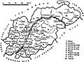
Map of Mureș County as constituted in 1938.
-
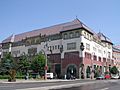
The Cultural Palace in Târgu Mureș, built between 1911 and 1913.
-
The historic city of Sighișoara.
-
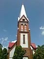
The Saxon Church in Reghin.
-
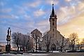
The Catholic Church in Luduș.
-
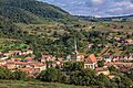
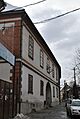
The fortified church in Saschiz.

.jpg)

.jpg)


See also
 In Spanish: Distrito de Mureș para niños
