National Register of Historic Places listings in Monroe County, Michigan facts for kids
Have you ever wondered about the oldest or most important buildings and places in your area? In Monroe County, Michigan, there's a special list called the National Register of Historic Places. This list helps protect and celebrate buildings, districts, and other sites that are important to American history, architecture, archaeology, engineering, or culture.
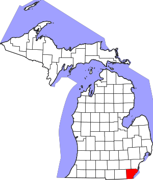
Monroe County has 19 places on this list. These include nine individual buildings or sites, five historic areas (called districts), and even one bridge! You can find a lighthouse, a statue, old houses, a trading post, a former factory, and a famous battlefield on the list. One of the historic districts is even an undeveloped archaeological site, which means it's a place where scientists study ancient human history. Many of these special places are in the city of Monroe. The oldest building on the list is the Navarre–Anderson Trading Post, built way back in 1789!
Contents
- Historic Places in Monroe County
- George Armstrong Custer Equestrian Monument
- Detroit River Light Station
- Dundee Historic District
- East Elm-North Macomb Street Historic District
- Edward Loranger House
- Governor Robert McClelland House
- Jefferson Avenue-Huron River and Harbin Drive-Silver Creek Canal Bridges
- Main Street Historic District (Milan, Michigan)
- Navarre-Anderson Trading Post
- Rudolph Nims House
- North Maumee Bay Archeological District
- Old Village Historic District (Monroe, Michigan)
- River Raisin National Battlefield Park
- Sawyer House (Monroe, Michigan)
- St. Mary's Church Complex Historic District
- Weis Manufacturing Company
- Wing–Allore House
- Former Listings
Historic Places in Monroe County
George Armstrong Custer Equestrian Monument
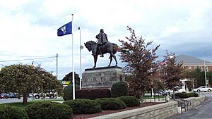
This impressive statue honors George Armstrong Custer, a famous cavalry officer who spent part of his childhood in Monroe. The statue shows him on horseback. It was first shown to the public in 1910 by President William Howard Taft and Custer's wife, Elizabeth Bacon Custer. The statue has moved a few times but found its current spot in 1955. It's a well-known landmark in Monroe.
Detroit River Light Station
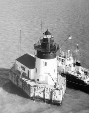
Built in 1885, this lighthouse stands in Lake Erie, near where the Detroit River meets the lake. It's about three miles (4.8 km) off the coast of the Pointe Mouillee State Game Area. This lighthouse is still working today, but it's fully automatic, so no one lives there anymore. You can't visit it, as it's owned and operated by the United States Coast Guard.
Dundee Historic District
This historic area in Dundee is sometimes called the "Triangle District" because of its unique shape. Some buildings here date back to 1866, but people started settling in this area as early as 1825. The district is located along the River Raisin and features beautiful buildings with Italianate and Greek Revival architecture styles. Today, these buildings house different shops and government offices.
East Elm-North Macomb Street Historic District
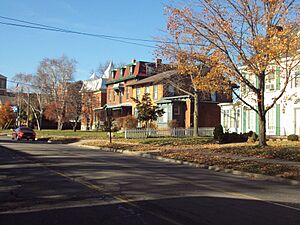
This district in Monroe is known for its large, grand houses. Some of these homes were built in the 1820s! You can see a mix of architectural styles here, including Greek Revival, Federal, Second Empire, and Victorian architecture. Important people from Monroe's past, like Robert McClelland, lived in this area. Today, these beautiful homes are still privately owned and are among the biggest in Monroe.
Edward Loranger House
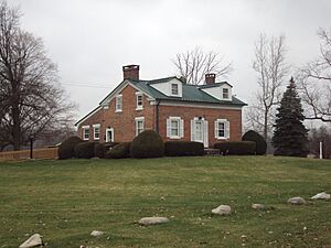
The Edward Loranger House was built in 1825 by Edward Loranger, a famous local bricklayer, landowner, and architect. It's one of the oldest buildings in Monroe County that is still standing in its original spot. Other buildings that were once on this property, like Loranger's sawmill, have been moved to The Henry Ford museum. But his house remains where it was built and has been carefully restored by its current owner.
Governor Robert McClelland House
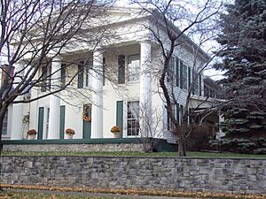
This house, built in 1841, was once home to Robert McClelland. He was a very important politician who served at local, state, and national levels. His house is a great example of Greek Revival architecture. Today, it's a privately owned home and is also part of the East Elm-North Macomb Street Historic District.
Jefferson Avenue-Huron River and Harbin Drive-Silver Creek Canal Bridges
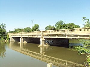
This listing actually includes two bridges. The main one is the Jefferson Avenue Bridge, which crosses the Huron River. The smaller one is the Harbin Drive Bridge over the Silver Creek Canal. Only the Jefferson Avenue Bridge is in Monroe County. It connects Monroe County to Wayne County and is also listed as a historic place in Wayne County.
Main Street Historic District (Milan, Michigan)
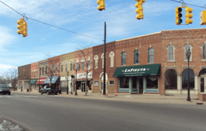
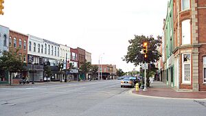
The Main Street Historic District is a commercial area in Milan with many historic buildings. These buildings were originally used as a hotel, city hall, fire station, post office, church, hospital, meeting hall, and even a theater! This district is unique because it crosses the county line between Washtenaw County, Michigan and Monroe County, Michigan. So, it's listed as a historic place in both counties.
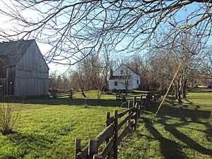
The main building of the Navarre-Anderson Trading Post was built in 1789, making it the oldest wooden house in Michigan! The cookhouse was built in 1810, and other buildings, like the barn, are replicas. The original buildings were moved from their first location in 1894. Today, the complex has been restored and is located near North Custer Road and Raisinville Road, outside of Frenchtown Township, along the River Raisin.
Rudolph Nims House
The Rudolph Nims House was built between 1836 and 1846 in the Greek Revival architecture style. Rudolph Nims bought the house in 1848, and his family owned it for over 100 years! The house has been changed and added to over time, but the front part still looks original. Today, it's a privately owned home in Monroe.
North Maumee Bay Archeological District
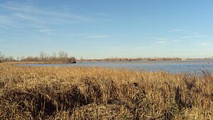
The exact location of this archaeological site is kept secret to protect it. However, we know it covers the area of the North Maumee Bay where the Ottawa River and Maumee River meet Lake Erie. This quiet area includes the Woodtick Peninsula, Garb Island, Indian Island, the Erie Fish and Hunt Club, and many grassy shorelines and wetlands. It's an important place for studying ancient history.
Old Village Historic District (Monroe, Michigan)
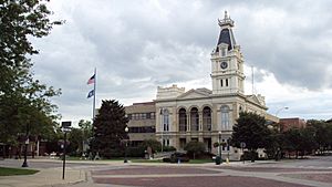
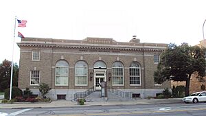
This district is in downtown Monroe, mainly around Front Street and Monroe Street. Some buildings here date back to 1830! Today, these buildings are home to various shops and apartments. The district also includes the historic courthouse (built in 1880) and the city's first post office (built in 1913), which is now a museum.
River Raisin National Battlefield Park
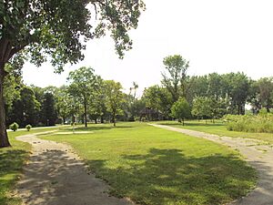
The River Raisin National Battlefield Park is a special park that is part of the National Park Service. It's located along the River Raisin in Monroe. This park remembers the Battle of Frenchtown, which happened during the War of 1812. The park is still being developed, but it's an important place to learn about this historical battle.
Sawyer House (Monroe, Michigan)
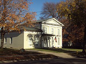
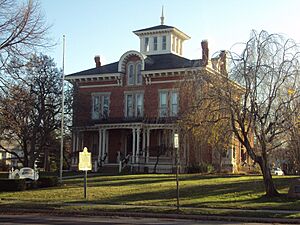
This beautiful Italianate style house is on one of the oldest pieces of land settled by Europeans in Monroe, dating back to 1785! The current house was built in 1873. A famous resident was Dr. Alfred Sawyer, who lived there from 1859 to 1870. In 1938, the house was given to the city of Monroe. Today, the Sawyer House is open to the public for many different events.
St. Mary's Church Complex Historic District
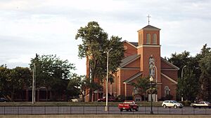
This historic complex includes four main buildings: St. Mary Church, the rectory (where the priest lives), St. Mary Catholic Central High School, and the Brothers of Holy Cross Hall. The church itself started in 1788, making it one of the oldest Catholic churches still operating. The current church building, built in 1835, is famous for its Gothic Revival architecture. It continues to be a very important religious place in Monroe.
Weis Manufacturing Company
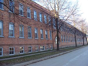
This large building complex was built between 1905 and 1912. For many years, it was a major employer in Monroe. The company made office equipment. Later, in 1964, it became a factory for La-Z-Boy furniture. The factory closed in 1978. In 1980, the city of Monroe bought the empty building and turned it into a residential hall for senior citizens.
Wing–Allore House
The Wing–Allore House is another historic home located in Monroe. It was added to the National Register of Historic Places in 2014.
Former Listings
Sometimes, a place is removed from the National Register of Historic Places. This usually happens if the building is torn down or changed so much that it no longer looks like it did historically.
Fix House
The Fix House was a brick house built in 1853 in the style of French-Canadian cottages. It was one of only about fifteen such buildings identified in Monroe County, which was settled by French pioneers in the 1780s. Sadly, the Fix House was torn down in 1980 and was removed from the list in 1981.


