
National Register of Historic Places listings in Pima County, Arizona facts for kids

Welcome, young history explorers! This article is all about the amazing and historic places in Pima County, Arizona that are listed on the National Register of Historic Places. Think of the National Register as a special list kept by the U.S. government. It helps protect buildings, sites, and objects that are important to American history, architecture, archaeology, engineering, or culture.
Pima County is home to over 200 of these cool historic spots! Some are even more special and are called National Historic Landmarks, which means they are super important to the whole country's history. Let's discover some of these fascinating places together!
Contents
Cool Historic Places in Pima County
Pima County has many different types of historic places, from old houses and schools to ranches and even a missile museum! Each one tells a unique story about the past.
Historic Homes and Districts
Many places on the list are old homes or groups of homes called "historic districts." These districts show us how people lived long ago and what their neighborhoods looked like.
- James P. and Sarah Adams House: This house in Tucson is a great example of an old home that has been preserved.
- Aldea Linda Residential Historic District: This neighborhood in Tucson was built around 1947. It has large lots and houses set back from the street, showing how neighborhoods were planned back then. A future state governor, Sam Goddard, helped develop it!
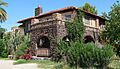
- Arthur Olaf and Helen S. Anderson House: Another historic home in Tucson, showing the different styles of houses from the past.
- Grace and Elliot Brown House: This house is also in Tucson and is recognized for its historical value.
- P.W. Fletcher House: Located in Tucson, this house adds to the rich history of homes in the area.
- John P. and Helena S. Corcoran House: This Tucson home is another example of a preserved historic residence.
- Phillip G. McFadden House: You can find this historic house in Tucson too.
- Nellie Mae Kellogg Van Schaick House: This house in Tucson is also on the National Register.
- Betty-Jean Wilson House: Another historic home in Tucson, adding to the list of important residences.
- Herbert and Irma Woollen House: This Tucson house is also recognized for its historical significance.
- Harold Bell Wright Estate: This estate in Tucson belonged to the famous author Harold Bell Wright.
- Harold Bell Wright Estates: This area was developed in 1950 on the land that used to be Harold Bell Wright's estate. It shows how land was used and developed over time.
- Cordova House: This house in Tucson, built a long time ago, is a great example of early architecture.
- Dodson-Esquivel House: Another historic house in Tucson, showing the different styles of homes.
- First Joesler House: This house in Tucson is special because it was designed by a famous architect.
- Gabel House: This historic house is also located in Tucson.
- Hecker House: You can find this historic house in Tucson as well.
- Professor George E. P. Smith House: This house in Tucson belonged to a professor and is recognized for its history.
- Sosa–Carrillo–Fremont House: This house in Tucson is a very old and important building.
- Schwalen-Gomez House: Another historic house in Tucson.
- Don Martin Apartment House: This apartment building in Tucson is also on the list.
- El Encanto Apartments: These apartments in Tucson are recognized for their historical design.
- Villa Catalina: This apartment complex in Tucson is also a historic site.
- Type A at 2101 E. Water St & Type B at 2019 E. Water St: These two buildings in Tucson are examples of specific types of historic architecture.
Important Buildings and Landmarks
Pima County has many buildings that played a big role in its history, from old hotels to government buildings.
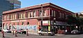
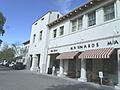
- Arizona Daily Star Building: This building in Tucson used to house a major newspaper.
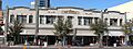
- Arizona Hotel: An old hotel in Tucson that has a lot of history.
- Arizona Inn: This historic hotel in Tucson is a beautiful example of old architecture.
- Coronado Hotel: Another historic hotel in Tucson.
- Hotel Congress: This famous hotel in Tucson has a long and interesting past.
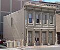
- First Hittinger Block: An important commercial building in Tucson.
- J. C. Penney-Chicago Store: This building in Tucson was once a big department store.
- Julian-Drew Building: Another historic commercial building in Tucson.
- Rebeil Block: This building in Tucson is also recognized for its historical importance.
- Rialto Building & Rialto Theatre: These two buildings in Tucson are important for their history in entertainment and business.
- Valley National Bank Building: This building in Tucson was once a major bank.
- James A. Walsh U.S. Courthouse: This building in Tucson served as a courthouse and post office.
- Pima County Courthouse: The old courthouse in Tucson is a very important historical building.
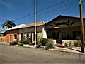
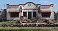
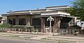
- El Paso and Southwestern Railroad Depot: This train station in Tucson opened in 1912 and was a busy place for travelers and goods.
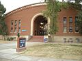
- Old Library Building, University of Arizona: This building on the University of Arizona campus is now the Arizona State Museum.
- Old Main, University of Arizona: This is the oldest building on the University of Arizona campus.
- Bear Down Gym: This gym on the University of Arizona campus is a historic sports building.
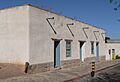
- University Heights Elementary School: This old school in Tucson is recognized for its history.
- Catalina American Baptist Church: This church in Tucson is a historic religious building.
- Santa Cruz Catholic Church: This church in Tucson is also a historic religious site.
- St. Philip's in the Hills Episcopal Church: This beautiful church in Tucson is recognized for its architecture and history.
- San Pedro Chapel: This chapel in Tucson is a historic place of worship.
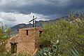
- Shrine of Santa Rita in the Desert: This shrine near Vail is a special religious site.
- El Tiradito: This small shrine in Tucson is a unique and historic spot.
Ranches, Parks, and Natural Sites
Pima County also has many historic ranches, parks, and natural areas that are important for their history or archaeology.
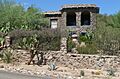
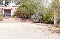
- Agua Caliente Ranch Rural Historic Landscape: This ranch in Tucson is recognized for its historic landscape.
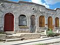
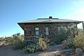
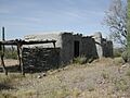
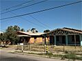
- Bates Well Ranch: This ranch near Ajo is an important historic site.
- Canoa Ranch Headquarters Historic District: This ranch near Green Valley has a long history.
- Deep Well Ranch: This ranch in Tucson is also a historic site.
- Dos Lomitas Ranch: Located in the Organ Pipe Cactus National Monument, this ranch is a historic part of the area.
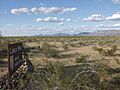
- Empire Ranch: East of Greaterville, this ranch is a centerpiece of the Las Cienegas National Conservation Area.
- Empirita Cattle Ranch Rural Historic District: This ranch area between Vail and Benson is recognized for its historic cattle ranching.
- Steam Pump Ranch: This ranch in Oro Valley has a unique history related to water.
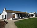
- Robles Ranch House: This ranch house near Robles Junction was established in 1882.
- Fort Lowell Park: This park in Tucson was once a military fort.
- Colossal Cave Preservation Park Historic District: This park near Vail includes the famous Colossal Cave.
- Cocoraque Butte Archaeological District: This site near Tucson is important for its ancient history.
- Gunsight Mountain Archeological District: This area near Three Points is an important archaeological site.
- Los Robles Archaeological District: This site near Red Rock is also important for its ancient history.
- Rincon Mountain Foothills Archeological District: This area near Tucson has many archaeological findings.
- Sutherland Wash Archeological District & Sutherland Wash Rock Art District: These areas near Tucson are important for ancient rock art and archaeological discoveries.
- The Tumamoc Hill Archeological District: This hill in Tucson is a very important archaeological site.
- University Indian Ruin Archeological Research District: This area near Tucson is a site for studying ancient ruins.
- Upper Davidson Canyon Archeological District: This area near Sonoita is also important for archaeology.
- Valencia Site (BB:13:15;BB:13:74): This site in Tucson is recognized for its archaeological importance.
- Ventana Cave: This cave near Santa Rosa is a National Historic Landmark because of its very old history.
- I'itoi Mo'o-Montezuma's Head and 'Oks Daha-Old Woman Sitting: These natural formations in the Organ Pipe Cactus National Monument are culturally significant.
Other Unique Historic Sites
Pima County also has some truly unique historic places that don't fit neatly into other categories.
- Titan Missile Museum: Located in Green Valley, this is a real, former missile site! It's a National Historic Landmark and a museum where you can learn about the Cold War.
- Ajo Townsite Historic District: This whole town in Ajo is a historic district, showing how mining towns were built.
- Desert Laboratory: West of Tucson, this laboratory on Tumamoc Hill is a National Historic Landmark important for science.
- El Camino Del Diablo: This "Devil's Highway" northwest of Lukeville is an old, historic trail.
- El Conquistador Water Tower: This water tower in Tucson is a historic landmark.
- Fourth Avenue Underpass & Sixth Avenue Underpass & Stone Avenue Underpass: These underpasses in Tucson are recognized for their engineering and history.
- Fox Commercial Building & Fox Tucson Theatre: These buildings in Tucson are important for their role in business and entertainment.
- Ghost Ranch Lodge: This old lodge in Tucson is a historic place to stay.
- Gist Residence: This residence in Tucson is also a historic site.
- John and Isabella Greenway House: This house in Ajo belonged to important historical figures.
- Haynes Building: This building in Tucson is recognized for its history.
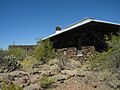
- Lowell Ranger Station: Northeast of Tucson, this station in the Coronado National Forest was important for forest management.
- Manning Cabin: East of Tucson in the Saguaro National Park, this cabin is a historic structure.
- Levi H. Manning House: This house in Tucson belonged to an important person in the city's history.
- Marist College Historic District: This area in Tucson includes the historic Marist College.
- Antonio Matus House and Property: This property in Tucson is recognized for its historical significance.
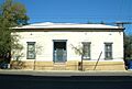
- Old Vail Post Office: This old post office in Vail is a historic building.
- Pascua Cultural Plaza: This plaza in Tucson is important for its cultural history.
- Southern Pacific 1673: This old train locomotive in Tucson is a cool piece of transportation history.
- USDA Tucson Plant Materials Center: This center in Tucson is recognized for its work with plants.
- Sasabe Port of Entry: This old border station in Sasabe is part of the U.S. Border Inspection Stations.
- Valley of the Moon: This unique place in Tucson is recognized for its special design.
- Velasco House: This house in Tucson is a historic building.
- Solomon Warner House and Mill: This house and mill in Tucson were built in 1875 and are important for the area's early industry.
Military and Mining History
Pima County also has sites related to its military and mining past.
- Cavalry Corrals, Officer's Quarters, Post Trader's Store and Riallito House, Post Trader's Storehouse, Quartermaster Storehouse, Quartermaster's Corrals, Site No. HD 4-8A, Site No. HD 5-26, Site Nos. HD 5-28/5-25, Site No. HD 7-0A, Site No. HD 7-13, Site Nos. HD 9-11/9-2, Site No. HD 9-28, Site Nos. HD 12-4/12-8, Site No. HD 13-4, Site No. HD 13-11, Site No. HD 13-13: These many sites around Fort Lowell in Tucson are all parts of the old military fort, showing where soldiers lived and worked.
- Bull Pasture: East of Lukeville, this site is part of the Organ Pipe Cactus National Monument and has historical significance.
- Gachado Well and Line Camp: East of Lukeville, this site is also in the Organ Pipe Cactus National Monument and was important for ranching.
- Growler Mine Area & Milton Mine & Victoria Mine: These old mine sites near Lukeville are important for understanding the history of mining in the area.
Historic Districts (Neighborhoods)
These are entire neighborhoods that are recognized for their historical importance and unique character.
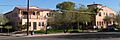
- Armory Park Historic Residential District: This large neighborhood in Tucson has many historic homes.
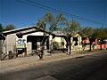
- Barrio Anita: This historic neighborhood in Tucson was named after Annie Hughes.
- Barrio El Hoyo Historic District: Another historic neighborhood in Tucson.
- Barrio El Membrillo Historic District: This neighborhood in Tucson is also recognized for its history.
- Barrio Libre: This historic neighborhood in Tucson is known for its unique character.
- Barrio Santa Rosa: Another historic neighborhood in Tucson.
- Binghampton Rural Historic Landscape: This area in Tucson is recognized for its historic rural landscape.
- Blenman-Elm Historic District: This neighborhood in Tucson is a historic district.
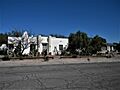
- Catalina Vista Historic District: This neighborhood in Tucson is also a historic district.
- Colonia Solana Residential Historic District: This neighborhood in Tucson is recognized for its historic homes.
- DeGrazia Gallery in the Sun Historic District: This area in Tucson includes the studio and home of artist Ettore DeGrazia.
- El Encanto Estates Residential Historic District: This neighborhood in Tucson was developed around 1928.
- El Montevideo Historic District: This neighborhood in Tucson is also a historic district.
- El Presidio Historic District: This area in Tucson is one of the oldest parts of the city.
- Feldman's Historic District: This neighborhood in Tucson was named after Alther M. Feldman, a homesteader and photographer.
- Indian House Community Residential Historic District: This community in Tucson is recognized for its historic homes.
- Indian Ridge Historic District: This area in Tucson is a historic district.
- Iron Horse Expansion Historic District: This neighborhood in Tucson is also a historic district.
- Jefferson Park Historic District: This neighborhood in Tucson has streets named after trees.
- Kentucky Camp Historic District: This area near Sonoita is a ghost town and former mining camp.
- Menlo Park Historic District: This neighborhood in Tucson is recognized for its history.
- Pie Allen Historic District: This neighborhood in Tucson is also a historic district.
- Rincon Heights Historic District: This neighborhood in Tucson is a historic district.
- San Clemente Historic District: This area in Tucson is a historic district.
- San Rafael Estates: This neighborhood in Tucson is also a historic district.
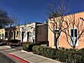
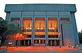
- Tucson Community Center Historic District: This area in Tucson is now known as the Tucson Convention Center.
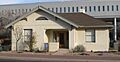
- Tucson Veterans Administration Hospital Historic District: This hospital in Tucson is recognized for its history.
- Tucson Warehouse Historic District: This area in Tucson includes the historic Amtrak Station.
- University of Arizona Campus Historic District: The campus of the University of Arizona itself is a historic district!
- West University Historic District: This neighborhood in Tucson is also a historic district.
- Winterhaven Historic District: This neighborhood in Tucson is known for its historic homes.
Bridges
Even bridges can be historic!
- Ciénega Bridge: Southeast of Vail, this bridge is recognized for its engineering and history.
Images for kids
-
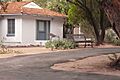
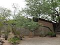
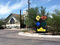
A historical marker at Agua Caliente Ranch.
-
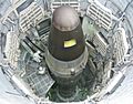
The Titan Missile Museum, a National Historic Landmark.
-
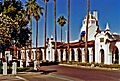
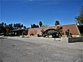
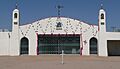
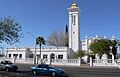
The historic Ajo Plaza.
-
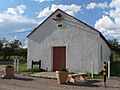
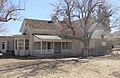
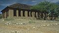
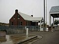
The Arivaca Schoolhouse, built in 1879.
-
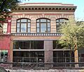
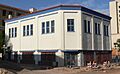
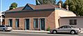
The Arizona Daily Star Building in Tucson.
-
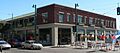
The historic Arizona Hotel in Tucson.
-
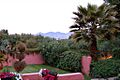
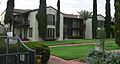
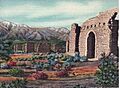
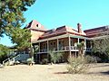
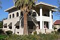
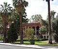
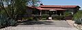
A garden at the Arizona Inn.
-
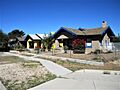
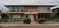
An old adobe house in the Armory Park Historic Residential District.
-
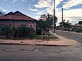
A street in Barrio Anita.
-
A building in Barrio El Hoyo Historic District.
-
A historic home in Barrio El Membrillo Historic District.
-
A street scene in Barrio Libre.
-
A building in Barrio Santa Rosa.
-
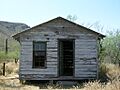
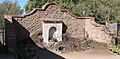
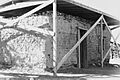
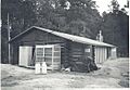
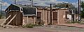
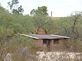
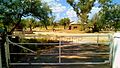
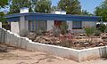
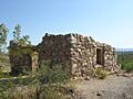
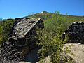
The bunkhouse at Bates Well Ranch.
-
A street in Blenman-Elm Historic District.
-
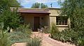
The Blixt-Avitia House in Tucson.
-
The Boudreaux-Robison House in Tucson.
-
The Bray-Valenzuela House in Tucson.
-
The Dr. William Austin Cannon House.
-
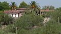
The Canoa Ranch Headquarters Historic District.
-
A street in Catalina Vista Historic District.
-
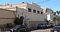
The Catalina American Baptist Church.
-
The Cavalry Corrals at Fort Lowell.
-
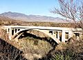
The historic Ciénega Bridge.
-
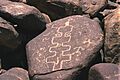
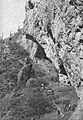
Cocoraque Butte, an archaeological district.
-
The Copper Bell Bed and Breakfast.
-
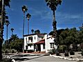
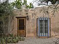
The Cordova House in Tucson.
-
The Coronado Hotel in Tucson.
-
A view of Deep Well Ranch.
-
The chapel at DeGrazia Gallery in the Sun Historic District.
-
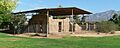
The Desert Laboratory on Tumamoc Hill.
-
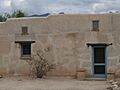
The Dodson-Esquivel House in Tucson.
-
The Don Martin Apartment House.
-
The ranch house at Dos Lomitas Ranch.
-
A view of El Camino Del Diablo.
-
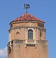
The El Conquistador Water Tower.
-
The El Encanto Apartments.
-
A street in El Encanto Estates Residential Historic District.
-
A street in El Montevideo Historic District.
-
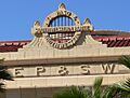
The emblem on the El Paso and Southwestern Railroad Depot.
-
A street in El Presidio Historic District.
-
The El Tiradito shrine.
-
The Eleven Arches building.
-
The headquarters building at Empire Ranch.
-
A street in Feldman's Historic District.
-
The First Hittinger Block.
-
The First Joesler House.
-
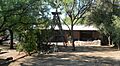
A building at Fort Lowell Park.
-
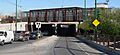
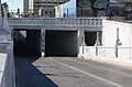
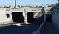
The Fourth Avenue Underpass.
-
The Fox Commercial Building.
-
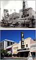
The Fox Tucson Theatre.
-
The Gabel House.
-
Gachado Well and Line Camp.
-
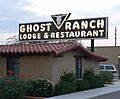
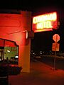
The sign for Ghost Ranch Lodge.
-
The Gist Residence.
-
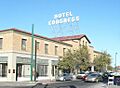
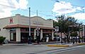
The historic Hotel Congress.
-
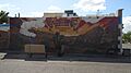
A mural in the Iron Horse Expansion Historic District.
-
The J. C. Penney-Chicago Store.
-

The Julian-Drew Building.
-
The office building at Kentucky Camp Historic District.
-
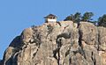
The Lemmon Rock Lookout House.
-

A view of the Los Robles Archaeological District.
-
A residence at Lowell Ranger Station.
-
The Manning Cabin.
-
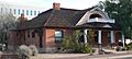
The Levi H. Manning House.
-
Marist College in Tucson.
-
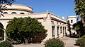
Bear Down Gym at the University of Arizona.
-
A street in Menlo Park Historic District.
-
The Officer's Quarters at Fort Lowell.
-
The Old Adobe Patio, also known as Charles O. Brown House.
-

The Old Library Building, now the Arizona State Museum.
-
Old Main at the University of Arizona.
-
The Old Vail Post Office.
-
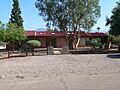
The chapel at Pascua Cultural Plaza.
-
The Pima County Courthouse.
-
The Post Trader's Store and Riallito House.
-
The Post Trader's Storehouse.
-
The Quartermaster Storehouse.
-
The Ramada House.
-
The Rebeil Block.
-
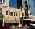
The Rialto Building.
-
The Rialto Theatre.
-
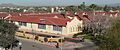
The grandstand at Rillito Race Track.
-
A street in Rincon Heights Historic District.
-
The Ronstadt House.
-
The Ronstadt-Sims Adobe Warehouse.
-
St. Philip's in the Hills Episcopal Church.
-
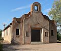
The San Pedro Chapel.
-
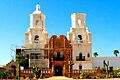
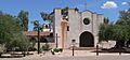
Mission San Xavier del Bac.
-
Santa Cruz Catholic Church.
-

The Schwalen-Gomez House.
-
Site No. HD 5-26.
-
Site Nos. HD 5-28/5-25.
-
The Sixth Avenue Underpass.
-
The Professor George E. P. Smith House.
-
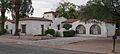
The Sosa-Carrillo-Fremont House.
-
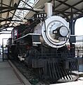
Southern Pacific Railroad Locomotive No. 1673.
-
A marker in the John Spring Neighborhood Historic District.
-
Steam Pump Ranch.
-
The Stone Avenue Underpass.
-
The Charles S. Todd House.
-
The Tucson Community Center Historic District.
-
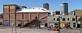
The historic Amtrak Station in the Tucson Warehouse Historic District.
-
Tumamoc Hill.
-
Type A at 2101 E. Water St.
-
Type B at 2019 E. Water St.
-
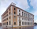
The James A. Walsh U.S. Courthouse.
-
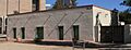
University Heights Elementary School.
-
A building on the University of Arizona campus.
-
The Administration building at USDA Tucson Plant Materials Center.
-
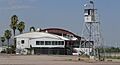
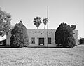
The U.S. Inspection Station-Sasabe, Arizona.
-
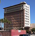
The Valley National Bank Building.
-
The Nellie Mae Kellogg Van Schaick House.
-
The Velasco House.
-
Ventana Cave.
-
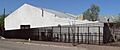
A stone building at Victoria Mine.
-
Villa Catalina Apartments.
-
The Solomon Warner House and Mill.
-
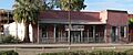
Time Market in the West University Historic District.
-
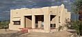
A home in the Harold Bell Wright Estates.


.jpg)


_from_S_2.JPG)
_from_E_1.JPG)
_from_SE_1.JPG)


.jpg)
_from_S_1.JPG)


_from_SE_1.JPG)


_from_SE_1.JPG)


_top_from_ESE_1.JPG)
_3.JPG)


_emblem.JPG)

_3.JPG)


_from_SW_1.JPG)


_sign_from_E_1.JPG)


_from_NE.JPG)


_residence_1.JPG)

_from_SE_1.JPG)
_from_NE_1.JPG)


_from_NE_1.JPG)


_2.JPG)

_from_NW_1.JPG)


_from_SE_1.JPG)
_from_NE_1.JPG)
_from_S_2.JPG)
_from_NE_1.JPG)

_from_E_2.JPG)
_from_E_1.JPG)


_3.JPG)


_from_S_4.JPG)


.JPG)


_from_SW_1.JPG)


_bldg_O_from_N_1.JPG)


