National Register of Historic Places listings in Suffolk County, Massachusetts facts for kids
Have you ever wondered about old buildings and special places that tell a story about the past? In Suffolk County, Massachusetts, there's a list of these amazing spots! It's called the National Register of Historic Places. This list helps protect important buildings, areas, and objects that have a lot of history.
When a place is on this list, it means it's recognized as special and important to the history of the United States. You can even find the exact locations of many of these places on a map using their latitude and longitude coordinates.
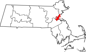
In Suffolk County, there are 343 places and areas on this list. A big part of these, 58 to be exact, are even more special and are called National Historic Landmarks. Most of these amazing places, over 300 of them, are in the city of Boston. Boston's historic places are listed separately because there are so many! This article will focus on the historic places in the other three towns in Suffolk County: Chelsea, Revere, and Winthrop.
-
- '
Historic Places in Boston
Boston has so many historic places that its list is divided into two parts: northern and southern Boston. The Massachusetts Turnpike highway helps divide these two areas.
Northern Boston's History
Northern Boston has 145 places on the National Register. This includes 39 historic districts (which are areas with many historic buildings), 48 important landmarks, and three very special National Historic Landmark Districts.
Southern Boston's History
Southern Boston, which also includes places in Boston Harbor, has 153 listings. This area has 45 historic districts, 12 landmarks, and one National Historic Landmark District.
Two historic areas are so large they stretch across both northern and southern Boston:
- The 1767 Milestones are old markers found in both parts of the city.
- The Olmsted Park System is a large group of parks that goes through much of Boston.
| Area | Image | First Date Listed | Last Date Listed | Count |
|---|---|---|---|---|
| Northern Boston | 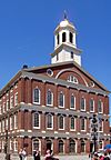 |
October 15, 1966 | December 29, 2015 | 145 |
| Southern Boston |  |
October 15, 1966 | July 18, 2016 | 153 |
Historic Places in Other Towns
Besides Boston, Suffolk County also has historic places in Chelsea, Revere, and Winthrop. Here are some of the interesting ones:
Chelsea's Historic Gems
Chelsea is home to several important historic sites.
Bellingham Square Historic District
This historic district is an area roughly bounded by Broadway, Shawmut, Chestnut, and Shurtleff Streets. It was added to the list on January 3, 1985. It shows what a neighborhood looked like long ago.
Bellingham-Cary House
The Bellingham-Cary House is located at 34 Parker Street. This house was added to the list on September 6, 1974. It is a very old and important building in Chelsea.
Chelsea Garden Cemetery
This cemetery, found at 70 Central Avenue, is not just a burial ground. It's also a historic place! It was listed on February 9, 2001.
Congregation Agudath Shalom
This historic synagogue is at 145 Walnut Street. It was recognized for its importance on April 16, 1993.
Downtown Chelsea Residential Historic District
This large historic area includes streets like Shurtleff, Marginal, and Division, and Bellingham Square. It was added to the list on June 22, 1988, showing the historic homes in the downtown area.
C. Henry Kimball House
The C. Henry Kimball House, at 295 Washington Avenue, is another historic home in Chelsea. It was listed on April 15, 1982.
Located at 1 Broadway, this district was once a naval hospital. It became a historic district on August 14, 1973.
Luna Tugboat
The Luna is a very special tugboat. It was the first diesel-electric ship docking tugboat ever made! Now, it's the last full-size wooden tugboat still around. It was listed as a National Historic Landmark on October 6, 1983.
Revere's Historic Spots
Revere also has many places that tell its story.
Church of Christ
This church, located at 265 Beach Street, was listed on November 13, 1984. It's an important part of Revere's history.
Immaculate Conception Rectory
The rectory, at 108 Beach Street, was added to the list on February 11, 2002.
Revere Beach Reservation
Revere Beach is a famous landmark! It was the first public beach in the United States. It was listed as a National Historic Landmark on May 27, 2003. The larger Revere Beach Reservation Historic District, which includes the beach and its surroundings, was listed on July 15, 1998.
Revere City Hall and Police Station
These important city buildings, at 281 Broadway and 23 Pleasant Street, were listed on March 7, 2012.
Mary T. Ronan School
The Mary T. Ronan School, at 154 Bradstreet Avenue, was added to the list on December 10, 1982.
Rumney Marsh Burying Ground
This old burying ground, located at Butler Street near Elm and Bixby Streets, was listed on February 11, 2004. It's a place where many early residents were buried.
Winthrop Parkway
The Winthrop Parkway is part of a larger park system. This section in Revere was listed on January 21, 2004.
Winthrop's Historical Sites
Winthrop has some unique historic places too.
Fort Banks Mortar Battery
Located on Kennedy Drive, this old military battery was listed on March 12, 2007. It was once part of a fort protecting the harbor.
Highland School
The Highland School, at 36 Grovers Avenue, was added to the list on March 18, 2014.
Edward B. Newton School
This school, at 131 Pauline Street, was listed on August 18, 1997.
Winthrop Center/Metcalf Square Historic District
This historic district includes an area roughly bounded by Lincoln, Winthrop Streets, Winthrop Cemetery, and other nearby streets. It was listed on March 23, 2010.
Deane Winthrop House
The Deane Winthrop House, at 34 Shirley Street, is a very old and important house. It was listed on March 9, 1990.
Winthrop Shore Drive
This scenic drive along the coast is part of the Metropolitan Park System. The section in Winthrop was listed on January 21, 2004.
Images for kids


