
National Register of Historic Places listings in southern Boston facts for kids

Welcome to the historic side of Boston, Massachusetts! This amazing city is packed with places that tell stories from the past. Many of these special spots are listed on the National Register of Historic Places. This means they are important to American history, architecture, or culture.
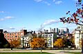
Boston is divided by the Massachusetts Turnpike. This article will explore the cool historic places found in the southern part of the city. There are 174 such places here, including 13 that are so important they are called National Historic Landmarks! Some historic areas, like the old 1767 Milestones and the beautiful Olmsted Park System, stretch across both northern and southern Boston.
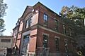
Contents
Historic Parks and Green Spaces
Boston has many beautiful parks and green areas that are also important historic sites. These places offer a glimpse into how people used to relax and enjoy nature.
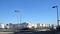
Arnold Arboretum
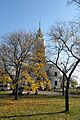
The Arnold Arboretum is a huge, living museum of trees and plants. It's located in Jamaica Plain and Roslindale. This special place was created in 1872 and is one of the oldest public arboreta in North America. It's a fantastic spot to learn about different types of trees and enjoy a peaceful walk. It's so important that it's a National Historic Landmark!
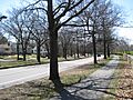
Olmsted Park System (Emerald Necklace)
The Olmsted Park System is a chain of parks designed by a famous landscape architect named Frederick Law Olmsted. He also designed Central Park in New York City! This "necklace" of green spaces winds through Boston, connecting several neighborhoods. It includes the Back Bay Fens, the Muddy River, Jamaica Park, and Franklin Park. It's a wonderful example of city planning that brings nature into urban areas.
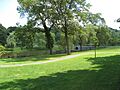
Other Notable Green Spaces
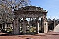
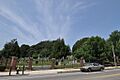
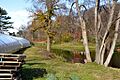
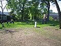
- Larz Anderson Park Historic District: This park in Jamaica Plain is a lovely green space that also extends into nearby Brookline. It's known for its beautiful landscapes.
- Blue Hills Parkway: This scenic road in Mattapan is part of a larger parkway system. It offers pretty views and connects different natural areas.
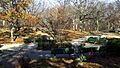
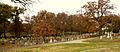
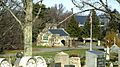
- Forest Hills Cemetery: Located in Jamaica Plain, this isn't just a cemetery; it's also a historic landscape with beautiful sculptures and trees, designed like a park.
- Brook Farm: In West Roxbury, this site was once home to a famous experimental community in the 1840s. People lived and worked together, trying out new ideas about society. It's a National Historic Landmark.
Important Buildings and Structures
Southern Boston is home to many historic buildings, from schools to churches and unique homes.
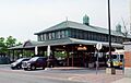
Fenway Park
Even if you're not a huge baseball fan, you've probably heard of Fenway Park! Located in Fenway–Kenmore, it's the oldest baseball park still used by Major League Baseball. It was built in 1912 and is the home of the Boston Red Sox. Imagine all the history and famous games that have happened there!

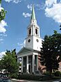
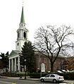
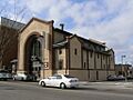
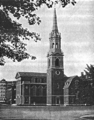
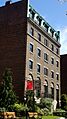
Symphony Hall
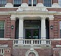
Symphony Hall in the South End is a world-famous concert hall. It opened in 1900 and is known for its amazing acoustics, which means the sound inside is incredibly clear and beautiful. It's home to the Boston Symphony Orchestra and is a National Historic Landmark.
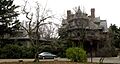
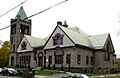
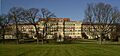
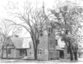
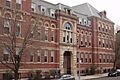
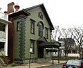
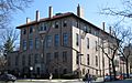
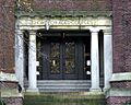
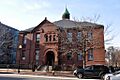
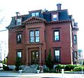
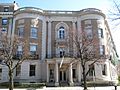
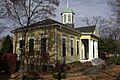
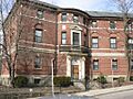
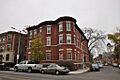
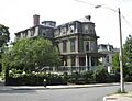
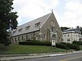
Shirley-Eustis House
The Shirley-Eustis House in Roxbury is a grand old mansion built in the 1740s. It was once the home of William Shirley, who was the royal governor of Massachusetts before the American Revolution. It's a great example of Georgian architecture and is a National Historic Landmark.
Other Notable Buildings
- Isabella Stewart Gardner Museum: This unique museum in Fenway–Kenmore is built like a Venetian palace. Isabella Stewart Gardner collected art from all over the world and displayed it in her home, which she then opened as a museum.
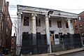
- William Lloyd Garrison House: In Roxbury, this was the home of William Lloyd Garrison, a very important leader in the movement to end slavery in the United States. It's a National Historic Landmark.
- Massachusetts Historical Society Building: Located in Fenway–Kenmore, this building houses the oldest historical society in the United States. It collects and preserves important documents and artifacts about Massachusetts history. It's a National Historic Landmark.
- Cyclorama Building: This round building in the South End was built in 1884 to display huge circular paintings called cycloramas. Today, it's used for events and art studios.

Lighthouses and Harbor Sites
Boston's harbor has been important for centuries, and some of its historic sites are out on the water.
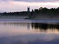
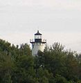
Boston Light
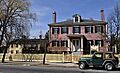
Boston Light is located on Little Brewster Island in Boston Harbor. It's the oldest lighthouse in the United States, first lit in 1716! It has guided ships safely into Boston for hundreds of years and is a National Historic Landmark.
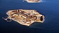
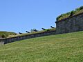
Fort Warren
On Georges Island in Boston Harbor, Fort Warren is a historic fort built in the mid-1800s. It was used to protect Boston during the Civil War and later as a training ground. You can visit the island and explore the old fort. It's a National Historic Landmark.
Other Harbor Sites
- The Graves Light: This lighthouse stands at the entrance to the North Channel of Boston Harbor. It's a strong, tall lighthouse that helps guide ships.
- Nix's Mate Daybeacon: This is a small stone tower in Boston Harbor. It's a navigational aid, marking a dangerous shoal (a shallow area) for ships. It's also linked to old pirate legends!
Historic Districts and Neighborhoods
Many parts of southern Boston are recognized as "historic districts." This means that a whole area, not just one building, has special historical importance.
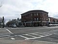
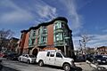
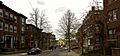
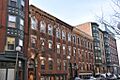
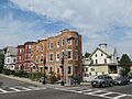
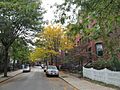
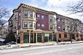
South End District
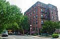
The South End District is famous for its beautiful Victorian brick row houses. It's one of the largest Victorian neighborhoods in the United States. Walking through its streets feels like stepping back in time. It's known for its unique architecture and charming squares.
Mission Hill Triangle Historic District
Mission Hill is a neighborhood with a mix of old and new. The Mission Hill Triangle Historic District includes many historic homes and buildings that show the area's development over time.
Other Historic Districts
- Brighton Center Historic District: This area in Brighton has many historic buildings, including churches and commercial blocks, that show the growth of this part of Boston.
- Chestnut Hill Reservoir Historic District: This district includes the beautiful Chestnut Hill Reservoir, which was an important part of Boston's water supply system. It's also a popular spot for walking and running.
- Codman Square District: In Dorchester, this district is a historic town center with important buildings and a strong community feel.
- Dorchester Heights Historic District: This area in South Boston is where George Washington famously placed cannons during the American Revolution, forcing the British to leave Boston. It's a very important site for American history.
Images for kids
-
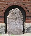
One of the 1767 Milestones.
-
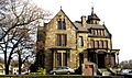
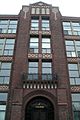
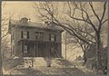
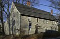
Abbotsford, a historic home in Roxbury.
-
The Adams-Nervine Asylum building.
-
All Saints' Church in Dorchester.
-
The Allston Congregational Church.
-
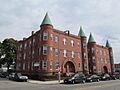
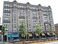
The Almont Apartments in Mattapan.
-
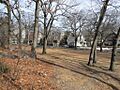
Larz Anderson Park.
-
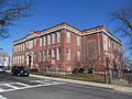
The Sarah J. Baker School.
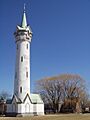
-
The Bellevue Standpipe.
-
The Benedict Fenwick School.
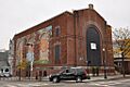
-
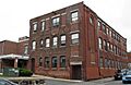
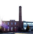
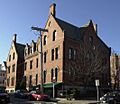
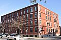
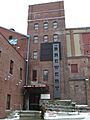
The Berger Factory in Roxbury.
-

The Bigelow School.
-
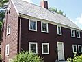
The James Blake House.
-

Blue Hills Parkway.
-
Boston Consumptives Hospital.
-
Georges Island in Boston Harbor.
-

The Boston Young Men's Christian Association building.
-
The Bowditch School.
-
The Brandegee Estate.
-
Brighton Allston Congregational Church.
-
Brighton Evangelical Congregational Church.
-
Buildings at 825-829 Blue Hill Avenue.
-
The Calf Pasture Pumping Station Complex.
-
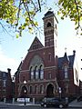
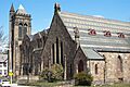
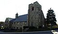
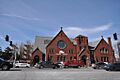
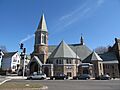
The Cathedral of St. George.
-
The Charles Street African Methodist Episcopal Church.
-
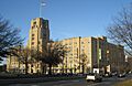
Chestnut Hill Reservoir.
-

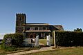
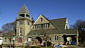
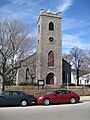
Christ Church, Hyde Park.
-
The Clapp Houses.
-
Codman Square.
-
The Collins Building.
-
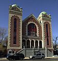
Congregation Adath Jeshurun.
-
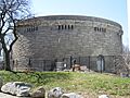
The Sarah Davidson Apartment Block.
-
The Dearborn School.
-
The Dillaway School.
-
Dimock Community Health Center Complex.
-
District 13 Police Station.
-
Dorchester Heights Historic District.
-
Dorchester North Burying Ground.
-
Dorchester Park.
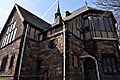
-
Dorchester Pottery Works.
-
Dorchester South Burying Ground.
-
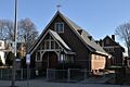
Dorchester Temple Baptist Church.
-
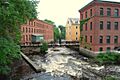
Lower Mills Industrial District.
-
Frederick Douglass Square.
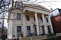
-
Dudley Station.
-
The Edna G. shipwreck.
-
The Egleston Substation.
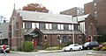
-
Eliot Burying Ground.
-
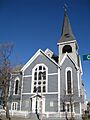
Eliot Congregational Church.
-
Eliot Hall.
-
Evergreen Cemetery.
-
Fairview Cemetery.
-
Fenway Studios.
-
Fenway-Boylston Street District.
-
Fields Corner Municipal Building.
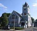
-
First Church of Jamaica Plain.
-
First Congregational Church of Hyde Park.
-
Fort Independence.
-
Frances and Isabella Apartments.
-
Francis Street-Fenwood Road Historic District.
-
Isabella Stewart Gardner Museum.
-
William Lloyd Garrison House.
-
William Lloyd Garrison School.
-
Goldsmith Block.
-
Governor Shirley Square Historic District.
-

The Graves Light.
-

Greek Orthodox Cathedral of New England.
-
Greenwood Memorial United Methodist Church.
-
Haffenreffer Brewery.
-
Edward Everett Hale House.
-
John Harris House and Farm (Allandale Farm).
-
Harrison Square Historic District.
-
Harriswood Crescent.
-
Harvard Avenue Fire Station.
-
Harvard Avenue Historic District.
-
Edward H. Haskell Home for Nurses.
-
Hibernian Hall.
-
Highland Spring Brewery Bottling and Storage Buildings.
-
Home for Aged Couples.
-
Home for Destitute Jewish Children.
-
House at 17 Cranston Street.
-
Timothy Hoxie House.
-
John Eliot Square District.
-
Joshua Bates School.
-
Alvah Kittredge House.
-
Lawrence Model Lodging Houses.
-
Long Island Head Light.
-
Harrison Loring House.
-
Loring-Greenough House.
-
Lower Roxbury Historic District.
-
Massachusetts Historical Society Building.
-
Massachusetts Mental Health Center.
-
Massachusetts School of Art.
-
Moreland Street Historic District.
-
Morton Street.
-
Mount Hope Cemetery.
-
Mount Pleasant Historic District.
-
Nazing Court Apartments.
-
Neponset Valley Parkway.
-
New England Conservatory of Music.
-
New Riding Club.
-
Nix's Mate Daybeacon.
-
Oak Square School.
-
Old Harbor Reservation Parkways.
-
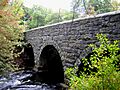
Paul's Bridge.
-
The Peabody.
-
Pierce House.
-
Pilgrim Congregational Church.
-
Ellen H. Swallow Richards House.
-
The Riviera.
-
Roslindale Baptist Church.
-
Roslindale Congregational Church.
-
Roslindale Substation.
-
Roxbury High Fort.
-
Roxbury Presbyterian Church.
-

Saint Augustine Chapel and Cemetery.
-
St. Joseph's Roman Catholic Church Complex.
-
St. Luke's and St. Margaret's Church.
-
Saint Mark's Episcopal Church.
-
St. Mary's Episcopal Church.
-
Savin Hill Historic District.
-
Sears Roebuck and Company Mail Order Store (Landmark Center).
-
Second Church in Boston.
-
Sherman Apartments Historic District.
-
South Boston Boat Clubs Historic District.
-
Stony Brook Reservation Parkways.
-
Students House.
-
Sumner Hill Historic District.
-

Symphony and Horticultural Halls.
-
William Monroe Trotter House.
-
Truman Parkway.
-
Upham's Corner Market.
-
US Post Office Garage.
-
VFW Parkway.
-
Walton and Roslin Halls.
-
West Roxbury Parkway.
-
Westerly Burial Ground.
-
Woodbourne Historic District.


-
- '
| Name on the Register | Image | Date listed | Location | City or town | Description | |
|---|---|---|---|---|---|---|
| 1 | 1767 Milestones |
 |
(#71000084) |
Between Boston and Springfield along Old Post Rd. 42°19′48″N 71°05′29″W / 42.33°N 71.091389°W |
Roxbury, Mission Hill | Includes markers in Allston-Brighton, and markers in Hampden, Middlesex, and Worcester counties |
| 2 | Abbotsford |
 |
(#87000885) |
300 Walnut Ave. 42°18′58″N 71°05′35″W / 42.316111°N 71.093056°W |
Roxbury | |
| 3 | Adams-Nervine Asylum |
 |
(#82004456) |
990-1020 Centre St. 42°18′13″N 71°07′31″W / 42.303611°N 71.125278°W |
Jamaica Plain | |
| 4 | All Saints' Church |
 |
(#80000678) |
211 Ashmont St. 42°17′09″N 71°03′48″W / 42.285833°N 71.063333°W |
Dorchester | |
| 5 | Allston Congregational Church |
 |
(#97001377) |
31-41 Quint Ave. 42°21′06″N 71°08′05″W / 42.351667°N 71.134722°W |
Allston | |
| 6 | Almont Apartments |
 |
(#14000698) |
1439-1443 & 1447-1451 Blue Hill Ave. 42°16′29″N 71°05′38″W / 42.2747°N 71.0939°W |
Mattapan | |
| 7 | Larz Anderson Park Historic District |
 |
(#85003245) |
Bounded by Goddard and Avon Sts. 42°18′43″N 71°08′10″W / 42.311944°N 71.136111°W |
Jamaica Plain | Extends into Brookline in Norfolk County |
| 8 | Arnold Arboretum |
.JPG) |
(#66000127) |
22 Divinity Ave. 42°17′55″N 71°07′30″W / 42.298611°N 71.125°W |
Jamaica Plain and Roslindale | |
| 9 | Sarah J. Baker School |
 |
(#83004285) |
33 Perrin St. 42°19′20″N 71°04′48″W / 42.3222°N 71.08°W |
Roxbury | |
| 10 | Bellevue Standpipe |
 |
(#89002251) |
On Bellevue Hill at Washington St. and Roxbury Parkway 42°16′31″N 71°08′40″W / 42.275278°N 71.144444°W |
West Roxbury | |
| 11 | Benedict Fenwick School |
 |
(#04000023) |
150 Magnolia St. 42°18′49″N 71°04′21″W / 42.313611°N 71.0725°W |
Dorchester | |
| 12 | Berger Factory |
 |
(#80000677) |
37 Williams St. 42°19′58″N 71°04′59″W / 42.332778°N 71.083056°W |
Roxbury | |
| 13 | Bigelow School |
 |
(#85000316) |
350 W. 4th St. 42°21′08″N 71°02′52″W / 42.352222°N 71.047778°W |
South Boston | |
| 14 | James Blake House |
 |
(#74002350) |
735 Columbia Rd. 42°19′11″N 71°03′37″W / 42.319722°N 71.060278°W |
Dorchester | |
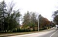
| 15 | Blue Hills Parkway |
 |
(#03000574) |
Blue Hills Parkway 42°15′21″N 71°05′38″W / 42.255833°N 71.093889°W |
Mattapan | Extends into Milton in Norfolk County |
| 16 | Boston Consumptives Hospital |
|
(#01001557) |
249 River St. 42°16′34″N 71°05′01″W / 42.276111°N 71.083611°W |
Dorchester | |
| 17 | Boston Harbor Islands Archeological District |
 |
(#85003323) |
Address Restricted |
Boston Harbor | Extends into Quincy in Norfolk County and Hingham in Plymouth County |
| 18 | Boston Light |
 |
(#66000133) |
Little Brewster Island, Boston Harbor 42°19′41″N 70°53′26″W / 42.328056°N 70.890556°W |
Boston Harbor | |
| 19 | Boston Young Men's Christian Association |
 |
(#98001082) |
312-320 Huntington Ave. 42°20′26″N 71°05′14″W / 42.340667°N 71.08725°W |
Fenway-Kenmore | |
| 20 | Bowditch School |
 |
(#90001145) |
80-82 Greene St. 42°18′42″N 71°06′36″W / 42.311667°N 71.11°W |
Jamaica Plain | |
| 21 | Brandegee Estate |
 |
(#85003244) |
280 Newton St. 42°18′18″N 71°08′05″W / 42.305°N 71.134722°W |
West Roxbury | Extends into Brookline in Norfolk County |
| 22 | Brighton Center Historic District |
 |
(#01000088) |
Academy Hill Rd., Chestnut Hill Ave., Dighton, Elko, Henshaw, Leicester, Market, Washington, and Winship Sts. 42°20′57″N 71°09′12″W / 42.349133°N 71.153469°W |
Brighton | |
| 23 | Brighton Evangelical Congregational Church |
 |
(#97000920) |
404-410 Washington St. 42°20′55″N 71°09′22″W / 42.348611°N 71.156111°W |
Brighton | |
| 24 | Brook Farm |
 |
(#66000141) |
670 Baker St. 42°17′14″N 71°10′43″W / 42.287222°N 71.178611°W |
West Roxbury | |
| 25 | Buildings at 825-829 Blue Hill Avenue |
 |
(#14000561) |
825-829 Blue Hill Ave. 42°17′49″N 71°05′16″W / 42.2969°N 71.0877°W |
Dorchester | |
| 26 | Calf Pasture Pumping Station Complex |
|
(#90001095) |
435 Mount Vernon St. 42°18′48″N 71°02′01″W / 42.313333°N 71.033611°W |
Dorchester | |
| 27 | Cathedral of St. George Historic District |
 |
(#98001361) |
517-523-525 E. Broadway 42°20′07″N 71°02′37″W / 42.335306°N 71.043556°W |
South Boston | |
| 28 | Charles Street African Methodist Episcopal Church |
 |
(#83000601) |
551 Warren St. 42°18′45″N 71°05′03″W / 42.3125°N 71.084167°W |
Roxbury | |
| 29 | Chestnut Hill Reservoir Historic District |
 |
(#89002271) |
Beacon St. and Commonwealth Ave. 42°19′58″N 71°09′27″W / 42.332778°N 71.1575°W |
Brighton | Extends into Newton. |
| 30 | Christ Church |
 |
(#86000140) |
1220 River St. 42°15′38″N 71°07′48″W / 42.260556°N 71.13°W |
Hyde Park | |
| 31 | Clapp Houses |
 |
(#74000911) |
199 and 195 Boston St. 42°19′12″N 71°03′25″W / 42.32°N 71.056944°W |
Dorchester | Home of the Dorchester Historic Society |
| 32 | Codman Square District |
 |
(#83000602) |
Norfolk, Talbot, Epping, Lithgow, Centre, and Moultrie Sts. 42°17′25″N 71°04′16″W / 42.290278°N 71.071111°W |
Dorchester | |
| 33 | Collins Building |
 |
(#05000559) |
213-217 Washington St. 42°18′02″N 71°04′37″W / 42.300556°N 71.076944°W |
Dorchester | |
| 34 | Congregation Adath Jeshurun |
 |
(#99001304) |
397 Blue Hill Ave. 42°18′43″N 71°04′53″W / 42.311944°N 71.081389°W |
Dorchester | |
| 35 | Cyclorama Building |
|
(#73000318) |
543-547 Tremont St. 42°20′40″N 71°04′19″W / 42.344444°N 71.071944°W |
South End | |
| 36 | Sarah Davidson Apartment Block |
 |
(#13000928) |
3 Gaylord St. 42°17′56″N 71°04′23″W / 42.299°N 71.073°W |
Dorchester | |
| 37 | Dearborn School |
 |
(#00000871) |
25 Ambrose St. 42°19′46″N 71°04′42″W / 42.329444°N 71.078333°W |
Roxbury | |
| 38 | Dillaway School |
 |
(#80001683) |
16-20 Kenilworth St. 42°19′43″N 71°05′14″W / 42.328611°N 71.087222°W |
Roxbury | |
| 39 | Dimock Community Health Center Complex |
 |
(#85000317) |
41 and 55 Dimock St. 42°19′14″N 71°05′51″W / 42.320556°N 71.0975°W |
Roxbury | |
| 40 | District 13 Police Station |
 |
(#87002549) |
28 Seaverns Ave. 42°18′43″N 71°06′46″W / 42.311944°N 71.112778°W |
Jamaica Plain | |
| 41 | Dorchester Heights Historic District |
 |
(#01001198) |
Roughly a one block area surrounding Telegraph Hill 42°19′58″N 71°02′48″W / 42.332778°N 71.046667°W |
South Boston | |
| 42 | Dorchester Heights National Historic Site |
 |
(#66000050) |
South Boston 42°19′58″N 71°02′47″W / 42.332778°N 71.046389°W |
South Boston | |
| 43 | Dorchester North Burying Ground |
 |
(#74000915) |
Stoughton St. and Columbia Rd. 42°19′00″N 71°03′52″W / 42.316667°N 71.064444°W |
Dorchester | |
| 44 | Dorchester Park |
 |
(#08000089) |
Bounded by Dorchester Ave., Richmond, Adams, and Richview Sts. 42°16′34″N 71°04′01″W / 42.276117°N 71.067014°W |
Dorchester | |
| 45 | Dorchester Pottery Works |
 |
(#85000318) |
101-105 Victory Rd. 42°17′49″N 71°03′05″W / 42.296944°N 71.051389°W |
Dorchester | |
| 46 | Dorchester South Burying Ground |
 |
(#14000365) |
2095 Dorchester Ave. 42°16′43″N 71°04′01″W / 42.2786°N 71.0669°W |
Dorchester | |
| 47 | Dorchester Temple Baptist Church |
 |
(#97001239) |
670 Washington St. 42°17′17″N 71°04′17″W / 42.288056°N 71.071389°W |
Dorchester | |
| 48 | Dorchester-Milton Lower Mills Industrial District |
 |
(#80000675) |
Both sides of the Neponset River; also Adams, River, and Medway Sts., Millers Lane, and Eliot and Adams Sts. 42°16′16″N 71°04′08″W / 42.271111°N 71.068889°W |
Dorchester | Extends into Milton in Norfolk County; second set of addresses represents a boundary increase |
| 49 | Frederick Douglass Square Historic District |
 |
(#96001063) |
Roughly bounded by Hammond St., Cobat St., Windsor St., and Westminster St., Lower Roxbury 42°20′09″N 71°05′04″W / 42.335833°N 71.084444°W |
Roxbury | |
| 50 | Dudley Station Historic District |
 |
(#85003074) |
Washington, Warren, and Dudley Sts. 42°19′48″N 71°05′04″W / 42.33°N 71.084444°W |
Roxbury | |
| 51 | Edna G. shipwreck (eastern rig dragger) |
 |
(#10000039) |
Stellwagen Bank National Marine Sanctuary |
Boston vicinity | Eastern Rig Dragger Fishing Vessel Shipwrecks in the Stellwagen Bank National Marine Sanctuary MPS |
| 52 | Egleston Substation |
 |
(#10001066) |
3025 Washington St. 42°19′01″N 71°05′51″W / 42.316944°N 71.0975°W |
Jamaica Plain | |
| 53 | Eliot Burying Ground |
 |
(#74000388) |
Eustis and Washington Sts. 42°19′55″N 71°04′55″W / 42.331944°N 71.081944°W |
Roxbury | |
| 54 | Eliot Congregational Church |
 |
(#93001587) |
56 Dale St., corner 118-120 Walnut St. 42°19′10″N 71°04′55″W / 42.319444°N 71.081944°W |
Roxbury | |
| 55 | Eliot Hall |
 |
(#88000959) |
7A Eliot St. 42°18′37″N 71°06′59″W / 42.310278°N 71.116389°W |
Jamaica Plain | |
| 56 | Evergreen Cemetery |
|
(#09000612) |
2060 Commonwealth Ave. 42°20′20″N 71°09′43″W / 42.338889°N 71.161944°W |
Brighton | |
| 57 | Fairview Cemetery |
 |
(#09000717) |
45 Fairview Ave. 42°14′45″N 71°08′18″W / 42.245897°N 71.138464°W |
Hyde Park | |
| 58 | Fenway Park |
|
(#12000069) |
24, & 2-4 Yawkey Wy., 64-76 Brookline Ave., & 70-80 Lansdowne St. 42°20′50″N 71°05′47″W / 42.34709°N 71.09631°W |
Fenway-Kenmore | Longtime home of Boston Red Sox built in 1912; has been oldest ballpark in use by Major League Baseball since 1999. |
| 59 | Fenway Studios |
 |
(#78000473) |
30 Ipswich St. 42°20′50″N 71°05′28″W / 42.347222°N 71.091111°W |
Fenway-Kenmore | |
| 60 | Fenway-Boylston Street District |
 |
(#84002875) |
Fenway, Boylston, Westland, and Hemenway Sts. 42°20′43″N 71°05′26″W / 42.345278°N 71.090556°W |
Fenway-Kenmore | |
| 61 | Fields Corner Municipal Building |
 |
(#81000620) |
1 Arcadia St., 195 Adams St. 42°18′07″N 71°03′38″W / 42.301944°N 71.060556°W |
Dorchester | |
| 62 | First Church of Jamaica Plain |
 |
(#88000955) |
6 Eliot St. 42°18′35″N 71°07′00″W / 42.309722°N 71.116667°W |
Jamaica Plain | |
| 63 | First Congregational Church of Hyde Park |
 |
(#99001308) |
6 Webster St. 42°15′27″N 71°07′15″W / 42.2575°N 71.120833°W |
Hyde Park | |
| 64 | Forest Hills Cemetery |
 |
(#04001219) |
95 Forest Hills Ave. 42°17′35″N 71°06′29″W / 42.293056°N 71.108056°W |
Jamaica Plain | |
| 65 | Fort Independence |
 |
(#70000921) |
Castle Island 42°20′17″N 71°00′42″W / 42.338056°N 71.011667°W |
South Boston | |
| 66 | Fort Warren |
 |
(#70000540) |
Georges Island, Boston Harbor 42°19′11″N 70°55′43″W / 42.319722°N 70.928611°W |
Boston Harbor | |
| 67 | Frances and Isabella Apartments |
 |
(#02000081) |
430-432 and 434-436 Dudley St. 42°19′27″N 71°04′29″W / 42.324167°N 71.074722°W |
Roxbury | |
| 68 | Francis Street-Fenwood Road Historic District |
 |
(#16000409) |
Roughly bounded by Huntington Ave., Francis, Vining & Fenwood Sts., St. Albans Rd. 42°20′05″N 71°06′23″W / 42.334680°N 71.106431°W |
Longwood | |
| 69 | Isabella Stewart Gardner Museum |
 |
(#83000603) |
280 The Fenway 42°20′17″N 71°05′59″W / 42.338056°N 71.099722°W |
Fenway-Kenmore | |
| 70 | William Lloyd Garrison House |
 |
(#66000653) |
125 Highland St. 42°19′34″N 71°05′38″W / 42.326111°N 71.093889°W |
Roxbury | |
| 71 | William Lloyd Garrison School |
 |
(#80000674) |
20 Hutchings St. 42°18′34″N 71°05′22″W / 42.309444°N 71.089444°W |
Roxbury | |
| 72 | Goldsmith Block |
 |
(#07000510) |
41 Ruggles St., 746-750 Shawmut Ave. 42°19′56″N 71°05′02″W / 42.332222°N 71.083889°W |
Roxbury | |
| 73 | Governor Shirley Square Historic District |
 |
(#16000454) |
Dudley, Hampden, Dunmore & Magazine Sts., Blue Hill & Mt. Pleasant Ave. 42°19′33″N 71°04′31″W / 42.325881°N 71.075185°W |
Roxbury | |
| 74 | Graves Light Station |
 |
(#87002041) |
Entrance to North Channel, Boston Harbor 42°21′54″N 70°52′11″W / 42.365°N 70.869722°W |
Boston Harbor | |
| 75 | Greek Orthodox Cathedral of New England |
 |
(#88000957) |
520 Parker St. 42°20′11″N 71°05′39″W / 42.336389°N 71.094167°W |
Fenway-Kenmore | |
| 76 | Greenwood Memorial United Methodist Church |
 |
(#02000154) |
378A-380 Washington St. 42°17′49″N 71°04′19″W / 42.296944°N 71.071944°W |
Dorchester | |
| 77 | Haffenreffer Brewery |
 |
(#82004453) |
Germania St. 42°18′52″N 71°06′15″W / 42.314444°N 71.104167°W |
Jamaica Plain | |
| 78 | Edward Everett Hale House |
 |
(#73000325) |
12 Morley St. 42°19′44″N 71°05′33″W / 42.328889°N 71.0925°W |
Roxbury | |
| 79 | John Harris House and Farm |
 |
(#85003246) |
284 Newton St. 42°18′16″N 71°08′19″W / 42.304444°N 71.138611°W |
West Roxbury | Extends into Brookline in Norfolk County |
| 80 | Harrison Square Historic District |
 |
(#02001190) |
Bounded by MBTA Braintree line embankment, Park, Everett, Freeport, Mill, Asland, Blanche Sts., Victory Rd. 42°18′07″N 71°03′13″W / 42.302031°N 71.053531°W |
Dorchester | |
| 81 | Harriswood Crescent |
|
(#86000375) |
60-88 Harold St. 42°19′05″N 71°05′47″W / 42.318056°N 71.096389°W |
Roxbury | |
| 82 | Harvard Avenue Fire Station |
 |
(#83000605) |
16 Harvard Ave. 42°21′19″N 71°07′58″W / 42.355278°N 71.132778°W |
Allston | |
| 83 | Harvard Avenue Historic District |
|
(#00000415) |
Roughly bounded by Linden St., Commonwealth Ave., Harvard Ave., and Park Vale Ave. 42°21′12″N 71°07′58″W / 42.353333°N 71.132778°W |
Allston | |
| 84 | Edward H. Haskell Home for Nurses |
 |
(#04000085) |
220 Fisther Ave., 63 Parker Hill Ave. 42°19′49″N 71°06′36″W / 42.330278°N 71.11°W |
Mission Hill | |
| 85 | Hibernian Hall |
 |
(#04000534) |
182-186 Dudley St. 42°19′43″N 71°04′57″W / 42.328611°N 71.0825°W |
Roxbury | |
| 86 | Highland Spring Brewery Bottling and Storage Buildings |
 |
(#10000300) |
154-166 Terrace St. 42°19′37″N 71°05′55″W / 42.326944°N 71.098536°W |
Mission Hill | |
| 87 | Home for Aged Couples |
 |
(#05000879) |
409, 419 Walnut Ave. and 2055 Columbus Ave. 42°18′49″N 71°05′43″W / 42.313611°N 71.095278°W |
Jamaica Plain | |
| 88 | Home for Destitute Jewish Children |
 |
(#14000840) |
150-156 American Legion Hwy. 42°17′41″N 71°05′34″W / 42.2948°N 71.0927°W |
Dorchester | Now houses a community center and charter school. |
| 89 | House at 17 Cranston Street |
 |
(#87001398) |
17 Cranston St. 42°19′14″N 71°06′35″W / 42.320556°N 71.109722°W |
Jamaica Plain | |
| 90 | Timothy Hoxie House |
 |
(#87001399) |
135 Hillside St. 42°19′52″N 71°06′19″W / 42.331111°N 71.105278°W |
Mission Hill | |
| 91 | John Eliot Square District |
 |
(#73000854) |
John Eliot Sq. 42°19′47″N 71°05′27″W / 42.329722°N 71.090833°W |
Roxbury | |
| 92 | Joshua Bates School |
 |
(#08000793) |
731 Harrison Ave. 42°20′15″N 71°04′19″W / 42.337626°N 71.071823°W |
South End | |
| 93 | Alvah Kittredge House |
 |
(#73000855) |
12 Linwood St. 42°19′47″N 71°05′38″W / 42.329722°N 71.093889°W |
Roxbury | |
| 94 | Lawrence Model Lodging Houses |
 |
(#83000606) |
79, 89, 99 and 109 E. Canton St. 42°20′17″N 71°04′14″W / 42.338056°N 71.070556°W |
South End | |
| 95 | Long Island Head Light |
 |
(#87001481) |
Long Island 42°19′49″N 70°57′28″W / 42.330278°N 70.957778°W |
Boston Harbor | |
| 96 | Harrison Loring House |
 |
(#83000604) |
789 E. Broadway St. 42°20′07″N 71°02′01″W / 42.335278°N 71.033611°W |
South Boston | |
| 97 | Loring-Greenough House |
 |
(#72000544) |
12 South St. 42°18′35″N 71°06′56″W / 42.309722°N 71.115556°W |
Jamaica Plain | |
| 98 | Lower Roxbury Historic District |
 |
(#94001494) |
Roughly the area surrounding Coventry, Cunard, and Walpole Sts. 42°20′11″N 71°05′12″W / 42.336389°N 71.086667°W |
Roxbury | |
| 99 | Massachusetts Historical Society Building |
 |
(#66000770) |
1154 Boylston St. 42°20′47″N 71°05′26″W / 42.346389°N 71.090556°W |
Fenway-Kenmore | |
| 100 | Massachusetts Mental Health Center |
|
(#93001489) |
74 Fenwood Rd. 42°20′08″N 71°06′35″W / 42.335556°N 71.109722°W |
Fenway-Kenmore | Campus demolished in 2010. |
| 101 | Massachusetts School of Art |
 |
(#89000974) |
364 Brookline Ave. 42°20′20″N 71°06′24″W / 42.338889°N 71.106667°W |
Fenway-Kenmore | |
| 102 | Mission Hill Triangle Historic District |
 |
(#89001747) |
Roughly bounded by Smith St., Worthington St., Tremont St., and Huntington Ave. 42°20′02″N 71°06′09″W / 42.333889°N 71.1025°W |
Mission Hill | |
| 103 | Monument Square Historic District |
|
(#90001536) |
Roughly bounded by Jamaicaway, Pond, Centre and Eliot Sts. 42°18′34″N 71°06′57″W / 42.309417°N 71.115778°W |
Jamaica Plain | Not to be confused with Monument Square Historic District (Charlestown, Boston, Massachusetts), where the Bunker Hill Monument is located. |
| 104 | Moreland Street Historic District |
 |
(#84002890) |
Roughly bounded by Kearsarge, Blue Hill Aves., Warren, Waverly, and Winthrop Sts. 42°19′25″N 71°04′48″W / 42.323611°N 71.08°W |
Roxbury | |
| 105 | Morton Street, Metropolitan Park System of Greater Boston |
 |
(#04001572) |
Morton St. 42°17′11″N 71°05′27″W / 42.286389°N 71.090833°W |
Jamaica Plain | |
| 106 | Mount Hope Cemetery |
 |
(#09000767) |
355 Walk Hill St. 42°17′12″N 71°06′19″W / 42.286572°N 71.105258°W |
Roslindale | |
| 107 | Mount Pleasant Historic District |
 |
(#89000004) |
Roughly bounded by Forest St. and Mount Pleasant Ave. 42°19′33″N 71°04′43″W / 42.325833°N 71.078611°W |
Roxbury | |
| 108 | Nazing Court Apartments |
 |
(#04000426) |
224-236 Seaver St. and 1-8 Nazing Court 42°18′13″N 71°05′36″W / 42.303611°N 71.093333°W |
Roxbury | |
| 109 | Neponset Valley Parkway, Metropolitan Park System of Greater Boston |
 |
(#04001573) |
Neponset Valley Parkway 42°14′14″N 71°07′36″W / 42.237222°N 71.126667°W |
Hyde Park | Extends into Milton in Norfolk County |
| 110 | New England Conservatory of Music |
 |
(#80000672) |
290 Huntington Ave. 42°20′26″N 71°05′13″W / 42.340556°N 71.086944°W |
Fenway-Kenmore | |
| 111 | New Riding Club |
 |
(#87001394) |
52 Hemenway St. 42°20′42″N 71°05′23″W / 42.345°N 71.089722°W |
Fenway-Kenmore | |
| 112 | Nix's Mate Daybeacon |
 |
(#04000189) |
Nubble Channel, The Narrows, Boston Harbor 42°19′56″N 70°56′42″W / 42.332222°N 70.945°W |
Boston Harbor | |
| 113 | Oak Square School |
 |
(#80000465) |
35 Nonantum St. 42°20′59″N 71°10′10″W / 42.349722°N 71.169444°W |
Brighton | |
| 114 | Old Harbor Reservation Parkways, Metropolitan Park System of Greater Boston |
 |
(#08000693) |
William J. Day Boulevard, Columbia Rd. between Farragut Rd and Kosciuszko Cir., and Old Colony Ave. between Pacuska Ave. 42°19′46″N 71°02′45″W / 42.329383°N 71.045722°W |
South Boston | |
| 115 | Olmsted Park System |
 |
(#71000086) |
Encompassing the Back Bay Fens, Muddy River, Olmsted (Leverett Park), Jamaica Park, Arborway, and Franklin Park 42°20′43″N 71°05′45″W / 42.345278°N 71.095833°W |
Jamaica Plain and Fenway-Kenmore | |
| 116 | Paul's Bridge |
 |
(#72000140) |
Neponset Valley Parkway over the Neponset River 42°14′04″N 71°07′24″W / 42.234444°N 71.123333°W |
Hyde Park | Extends into Milton in Norfolk County |
| 117 | The Peabody |
|
(#01000872) |
195-197 Ashmont St. 42°17′07″N 71°03′53″W / 42.285278°N 71.064722°W |
Dorchester | |
| 118 | Pierce House |
 |
(#74000917) |
24 Oakton Ave. 42°17′13″N 71°03′13″W / 42.286944°N 71.053611°W |
Dorchester | |
| 119 | Pilgrim Congregational Church |
 |
(#13000929) |
540-544 Columbia Road 42°18′58″N 71°04′01″W / 42.316°N 71.067°W |
Dorchester | |
| 120 | Ellen H. Swallow Richards House |
 |
(#92001874) |
32 Eliot St. 42°18′57″N 71°07′06″W / 42.315833°N 71.118333°W |
Jamaica Plain | |
| 121 | The Riviera |
 |
(#95001450) |
270 Huntington Ave. 42°20′30″N 71°05′11″W / 42.341667°N 71.086389°W |
Fenway-Kenmore | |
| 122 | Roslindale Baptist Church |
 |
(#98001330) |
52 Cummins Highway 42°17′07″N 71°07′41″W / 42.285278°N 71.128056°W |
Roslindale | |
| 123 | Roslindale Congregational Church |
 |
(#91000925) |
25 Cummins Highway at its junction with Summer Ave. 42°17′42″N 71°07′43″W / 42.295°N 71.128611°W |
Roslindale | |
| 124 | Roslindale Substation |
 |
(#13000621) |
4228 Washington St., 42°17′11″N 71°07′41″W / 42.286262°N 71.128063°W |
Roslindale | |
| 125 | Roxbury High Fort |
 |
(#73000856) |
Beech Glen St. at Fort Ave. 42°19′16″N 71°05′24″W / 42.321111°N 71.09°W |
Roxbury | |
| 126 | Roxbury Highlands Historic District |
|
(#89000147) |
Roughly bounded by Dudley St., Washington St., and Columbus Ave. 42°19′32″N 71°05′26″W / 42.325556°N 71.090556°W |
Roxbury | |
| 127 | Roxbury Presbyterian Church |
 |
(#89002125) |
328 Warren St. 42°19′10″N 71°04′55″W / 42.319444°N 71.081944°W |
Roxbury | |
| 128 | Saint Augustine Chapel and Cemetery |
 |
(#87001495) |
Dorchester St. between W. 6th and Tudor Sts. 42°20′02″N 71°03′00″W / 42.333889°N 71.05°W |
South Boston | |
| 129 | St. Joseph's Roman Catholic Church Complex |
 |
(#89002169) |
Bounded by Circuit, Regent, Hulbert, and Fenwick Sts. 42°19′26″N 71°05′16″W / 42.323889°N 71.087778°W |
Roxbury | |
| 130 | St. Luke's and St. Margaret's Church |
 |
(#97001472) |
5-7 St. Luke's Rd. 42°21′07″N 71°07′40″W / 42.351944°N 71.127778°W |
Allston | |
| 131 | Saint Mark's Episcopal Church |
 |
(#12000783) |
73 Columbia Rd. 42°18′16″N 71°04′56″W / 42.3045°N 71.0821°W |
Dorchester | |
| 132 | St. Mary's Episcopal Church |
 |
(#98001292) |
14-16 Cushing Ave. 42°18′59″N 71°03′54″W / 42.316389°N 71.065°W |
Dorchester | |
| 133 | Savin Hill Historic District |
 |
(#03000385) |
Roughly bounded by Savin Hill Ave., Morrissey Boulevard, Dorchester Bay, and Interstate 93 42°18′33″N 71°03′01″W / 42.309167°N 71.050278°W |
Dorchester | |
| 134 | Sears Roebuck and Company Mail Order Store |
 |
(#90001992) |
309 Park Dr. and 201 Brookline Ave. 42°20′41″N 71°06′12″W / 42.344722°N 71.103333°W |
Fenway-Kenmore | A former Sears building now known as Landmark Center |
| 135 | Second Church in Boston |
 |
(#10000391) |
874, 876, 880 Beacon St. 42°20′49″N 71°06′17″W / 42.346944°N 71.104722°W |
Fenway–Kenmore | |
| 136 | Sherman Apartments Historic District |
 |
(#12000978) |
544-546 Washington, 4-6, 12-14, 18 Lyndhurst Sts. 42°17′32″N 71°04′17″W / 42.2923°N 71.0715°W |
Dorchester | |
| 137 | Shirley-Eustis House |
_-_exterior_before_restoration.jpg) |
(#66000787) |
31-37 Shirley St. 42°19′24″N 71°04′21″W / 42.323333°N 71.0725°W |
Roxbury | |
| 138 | South Boston Boat Clubs Historic District |
|
(#05000936) |
1793-1849 William J. Day Boulevard 42°19′56″N 71°01′37″W / 42.332222°N 71.026944°W |
South Boston | |
| 139 | South End District |
 |
(#73000324) |
South Bay area between Huntington and Harrison Aves.; also 200-224 Northampton St. 42°20′23″N 71°04′23″W / 42.339722°N 71.073056°W |
South End | Second set of addresses represents a boundary increase December 29, 2014 |
| 140 | Stony Brook Reservation Parkways, Metropolitan Park System of Great Boston MPS |
|
(#05001509) |
Dedham, Enneking, Turtle Pond Parkways, Smith Field, Reservation, W. Border Rds. 42°15′28″N 71°08′32″W / 42.257778°N 71.142222°W |
Hyde Park and West Roxbury | Extends into Dedham in Norfolk County |
| 141 | Students House |
 |
(#97000970) |
96 The Fenway 42°20′31″N 71°05′33″W / 42.341944°N 71.0925°W |
Fenway-Kenmore | |
| 142 | Sumner Hill Historic District |
 |
(#87001889) |
Roughly bounded by Seaverns Ave., Everett St., Carolina Ave., and Newbern St. 42°18′35″N 71°06′43″W / 42.309722°N 71.111944°W |
Jamaica Plain | |
| 143 | Symphony and Horticultural Halls |
 |
(#75000301) |
Massachusetts and Huntington Aves. 42°20′33″N 71°05′09″W / 42.3425°N 71.085833°W |
Fenway-Kenmore | |
| 144 | Symphony Hall |
 |
(#99000633) |
301 Massachusetts Ave. 42°20′33″N 71°05′09″W / 42.3425°N 71.085833°W |
South End | |
| 145 | William Monroe Trotter House |
.jpg) |
(#76002003) |
97 Sawyer Ave. 42°18′47″N 71°03′46″W / 42.313056°N 71.062778°W |
Dorchester | |
| 146 | Truman Parkway-Metropolitan Park System of Greater Boston |
 |
(#04001430) |
Truman Parkway 42°14′53″N 71°06′59″W / 42.248056°N 71.116389°W |
Hyde Park | Extends into Milton in Norfolk County |
| 147 | Upham's Corner Market |
 |
(#90001537) |
600 Columbia Rd. 42°19′02″N 71°03′55″W / 42.317222°N 71.065278°W |
Dorchester | |
| 148 | US Post Office Garage |
 |
(#86001378) |
135 A St. 42°20′36″N 71°03′14″W / 42.343333°N 71.053889°W |
South Boston | Destroyed |
| 149 | VFW Parkway, Metropolitan Park System of Greater Boston |
 |
(#04001432) |
VFW Parkway, between Spring and Centre Sts. 42°17′10″N 71°09′31″W / 42.286111°N 71.158611°W |
West Roxbury | Briefly crosses into Brookline in Norfolk County. |
| 150 | Walton and Roslin Halls |
 |
(#13000930) |
702-708 & 710-726 Washington St., 3-5 Walton St. 42°17′13″N 71°04′16″W / 42.286993°N 71.071009°W |
Dorchester | |
| 151 | West Roxbury Parkway, Metropolitan Park System of Greater Boston |
 |
(#05001528) |
West Roxbury Parkway, Bellevue Hill, East Border Rd., and West Border Rd. 42°18′10″N 71°09′11″W / 42.302778°N 71.153056°W |
West Roxbury | Extends into Brookline in Norfolk County |
| 152 | Westerly Burial Ground |
 |
(#87001401) |
Centre St. 42°16′53″N 71°09′34″W / 42.281389°N 71.159444°W |
West Roxbury | |
| 153 | Woodbourne Historic District |
 |
(#99000593) |
Roughly bounded by Walk Hill, Goodway, and Wachusett Sts. 42°17′30″N 71°06′58″W / 42.291667°N 71.116111°W |
Jamaica Plain |
