
National Register of Historic Places listings in Berkshire County, Massachusetts facts for kids
Berkshire County in Massachusetts is a beautiful area with a rich history! Many special places here are listed on the National Register of Historic Places. This is like a national list of important buildings, sites, and districts that are worth protecting because of their history, architecture, or what happened there.
There are 177 places in Berkshire County on this list. Ten of these are even more special and are called National Historic Landmarks. These landmarks are recognized as being important to the history of the entire United States!

Contents
- Famous Homes and Important People
- Art, Dance, and Creativity
- Historic Districts and Old Buildings
- Becket Center Historic District
- Blackinton Historic District
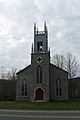
- Church Street-Cady Hill Historic District
- Cranesville Historic District
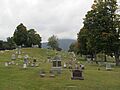
- East Lawn Cemetery and Sherman Burbank Memorial Chapel
- Elm-Maple-South Streets Historic District
- Farnams Village Historic District
- Five Corners Historic District
- Freeman's Grove Historic District
- Freight Yard Historic District
- Lee Lower Main Street Historic District
- Lower Historic District (Washington)
- Main Street Historic District (Stockbridge)
- Middlefield-Becket Stone Arch Railroad Bridge District
- Mill River Historic District
- Mill Village Historic District (Williamstown)
- Monument Square-Eagle Street Historic District
- Mount Greylock Summit Historic District
- New Marlborough Village Historic District
- Normal School Historic District
- North Becket Village Historic District
- North Egremont Historic District
- Old Curtisville Historic District
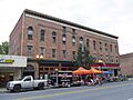
- Park Square Historic District (Pittsfield)
- Richmond Furnace Historical and Archeological District
- Shadow Brook Farm Historic District
- Sheffield Center Historic District
- Sheffield Plain Historic District
- South Egremont Village Historic District
- South Lee Historic District
- Springside Park (Pittsfield)
- Summer Street Historic District (Adams)
- Taconic and West Avenues Historic District
- Tyringham Shaker Settlement Historic District
- Upper Historic District (Washington)
- Upper North Street Commercial District
- Ventfort Hall
- Westover-Bacon-Potts Farm
- Williamstown Rail Yard and Station Historic District
- Other Notable Historic Places
- Images for kids
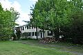
Famous Homes and Important People
Berkshire County is home to several places connected to famous Americans.
Susan B. Anthony's Birthplace
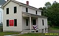
The Anthony House in Adams is where Susan B. Anthony was born. She was a very important leader in the movement to give women the right to vote. This house is now a museum where you can learn about her early life and her fight for equality.
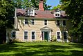
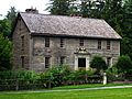
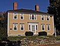
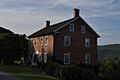
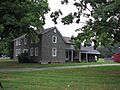
Colonel John Ashley House: A Fight for Freedom
The Colonel John Ashley House in Sheffield is a really old house from the 1700s. Something amazing happened here! In 1773, a document called the Sheffield Declaration was written in this house. It said that all people are born free. Later, in 1781, an enslaved woman named Elizabeth Freeman, also known as "Mum Bett," won her freedom in a court case that started from this house. Her case helped end slavery in Massachusetts!
W.E.B. Du Bois Boyhood Homesite
In Great Barrington, you can find the site where W. E. B. Du Bois grew up. He was a very important African American writer, teacher, and activist who fought for civil rights. His childhood home reminds us of his beginnings and his powerful impact on American history.
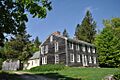
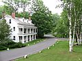
Herman Melville's Arrowhead
The house called Arrowhead in Pittsfield was the home of famous author Herman Melville. He wrote the classic book Moby Dick while living here. Imagine him looking out at the snowy fields, which he said reminded him of a white whale!
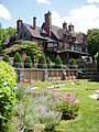
The Mount: Edith Wharton's Home
The Mount in Lenox was the beautiful home of Edith Wharton, a famous American writer. She designed the house and gardens herself. Many of her stories were about the lives of wealthy people in society.
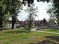
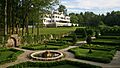
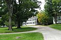
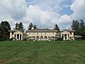
Naumkeag: A Gilded Age Estate
Also in Stockbridge, Naumkeag is a grand country estate built in the late 1800s, a time often called the "Gilded Age." It belonged to the Choate family and has stunning gardens designed by a famous landscape architect. It's like stepping back in time to see how wealthy families lived.
Art, Dance, and Creativity
Berkshire County has also inspired many artists and creative works.
Chesterwood: A Sculptor's Home
Chesterwood in Stockbridge was the home and studio of Daniel Chester French. He was a very famous sculptor who created the statue of Abraham Lincoln inside the Lincoln Memorial in Washington, D.C.! You can visit his studio and see where he worked.
Jacob's Pillow Dance Festival
The Jacob's Pillow Dance Festival in Becket is a world-famous place for dance. It started in the 1930s and is still a place where dancers from all over the world come to perform and learn. It's a National Historic Landmark because of its importance to dance history.
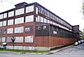
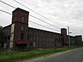
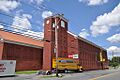
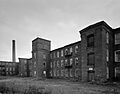
MASS MoCA: From Factory to Art Museum
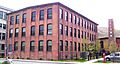
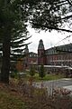
The Arnold Print Works in North Adams used to be a huge factory where they printed designs on fabric. Today, it's been transformed into the Massachusetts Museum of Contemporary Art (MASS MoCA), one of the largest modern art museums in the country! It's a great example of how old buildings can find new life.
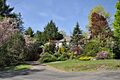
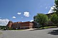
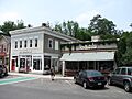
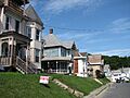
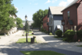
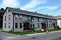
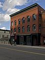
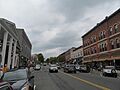
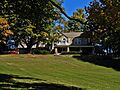
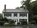
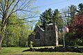
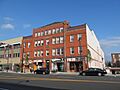
Historic Districts and Old Buildings
Many towns in Berkshire County have entire areas that are protected as historic districts. These districts include many old buildings that show what life was like long ago.
Becket Center Historic District
The Becket Center Historic District in Becket includes several old buildings that show the history of this small town. It's like a snapshot of how a New England village looked many years ago.
Blackinton Historic District
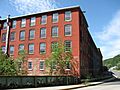
In North Adams, the Blackinton Historic District is an area that grew up around a mill. It includes homes and other buildings that were part of the community that worked at the mill.
Church Street-Cady Hill Historic District
Also in North Adams, this district has many historic buildings, including churches and homes, that show the growth of the city over time.
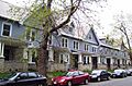
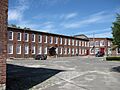
Cranesville Historic District
The Cranesville Historic District in Dalton is another area with historic buildings, showing the development of this part of the town.
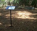
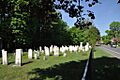
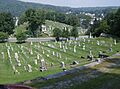
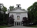
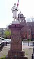
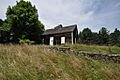
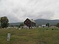
East Lawn Cemetery and Sherman Burbank Memorial Chapel
In Williamstown, this historic cemetery and chapel are important examples of old burial grounds and their beautiful architecture.
Elm-Maple-South Streets Historic District
This district in Stockbridge features a collection of buildings that tell the story of the town's development.
Farnams Village Historic District
In Cheshire, this district preserves the historic feel of a village that grew around its industries.
Five Corners Historic District
This area in Williamstown is named for the way several roads meet, and it contains historic buildings that show the early settlement patterns.
Freeman's Grove Historic District
Part of North Adams, this district has historic homes and streets that show how the city expanded.
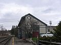
Freight Yard Historic District
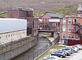
Also in North Adams, this district is part of the Western Gateway Heritage State Park. It includes old railroad buildings and shows the importance of trains to the area's history.
Lee Lower Main Street Historic District
This area in Lee includes many historic buildings along its main streets, showing the town's growth as a center for industry and trade.
Lower Historic District (Washington)
In Washington, this district includes historic buildings along Washington Mountain Road, showing the town's rural past.
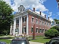
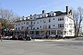
Main Street Historic District (Stockbridge)
The heart of Stockbridge is a historic district, with famous buildings like the Red Lion Inn that have been part of the town for centuries.
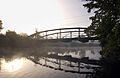
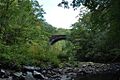
Middlefield-Becket Stone Arch Railroad Bridge District
This district includes impressive stone arch bridges that were built for the railroad. These bridges are amazing examples of old engineering.
Mill River Historic District
In New Marlborough, the Mill River area has historic buildings that show its past as a small industrial and farming community.
Mill Village Historic District (Williamstown)
This district in Williamstown includes buildings that were part of the town's early industrial development.
Monument Square-Eagle Street Historic District
This central area in North Adams includes the city's monument square and surrounding historic buildings.
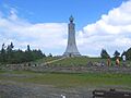
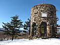
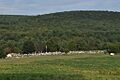
Mount Greylock Summit Historic District
Mount Greylock is the highest point in Massachusetts. The summit has historic buildings and monuments, including a tower, that offer amazing views and tell the story of the mountain's importance.
New Marlborough Village Historic District
This district in New Marlborough preserves the historic character of the village center.
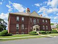
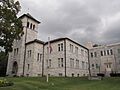
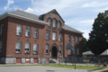
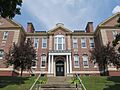
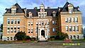
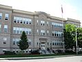
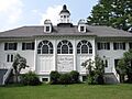
Normal School Historic District
In North Adams, this district is near the Massachusetts College of Liberal Arts (which used to be a "Normal School" for training teachers). It has many Victorian-style homes.
North Becket Village Historic District
This district in Becket includes historic buildings along its main streets, showing the village's development.
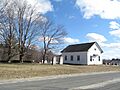
North Egremont Historic District
In Egremont, this district has historic buildings that show the town's early settlement and farming history.
Old Curtisville Historic District
North of Stockbridge, this district includes historic buildings along Route 183, showing the area's past as a small village.
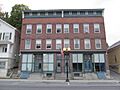
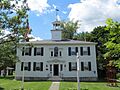
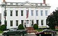
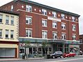
Park Square Historic District (Pittsfield)
The center of Pittsfield is a historic district, with many important buildings around Park Square.
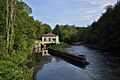
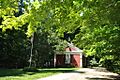
Richmond Furnace Historical and Archeological District
This district in Richmond tells the story of an old iron furnace and the community that grew around it. It's a place where you can learn about early industry.
Shadow Brook Farm Historic District
Near Stockbridge, this district includes a historic farm and estate, showing the area's agricultural and wealthy estate history.
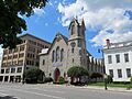
Sheffield Center Historic District
The center of Sheffield is a historic district with many old buildings along its main street.
Sheffield Plain Historic District
This district in Sheffield includes historic farmhouses and other buildings that show the town's agricultural past.
South Egremont Village Historic District
This district in Egremont preserves the historic character of the village, with many old homes and businesses.
South Lee Historic District
This district in Lee includes historic buildings along its streets, showing the development of this part of the town.
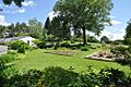
Springside Park (Pittsfield)
Springside Park in Pittsfield is a historic park with beautiful landscapes and buildings.
Summer Street Historic District (Adams)
This district in Adams includes historic homes and streets, showing the town's residential development.
Taconic and West Avenues Historic District
In Great Barrington, this district includes historic buildings along its main avenues.
Tyringham Shaker Settlement Historic District
This district in Tyringham was once a settlement of the Shakers, a religious group known for their simple lifestyle and crafts. You can see the unique architecture of their community.
Upper Historic District (Washington)
This district in Washington includes historic buildings along Washington Mountain Road, showing more of the town's rural history.
Upper North Street Commercial District
This district in Pittsfield includes many historic commercial buildings along North Street.
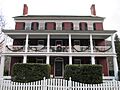
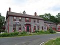
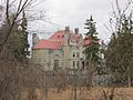
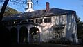
Ventfort Hall
Ventfort Hall in Lenox is a grand "cottage" from the Gilded Age, similar to Naumkeag. It's a beautiful example of the large homes built by wealthy families in the Berkshires.
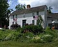
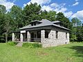
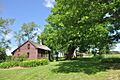
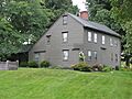
Westover-Bacon-Potts Farm
This historic farm in Egremont shows the long history of farming in the area.
Williamstown Rail Yard and Station Historic District
This district in Williamstown includes the old railroad yard and station, showing the importance of trains for transportation and trade in the past.
Other Notable Historic Places
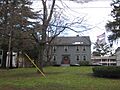
Many other individual buildings and sites in Berkshire County are also on the National Register of Historic Places.
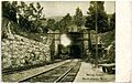
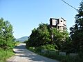
- The Hoosac Tunnel in North Adams is a very long railroad tunnel that was a huge engineering challenge when it was built.
- The Crane and Company Old Stone Mill Rag Room in Dalton is part of a paper mill that has been making paper for U.S. currency for a very long time.
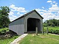
- The Old Covered Bridge in Sheffield is a classic wooden covered bridge, a type of bridge that was common long ago.
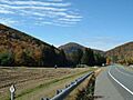
- The Mohawk Trail is a historic road that follows an old Native American path through the mountains.
These are just some of the many fascinating historic places you can find in Berkshire County, each with its own story to tell about the past.
Images for kids
-
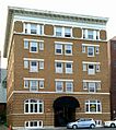
Allen Hotel
-
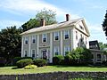
William Russell Allen House
-
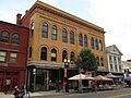
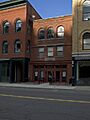
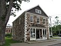
Armory Block
-
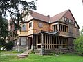
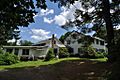
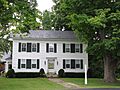
Armstrong House
-
Arnold Print Works
-
P. J. Barrett Block
-
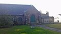
Beaver Mill
-
Berkshire Mill No. 1
-

Berkshire Life Insurance Company Building
-
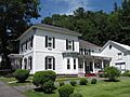
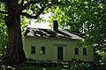
Rev. Adonijah Bidwell House
-
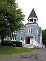
Blackinton Historic District
-
The Boardman
-
Capt. John Brewer House
-
Charles Browne House
-
Cheshire Town Hall Complex
-
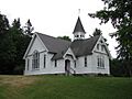
Church on the Hill
-
Church Street-Cady Hill Historic District
-

Citizens Hall
-
H. W. Clark Biscuit Company
-
Clark-Eames House
-
Clinton African Methodist Episcopal Zion Church
-
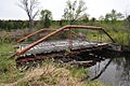
Coleman Bridge
-
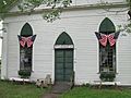
Congregational Church of West Stockbridge
-
Cranesville Historic District
-
Crowley House
-
Dalton Grange Hall No. 23
-
W.E.B. Du Bois Boyhood Homesite
-
Dwight-Henderson House
-
Philip Eames House
-
East Lawn Cemetery and Sherman Burbank Memorial Chapel
-
East Main Street Cemetery
-
Eaton, Crane & Pike Company Factory
-
Elm Court
-
Elm-Maple-South Streets Historic District
-
Fairview Cemetery
-
Farnams Village Historic District
-
Fitch-Hoose House
-
Five Corners Historic District
-
Freeman's Grove Historic District
-
Freight Yard Historic District
-
Glendale Power House
-
Golden Hill Bridge
-
Goodwood
-
Hall's Tavern
-
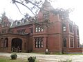
Hancock Shaker Village
-
Hancock Town Hall
-
Samuel Harrison House
-
Hathaway Tenement
-
Hillside Cemetery
-
Hoosac Street School
-
Hoosac Tunnel
-
Housatonic Congregational Church
-
Frank Howard Building
-
Hyde House
-
Hyde School
-
Jacob's Pillow Dance Festival
-
Johnson Manufacturing Company
-
Johnson School
-
Jones Block
-
Kenmore
-
Lee Lower Main Street Historic District
-
Lee Station
-
Lenox Academy
-
Lenox High School
-
Lenox Library
-
Lenox Railroad Station
-
Lower Historic District
-
Mahaiwe Block
-
Main Street Cemetery
-
Main Street Historic District
-
Maple Street Cemetery
-
Mausert Block
-
Herman Melville House
-
Merrell Tavern
-
Methodist Episcopal Society of Tyringham
-
Middlefield-Becket Stone Arch Railroad Bridge District
-
Mill River Historic District
-
Mill Village Historic District
-
Mission House
-
Mohawk Trail
-
Montville Baptist Church
-
Monument Mills
-
Monument Square-Eagle Street Historic District
-
Morewood School
-
Mount Greylock Summit Historic District
-
The Mount
-
Naumkeag
-
New Boston Inn
-
New Marlborough Village
-
Nichols-Sterner House
-

Norad Mill
-
Normal School Historic District
-
North Becket Village Historic District
-
North Egremont Historic District
-
Northeast School
-
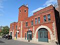
Old Central Fire Station
-
Old Central High School
-
Old Churchyard Cemetery
-
Old Covered Bridge
-
Old Curtisville Historic District
-
Old Town Hall
-
Benjamin Osborn House
-
Park Square Historic District
-
Park Street Firehouse
-
Pettibone Farm
-
Phillips Woolen Mill
-
Pilgrim Memorial Church and Parish House
-
Pittsfield & North Adams Passenger Station and Baggage & Express House
-
Pittsfield Cemetery
-
Charles Whittlesey Power House
-
Providence Court
-
Quaker Meetinghouse
-

Ramsdell Public Library
-
Renfrew Mill No. 2
-
A.H. Rice Silk Mill
-
Richmond Furnace Historical and Archeological District
-
Rising Paper Mill
-
Rock Ridge
-
Philemon Sage House
-
Saint Andrew's Chapel
-
St. Joseph's School
-
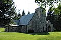
St. Luke's Episcopal Church
-
Searles Castle
-
Shadow Brook Farm Historic District
-
Shaker Farm
-
Sheffield Center Historic District
-
Sheffield Plain Historic District
-
Thomas Shepard House
-
Eber Sherman Farm
-
William B. Sherman Farm
-
Sibley-Corcoran House
-
Simmons Block
-
Col. Benjamin Simond House
-
Society of the Congregational Church of Great Barrington
-
South Center School House
-

South Egremont Village Historic District
-
South Lee Historic District
-
South Mountain Concert Hall
-
Springside Park
-
Stafford Hill Memorial
-
Stockbridge Casino
-
Summer Street Historic District
-
Sykes House
-
Taconic and West Avenues Historic District
-
Trinity Episcopal Church
-
Tyringham Cemetery
-
Tyringham Shaker Settlement Historic District
-
Upper Historic District
-
Upper North Street Commercial District
-
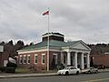
US Post Office-Great Barrington Main
-
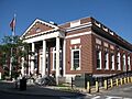
US Post Office-Williamstown Main
-
Ventfort Hall
-
Villa Virginia
-
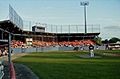
Wahconah Park
-
Wells House
-
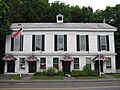
West Stockbridge Grange No. 246
-
West Stockbridge Town Hall
-
Westover-Bacon-Potts Farm
-
Wheatleigh
-
Wheeler Family Farmstead
-
Williamstown Rail Yard and Station Historic District
-
Windsor Print Works
-
Wollison-Shipton Building


_3.jpg)


.jpg)


,_Pittsfield,_Massachusetts.JPG)


.JPG)


_-_general_view.JPG)


_,_Egremont_Mass.JPG)


