
Chelsea, Massachusetts facts for kids
Quick facts for kids
Chelsea
|
|||
|---|---|---|---|

The Tobin Bridge, linking Chelsea and Boston
|
|||
|
|||

Location in Suffolk County and the state of Massachusetts
|
|||

Chelsea, Massachusetts
Location in Greater Boston area

Chelsea, Massachusetts
Location in Massachusetts

Chelsea, Massachusetts
Location in the United States
|
|||
| Country | United States | ||
| State | Massachusetts | ||
| County | Suffolk | ||
| Settled | 1624 | ||
| Incorporated (town) | 1739 | ||
| Incorporated (city) | 1857 | ||
| Government | |||
| • Type | Council–manager | ||
| Area | |||
| • Total | 2.47 sq mi (6.39 km2) | ||
| • Land | 2.22 sq mi (5.75 km2) | ||
| • Water | 0.25 sq mi (0.64 km2) | ||
| Elevation | 10 ft (3 m) | ||
| Population
(2020)
|
|||
| • Total | 40,787 | ||
| • Density | 18,380.80/sq mi (7,097.87/km2) | ||
| Time zone | UTC−5 (Eastern) | ||
| • Summer (DST) | UTC−4 (Eastern) | ||
| ZIP Code |
02150
|
||
| Area code(s) | 617/857 | ||
| FIPS code | 25-13205 | ||
| GNIS feature ID | 0612723 | ||
| Website | www.chelseama.gov | ||


Chelsea is a city in Suffolk County, Massachusetts, United States. It is located right across the Mystic River from Boston. In 2020, about 40,787 people lived there. This makes Chelsea one of the most crowded cities in Massachusetts. Only Somerville has more people per square mile.
Chelsea is also the smallest city in Massachusetts by total area. It covers about 2.46 square miles (6.39 square kilometers). Chelsea has one of the highest percentages of Latino residents in Massachusetts. Only Lawrence has more.
Contents
History of Chelsea
Early Days
The area where Chelsea is now was first called Winnisimmet. This name might mean "swamp hill." The Naumkeag tribe lived here for thousands of years.
First European Settlers
Samuel Maverick was the first European to live permanently in Winnisimmet. He settled there in 1624. His trading post was the first lasting settlement near Boston Harbor. In 1635, Maverick sold most of Winnisimmet to Richard Bellingham. Only his house and farm were kept.
The community was part of Boston until 1739. That year, it became its own town. It was named after Chelsea, a neighborhood in London, England.
American Revolution
In 1775, the Battle of Chelsea Creek happened here. This was the second battle of the Revolutionary War. During this battle, American forces captured a British ship for the first time. Part of George Washington's army stayed in Chelsea during the Siege of Boston.
Growth in the 1800s
On February 22, 1841, a part of Chelsea became part of Saugus. Then, in 1846, North Chelsea became a separate town. This area is now Revere and Winthrop.
Chelsea became a city again in 1857. It grew into a busy industrial center. In the mid-1800s, it was known for building wooden sailing ships. As steam power became more common, Chelsea's industries changed. Factories making rubber, elastic goods, shoes, stoves, and glues opened. These factories were built along Boston Harbor. The Chelsea Naval Hospital, designed by Alexander Parris, opened in 1836.
Many Russian Jews and other immigrants from Eastern Europe came to Chelsea after 1890. By 1910, almost one-third of the city's population was Jewish. Chelsea had a very large Jewish community for its size.
Fires and Changes in the 1900s

On April 12, 1908, a huge fire destroyed almost half of Chelsea. This was the first of two big fires. About 18,000 people lost their homes. Many found shelter with neighbors or in nearby Revere. It took years for the city to rebuild. After the fire, streets were made wider for emergency vehicles.
By 1919, Chelsea had over 52,000 people. Almost half of them were born in other countries. The city's waterfront was busy with shipbuilding, lumberyards, and factories.
Between 1940 and 1980, Chelsea's population went down. This was partly because the Northeast Expressway was built. This highway connected Boston to the northern suburbs using the Mystic River Bridge.
In 1973, the Second Great Chelsea Fire destroyed 18 city blocks. Both major fires started in areas with many old shops and buildings. These buildings were close together and made of wood, so fires spread quickly.
By 1990, Chelsea faced tough times. The city's finances were in trouble. There were also issues with local government. Many people had moved away, which meant less tax money for the city.
In 1991, the state of Massachusetts stepped in to help Chelsea. For the first time in a long time, a Massachusetts city let the state take control. A state-appointed manager helped reorganize city services. Management of the public schools was even given to Boston University for a time.
By 1995, Chelsea's government was returned to its people. A new plan for the city was created. This plan changed how the city was run. Instead of a mayor, a city manager now leads the city. This manager is chosen by the City Council. This new system helped improve city services and finances.
Geography of Chelsea


Chelsea is on a small piece of land in Boston Harbor. It is the smallest city in Massachusetts by area. Water surrounds Chelsea on three sides. The Mystic River is to the southwest. The Chelsea Creek and other smaller rivers are to the west.
Chelsea's land has low coastal areas and four hills. These hills were formed by glaciers long ago. They are called Admirals Hill, Mount Bellingham, Powderhorn Hill, and Mount Washington. A smaller hill, Mill Hill, is also in Chelsea. These hills help divide the city into different neighborhoods. Each neighborhood has its own special feel.
Chelsea's Neighborhoods
Chelsea has several unique neighborhoods:
- Admirals Hill: This area is between the Mystic River and Island End River. It has many homes and the historic Naval Hospital Boston Historic District. Mary O'Malley Park, Chelsea's largest public park, is on the south side of the hill.
- Addison-Orange: This neighborhood is north of downtown. It is flat, residential, and has many homes close together.
- Bellingham Square: This area became the city's main center after the 1908 fire. It has City Hall, which looks like Old Independence Hall in Philadelphia. The Public Library and Phoenix Charter Academy are also here.
- Box District: This neighborhood is near City Hall. It got its name from box-making companies that used to be here. Now, it has been redeveloped for homes.
- Carter Park—Wyndham Area: This small area has mostly single-family homes in the Queen Anne style. Chelsea High School, Boston's FBI office, and Mystic Mall are in this area. The historic Chelsea Clock Company used to be here.
- Chelsea Square: This historic area includes a waterfront section. The Chelsea Police Department is located here.
- Chelsea Commons: This area used to be a landfill. It now has large stores, restaurants, and apartment buildings. It is bordered by wetlands.
- Mill Hill: This is a residential area with many two- and three-story wooden homes. It is on a small piece of land between Chelsea Creek and Mill Creek.
- Prattville: This is the northwestern part of the city. It borders Revere and Everett. Washington Park and Voke Park are in this area.
- Soldiers Home: This neighborhood is on Powderhorn Hill. It has many Queen Anne style homes. The Soldiers Home building is at the top of the hill.
- Waterfront District: This area is mostly for industrial businesses. But Chelsea is working to connect more with its waterfront.
People in Chelsea
Population Facts
| Historical population | ||
|---|---|---|
| Year | Pop. | ±% |
| 1790 | 472 | — |
| 1800 | 849 | +79.9% |
| 1810 | 594 | −30.0% |
| 1820 | 642 | +8.1% |
| 1830 | 771 | +20.1% |
| 1840 | 2,390 | +210.0% |
| 1850 | 6,701 | +180.4% |
| 1860 | 13,395 | +99.9% |
| 1870 | 18,547 | +38.5% |
| 1880 | 21,782 | +17.4% |
| 1890 | 27,909 | +28.1% |
| 1900 | 34,072 | +22.1% |
| 1910 | 32,452 | −4.8% |
| 1920 | 43,184 | +33.1% |
| 1930 | 45,816 | +6.1% |
| 1940 | 41,259 | −9.9% |
| 1950 | 38,912 | −5.7% |
| 1960 | 33,749 | −13.3% |
| 1970 | 30,625 | −9.3% |
| 1980 | 25,431 | −17.0% |
| 1990 | 28,710 | +12.9% |
| 2000 | 35,080 | +22.2% |
| 2010 | 35,177 | +0.3% |
| 2020 | 40,787 | +15.9% |
| 2022 | 38,637 | −5.3% |
| U.S. Decennial Census | ||
In 2010, Chelsea had 35,177 people living in 11,888 homes. The city is very crowded, with many people living in a small area. Some estimates suggest the actual population might be higher, possibly 50,000 or more.
The people in Chelsea come from many different backgrounds. In 2010, about 47.8% were White, 8.5% Black, and 3.1% Asian. About 62.1% of residents were Hispanic or Latino. Many people are from El Salvador, Puerto Rico, Honduras, and Guatemala.
About 27.3% of the population is under 18 years old. The average age in Chelsea is 31 years. The median income for a family was $32,130. About 23.3% of the population lived below the poverty line.
People from Other Countries
In 2010, 38% of Chelsea residents were born outside the United States. This is the highest percentage in Massachusetts. Chelsea has an "Interfaith Alliance" that brings together Jewish, Christian, and Muslim communities. They work to promote acceptance and diversity. The city also has a "Sanctuary City Resolution" to support all foreign-born residents.
Economy of Chelsea
Major Employers
Here are some of the biggest employers in Chelsea:
| # | Employer | # of Employees |
|---|---|---|
| 1 | City of Chelsea | 1,254 |
| 2 | Massachusetts Information Technology Center | 1,150 |
| 3 | Market Basket | 900 |
| 4 | Massachusetts Water Resources Authority | 568 |
| 5 | Kayem Foods | 328 |
| 6 | Massachusetts General Hospital | 246 |
| 7 | Paul Revere Transportation | 220 |
| 8 | Signature Breads | 202 |
| 9 | Metropolitan Credit Union | 178 |
(Note: Stop & Shop closed in 2023)
Economic Development
Chelsea uses special programs to help its economy grow. They work with students from Harvard Kennedy School to get new ideas. In 2016, the City Council approved a $5.2 million grant. This money was for improving roads and other important city structures. The city also has a "Downtown Coordinator" to help local businesses.
Since 2017, city officials have worked on "Reimagining Broadway." This project aims to make downtown streets better for cars, walkers, and public transport. The state also helps Chelsea with its Transformative Development Initiative (TDI). This program helps cities grow their economies.
Other projects like "Commonwealth Places" and "The Chelsea Business Foundation" are also helping Chelsea's economy.
City Improvement Plan
Chelsea has a plan to invest in its future. This plan includes money for parks, building repairs, and water systems. It also covers street and sidewalk improvements. New equipment for graffiti and snow removal will also be bought. These efforts aim to make life better for residents. A large part of the budget is for improving streets and sidewalks.
Housing in Chelsea
Chelsea has about 12,940 households. Most homes (72.1%) are rented, while 27.9% are owned. Chelsea is known as the "City of Renters." However, there is a push to help more people own their homes. The Chelsea Restoration Corporation helps with this. They offer workshops and work with partners to create affordable housing.
Many homes in Chelsea use natural gas for heating. The city is also working on renewable energy and sustainability. They partner with SolSmart to make solar panels more accessible. They offer affordable options and provide information about solar energy.
Reimagine Broadway Project
Reimagine Broadway began in 2017. It is a plan to improve downtown Chelsea. The project aims to make public spaces better. It also supports existing businesses and helps new ones grow. The goal is to make the area look nicer and safer for everyone. This includes improving how cars, buses, walkers, and bikers move around.
Getting Around Chelsea
Roads
The Route 1 North Expressway is a major highway. It cuts through the middle of Chelsea. The Tobin Bridge carries Route 1 from Chelsea. It crosses the Mystic River to Charlestown.
Train Service
Chelsea has train service from the Massachusetts Bay Transit Authority (MBTA). The Commuter Rail goes from Boston's North Station. It stops at the Chelsea station on the Newburyport/Rockport Line. Some MBTA bus routes also connect to the subway system.
Bus Service
Many MBTA bus routes serve Chelsea. They provide local service to nearby cities like East Boston, Revere, and Everett. There are also fast bus connections to Logan Airport and downtown Boston. These are part of the MBTA's Silver Line.
The Silver Line's SL3 route started in 2018. It goes from South Station through a tunnel. It connects to the Blue Line at Airport Station. The Silver Line stops at four stations in Chelsea: Eastern Avenue, Box District, Downtown Chelsea, and Mystic Mall. A new train station was built at Mystic Mall. This helps trains move better and makes the area more accessible.
There is also a multi-use path for walking and biking. It runs next to the Silver Line busway. This path connects Downtown Chelsea and Eastern Avenue stations.
Education in Chelsea
Chelsea Public Schools has four elementary schools. It also has three middle schools and one high school, Chelsea High School. The school system has faced challenges with test scores. Many students move in or out during the year.
From 1988 to 2008, Boston University helped manage the school district. After that, the schools returned to local control. Chelsea no longer has private schools, as St. Rose closed in 2020. There are two public charter schools: Excel Academy and Phoenix Charter Academy. Bunker Hill Community College and Everest Institute also have locations in Chelsea.
Fire Department

The City of Chelsea Fire Department has firefighters working from three stations. Each shift is led by a Deputy Chief. The department has four engines, two ladders, and other special units. They respond to about 11,000 emergency calls each year. The Chief of Department is John Quatieri.
Emergency Medical Services are provided by a private company called Cataldo Ambulance Service. They have served Chelsea since 1982.
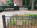
Places to See in Chelsea
Historic Sites
Chelsea has eight places listed on the National Register of Historic Places.
-
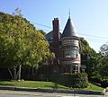
C. Henry Kimball House
-
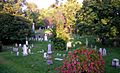
Chelsea Garden Cemetery
-
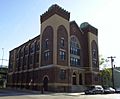
Congregation Agudath Shalom


Chelsea Clock Company
The Chelsea Clock Company was founded in 1897. It is an American company that still makes clocks today. In 2015, the company moved to a smaller building. Their old building was torn down to build new homes.
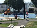
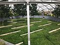
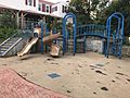
Parks and Open Spaces
-
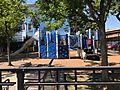
Kayem Park
-
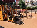
Dever Park
-
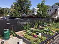
Anita's Garden
-
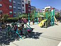
Judie Dyer Park
-
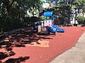
Eden Street Park
-
Bellingham Park
-
Port Park
-
Ciepela Memorial Park
-
O'Neil Park
-
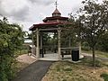
Mystic River Overlook Park & Dog Park
-
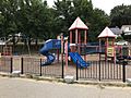
Carter Park
-
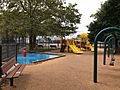
Voke Park


Famous People from Chelsea
- Horatio Alger, author
- Richard Bellingham, early governor of the Massachusetts Bay Colony
- Ian Bremmer, political scientist
- Vannevar Bush, co-founder of Raytheon Company
- Chick Corea, jazz musician
- Norman Cota, United States Army general
- Lewis Howard Latimer, scientist and inventor
- Samuel Maverick, early colonist
- John Ruiz, heavyweight boxing champion
- Arnold Stang, actor
- Elizabeth Cady Stanton, social activist and leader in women's rights
- Michelle Tea, author and artist
- Carl Voss, National Hockey League Hall of Famer
See also
 In Spanish: Chelsea (Massachusetts) para niños
