
Nemrut (volcano) facts for kids
- Turkey also has a mountain called Nemrut
Quick facts for kids Nemrut Dağı |
|
|---|---|

Satellite view from 2001
|
|
| Highest point | |
| Elevation | 2,948 metres (9,672 feet) |
| Geography | |
| Location | Turkey |
| Geology | |
| Mountain type | Stratovolcano |
| Last eruption | 1692 |
Nemrut (in Turkish: Nemrut Dağı, in Armenian: Սարակն, meaning «Mountain spring», and in Kurdish Çiyayê Nemrud) is a huge, dormant volcano in Eastern Turkey. It is located very close to Lake Van.
This volcano gets its name from King Nimrod. People say he ruled this area around 2100 BC.
Contents
What is Nemrut Volcano?
Nemrut is a type of volcano called a stratovolcano. It sits where two giant land plates, the Arabian and Eurasian plates, are slowly crashing into each other. This collision causes a lot of earthquakes and volcanic activity in the area.
The collision of these plates started millions of years ago. It closed a large ancient sea called the Tethys Ocean.
Nemrut is one of four large volcanoes in eastern Turkey. The others are Ararat, Tendürek, and Süphan. All of them are found along a big crack in the Earth's crust. This crack runs along the edge of the Arabian and Eurasian plates.
Nemrut is the westernmost of these volcanoes. It is also the only one that has erupted in recent history. It is about 10 kilometers (6 miles) north of the city of Tatvan. This city is on the northwestern shore of Lake Van.
How Nemrut Formed
Nemrut volcano likely started forming about 1 million years ago. This was during the early Quaternary Period. It was most active during the Ice Age, with many eruptions.
About 250,000 years ago, a huge eruption happened. It created a lava flow over 60 kilometers (37 miles) long. This lava blocked the water flowing out of the Van basin. This is how Lake Van was formed. It is now the world's largest salty, landlocked lake.
Around the same time, the top of the volcano collapsed inwards. This formed a giant bowl-shaped area called a caldera. It is about 8.3 by 7 kilometers (5.2 by 4.3 miles) wide. Later, a freshwater lake called Lake Nemrut formed inside this caldera. It is now the world's second largest caldera lake. Other eruptions later separated a smaller lake, Ilı, from Lake Nemrut.
Nemrut volcano has an oval shape. Its base is about 27 by 18 kilometers (17 by 11 miles) wide. It contains a massive amount of volcanic rock. The caldera of Nemrut is the largest in Turkey. It is also the fourth largest in Europe and the sixteenth largest in the world.
Volcanic Activity
Nemrut's eruptions were mostly explosive, like the Plinian type. They produced different kinds of lava, from basalt to rhyolite. They also released ash and volcanic rock. Some eruptions were gentle, while others were very powerful.
Nemrut sits on a crack in the Earth that runs from north to south. This crack goes through the main crater. It also has many smaller craters, hot springs, and steam vents called fumaroles.
|
 |
 |
| Nemrut from space in winter | The caldera seen from its southeastern edge | Red line shows the Nemrut fault with arrows indicating directions of lava flows |
The volcano's activity happened in three main stages. First, the cone formed. Then, activity happened after the caldera collapsed. Finally, there was a late stage of eruptions.
How the Volcano Cone Formed
Nemrut started forming about 1 million years ago. Lava first came out of long cracks in the ground. Later, it came from specific openings. These early eruptions created a thick layer of volcanic ash and rock. This covered an area of 500 square kilometers (193 square miles).
The cone of Nemrut grew taller from flowing lava. This lava filled the Bitlis gorge for 80 kilometers (50 miles). The lava flows were up to 200 meters (656 feet) wide. They were also 5 to 30 meters (16 to 98 feet) thick. Eventually, the cone reached a height of about 4400-4500 meters (14,400-14,800 feet).
A huge eruption then created large empty spaces inside the volcano. This caused the top of the cone to collapse. This formed the caldera. Scientists first thought this happened about 310,000 years ago. But newer studies suggest it happened about 270,000 years ago. The collapse likely happened in three steps.
Activity After the Caldera Formed
After the caldera formed, eruptions happened around its edges. They created more than ten small craters, mostly on the northern side. These eruptions produced thick, sticky lavas. Volcanic ash and rock also piled up at the bottom of the caldera. This formed rocks like obsidian. A cone-shaped crater called Göltepe also formed inside the caldera.
Recent Activity
In the most recent stage, about 20 small craters formed on the caldera floor. Many also formed outside the main cone, especially in the north. The lava from these craters is the youngest rock found at Nemrut.
The last known eruption happened on April 13, 1692. Since then, only bursts of steam have been seen at the bottom of the caldera. This shows that some heat is still coming from inside the volcano.
Nemrut's Historical Importance
Besides the stories about King Nimrod, Nemrut played a big role in early human history. Scientists found that Nemrut was a main source of obsidian. Obsidian is a sharp, glass-like volcanic rock. It was very important for making tools in the Stone Age. People in Mesopotamia and around the Dead Sea used obsidian from Nemrut.
 |
 |
 |
| Obsidian deposits at the bottom of Nemrut caldera | Obsidian arrowhead | Obsidian eye in an ancient sculpture |
An ancient center for processing and trading obsidian was found at Lake Van. This was part of one of the earliest trade routes.
Two eruptions of Nemrut were likely seen by people of Urartu. This was an ancient kingdom in eastern Turkey. These eruptions happened around 787 BC and 657 BC. The later eruption might have caused the sudden disappearance of the city of Uaiais. This city was 30 kilometers (19 miles) east of Süphan.
Nemrut Today
Current Volcanic Activity
In the 1980s, scientists studied gases inside Nemrut's caldera. They found certain gases that show volcanic activity is still happening deep inside. Recent studies have confirmed this.
The area also has many earthquakes. Several recent earthquakes are directly linked to the Nemrut fault. Strong earthquakes have happened near Nemrut in the last 150 years. These include quakes in 1881, 1907, 1913, 1915, and 1997.
Scientists believe the way the plates are pushing might be changing. This could affect future volcanic activity. Hot springs and steam vents are still active at the bottom of the caldera.
 |
 |
 |
| A fumarole (steam vent) of Nemrut on the bottom of the caldera | One of the hot springs that feeds Lake Nemrut | |
Nemrut's Structure
The volcano has an oval shape and covers 486 square kilometers (188 square miles). It contains a huge amount of volcanic material. Nemrut has a clear caldera. The highest point of the caldera's edge is 2,935 meters (9,629 feet) above sea level. This point is called Sivritepe.
The walls of the caldera are about 600 meters (2,000 feet) high from its bottom. The lowest point of the caldera is also the deepest point of Lake Nemrut. There are three lakes at the bottom of the caldera: the large Lake Nemrut, and two smaller ones, Ilı and the "Seasonal Lake."
 |
 |
 |
| Ilı, eastern view | Lake Nemrut, northeastern view | "Seasonal Lake" |
Lake Nemrut
Lake Nemrut (in Turkish: Nemrut gölü) is in the southwestern part of the caldera. It is a freshwater lake. However, due to volcanic processes, it is slowly becoming a salty lake. Hot springs feed the lake, making its bottom warmer than its surface. This is why it does not freeze in winter. The lake is 4.9 by 2.1 kilometers (3.0 by 1.3 miles) wide. Its average depth is 140 meters (460 feet), and its deepest point is 176 meters (577 feet). The lake is 2,247 meters (7,372 feet) above sea level.
Lake Ilı
Lake Ilı, which means "hot lake," was separated from Lake Nemrut by an old lava flow. Ilı is closer to the fault line. So, it gets more hot spring water and is warmer. In summer, its temperature can reach 60 °C (140 °F). On average, it is 6–8 °C (11–14 °F) warmer than expected for a lake at its height. Even so, it partly freezes in winter because it is small and not very deep.
Risk of Future Eruptions
Recent studies show that future eruptions are possible. Nemrut is close to several towns. These include Tatvan (10 km or 6 miles away, population 66,000), Bitlis (population 52,000), and Ahlat (population 22,000). In total, about 135,000 people live in the area that could be affected by an eruption.
The caldera also holds over 1 cubic kilometer (0.24 cubic miles) of water. This means there is a risk of flooding. A flood could destroy Güroymak, a town of 15,000 people.
Climate, Plants, and Animals of the Caldera
The climate inside the caldera is special for the Armenian Highland. It is the only place in the region where deciduous trees (trees that lose their leaves) grow at high altitudes. This is because of the warm temperatures, humidity, and protection from winds by the caldera walls. The caldera also has unique flowers and trees.
Velvet scoters and two types of gulls live and breed on the shores of Lake Nemrut. For a long time, the bottom of the caldera has been used for grazing animals from nearby villages.
 |
 |
 |
| Unusual deciduous trees for the region | Gull at Lake Nemrut | Flock of sheep on the banks of a seasonal hot spring |
Tourism at Nemrut
Nemrut is known as one of the most amazing volcanoes in the region. You can reach its caldera in the summer using 4x4 vehicles. You can drive from the south or east side.
Nemrut is covered with snow for five months each year. Because of this, Turkish authorities are building a ski resort there. It will have a 2,517 meter (8,258 feet) long ski track on its slopes.
 |
 |
Left: unfinished elevator on the southern slope of Nemrut which will be part of a ski resort, right: a road to caldera on the south-eastern slope. |
Images for kids
-
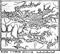
A 19th century map of the Nemrut area composed by a British traveler.

See also
 In Spanish: Nemrut (volcán) para niños
