Nepean Bay facts for kids
Quick facts for kids Nepean Bay |
|
|---|---|
 |
|
| Location | Kangaroo Island, South Australia |
| Coordinates | 35°40′57″S 137°44′43″E / 35.68250°S 137.74528°E |
| Type | Bay |
| Basin countries | Australia |
| Max. length | 30 km (19 mi). |
| Max. width | 30 km (19 mi) |
| Max. depth | 13.4 m (44 ft) |
| Islands | Busby Islet, Beatrice Islets |
| Settlements | Kingscote Cygnet River Brownlow KI Nepean Bay American River Baudin Beach Island Beach |
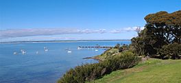
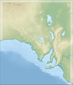
Nepean Bay is a large bay located on the north-east coast of Kangaroo Island in South Australia. It's about 130 kilometers (80 miles) south-south-west of Adelaide, the capital city of South Australia.
This bay was given its name by a British explorer named Matthew Flinders. He named it after Sir Evan Nepean on March 21, 1802. Sir Evan Nepean was an important person in the British Navy at the time.
Contents
Where is Nepean Bay Located?
Nepean Bay is found between two points on Kangaroo Island: Point Marsden and Kangaroo Head. It faces into a larger body of water called Investigator Strait.
Inside Nepean Bay, there are several smaller water areas, like smaller bays or inlets. These include the Bay of Shoals, Western Cove, and Eastern Cove. Eastern Cove also has a special channel called American River, which connects to a lagoon system known as Pelican Lagoon.
Bay of Shoals
The Bay of Shoals is a water area just north of the town of Kingscote. Its entrance is about 5 kilometers (3 miles) wide. The deepest part of this bay is about 2.7 meters (9 feet).
A narrow strip of land, like a sandbar, called 'The Spit' helps form the bay. This spit extends from Cape Rouge and includes two small islands: Busby Islet and Beatrice Islets. Sometimes, during low tides, parts of 'The Spit' can be seen above the water. Boats can enter the Bay of Shoals through a natural channel near Beatrice Point.
Kingscote Harbour
Kingscote Harbour is a calm and protected area of water located between the Bay of Shoals and Western Cove. The Beatrice Islets help to shield this harbor from strong waves. It sits right in front of the northern part of the town of Kingscote.
Western Cove
Western Cove is another part of Nepean Bay. Its entrance is about 8 nautical miles (15 kilometers or 9 miles) wide, stretching between Beare Point and Morrison Point. The deepest part of Western Cove's entrance is about 10 meters (33 feet).
The southern shore of Western Cove has high, rocky areas and wooded hills. Further west, the shoreline changes to red cliffs and then a long sandy beach. The land at the very end of the cove is low and can be swampy.
Eastern Cove
Eastern Cove is located between Morrison Point and Kangaroo Head, with an entrance about 6 nautical miles (11 kilometers or 7 miles) wide. It's the deepest part of Nepean Bay, reaching about 14 meters (46 feet) at its entrance.
The shoreline of Eastern Cove near Kangaroo Head is rugged and rocky. As you move south, you'll find a mix of beaches and low, rocky points. The southern side of the cove has sandy beaches and low land with wooded hills behind it.
Eastern Cove also includes a smaller area called Ballast Head Harbor, which is on the western side near Ballast Head.
Towns and Settlements
Several towns and communities are located along the shores of Nepean Bay. These include:
- Kingscote
- Brownlow KI
- Nepean Bay (which is also the name of a small town)
- American River
- Baudin Beach
- Island Beach
Protected Areas
Nepean Bay is home to several protected areas that help look after its natural environment and wildlife. These include:
- Aquatic Reserves: American River Aquatic Reserve protects the water and marine life.
- Conservation Parks: These parks protect land areas and their plants and animals. They include Beatrice Islet, Busby Islet, Cygnet Estuary, Nepean Bay, and Pelican Lagoon.
- Marine Parks: The Encounter Marine Park helps protect the larger marine environment, including parts of Nepean Bay.
 | Jackie Robinson |
 | Jack Johnson |
 | Althea Gibson |
 | Arthur Ashe |
 | Muhammad Ali |


