New Norfolk facts for kids
Quick facts for kids New NorfolkTasmania |
|||||||||
|---|---|---|---|---|---|---|---|---|---|
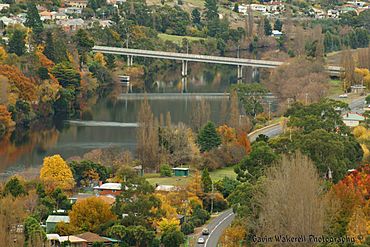
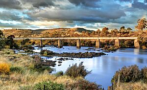
New Norfolk's Blair Street Bridge and River Derwent in autumn, 2012
|
|||||||||
| Population | 6,153 (2021 census) | ||||||||
| Established | 1807 | ||||||||
| Postcode(s) | 7140 | ||||||||
| Location |
|
||||||||
| LGA(s) | Derwent Valley Council | ||||||||
| State electorate(s) | Lyons | ||||||||
| Federal Division(s) | Lyons | ||||||||
|
|||||||||
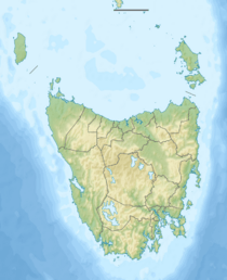
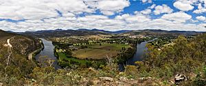
New Norfolk (pronounced nyoo NOR-fək) is a town by the River Derwent. It is located in southeastern Tasmania, Australia. The local Aboriginal people, the Leenowwenne, called this area wulawali.
New Norfolk was started in 1807. This makes it Tasmania's fourth-oldest European town. It is also the twelfth oldest in all of Australia! People from Norfolk Island first settled here.
As of 2021, about 6,153 people live in New Norfolk. It is the main town in the Derwent Valley region. The town is about 32 kilometers (20 miles) northwest of Hobart. It sits along the Lyell Highway.
For a long time, New Norfolk's economy relied on farming. Growing hops (used in beer) and the timber industry were very important. The Boyer Mill is a big paper factory nearby. It is the only place in Australia that makes newsprint, magazine, and book paper.
Recently, New Norfolk has been growing. A large housing and community project called The Mills is being built. Tourism is also a big industry. People visit for the town's natural beauty and old buildings. St. Matthews Anglican Church is Tasmania’s oldest church. The Bush Inn is one of Australia’s oldest hotels that is still open. The Salmon Ponds, started in 1861, is the oldest trout hatchery in the southern hemisphere.
In 2024, a company called Incat announced plans to build electric ferries nearby. This project could create up to 1,000 jobs.
Contents
Discovering New Norfolk's Past
The area where New Norfolk now stands was once home to the Leenowwenne people. They were one of five Aboriginal tribes in the Big River district. Aboriginal Tasmanians arrived in Tasmania about 40,000 years ago. They crossed a land bridge from mainland Australia. When the ice age ended, sea levels rose. This created Bass Strait, separating Tasmania from Australia.
In 1793, explorer John Hayes was the first European to explore this area. He sailed up the River Derwent. When the water became too shallow, he rowed further upstream. He reached a spot just past where New Norfolk is today.
How Norfolk Islanders Settled Here
After a settlement on Norfolk Island closed, many people moved to Tasmania. Between 1807 and 1808, 544 soldiers, convicts, and free settlers came to New Norfolk. Many free settlers were farmers. They were given land in Tasmania to make up for moving.
The weather here was colder than Norfolk Island. This was tough for the first settlers. But after a few years, the area could support itself. In 1825, the town's first name, Elizabeth Town, was changed. It became New Norfolk to honor their old home.
Many of the first people here were "First Fleeters." These were people who arrived in Australia on the First Fleet in 1788. Ten First Fleeters are buried in a church at Lawitta, New Norfolk. One famous person was Betty King. She was a First Fleet convict. Her gravestone says she was "The first white woman to set foot in Australia." She was also believed to be the last surviving First Fleeter when she died at 89. Her husband, Samuel King, was also a First Fleeter. He was the last male First Fleeter to survive.
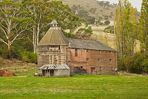
The early settlers were good farmers. They raised cattle and sheep. They also grew crops as they cleared the land. Hop plants were brought in in 1846. They became a very important crop. You can still see old hop drying kilns, called oast houses, in the area.
The First Road in Van Diemen's Land
In 1818, a former convict named Denis McCarty suggested building a road. It would connect Hobart Town and New Norfolk. This road would help open up the valley. It would also help stop bushrangers (outlaws).
McCarty offered to build a road from New Town to Austins Ferry. He would then extend it to New Norfolk. He asked for land and supplies in return. His first offer was turned down. But later, he was asked to quote for a wider road.
Even without a formal contract, McCarty started building. The Hobart Town Gazette newspaper wrote about it. They said the road would be a great help to the settlement. By June 1819, McCarty said the road was finished. But when officials checked it, they found it was in poor condition. It lacked proper drainage and bridges.
Willow Court: A Historic Site
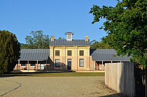
Willow Court is a very old and important place in New Norfolk. It was started in 1827 by Governor George Arthur. It was part of the New Norfolk Asylum. This made it one of Australia’s oldest places for mental health care. At first, it housed convicts who were mentally ill. Later, it cared for people with mental and intellectual disabilities.
Willow Court was a key part of Australia's mental health system for over 170 years. It closed in 2000. Its history shows how ideas about mental health care have changed. In earlier years, conditions at Willow Court were often very hard. Patients sometimes received old-fashioned and unkind treatments.
Today, Willow Court is a heritage site. It has 23 buildings and covers about 18 hectares (44 acres). The original building, called the Barracks, is still there. Other buildings show different styles from over the years. Today, it is a large antiques center. There are plans to fix up parts of it for tourism and community use.
The site's history reminds us of the difficult past of mental health care. But it is also a rich historical place. Willow Court is also rumored to be haunted! This has made it popular for ghost tours and paranormal investigations.
The Derwent Valley Railway
The Derwent Valley Railway is a historic train line in New Norfolk. It first opened in 1887. The line was 18 kilometers (11 miles) long, from Bridgewater to New Norfolk. Over time, it was made longer, reaching 74 kilometers (46 miles) by 1936. It mainly served farms and logging areas. Train traffic grew a lot when the Boyer paper mill opened in 1940.
Parts of the line started closing in the mid-1900s. Floods in 1995 caused the line to close past New Norfolk. A group called the Derwent Valley Railway Preservation Society wants to bring back tourist trains. They are working to restore parts of the line.
The Plaza Theatre
In 1932, Mrs. R. M. Hall built the Plaza Theatre in New Norfolk. It cost about £A2,200. Her late husband had started showing films in the area 24 years earlier. After he died, Mrs. Hall continued the business. She brought in "talkies" (movies with sound).
The theatre could originally seat 500 to 600 people. It had a sloped floor so everyone could see the stage. It also had modern sound and film equipment. In 1940, more seats were added, making room for 650 people. But by 1971, seating was cut to 250. In 1986, parts of the theatre were changed into shops. By 2016, the building had become a pharmacy.
The Boyer Mill
The Boyer Paper Mill is a big factory near New Norfolk. It has been very important to the area's economy since it opened in 1941. The mill makes newsprint and other paper for books and magazines. It was the first mill in the southern hemisphere to make paper from pine trees grown on farms. This was a big step towards using more sustainable materials.
The Boyer Mill helped Tasmania's industries grow. It also gave many jobs to people in the area. Over the years, it has changed to become more efficient and environmentally friendly. The mill has supplied paper for newspapers across Australia and Asia.
Even though fewer people read print newspapers now, the Boyer Mill still operates. It keeps finding new ways to work. It is still a key part of the Derwent Valley's economy. The mill also helps the region develop new industries, like renewable energy.
Exploring New Norfolk: A Tourist's Guide
New Norfolk is a great place for tourists in the Derwent Valley. From here, you can easily visit places like Mount Field, Lake Pedder, and the Gordon Dam. The town has a Tourist Information Centre on Circle Street.
In 2021, New Norfolk won the "Top Tourism Town" award. This shows it is becoming a popular place to visit. The town is also known for its great wine and food. The Agrarian Kitchen was named Restaurant of the Year in 2024. This was the first time a Tasmanian restaurant won this award!
Old buildings like Glen Derwent and Tynwald are now bed-and-breakfasts. They also host tea rooms, restaurants, and weddings. Other historic homes, like Stanton and Valleyfield, are still standing. Woodbridge on the Derwent is a beautiful old mansion from 1825. It is now a luxury hotel. It was built by convicts for Captain Roadknight, the first police officer of Elizabeth Town. The old Tollhouse by the Blair Street Bridge is still there.
New Norfolk is also called the "antiques capital of Tasmania." It has many antique shops. There is a large antique complex in the old Willow Court area. With its natural beauty, history, and great food, New Norfolk is a growing tourist spot in Tasmania.
Who Lives in New Norfolk?
| Historical population | ||
|---|---|---|
| Year | Pop. | ±% |
| 2001 | 5,009 | — |
| 2006 | 5,230 | +4.4% |
| 2011 | 5,543 | +6.0% |
| 2016 | 5,834 | +5.2% |
| 2021 | 6,153 | +5.5% |
| Source: Australian Bureau of Statistics census data. | ||
New Norfolk is a typical Tasmanian regional town. It has an older population. Many people work in traditional jobs. The cost of living here is cheaper than in Hobart.
In 2021, about 6,153 people lived in New Norfolk's town center. If you include the nearby areas, the total population is 7,293. Most residents have English (41.1%) or Australian (36.2%) family backgrounds. About 6.2% of New Norfolk's people are Aboriginal Australians or Torres Strait Islander. This is higher than the Australian average of 3.2%.
Almost half (47.6%) of people say they have no religion. Anglicanism is still common (16.5%). The average age in New Norfolk is 40. This is older than the national average of 38. Many people are over 55 years old. This is common in many regional Tasmanian towns.
In 2021, the average household income in New Norfolk was $1,107 per week. This is lower than the national average of $1,746. This shows that incomes in regional towns are often lower than in big cities. The main local jobs, like farming and retail, usually pay less. New Norfolk's unemployment rate was 6.8%. This is a bit higher than the national rate of 5.1%.
More people own their homes in New Norfolk than in big cities. Houses are cheaper here than in Hobart. This makes it a good choice for families and retirees. The town has several schools for primary and secondary education. Some students travel to Hobart for higher education.
New Norfolk's Climate
New Norfolk is Tasmania's warmest area during summer afternoons. It has a cool oceanic climate. This type of climate is called Cfb in the Köppen Climate Classification.
| Climate data for New Norfolk, 1965-1983 | |||||||||||||
|---|---|---|---|---|---|---|---|---|---|---|---|---|---|
| Month | Jan | Feb | Mar | Apr | May | Jun | Jul | Aug | Sep | Oct | Nov | Dec | Year |
| Record high °C (°F) | 39.4 (102.9) |
39.4 (102.9) |
37.8 (100.0) |
29.0 (84.2) |
23.8 (74.8) |
19.6 (67.3) |
20.0 (68.0) |
23.1 (73.6) |
27.6 (81.7) |
31.1 (88.0) |
36.1 (97.0) |
37.2 (99.0) |
39.4 (102.9) |
| Mean daily maximum °C (°F) | 25.2 (77.4) |
25.0 (77.0) |
22.2 (72.0) |
18.3 (64.9) |
14.2 (57.6) |
11.0 (51.8) |
9.9 (49.8) |
10.9 (51.6) |
14.5 (58.1) |
17.6 (63.7) |
19.3 (66.7) |
22.7 (72.9) |
17.3 (63.1) |
| Mean daily minimum °C (°F) | 10.8 (51.4) |
11.3 (52.3) |
9.5 (49.1) |
7.0 (44.6) |
4.4 (39.9) |
2.1 (35.8) |
1.3 (34.3) |
2.2 (36.0) |
4.5 (40.1) |
6.2 (43.2) |
8.2 (46.8) |
9.8 (49.6) |
6.6 (43.9) |
| Record low °C (°F) | −1.2 (29.8) |
2.0 (35.6) |
0.3 (32.5) |
−1.0 (30.2) |
−3.4 (25.9) |
−5.7 (21.7) |
−4.0 (24.8) |
−2.8 (27.0) |
−3.0 (26.6) |
−1.5 (29.3) |
0.0 (32.0) |
1.2 (34.2) |
−5.7 (21.7) |
| Average precipitation mm (inches) | 39.8 (1.57) |
34.6 (1.36) |
38.7 (1.52) |
47.6 (1.87) |
44.0 (1.73) |
48.6 (1.91) |
48.4 (1.91) |
46.6 (1.83) |
49.0 (1.93) |
55.0 (2.17) |
47.2 (1.86) |
49.6 (1.95) |
551.1 (21.70) |
| Average precipitation days | 8.0 | 6.8 | 8.8 | 10.1 | 11.1 | 12.0 | 13.0 | 13.9 | 13.2 | 13.8 | 12.0 | 10.8 | 133.5 |
Getting to New Norfolk
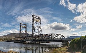
New Norfolk is on the Lyell Highway. This is the main road that goes east to west in southern Tasmania. It connects Hobart to Strahan on the west coast. The Lyell Highway is the only major east-west road in southern Tasmania. It links New Norfolk to other parts of the island.
The town is about 55 kilometers (34 miles) from Hobart Airport. You can also get there by bus. Metro Tasmania runs regular bus routes.
In the past, New Norfolk had passenger rail and freight rail services. Barges also traveled along the River Derwent. The town was an important stop on the Tasmanian Government Railways network. The Bridgewater Bridge was a key transport point. Paper from the Australian Newsprint Mills was sent by barges to Hobart until 1984. After that, river transport stopped.
 | Selma Burke |
 | Pauline Powell Burns |
 | Frederick J. Brown |
 | Robert Blackburn |


