North Fork Toutle River facts for kids
Quick facts for kids North Fork Toutle River |
|
|---|---|

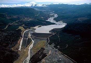
Sediment retention dam
|
|
|
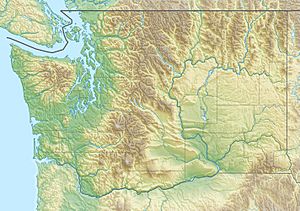
Location of the mouth of North Fork Toutle River in Washington
|
|
| Country | United States |
| State | Washington |
| County | Skamania, Cowlitz |
| Physical characteristics | |
| Main source | Spirit Lake (before 1980) Mount St. Helens National Volcanic Monument, Gifford Pinchot National Forest, Skamania County 3,449 ft (1,051 m) 46°15′54″N 122°09′39″W / 46.26500°N 122.16083°W |
| River mouth | Toutle River near Toutle, Cowlitz County 443 ft (135 m) 46°19′40″N 122°43′00″W / 46.32778°N 122.71667°W |
| Length | 39 mi (63 km) |
| Basin features | |
| Basin size | 302 sq mi (780 km2) |
The North Fork Toutle River is a river in southwestern Washington in the United States. It's a branch of the larger Toutle River. This river is famous because it was greatly changed by the 1980 eruption of Mount St. Helens.
Contents
About the North Fork Toutle River
Where the River Flows
The North Fork Toutle River starts near Spirit Lake. This area is on the north side of Mount St. Helens. The river flows for about 39 miles (63 km). It eventually joins the main Toutle River. This meeting point is about 17 miles (27 km) upstream from where the Toutle River meets the Cowlitz River. The biggest stream that flows into the North Fork Toutle River is called the Green River. It joins near the town of Toutle.
The Impact of the 1980 Mount St. Helens Eruption
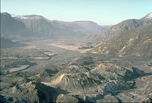
The area around the North Fork Toutle River was hit very hard by the 1980 eruption of Mount St. Helens. The eruption covered the valley with a thick layer of ash. It also caused huge mudflows, which are like rivers of mud and debris. These mudflows filled the valley.
Because of the eruption, many hillsides lost their trees. This meant that the soil and ash could wash away much more easily. As a result, the North Fork Toutle River became filled with a lot of sediment. Sediment is like tiny bits of rock, sand, and mud.
How the River Changed
Before the eruption, Spirit Lake was the source of the river. But the eruption blocked the lake's natural outlet. So, Spirit Lake no longer flowed directly into the North Fork. To fix this, a tunnel was dug in 1985. This tunnel connects Spirit Lake to South Coldwater Creek, which is a stream that flows into the North Fork.
The North Fork Toutle River used to be a more typical river. But after the eruption, it changed into a braided stream. This means it now has many small, shifting channels that weave in and out. The valley floor itself is quite new, less than 30 years old in some places.
Preventing More Sediment
All the extra sediment in the river caused problems. It could travel downstream and clog the shipping channel of the Columbia River. To stop this, the U.S. Army Corps of Engineers built a special structure. It's called the Toutle River Sediment Retention Structure. This dam was built in 1989. Its job is to hold back the sediment and keep it from going further downstream.
The very top part of the North Fork Toutle River's watershed was even redirected into the crater of Mount St. Helens for a short time until 1982. The river's beginnings are now on a large deposit of volcanic ash. This ash deposit is about 3 miles (5 km) long and 200 feet (61 m) deep. It's a major source of all the extra sediment in the river.
 | Madam C. J. Walker |
 | Janet Emerson Bashen |
 | Annie Turnbo Malone |
 | Maggie L. Walker |


