Okara, Pakistan facts for kids
Quick facts for kids
Okara
اوکاڑہ
|
|
|---|---|
|
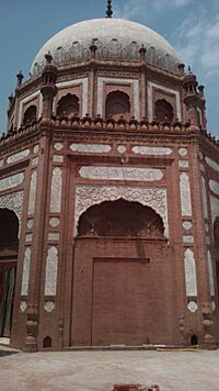
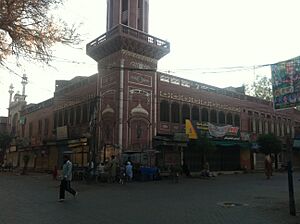
The shrine of Khoo Pak, Company Bagh
|
|
|
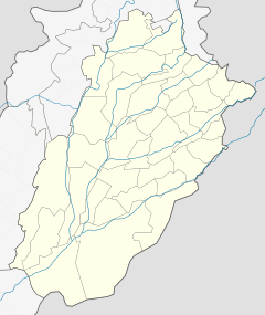
Location in Punjab, Pakistan
|
|
| Country | |
| Province | |
| Division | Sahiwal |
| District | Okara |
| Area | |
| • Metro | 4,377 km2 (1,690 sq mi) |
| Elevation | 105 m (344 ft) |
| Population
(2023 census)
|
|
| • City | 533,693 |
| • Rank | 25th, Pakistan |
| Time zone | UTC+5 (PST) |
| Postal code |
56300
|
| Area code | 044 |
| Highways | |
| Number of Union councils | 140 |
Okara is a busy city in the Punjab province of Pakistan. It is the main city of the Okara District. The name Okara comes from Okaan, which is a type of tree. Long ago, there were many Okaan trees here, giving the area its name.
Okara is one of the largest cities in Pakistan by population. It is located southwest of Lahore and about 100 kilometers (62 miles) from Faisalabad, past the Ravi River. The city is well-known for its farming and cotton factories. The closest major city is Sahiwal. Okara is also home to Pakistan's military dairy farms, which are famous for their cheese. These farms were started before Pakistan became an independent country in 1947.
Contents
Climate in Okara
The weather in Okara is usually warm and dry. The coldest months are from December to February. During this time, temperatures can drop to about 3 degrees Celsius (37 degrees Fahrenheit). There is also some rain. The hottest months are May to July, when temperatures can reach up to 45 degrees Celsius (113 degrees Fahrenheit). On average, Okara gets about 390 millimeters (15 inches) of rain each year.
History of Okara
Okara is a fairly new city that grew because of farming. When the British ruled this area, there was a large forest of Okaan trees where the city now stands. This is how the city got its name. During British rule, Okara was part of the Montgomery District. It also had a big factory that made saltpeter, a substance used in many products.
Many textile (cloth) factories were built in Okara. Most of the people living here were Muslim. They supported the All-India Muslim League and the idea of creating Pakistan. After Pakistan became independent in 1947, many Muslim families who had to leave their homes settled in the Okara District. In 1982, Okara became the main city of the new Okara District. A railway line has connected Okara to other places since 1892.
Okara is also famous for its special types of farm animals. These include the Sahiwal cattle, which are a type of cow, and the Niliravi, a kind of water buffalo. The area has many animals raised for food and other products. There is a very large government farm nearby called the Livestock Production Research Institute Bahadar Nagar Farm. This farm has many cows, buffalo, bulls (for breeding), goats, and sheep.
How Okara is Managed
The city of Okara is the main center for both the Okara District and the Okara Tehsil (a smaller administrative area). The city itself is divided into ten smaller areas called Union Councils, which help manage local services. The city is led by a Deputy Commissioner.
Places to See in Okara
If you visit Okara, you might want to see:
- Mir Chakar Rind
- Hujra Shah Muqeem
- Satluj River
People of Okara
Population
In 2023, the population of Okara was about 533,693 people. This makes it one of the largest cities in Pakistan.
Languages Spoken
Punjabi is the most common language spoken in Okara. About 95 out of every 100 people speak Punjabi as their first language. The main types of Punjabi spoken here are Majhi and Jhangvi.
Religion
The main religion followed in Okara is Islam.
See also
 In Spanish: Okara (Pakistán) para niños
 | Ernest Everett Just |
 | Mary Jackson |
 | Emmett Chappelle |
 | Marie Maynard Daly |


